Northern Mich~Mash Preserve
~ PUBLICLY SPEAKING ~
~ PUBLICLY SPEAKING ~
~ Waugoshance Lighthouse ~
Replaced by...
~ White Shoal Lighthouse ~
and
~ Grays Reef Lighthouse~
(ALL in Emmet County, Michigan)
The design and compilation of the text and photos on this site are copyrighted 2017.
Most posted items will enlarge by "clicking" on them.
"Clicking" on some color highlighted words may access additional information.
Most posted items will enlarge by "clicking" on them.
"Clicking" on some color highlighted words may access additional information.
Please do not copy the photos on this site, many of which have been submitted by private individuals...
just come back and visit the site often to view the photos.
just come back and visit the site often to view the photos.
Michigan has more lighthouses than any other state,
with more than 115 lighthouses along the Great Lakes.
with more than 115 lighthouses along the Great Lakes.
Arrows point out area of six Lighthouses near Straits of Mackinac.
Red = Waugoshance Shoal Lighthouse
Blue = White Shoal Lighthouse
Green = Skilagalee Lighthouse
Orange = McGulpin Point Lighthouse
Black = Grays Reef Lighthouse
Purple = St. Helena Island Lighthouse
Red = Waugoshance Shoal Lighthouse
Blue = White Shoal Lighthouse
Green = Skilagalee Lighthouse
Orange = McGulpin Point Lighthouse
Black = Grays Reef Lighthouse
Purple = St. Helena Island Lighthouse
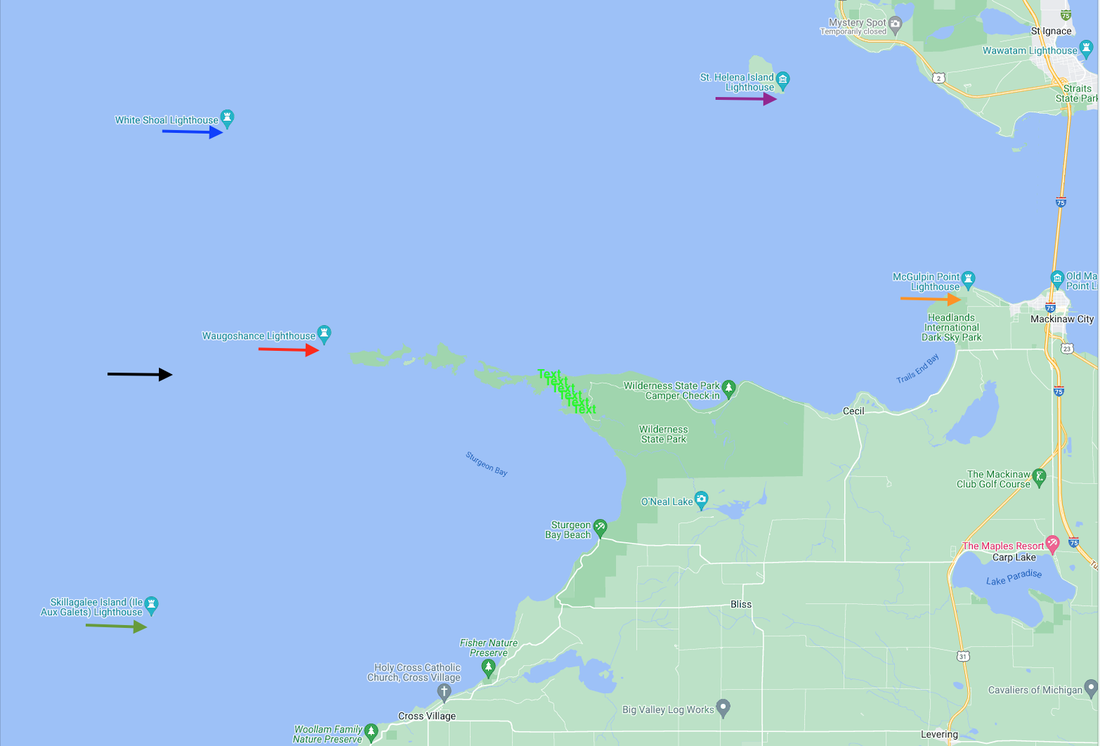
Google Map with Webmaster's Color Coded Arrows
The Mackinac Straits always have been a dangerous area for navigators.
Waugoshance Point with a chain of small islands and reefs is located at the tip/point of
seven miles of extension out into Lake Michigan; creating a hazardous setting for mariners.
seven miles of extension out into Lake Michigan; creating a hazardous setting for mariners.
Waugoshance Point from the Air
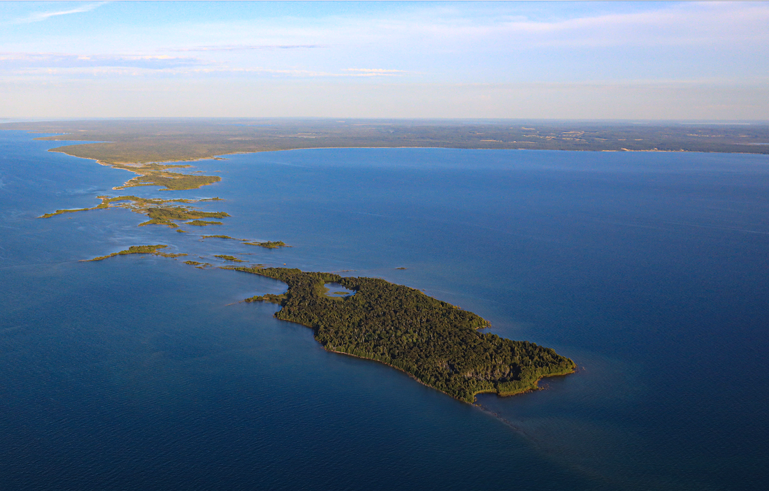
21 August 2019 ~ Photographed and Submitted by Charlie MacInnis
As early as 1831/32 the FIRST anchored wood lightship, the Lois McLain, at a very shallow area of Waugoshance Point marked the western entrance to the Straits of Mackinac. Congress had appropriated $5,000 in March of 1837 for a lighthouse on Waugoshance. U.S. Navy Lieutenant Pendergrast was dispatched to investigate the site. Click HERE to learn about Pendergast’s report on his findings, as well as learn about the improvements and maintenance of the lighthouse for several years to come.
In 1851 a replacement for the lightship was built on a wooden crib which had been built, under the direction of Captain Augustus Canfield, on St. Helena Island (pointed out in the above map), and then floated to the location over the shallow shoal and sunken with huge boulders. Bricks were used to construct the 76 feet tall conical tower and the keeper’s quarters. Waugoshance Lighthouse was the FIRST lighthouse to be completely surrounded by water which made for extremely difficult construction and maintenance.
The waters and the weather made for drastic wear and tear by 1879; demanding steel wrappings to encircle the lighthouse.
The Waugoshance Lighthouse was deactivated and abandoned in 1912. It was replaced by White Shoal Lighthouse 3.8 miles west of Waugoshance Island in Bliss Township, and by Grays Reef Lighthouse in northeastern Lake Michigan.
Transcribed from Where Michigan Began A Guide to Emmet County, Published 1941: Cross Village offers a wide view of Lake Michigan. Directly west is the Beaver Island group. In the foreground is the rocky island named Isle Aux Galet by the early French and mispronounced 'Skill–i–ga–lee; by the indians and many modern sailors who are guided by the light house there. Northwest from Cross Village is Grey's Reef, where a lightship swings at anchor during the season of open navigation. Directly east of the lightship and north from Cross Village is Wau–go–shance Islands. A Lighthouse, erected here during the Civil War, was abandoned in 1912. Strangely, the name of this lighthouse too, was much abused in its pronunciation by the sailors of the Lakes, who called it Wau–gee–shank or simply The Shank. It is believed by some that the spelling of this old French name as it appears now on maps is a corruption of the original. Records, however, vary. Regardless of names and their corruption, the view from the bluff at Cross Village is one that should not be missed by the visitor..."
Waugoshance Light Station was listed 4 August 1983 on the
National Register of Historic Places.
National Register of Historic Places.
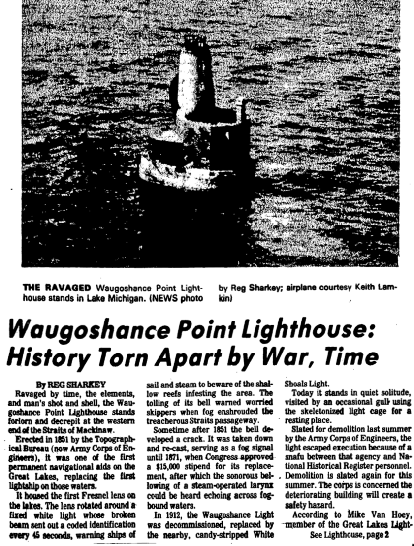
~ Waugoshance Lighthouse ~
Photo Below: Emmet County's Waugoshance Lighthouse protects boats
from a shoal area at the northern end of Lake Michigan.
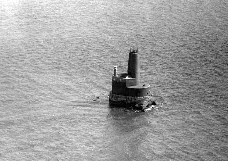
Greenwood Photo Archive Collection from Petoskey newspapers (October 1977)
Waugoshance Lighthouse,
located near the tip of Michigan's mitten, and off the coast of Wilderness State park, is:
20 miles west of Mackinaw City
22 miles east of Beaver Island
Over 30 miles from Charlevoix
Visible from Legs Inn in Cross Village (on a good day)
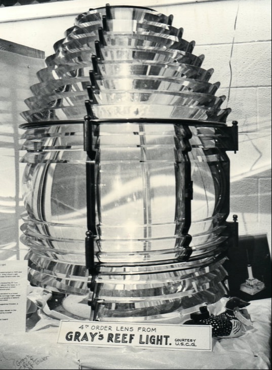
Fourth Order Fresnel Lens
Still standing in 2024, but not operational
located near the tip of Michigan's mitten, and off the coast of Wilderness State park, is:
20 miles west of Mackinaw City
22 miles east of Beaver Island
Over 30 miles from Charlevoix
Visible from Legs Inn in Cross Village (on a good day)
Fourth Order Fresnel Lens
Still standing in 2024, but not operational
Raymond Kalbfleisch reported about Waugoshance Lighthouse and its relationship to Cross Village in the September 3-9, 1986 Harbor Light newspaper: "A wood lightship was first anchored near Waugoshance in 1832. Later, lighthouses pinpointed the obstructions to lake navigation northwest of Cross Village. [Article below indicates that Waugoshance Lighthouse was commissioned in 1851.] And over the years many of the lighthouse keepers were from the village area. Also, the keepers usually came to Cross Village for supplies. Thus, they too, were recognized as having an active part in the economic and social life of the village."
Click HERE to access (at the very bottom of that web page),
a list of the many Waugoshance Lighthouse keepers with First and Second Assistants as well.
Two head keepers perished while serving at Waugoshance Point Lighthouse...
W.L. Thomas Marshall drowned in 1886;
John Herman, a drinker, perished in 1900 by possibly falling into the lake.
Stories abound surrounding the keepers' deaths.
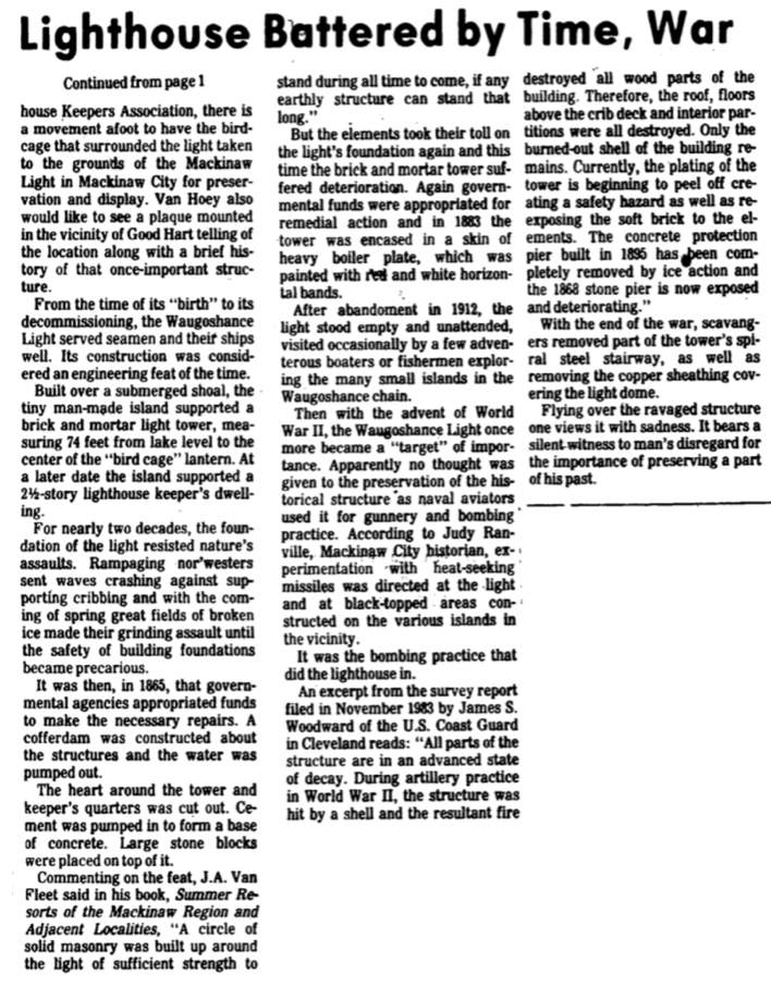
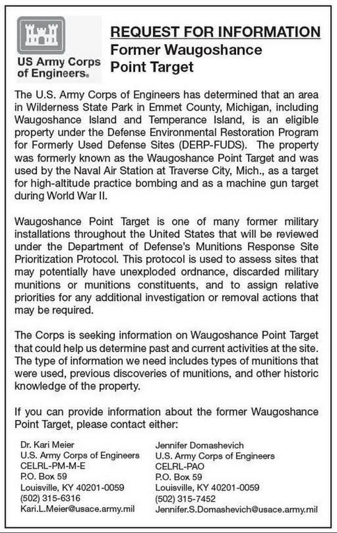
~ The abandoned lighthouse, during World War II, was used by the U.S. Navy for bombing practice. ~
In August 1943, during WWII, the U.S. Navy controlled several islands in northern Lake Michigan,
including Waugoshance Point, for naval task forces training. Waugoshance Lighthouse
become a bombing and gunnery range for the Naval Air Station in Traverse City, Michigan
(Now Cherry Capital Airport).
The lighthouse was bombed and strafed by Navy pilots; once causing a fire that left a charred structure.
23 October 1984 ~ Petoskey News Review continues below...
23 October 1984 ~ Petoskey News Review continues from above article...
Click HERE to access a video titled:
"Waugoshance Lighthouse in Lake Michigan was bombed by the US Military"
"Waugoshance Lighthouse in Lake Michigan was bombed by the US Military"
The U.S. Coast Guard Waugoshance Keepers' List:
John Levaks (1852), Lewis Laskey (1852 and 1853-8155), Nathaniel Johnson (1852-8153), Augustus Todd (1855-1861), Noal Leville (1861-8164), Charles Wackler 1864-8165), John McHaney (1865-1877), John Mulcroone 1877-1881), Levi Chapman (1881-1882), Thomas Marshall (1882-1886), George Marshall (1886-1890), John Herman (1890-1900), James Gallagher (1900-1902), Ingvald Olsen (1902-1910), Joseph Kilgore (1910-1911), Everitt Sterritt (1911-1912).
John Levaks (1852), Lewis Laskey (1852 and 1853-8155), Nathaniel Johnson (1852-8153), Augustus Todd (1855-1861), Noal Leville (1861-8164), Charles Wackler 1864-8165), John McHaney (1865-1877), John Mulcroone 1877-1881), Levi Chapman (1881-1882), Thomas Marshall (1882-1886), George Marshall (1886-1890), John Herman (1890-1900), James Gallagher (1900-1902), Ingvald Olsen (1902-1910), Joseph Kilgore (1910-1911), Everitt Sterritt (1911-1912).
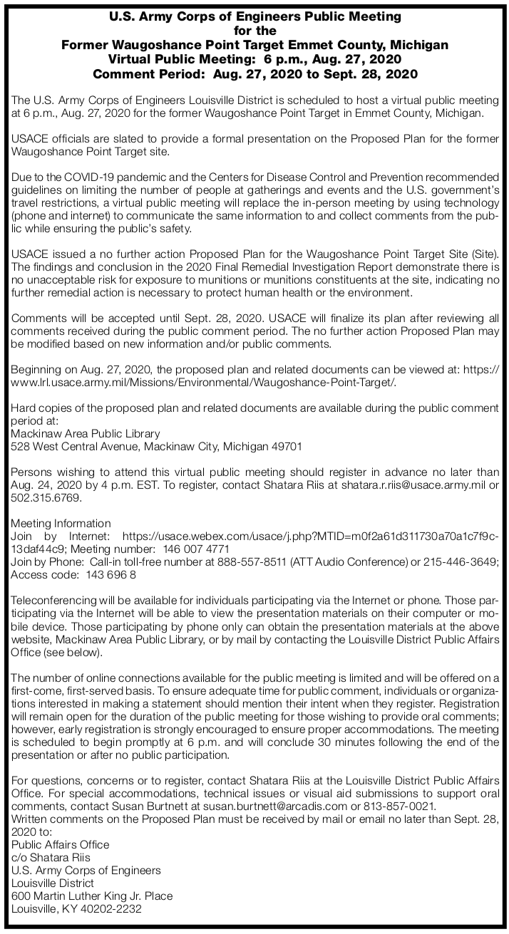
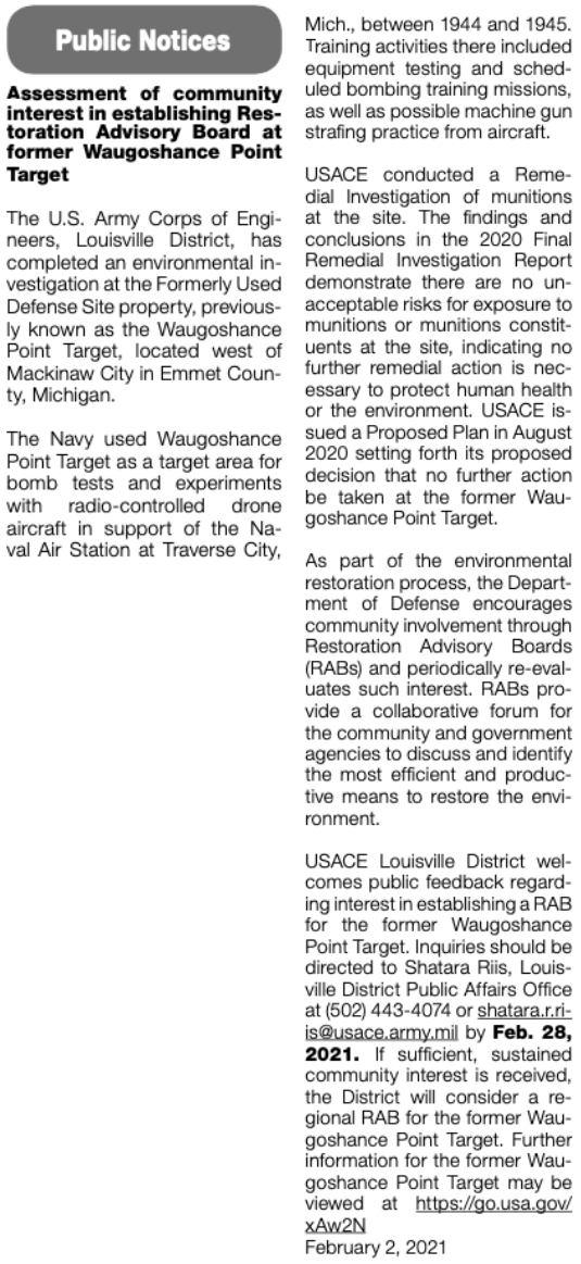
Finally, about 2005, clean up of the area of Waugoshance Lighthouse, involving the safe detonation of live bombs, after discovery using metal detectors and disarming equipment... found there at the bottom of Lake Michigan near the targeted Waugoshance Lighthouse.
Click HERE to easily access the above US Army Corps of Engineers Waugoshance Point Target web page.
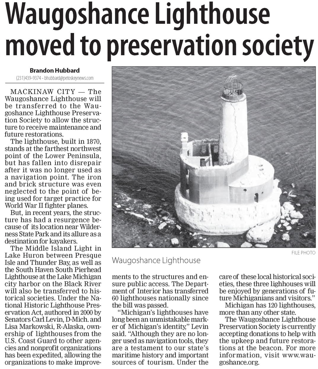
In 2009 Waugoshance Point Lighthouse was deemed excess by the Coast Guard, so was offered at no cost to any federal, state, local governments or to local agencies, non-profit corporations and education organization under the National Historic Lighthouse Preservation Act of 2000.
20 May 2011 ~ Petoskey News Review
On 4 October 2011 Waugoshance Lighthouse was awarded to Waugoshance Lighthouse Preservation Society; to work toward restoration of the structure.
The lighthouse no longer was used as a navigation tool, but it was considered to be an important source of navigational history and tourism, to be enjoyed by generations of future Michiganians and visitors.
The lighthouse no longer was used as a navigation tool, but it was considered to be an important source of navigational history and tourism, to be enjoyed by generations of future Michiganians and visitors.
5 October 2011 ~ Petoskey News Review
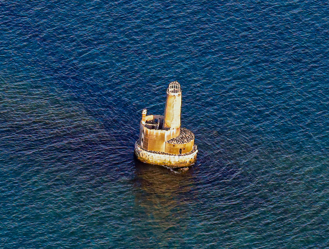
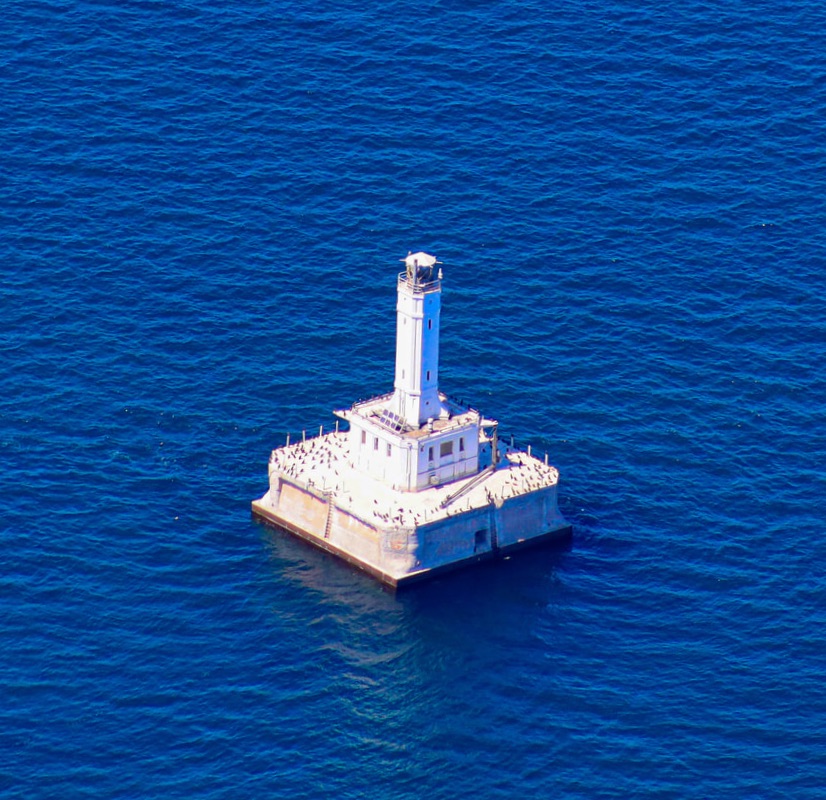
Three 2019 Photos Below by Pilot, and Photographer, Charlie MacInnis of Harbor Springs reveal
~ Waugoshance in Ruins, Covered with Cormorants ~
Click HERE to access an article titled
"After federal rule change, Michigan resumes killing cormorants to save fish"
~ Waugoshance in Ruins, Covered with Cormorants ~
Click HERE to access an article titled
"After federal rule change, Michigan resumes killing cormorants to save fish"
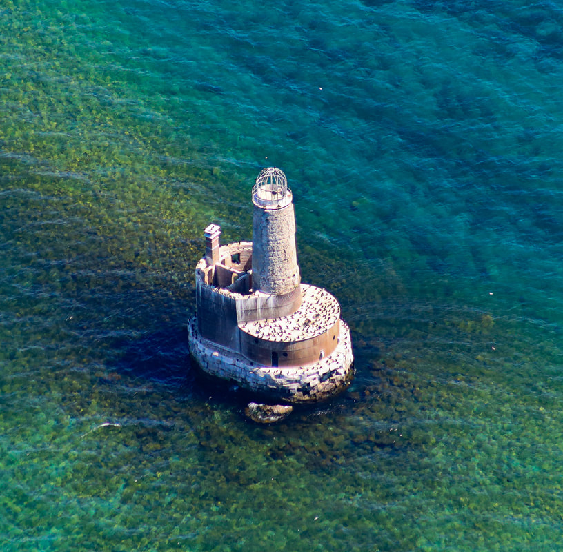
21 August 2019 ~ Photographed and Submitted by Charlie MacInnis
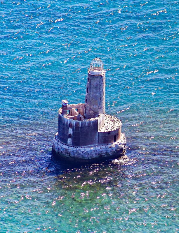
21 August 2019 ~ Photographed and Submitted by Charlie MacInnis
21 August 2019 ~ Photographed and Submitted by Charlie MacInnis
Click HERE to access the 24 October 2019 MLive.com published article titled
"High water, erosion threaten to topple historic Lake Michigan lighthouse".
"High water, erosion threaten to topple historic Lake Michigan lighthouse".
2020 ~ "The findings and conclusion in the 2020 Final Remedial Investigation Report demonstrate no unacceptable risk for exposure to munitions or munitions constituents at the site, indicating no further remedial action is necessary to protect human health or the environment."
14 July 2020 ~ Petoskey News Review
After viewing the record high water levels erode the lighthouse's base... in January 2021 the board of directors of Waugoshance Lighthouse Preservation Society decided to dissolve the non-profit organization after determining the lighthouse could not be saved; ownership went back to the federal government. The society notified the National Park Service and Michigan State Historic Preservation Office of the need to remove salvagable items, like the crown jewel of the tower, the birdcage lantern room and metal plating, for display at museums, but the government agencies felt the lighthouse could still be saved and suggested another group should take over the preservation efforts. The governmental agencies prevented the Waugoshance Lighthouse Preservation Society from recovering the historically significant items for preservation in a museum.
2 February 2021 ~ Petoskey News Review
The Waugoshance Lighthouse is CLOSED TO THE PUBLIC.
Although the web page has not been updated since 2005, the Waugoshance Lighthouse information presented by Terry Pepper (deceased in 2019) is very interesting and complete.
Terry Pepper, on his above web page, explained the necessity for White Shoal Lighthouse coming into being...
"By the end of the 1880's the size of the vessels plying the Great Lakes was increasing. These larger vessels, drawing more water, began entering the Straits of Mackinac at a point approximately four miles further North, in an area of deeper water. The White Shoal reef sat perilously close to this new passage, and in 1878, the Chicago Lumbering Company stationed an old derelict vessel over White Shoal to warn mariners of the danger lurking a few feet beneath the waves."
"By the end of the 1880's the size of the vessels plying the Great Lakes was increasing. These larger vessels, drawing more water, began entering the Straits of Mackinac at a point approximately four miles further North, in an area of deeper water. The White Shoal reef sat perilously close to this new passage, and in 1878, the Chicago Lumbering Company stationed an old derelict vessel over White Shoal to warn mariners of the danger lurking a few feet beneath the waves."
~ White Shoal Lighthouse ~
White Shoal Lighthouse,
located near the tip of Michigan's mitten, and off the coast of Wilderness State park, is:
20 miles west of the Mackinac Bridge
2.6 miles northwest of Waugoshance Island,
guarding an almost 2 miles long east/west oriented shallow shoal,
and is the tallest lighthouse on the Great Lakes.
Second Order Fresnel Lens
Whitefish Shoal Lighthouse's original Fresnel Lens is on display at Whitefish Point Lighthouse Museum.
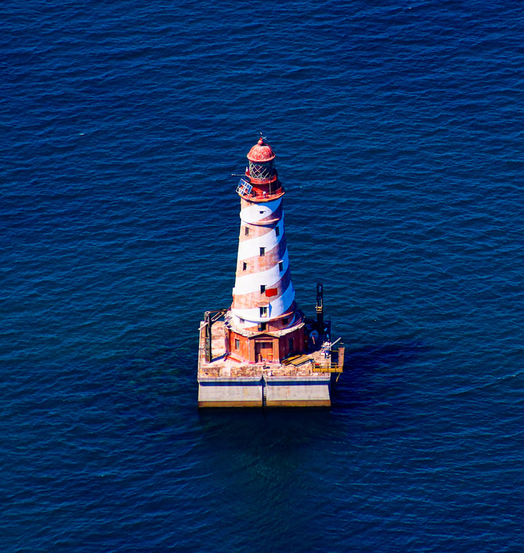
21 August 2019 ~ Photographed and Submitted by Charlie MacInnis
The increased size of freighters moved the shipping passages away from Waugoshance Lighthouse which had protected the smaller ships. So, creation began on the White Shoal Lighthouse in the Spring of 1908. The huge crib was mastered on the shore of St. Ignace, and towed to its resting place. 4000 tons of stones sank the crib on to a leveled gravel bed on the lake bottom. The foundation was made of white oak timbers. The wood crib is 72 feet square and 18 feet tall, totally filled with stones and gravel. Only about four feet below the water, the concrete began, then rising about 20 feet above the water's surface. Final cost of the lighthouse construction was $225,000.00. The lighthouse included a fog signal, as well as a submersible bell for warning.
|
The White Shoal Lighthouse tower continued with NINE decks:
1) Oil engine powered fog signal, heating plant, and storage for the station’s powerboat 2) A tool room, bathroom and food storage area 3) A kitchen, living room and one bedroom 4) Two more bedrooms and a toilet 5) A living area and another bedroom 6 & 7) A single open room on each 8) The service room 9) The watchroom topped the living quarters [each 12 ½ feet in diameter] |
21 August 2019 ~ Photographed and Submitted by Charlie MacInnis
Compare Two Photos Above: Viewa from two sides of the White Shoal Lighthouse
As the tower was completed, the entire structure...
crib and tower were painted bright white for high visibility during daylight hours;
originally sheathed in glazed white tiles (See Photo Below).
As water seeped under the tiles, and froze, the tiles broke off.
Then, the tower was covered in wire mesh, covered with 8 inches of concrete.
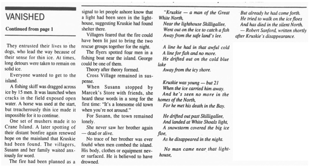
The red barber's pole stripe, added in 1954, is the only "barber pole" lighthouse in the U.S.
This image was once used as the model for the Michigan lighthouse license plates.
(Click HERE to access additional information like above)
Station established 1891
The White Shoals Lighthouse lit and opened in 1910,
two years before Waugoshance Lighthouse was abandoned in 1912.
Second Order Fresnel Lens
crib and tower were painted bright white for high visibility during daylight hours;
originally sheathed in glazed white tiles (See Photo Below).
As water seeped under the tiles, and froze, the tiles broke off.
Then, the tower was covered in wire mesh, covered with 8 inches of concrete.
The red barber's pole stripe, added in 1954, is the only "barber pole" lighthouse in the U.S.
This image was once used as the model for the Michigan lighthouse license plates.
(Click HERE to access additional information like above)
Station established 1891
The White Shoals Lighthouse lit and opened in 1910,
two years before Waugoshance Lighthouse was abandoned in 1912.
Second Order Fresnel Lens
U.S. Coast Guard Public Domain
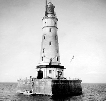
Photo Below labeled as
" White Shoal Light House 20 miles off Cross Village"
" White Shoal Light House 20 miles off Cross Village"
Little Traverse Historical Society Photo Collection (Undated, but EARLY YEARS when covered with white tiles)
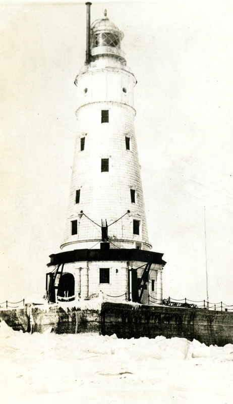
Compare the Winter/Ice photo above to the more recent view to the Winter/Ice view in the photo below.
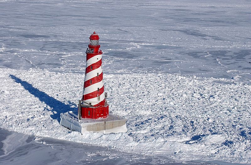
Public Domain provided by the U.S. Coast Guard (Undated)
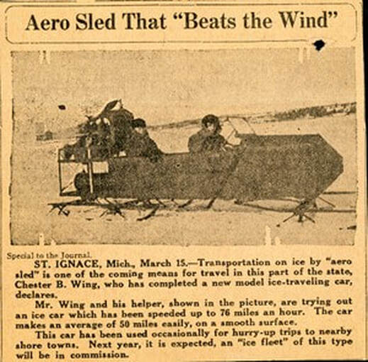
The 1922 clippings below involve Lighthouse Keepers.
Click HERE to access a LIST of White Shoal LIghthouse Keepers and Assistant Keepers.
Click HERE to access a LIST of White Shoal LIghthouse Keepers and Assistant Keepers.
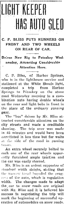
8 February 1922 ~ Petoskey Evening News
|
Greenwood Photo Archive Collection from Petoskey newspapers (1922)
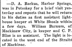
The FIRST White Shoal LIghthouse Keeper was Ingval Olsen who was transferred to Sheboygan, Wisconsin in 1914. Olsen was replaced by James Marshall.
4 April 1922 ~ Petoskey Evening News
|
18 > 29 January 1929
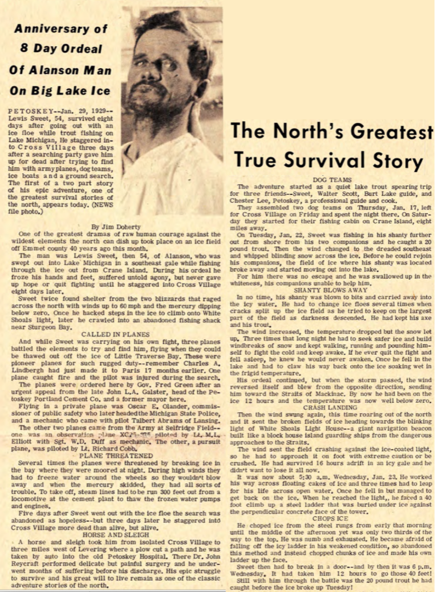
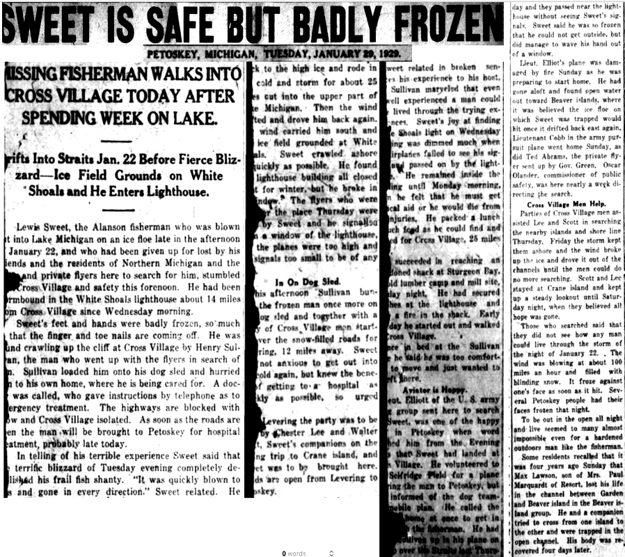
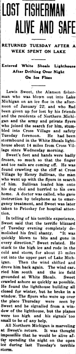
Lewis Sweet of Alanson Thought LOST off Cross Village
Sweet used Shoal Lighthouse for short-term refuge...
Lewis Sweet of Alanson Thought LOST off Cross Village
Sweet used Shoal Lighthouse for short-term refuge...
Friday, 18 January 1929, Walter Scott, a well known fishing guide, along with friends Chester Lee, and Lewis Sweet (54 years old), went ice fishing together; together at Scott's cabin on Crane Island, located about 8 miles from Cross Village where the three had spent the night. Crane Island is the older name for Waugoshance Island, off the end of Waugoshance Point. The weather rapidly deteriorated with no forewarning to them. Scott and Lee left Sweet in his own shanty when Sweet did not reply to their call to quickly leave. Scott and Lee took the dog sled and returned to the cabin, a mile away. In the 17 January 1969 Petoskey News Review Jim Doherty chronicled the epic 1929 saga in the beginning....
17 January 1969 ~ Petoskey News Review; written by Jim Doherty
18 January 1969 ~ Petoskey News Review photo/text continued below...
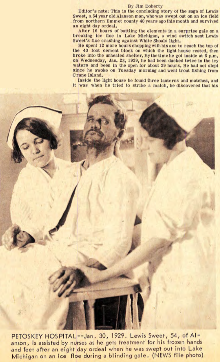
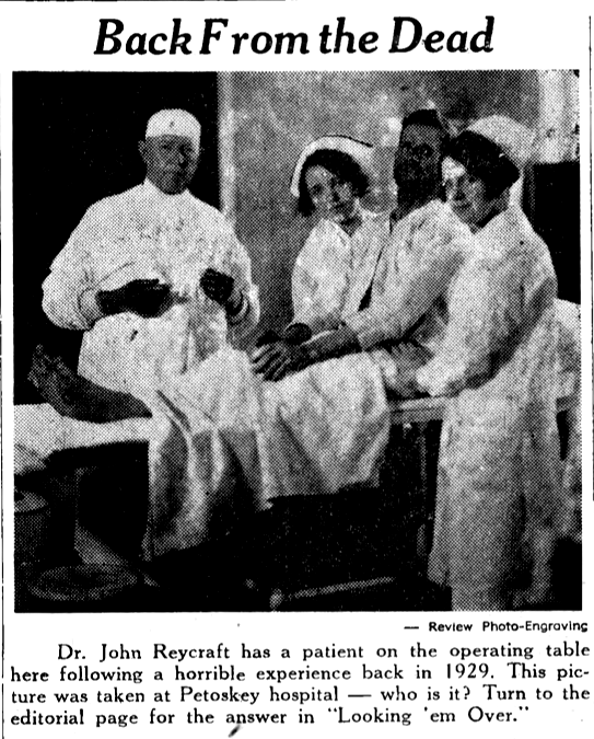
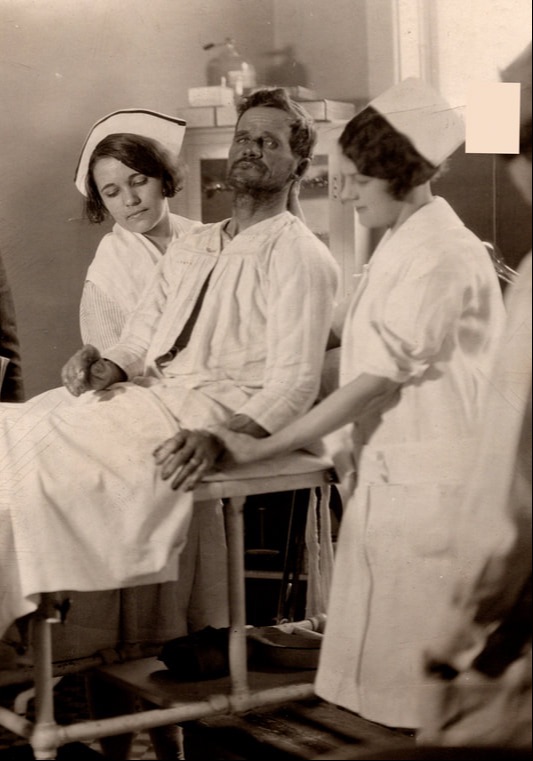
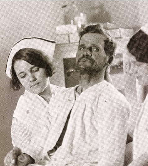
Photo Above: In 1969, according to Sheriff Richard Zink, his mother, the former Letha V. Fisher was the nurse on the left, and the nurse on the right was Mrs. Henry Pfeiffle (Ruth Schmalzried). Bill Kritcher, a retired barber who resided in Oden was called to the hospital to shave the beard off the fisherman, and he did. Bill, the barber recalled, "He was very weak."

18 January 1969 ~ Petoskey News Review continued from above...
Perhaps Help was Arriving?
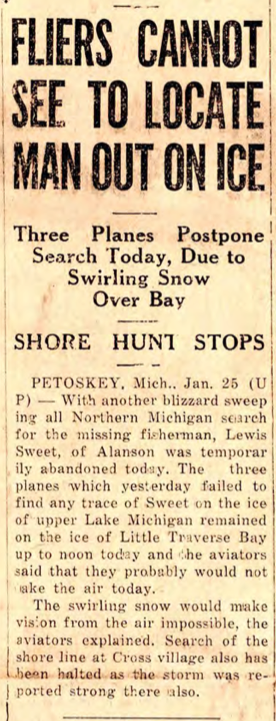
Planes Hunt Missing Fisherman
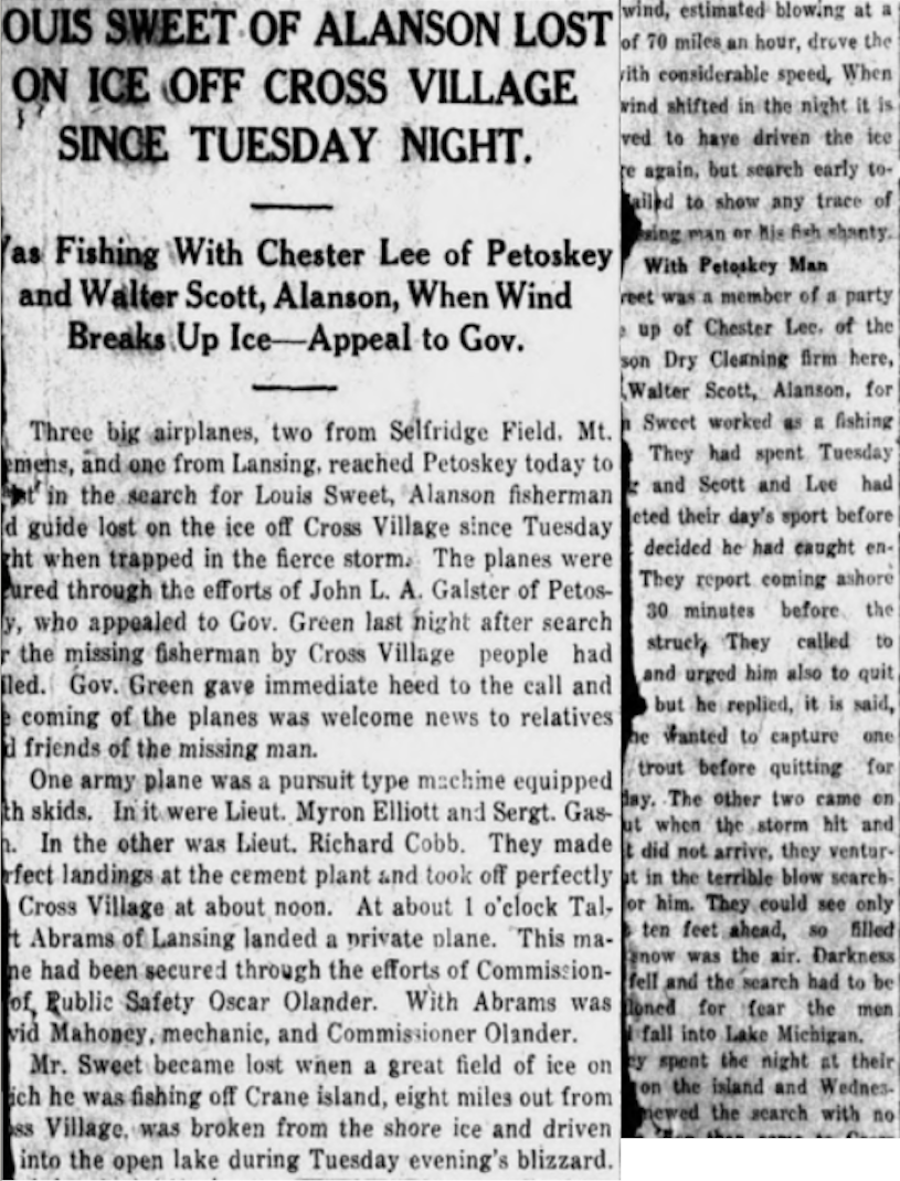
24 January 1929 ~ Petoskey Evening News continued below...
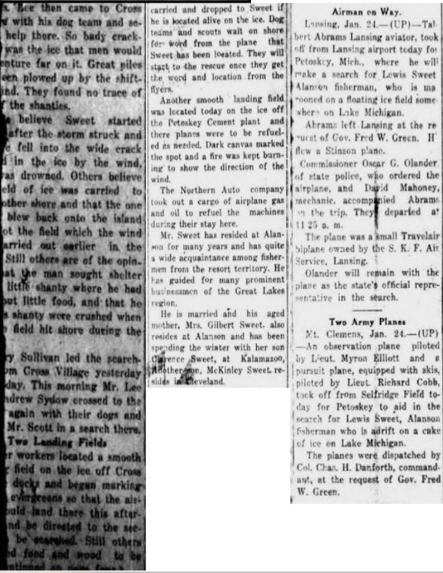
24 January 1929 ~ Petoskey Evening News continued from above...
Greenwood Photo Archive Collection from Petoskey newspapers (1929)
Search Planes for Sweet
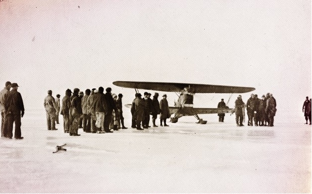
Three planes had landed on the ice off Petoskey's cement plant, to plan for an orchestrated search for Sweet who was lost on the ice near Waugoshance Point. The planes had been ordered by Governor Green after an urgent appeal from John L.A. Galster, head of the Petoskey Portland Cement Co. and a former Petoskey mayor. The planes flew very close to the White Shoal Lighthouse, but at the time, Sweet who was inside the lighthouse was too weak to make it to an opening to signal for help. The searchers did not realize he had been in the lighthouse as they flew by looking for any sign of Sweet. The Petoskey News Review told of the saga in a recalling 17 January 1969 article.
17 January 1969 ~ Petoskey News Review; written by Jim Doherty
25 January 1929 ~ Petoskey Evening News
25 January 1929 ~ Cheboygan Daily Tribune
Below: The Petoskey Evening News articles, now ragged around the edges,
daily updated the efforts to locate and rescue the missing fisherman.
daily updated the efforts to locate and rescue the missing fisherman.
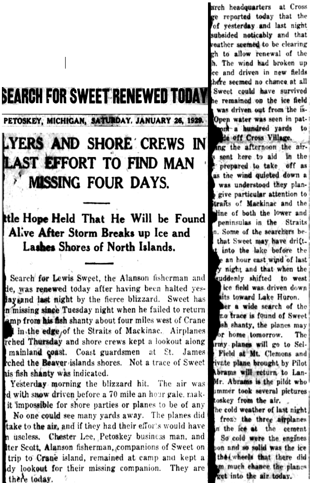
26 January 1929 ~ Petoskey News Review
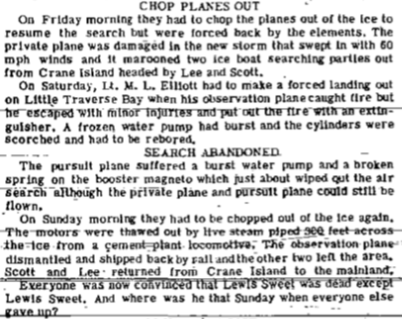
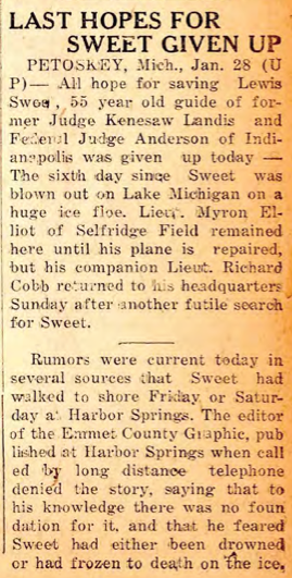
After six days of searching, in all weather conditions,
the air and land searches both were abandoned.
the air and land searches both were abandoned.
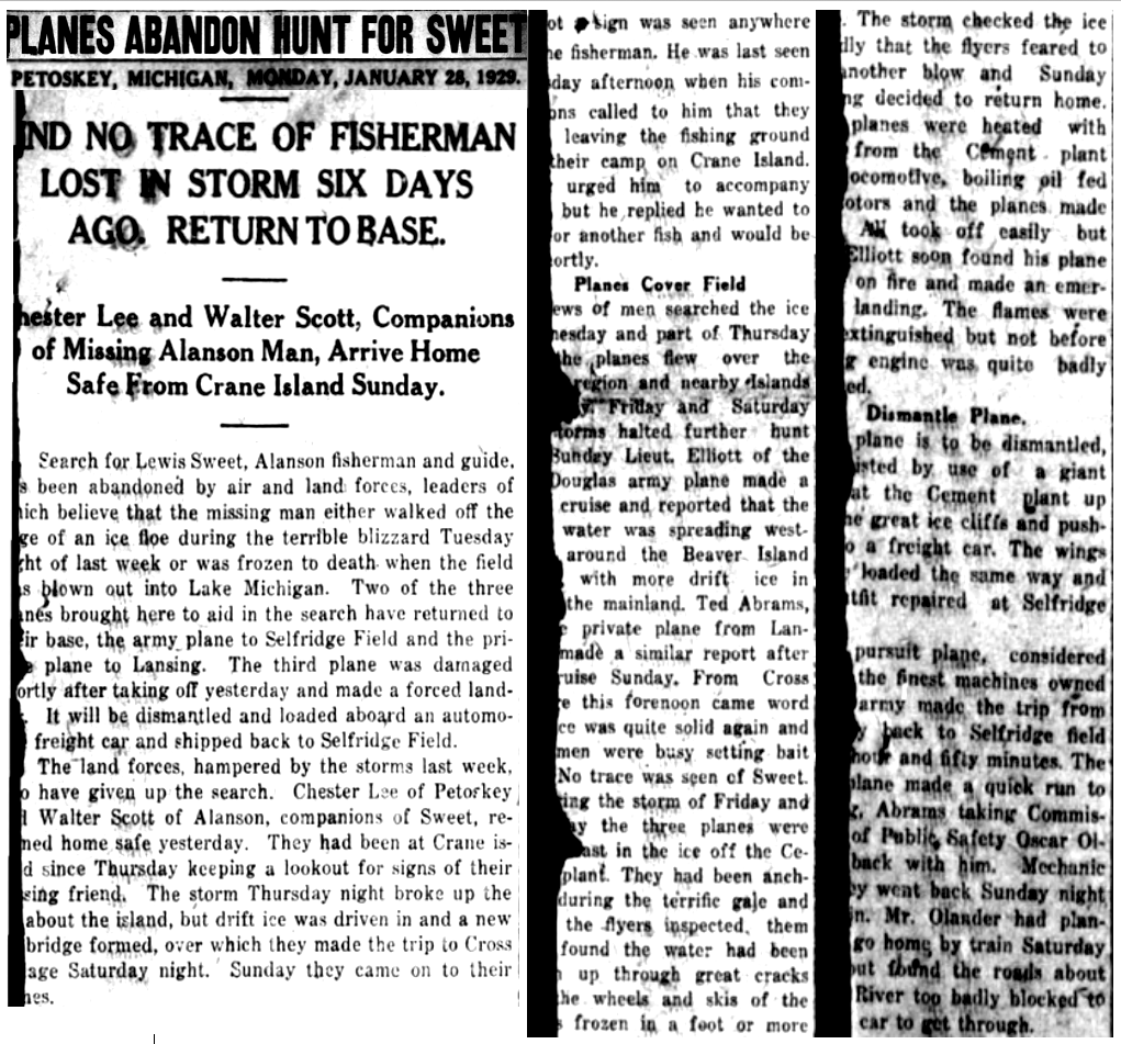
28 January 1929 ~ Petoskey Evening News
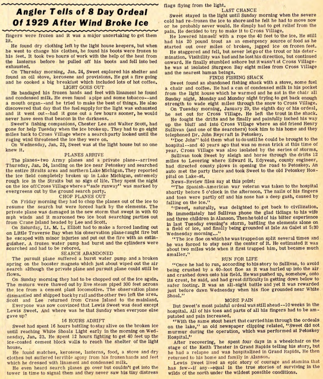
17 January 1969 ~ Petoskey News Review
The February 1969 letter below, following the article above, found in the Petoskey News Review told of the actual experience, in his own words, of pilot Talbert Abrams with Abrams Aerial Survey Corporation out of Lansing, Michigan, while he was searching for the missing fisherman Lewis Sweet.
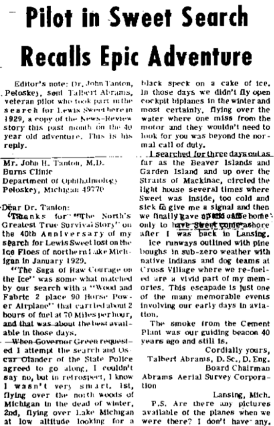
5 February 1969 ~ Petoskey News Review
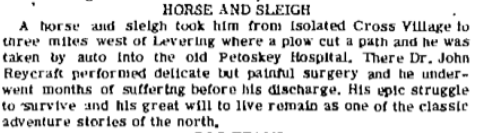
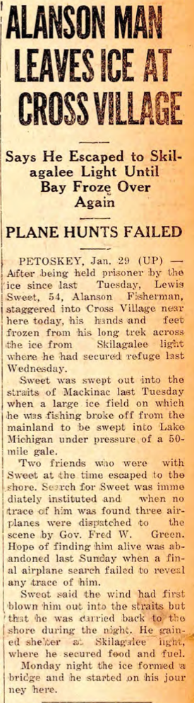
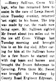
On the seventh day, Lewis Sweet came in to Cross Village, alive, but badly frozen, with his finger and toe nails coming off. Sweet crawled up a Cross Village cliff when one of the searchers, Henry Sullivan noticed Sweet. Sullivan loaded Sweet into his dog sled and hurried Sweet on to Sullivan's own home where he was cared for temporarily. A doctor gave instructions by telephone for emergency treatment because Sweet could not immediately be moved to the nearest Petoskey hospital... the roads were blocked with snow, and Cross Village was isolated.
17 January 1969 ~ Petoskey News Review; written by Jim Doherty
28 January 1929 ~ Cheboygan Daily Tribune
|
19 January 1929 ~ Cheboygan Daily Tribune
|
29 January 1929 ~ Petoskey Evening News
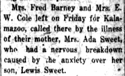
Upon reaching Sullivan's home, Lewis Sweet immediately had Sullivan call his wife and three children in Alanson. By the next day after reaching Sullivan's temporary emergency help, Sweet had arrived in the hospital. Dr. John Reycraft was apprehensive for Sweet because of his severe freezing of his extremities.
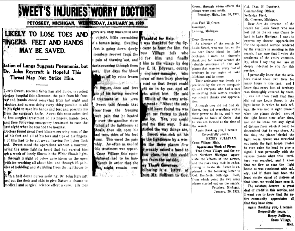
30 January 1929 ~ Petoskey Evening News
30 January 1929 ~ Charlevoix Courier
A 1947 newspaper recalled that the photo below includes: Dr. John Reycraft, nurses Letha V. Fisher (mother of Sheriff Richard Zink) and Mrs. Henry (Ruth Schmalzried) Pfeiffle, caring for Lewis Sweet who was being treated for his frozen hands and feet.
6 February 1947 ~ Northern Michigan Review
|
Greenwood Photo Archive Collection from Petoskey newspapers...
|
Greenwood Photo Archive Collection from Petoskey newspapers...
Lewis Sweet prevailed to give an accounting of his harrowing experience of having been lost on the ice.
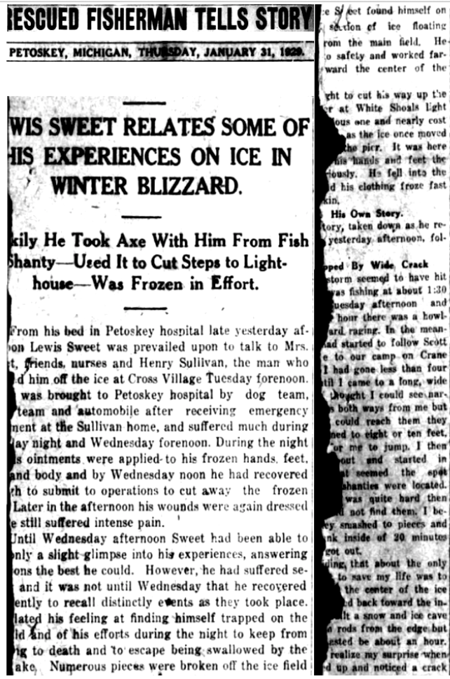
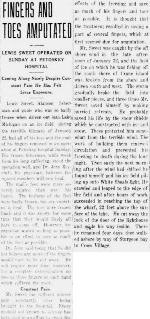
31 January !929 ~ Petoskey Evening News article continued below...
31 January !929 ~ Petoskey Evening News article continued from above...
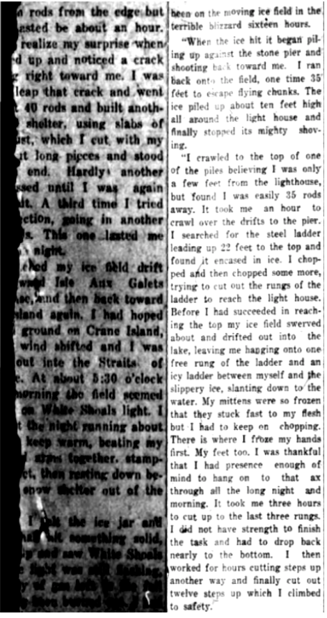
For Sweet to access the White Shoal light house was very challenging.
He built ice steps, with his axe, up 40 feet to reach the main shelter of the light house.
He stayed there until the severe cold had refrozen the cracked ice and open water around the light house,
but to get down from the White Shoal light house Sweet lowered himself the 40 feet by rope.
He built ice steps, with his axe, up 40 feet to reach the main shelter of the light house.
He stayed there until the severe cold had refrozen the cracked ice and open water around the light house,
but to get down from the White Shoal light house Sweet lowered himself the 40 feet by rope.
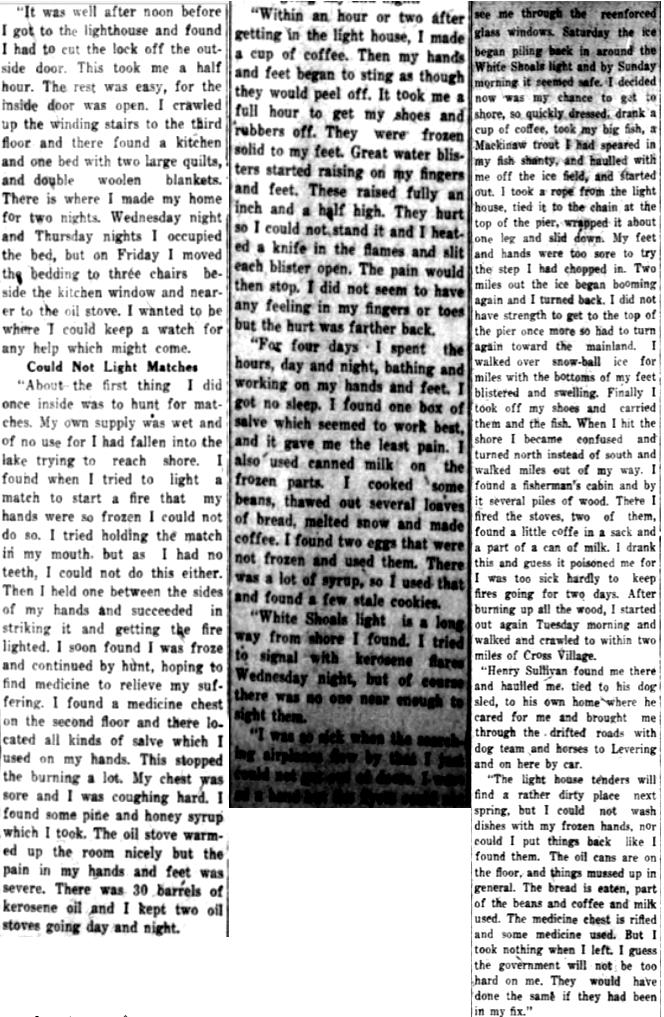
31 January !929 ~ Petoskey Evening News article continued from above...
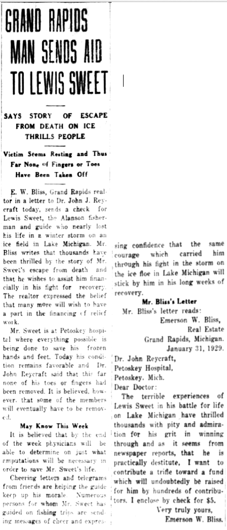
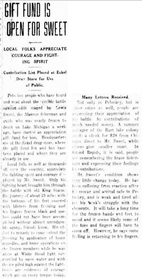
People from "all over" were so touched by Lewis Sweet's ordeal that they created a fund
set up by Mr. Bliss from Grand Rapids, Michigan, to help care for Sweet.
set up by Mr. Bliss from Grand Rapids, Michigan, to help care for Sweet.
1 February 1929 ~ Petoskey Evening News
|
1 February 1929 ~ Petoskey Evening News
|
2 February 1929 ~ Petoskey News Review
|
8 February 1929 ~ Petoskey Evening News

23 February 1929 ~ Petoskey Evening News
Article Above: Sweet's ordeal brought the limelight to Cross Village; in the limelight 50 years previous in 1879 when a statute was enacted for construction of a state road through the swamplands separating Cross Village from Cheboygan.
|
Article Below:
In February 1929 Lewis Sweet survived Dr. Reycraft's surgery for that amputation that had to occur.
In February 1929 Lewis Sweet survived Dr. Reycraft's surgery for that amputation that had to occur.
25 February 1929 ~ Petoskey Evening News
14 March 1929 ~ Petoskey Evening News
Advertisement Below:
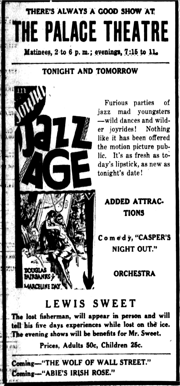
Petoskey's Palace Theatre featured Lewis Sweet telling his experiences while lost on the ice,
with a fee to benefit Mr. Sweet. Click HERE to access additional information about The Palace Theatre.
Petoskey's Palace Theatre featured Lewis Sweet telling his experiences while lost on the ice,
with a fee to benefit Mr. Sweet. Click HERE to access additional information about The Palace Theatre.
25 March 1929 ~ Petoskey Evening News
20 November 1929 ~ Petoskey Evening News
1930 Article Below:
Lewis Sweet was still well recognized, and rode in front of his fish shanty on the float in
Petoskey's 1930 Winter Parade.
Lewis Sweet was still well recognized, and rode in front of his fish shanty on the float in
Petoskey's 1930 Winter Parade.
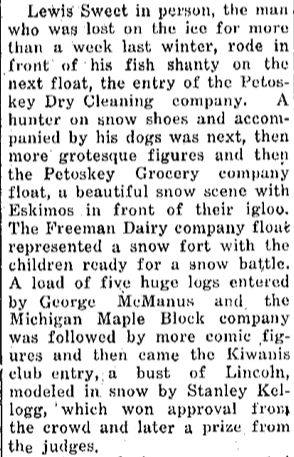
12 February 1930 ~ Petoskey Evening News
Obituaries...
Mr. Sweet, born 23 November 1875, lived until 12 January 1941 when he passed away in sunny Florida.
Lewis Elias Sweet, a Spanish American veteran,
was buried in the Littlefield Township Cemetery in Alanson.
Mr. Sweet, born 23 November 1875, lived until 12 January 1941 when he passed away in sunny Florida.
Lewis Elias Sweet, a Spanish American veteran,
was buried in the Littlefield Township Cemetery in Alanson.
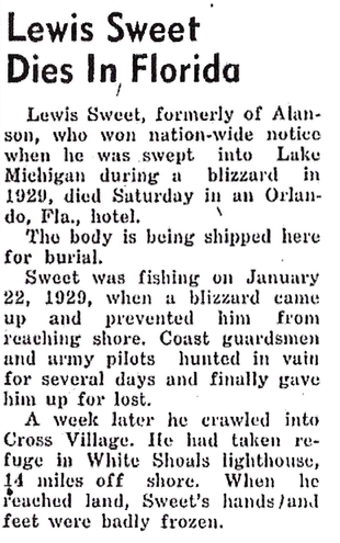
13 January 1941 ~ Petoskey Evening News
|
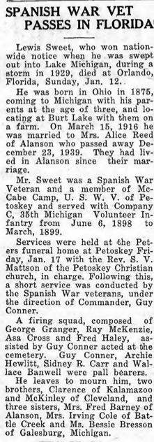
23 January 1941 ~ Emmet County Graphic
|
Obituary Below: Lewis Sweet's epic saga friend and guide Walter Scott became "one of the best known fishing guides in the north." In fact, Walter Scott was out in his boat with a fishing party on Burt Lake when stricken with a heart attack. He died shortly after in Lockwood General Hospital in Petoskey in 1949.
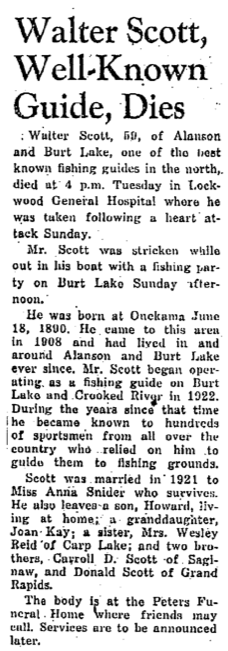
7 September 1949 ~ Petoskey Evening News
Mr. Sweet's harrowing tale continued to live on and on, and was recalled again in the 1955 article below.
The perseverance of this man's spirit was extraordinary.
The perseverance of this man's spirit was extraordinary.
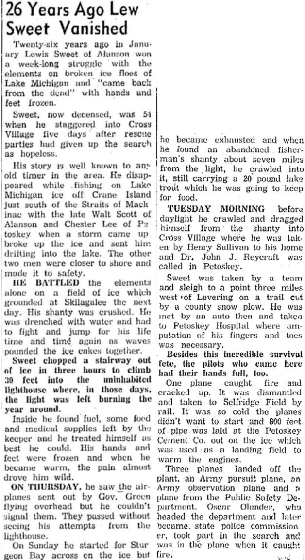
3 January 1955 ~ Petoskey News Review article continued below left...

3 January 1955 ~ Petoskey News Review article continue on column right...
Click HERE to access a copy of the entire actual book titled The Perious Adventure of Lewis Sweet
by O.J. Laylander. The book was sold with all proceeds going to the benefit of Lewis Sweet.
by O.J. Laylander. The book was sold with all proceeds going to the benefit of Lewis Sweet.
1931
ANOTHER
Fisherman Lost, Possibly Heading toward White Shoals Lighthouse
ANOTHER
Fisherman Lost, Possibly Heading toward White Shoals Lighthouse
Two Articles Below:
The discontinuation of various lights on the east side of Lake Michigan
for the winter of 1930-1931 began 5 December 1930 for White Shoals.
The discontinuation of various lights on the east side of Lake Michigan
for the winter of 1930-1931 began 5 December 1930 for White Shoals.
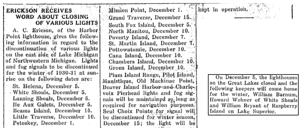
Both... 20 November 1930 AND 6 December 1930 Petoskey Evening News
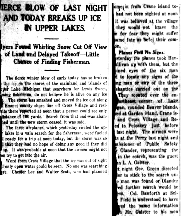
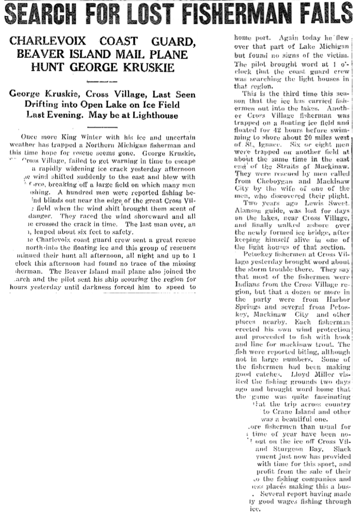
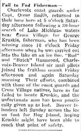
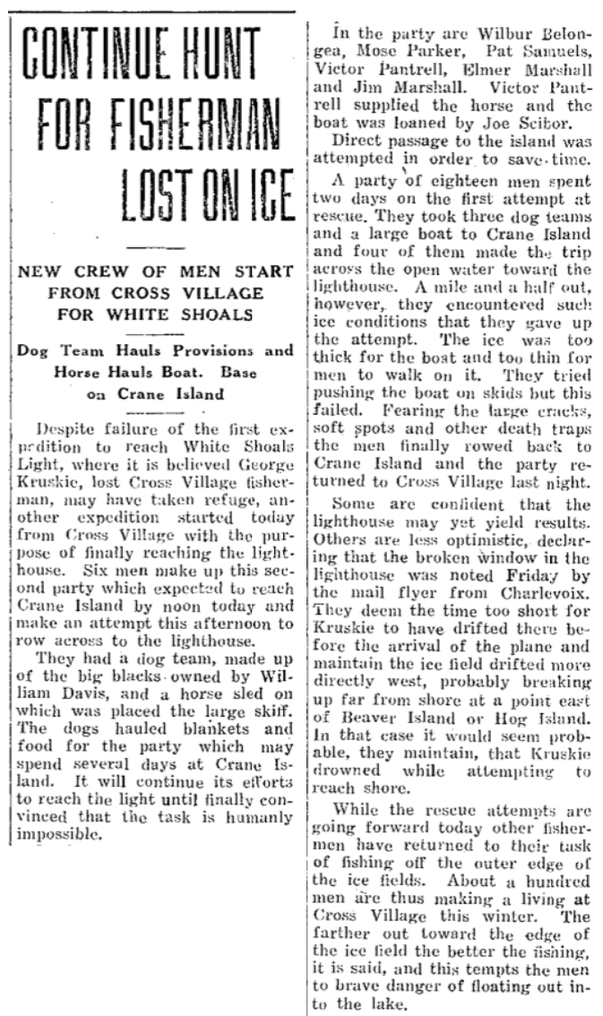
The 7 February 1931 Petoskey Evening News below reported the tragic end to a busy time of ice fishing for a hundred men. The wind shifted, widening an ice crack to six feet, which all the men successfully jumped except for George Kruskie of Cross Village. A massive search involving the Charlevoix Coast Guard found no trace of the missing fisherman. Even the Beaver Island mail plane joined the search. Hope was not lost at first because this event was the third time of the season that ice had carried fishermen out into the lakes. Another Cross Village fisherman was trapped on the floating ice field and floated for 42 hours before swimming to shore about 20 miles west of St. Ignace. Two years previous, Lewis Sweet was lost four days on the lakes near Cross Village and finally walked to shore, after keeping himself alive in one of the lighthouses (White Shoal Lighthouse) of that section.
The article below noted that most of the fishermen were Indians from Cross Village with a few fishermen from other surrounding cities. No other names than George Kruskie were noted.
The article below noted that most of the fishermen were Indians from Cross Village with a few fishermen from other surrounding cities. No other names than George Kruskie were noted.
Tattered article from 7 February 1931 ~ Petoskey Evening News
|
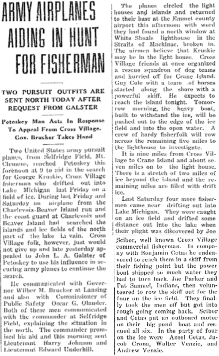
Article Right Column: Petoskey Portland Cement's John L.A. Galster used his influence to secure army planes to continue the search for George Kruskie. The planes circled the lighthouses and islands and returned to their base at the Emmet County Airport with word they had found a "broken-in" north window at White Shoals lighthouse in the Straits of Mackinac. The airmen believed that Kruskie could be in the lighthouse. Cross Village friends organized a rescue squadron of dog teams and hurried off for Crane Island about nine miles away; with White Shoals lighthouse about seven miles beyond Crane Island. About two miles of ice existed beyond the island and the remaining five miles were filled with drift ice before reaching the lighthouse.
The photo below from Little Traverse Historical Society Photo Collection shows one of the dog teams. 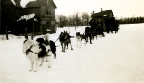
Little Traverse Historical Society Photo Collection
|
9 February 1931 ~ Petoskey Evening News
|
9 February 1931 ~ Petoskey Evening News
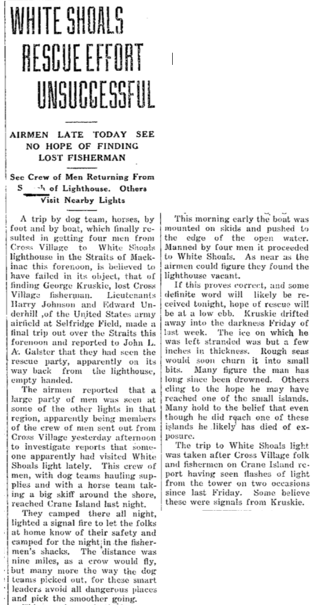
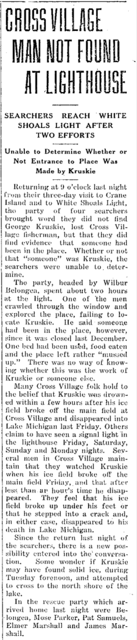
10 February 1931 Article Below: Four men from Cross Village finally reached the White Shoal Lighthouse after several modes of transportation, and by foot. This article below was based on the report from the airmen, and revealed the four men probably found the lighthouse vacant. Many thought Kruskie had long since drowned... others clung to hope he may have reached a small island. Some people reported having seen flashes of light from the tower on two occasions since the previous Friday. Some believed those were signals from Kruskie.
10 February 1931 ~ Petoskey Evening News
|
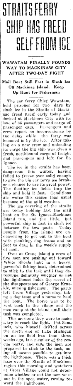
Article Below Left: It had been assumed that the first search team with dogs, mentioned in the article above, eventually had made it to the White Shoal Lighthouse, but when the four men in the boat were into the open water heading toward the lighthouse, the open water had such treacherous ice conditions that they gave up the attempt. The ice was too thick for the boat and too thin for the men to walk on it. The men rowed back to Crane Island spent the night, and returned to Cross Village. The conditions remained overpowering, for a successful rescue, although they continued the hunt.
11 February 1931 ~ Petoskey Evening News
Article Right Column: The ice in the Straits had been dangerous so far that year. Five men over on Crane Island were pushing out toward White Shoal in a heavy powerful fishing boat, trying to determine if the lighthouse held the secret of the disappearance of George Kruskie, the missing fisherman.
|
12 February 1931 ~ Petoskey Evening News
|
|
13 February 1931 Article Right Column: The second search crew did reach the White Shoal Lighthouse, only to learn George Kruskie was not to be found. They did, however, find evidence that someone had been in the place... but could not tell if that "someone" had been George Kruskie. They spent about two hours at the light, with one man crawling through the window to explore the lighthouse. Someone had been in the place since it had closed on 5 December 1930 just as several of the lighthouses in the area had been ordered to close for the winter season. The White Shoal Lighthouse had been left in a "messed up" condition with one bed having been used and food eaten. That discovery added to the Cross Village folks' uncertainty of George Kruskie's fate; with some thinking that the lighthouse findings could lead to a new outcome.
Article Below... 12 February 1932, a year later: The loss of George Kruskie was still remembered, but no notice of him having surfaced... In later years a grave stone does exist for George Kruskie in Cross Village with the epitaph "Lost on Ice" engraved with dates (16 October 1909 ~ 6 February 1931). 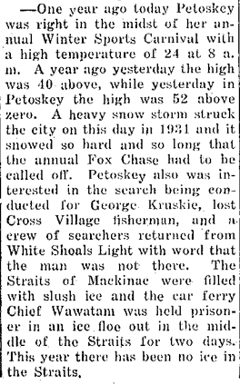
12 February 1932 ~ Petoskey Evening News
|
13 February 1931 ~ Petoskey eVening News
|
16 February 1996 Article Below: Then again 65 years later, George Kruskie's sister Susann (Kruskie) Crick, brought forward the incident of George Kruskie having been "Lost on Ice" in 1931, with photos, and shared memories.
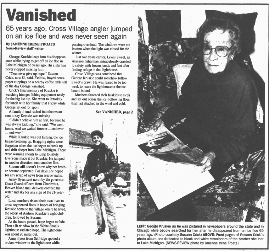
16 February 1996 ~ Petoskey News Review article continued below...
16 February 1996 ~ Petoskey News Review article continued from above...
U.S. Coast Guard ~ Public Domain
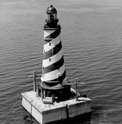
1937
A White Shoal Lighthouse replica was created as a massive ice structure
or the 1937 Petoskey Winter Queen Setting at the Ice Rink
A White Shoal Lighthouse replica was created as a massive ice structure
or the 1937 Petoskey Winter Queen Setting at the Ice Rink
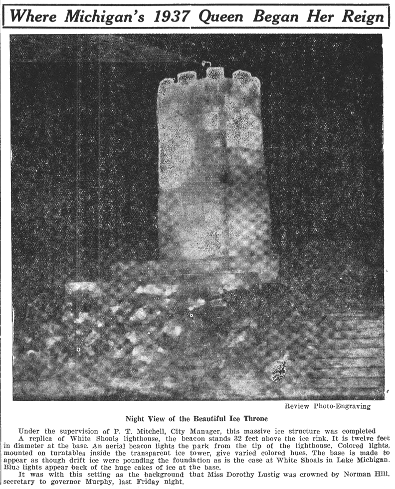
11 February 1937 ~ Northern Michigan Review
1946
|
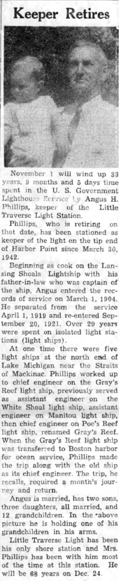
Article Right: Angus H. Phillips, worked as chief engineer on the Grays Reef Lighthouse Ship, previously served as assistant engineer on the White Shoal Lightship... a keeper of various sorts.
Article Below: Cross Village's George Keller held the longest record for service at an isolated crib station, retired 31 August 1946 after serving 28 years. 
5 September 1946 ~ Northern Michigan Review
|
31 October 1946 ~ Emmet County Graphic
|
1948
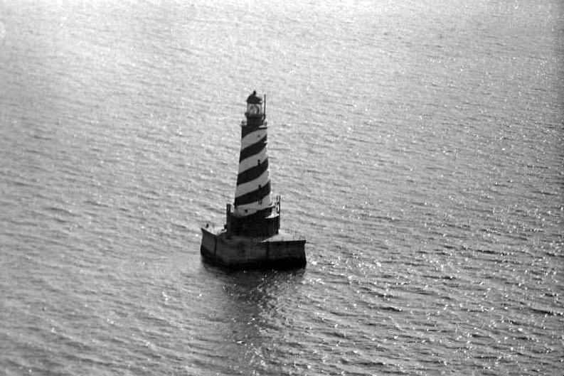
~ Airview of White Shoal ~
from plane piloted by Oliver Du Chaine of Northgate Airfield in Petoskey
To access additional information about Petoskey's Northgate Airfield "click" HERE.
~ Airview of White Shoal ~
from plane piloted by Oliver Du Chaine of Northgate Airfield in Petoskey
To access additional information about Petoskey's Northgate Airfield "click" HERE.
9 April 1948 ~ Petoskey Evening News photo accompanied article below...

9 April 1948 ~ Petoskey Evening News article accompanied airview photo above...
1950
10 August 1950 ~ Northern Michigan Review
1977
1977 Photo Below:
The White Shoal Light is located about 20 miles west of the Mackinac Bridge, and is still active.
It is the tallest lighthouse in the Great Lakes.
The White Shoal Light is located about 20 miles west of the Mackinac Bridge, and is still active.
It is the tallest lighthouse in the Great Lakes.
Greenwood Photo Archive Collection from Petoskey newspapers (October 1977)
The Below Clipping was written by Fran Martin of Charlevoix
who had her own column in the Petoskey News Review.
who had her own column in the Petoskey News Review.
7 October 1977 ~ Petoskey News Review
Click HERE to access a 7 June 2012 video visit to White Shoal Lighthouse.
White Shoal Light will be closed in 2024.
Scheduled to reopen in 2025
Scheduled to reopen in 2025
The 11 February 2024 Facebook page for "White Shoal Lighthouse Historical Preservation Society" told, "Though we were not scheduled to open to the public until 2024, we successfully hosted volunteers, day tours, and overnight guests during our inaugural season in 2019. The pandemic kept us completely closed in 2020, but we reopened to host volunteer operations in 2021 and 2022. The 2023 season was our most successful season yet as we hosted an amazing roster of volunteers and opened the last half of our season to overnight guest stays once again.
Unsurprisingly, a project of this size and scope presents endless challenges to our team that, season to season, we must logistically strategize, prioritize, and plan for. Our board of directors, having met recently and having reviewed the 2024 calendar, potential five-year plan, and numerous variables restoration is presenting us with, has decided to keep White Shoal closed to the public in 2024. This will allow us to bring in additional contractors to consult on future projects and continue specialized work on current projects. Our plan is to reopen White Shoal in 2025 and resume volunteer operations and overnight stays.
We appreciate everyone's continued support of this challenging project. Just because we will be closed for 2024 does not mean we will not be producing great content for everyone to enjoy on our Facebook page and website. You can look forward to many exciting updates throughout the 2024 season!"
The Spring 2024 issue of 360 AT magazine features White Shoal Lighthouse.
Click HERE to access the magazine.
Click HERE to access the magazine.
~ Grays Reef Lighthouse ~
Grays Reef Lighthouse,
located near the tip of Michigan's mitten, and off the coast of Wilderness State park, is:
3.8 miles west of Waugoshance Island in Bliss Township, Michigan
23 Miles SW of the Mackinac Straits
4 ½ Miles South of White Shoal Lighthouse
A twin of the Minneapolis Shoal Lighthouse
A marker of the Grays Reef Channel
Listed on the National Register of Historic Places as of 2005
Grays Reef ~ Greenwood Photo Archive collection from Petoskey Newspapers (Undated)
|
Petoskey District Library with Library of Michigan Digital Repository (Undated)
|
Public Domain On-Line
The original Gray's Reef Lighthouse's 3 ½ order Fresnal Lens can be viewed at
Harsha House Museum, Charlevoix, Michigan.
Harsha House Museum, Charlevoix, Michigan.
Grays Reef ~ Greenwood Photo Archive collection from Petoskey Newspapers (Undated)
When the Reef Passage area first was designated for better lighting in the shoals area, a lightvessel (LV57) was moored there. LV57 was constructed by Blythe Craig Shipbuilding of Toledo, Ohio, and placed in 1891, serving until 1923 when its hull was deteriorated. Then, another lightvessel (LV103) served on Grays Reef from 1923 to 1927 when LV56 was moved to the station, lasting only two years until deterioration. LV103 was returned for first part of 1929 season and then was replaced with LV99.
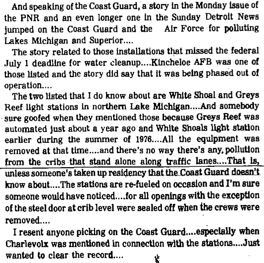
Finally, rather than depending on moored lightvessels, work on a lighthouse was approved by Congress, to begin on 1934, with completion on September 1936; opening in 1937.
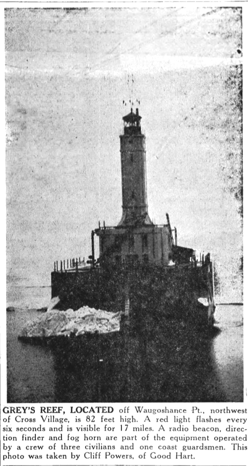
In 1937, a radio beacon and a 40 feet tower were installed on the lighthouse (visible in early photos). The lighthouse was manned by the U.S. Coast Guard, until 1976, after the installation of a solar-powered system.
The lighthouse today is described as follows:
The concrete pier is 30'X64.
Atop the pier are two stories which house:
1) diesel generators, boilers, and compressors to provide power and heat to the light, fog signal, and keeper's quarters
2) the keeper's quarters.
Centered atop the two stories is a 65 feet tower which has the lantern atop
The exterior is covered with steel plates.
Finally, rather than depending on moored lightvessels, work on a lighthouse was approved by Congress, to begin on 1934, with completion on September 1936; opening in 1937.
In 1937, a radio beacon and a 40 feet tower were installed on the lighthouse (visible in early photos). The lighthouse was manned by the U.S. Coast Guard, until 1976, after the installation of a solar-powered system.
The lighthouse today is described as follows:
The concrete pier is 30'X64.
Atop the pier are two stories which house:
1) diesel generators, boilers, and compressors to provide power and heat to the light, fog signal, and keeper's quarters
2) the keeper's quarters.
Centered atop the two stories is a 65 feet tower which has the lantern atop
The exterior is covered with steel plates.
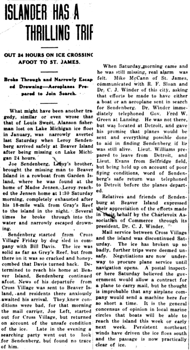
Article Below:
Another 1929 Narrow Escape
Similar to Lewis Sweet’s narrow escape with his White Shoal Lighthouse experience,
Leroy Sandenberg endured cracked ice after leaving the Grays Reef area.
Another 1929 Narrow Escape
Similar to Lewis Sweet’s narrow escape with his White Shoal Lighthouse experience,
Leroy Sandenberg endured cracked ice after leaving the Grays Reef area.
27 March 1929 ~ Charlevoix Courier
1936
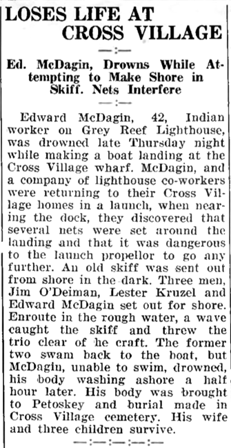
Article Below:
Gray Reef Lighthouse Workers Endangered by Underwater Nets...
Ed McDagin Drowned.
Article Below:
Gray Reef Lighthouse Workers Endangered by Underwater Nets...
Ed McDagin Drowned.
4 June 1936 ~ Northern Michigan Shoppers Guide
1950
31 August 1950 ~ Northern Michigan Review
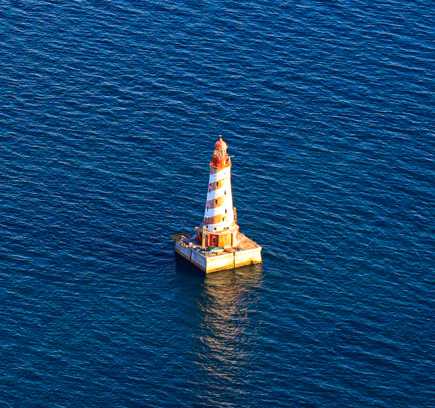
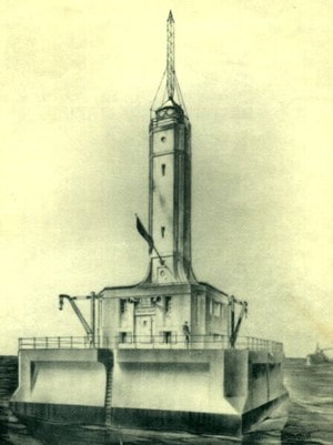
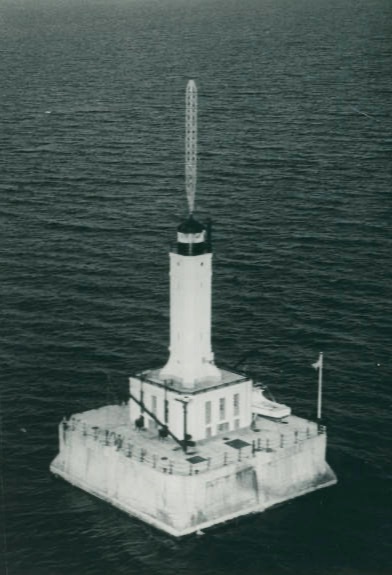
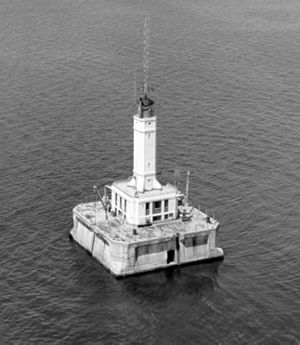
21 August 2019
Photo Below submitted by Pilot and Photographer Charlie MacInnis of Harbor Springs, Michigan
Photo Below submitted by Pilot and Photographer Charlie MacInnis of Harbor Springs, Michigan
21 August 2019 ~ Photographed and Submitted by Charlie MacInnis
Grays Reef Lighthouse was last manned with a crew in October 1976,
being the LAST manned lighthouse in the NE Great Lakes.
being the LAST manned lighthouse in the NE Great Lakes.
Click HERE to access the White Shoal Light Historical Preservation Society Facebook page
which includes present day photos/text as well as historical.
which includes present day photos/text as well as historical.
