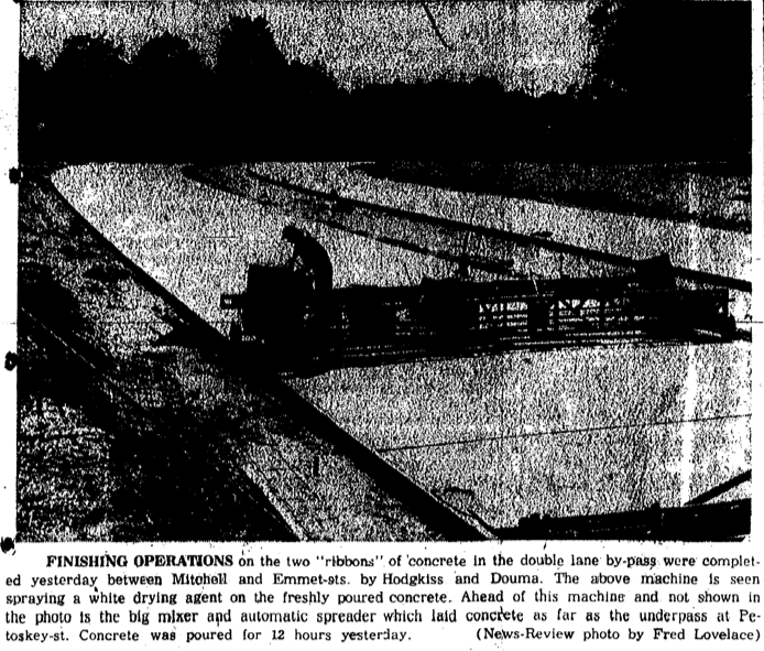
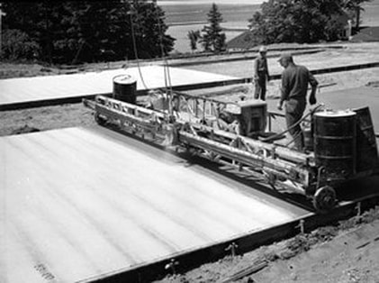
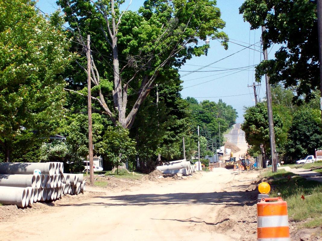
Header Photo: 20 June 2012 ~ US 131 & Sheridan Street Intersection Pavement Rising
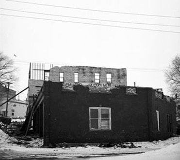
(Side Note Regarding Header Photo: This Americas Best Value Inn Petoskey burned on 3 May 2019)
(Side Note Regarding Header Photo: This Americas Best Value Inn Petoskey burned on 3 May 2019)
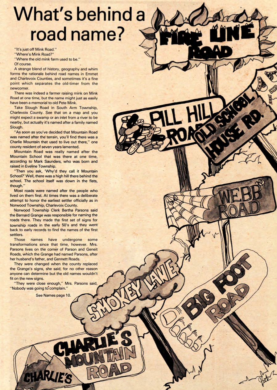
Northern Mich~Mash Preserve
~ BYPASSES and R0ADWAYS~
The design and compilation of the text and photos on this site are copyrighted 2017.
Most posted items will enlarge by "clicking" on them.
"Clicking" on some color highlighted words may access additional information.
Most posted items will enlarge by "clicking" on them.
"Clicking" on some color highlighted words may access additional information.
Please do not copy the photos on this site, many of which have been submitted by private individuals...
just come back and visit the site often to view the photos.
just come back and visit the site often to view the photos.

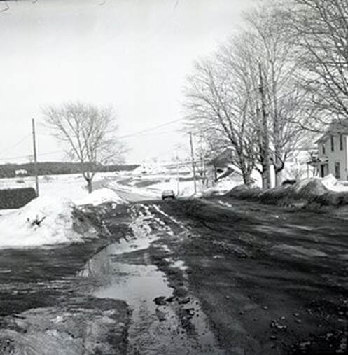
13 July 1978 ~ Emmet County Graphic
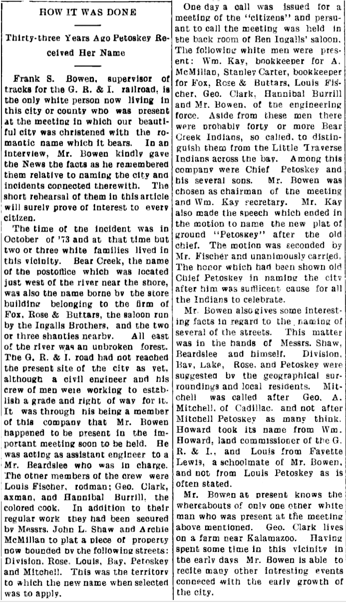
October 1873
Article Below reported in the 30 March 1906 The Petoskey Independent: Frank S. Bowen, supervisor of the tracks for the Grand Rapids & Indiana [G.R. & I.] railroad was at the 1873 meeting when the City of Petoskey was christened with the name it bears now [2023]. Only two or three white families lived in the vicinity. Bear Creek, was the name of the post office in 1873 it first was designated in 1857 with the Porter Mission Farm aka "Porter's Village", with Andrew Porter claiming title to being the FIRST Petoskey Postmaster along with Dr. LIttle. In 1874 a petition was circulated to remove the post office from the mission when the name changed to Petoskey City, and then the post office was kept in Dr. Little's Rose House on Lake Street.
The G.R. & I. railroad had not reached yet the present site of the city. It was through Mr. Bowen's being a member of the railroad company that Mr. Bowen happened to be present in the important October 1873 meeting to be held; planning to establish a grade and right of way for the future tracks. Mr. Bowen was acting as assistant engineer to Mr. Beardslee who was in charge. The other members of the crew were Louis Fischer, rodman; George Clark, axman, and Hannibal Burrill, the colored cook. In addition to their regular work they had been secured by Mssrs. John L. Shaw and Archie McMillan to plat a piece of property now surrounded by the following streets: Division, Rose, Louis, Bay, Petoskey and Mitchell. This was the territory to which the new name when selected was to apply.
The meeting was held in the back room of Ben Ingalls’ saloon, in the west side. Those present were: William Kay, bookkeeper for A. McMillian, Staley Carter, bookkeeper for Fox, Rose & Buttars, Louis Fischer, George Clark, Hannibal Burrill and Mr. Bowen, of the engineering force. Aside from these men were probably forty or more Bear Creek Indians, so called, to distinguish them from the Little Traverse Indians across the bay. Among this company were Chief Petoskey and his several sons. Mr. Bowen was chosen as chairman of the meeting and William Kay as secretary. Mr. Kay introduced the motion to name the new plat of ground “Petoskey” after the old chief. The motion unanimously carried.
In the 1906 article Mr. Bowen told that the naming of several of the streets was in the hands of Messrs. Shaw, Beardslee, and himself. Division, Bay, Lake, Rose, and Petoskey were suggested by the geographical surroundings and local residents. Mitchell was called after George A. Mitchell, of Cadillac, and not after Mitchell Petoskey as many think. Howard Street took its name from William Howard*, land commissioner of the G.R. & I. and Lewis Street from Fayette Lewis a schoolmate of Mr. Bowen, and not from Louis Petoskey as is often stated.
* William Alanson Howard (8 April 1913-10 April 1880) was Land Commissioner of the G.R.&I. from 1869 to 1871. Howard served as a member of the United States House of Representatives from Michigan from 4 March 1855 to 3 March 1859 and from 15 May 1860 to 3 March 1861. Howard was the sixth Governor of the Dakota Territory from 1878 to 1880.
30 March 1906 ~ Petoskey Evening News
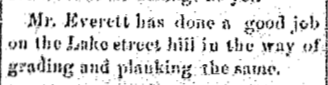
Article Below: Lake Street was improved with grading and planking.
1875
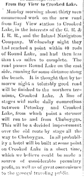
11 June 1875 ~ Emmet County Democrat
Article Below: New Road from Bay View Station to Crooked Lake
1877
1877
22 June 1877 ~ Emmet County Democrat
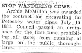
Article Below: An 1881 contract for water pipes needed an ordinance for prohibiting wandering cows.
1881
1881
10 July 1952 ~ Northern Michigan Review
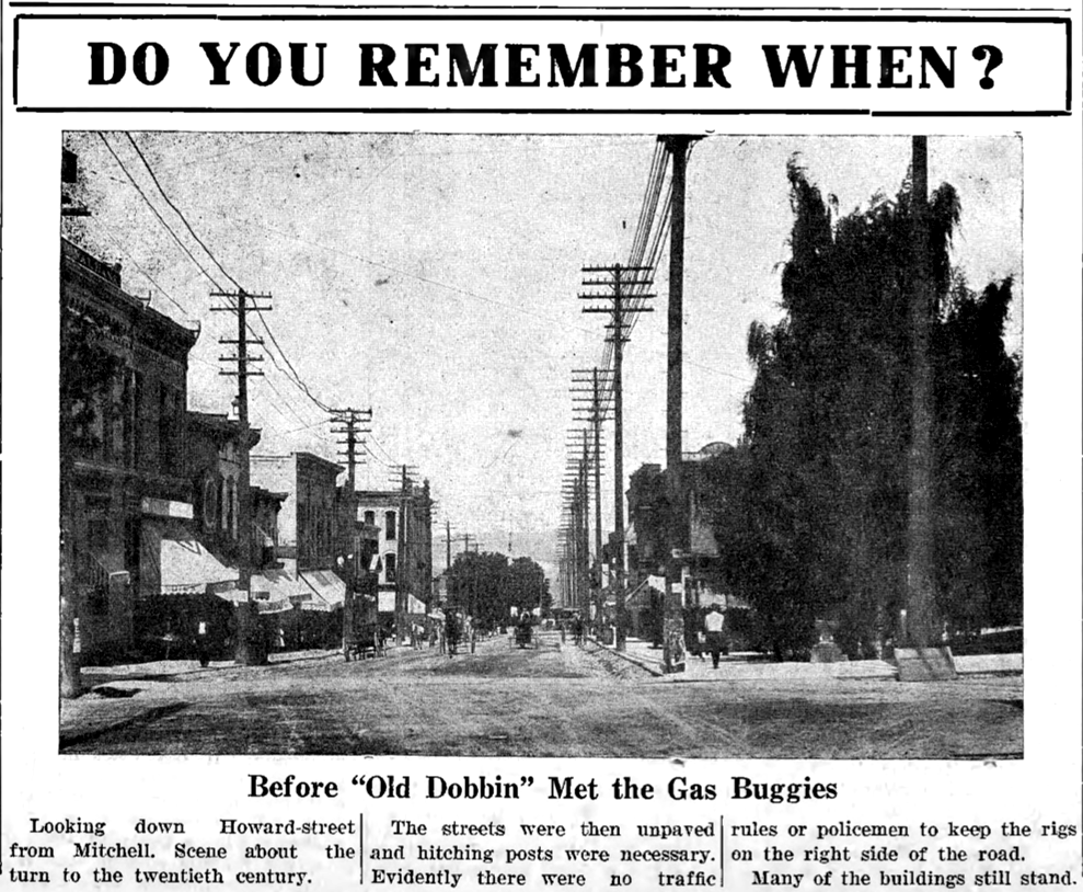
Article Below: Bliss residents had driven a route by way of Otsego and Gaylord,
a route that for a good portion of the way between Gaylord and Petoskey is only a blazed trail.
1881
a route that for a good portion of the way between Gaylord and Petoskey is only a blazed trail.
1881
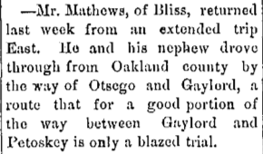
22 November 1881 ~ Emmet County Independent
By 1895, James Buckley was the FIRST Mayor of Petoskey,
although several men had served as Village Presidents.
Buckley had lived in Petoskey for 37 years and had been connected with all the public affairs of civic life when he passed in 1911.
Mr. Buckley served as Petoskey Postmaster two different times.
1881
although several men had served as Village Presidents.
Buckley had lived in Petoskey for 37 years and had been connected with all the public affairs of civic life when he passed in 1911.
Mr. Buckley served as Petoskey Postmaster two different times.
1881
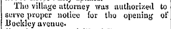
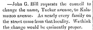
20 December 1881 ~ Emmet County Independent
Article Below: Change Name of Tucker Avenue to Kalamazoo Avenue... Petoskey, Michigan
1882
1882
11 April 1882 ~ Petoskey City Record
Article Below: GR&I Fence will Fence Out Any Wagon Road Leading North into the Country
1882
1882

22 June 1882 ~ Petoskey City Record
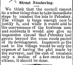
Article Below: Street Numbers requested for Village of Petoskey
1887
1887
20 July 1887 ~ The Petoskey Resorter
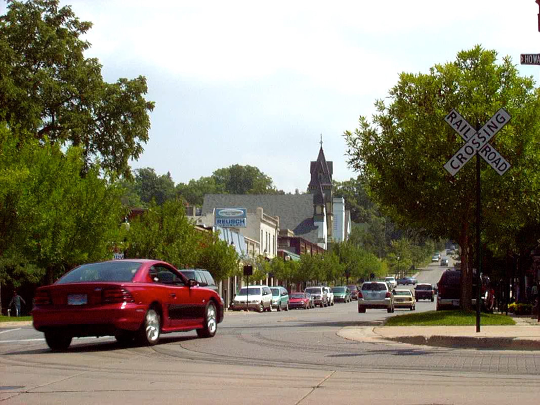
Photo Below: The FIRST train came into Petoskey in 1873... Trains were a major transportation source. This train is parked in Petoskey's downtown Park... probably "Railroad Park" at that time... later, "Cushman Park" and now "Pennsylvania Park." Click HERE to access additional information on this same web site, about Petoskey's railroads.
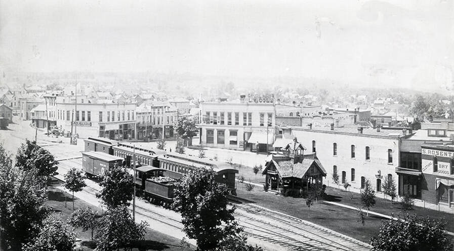
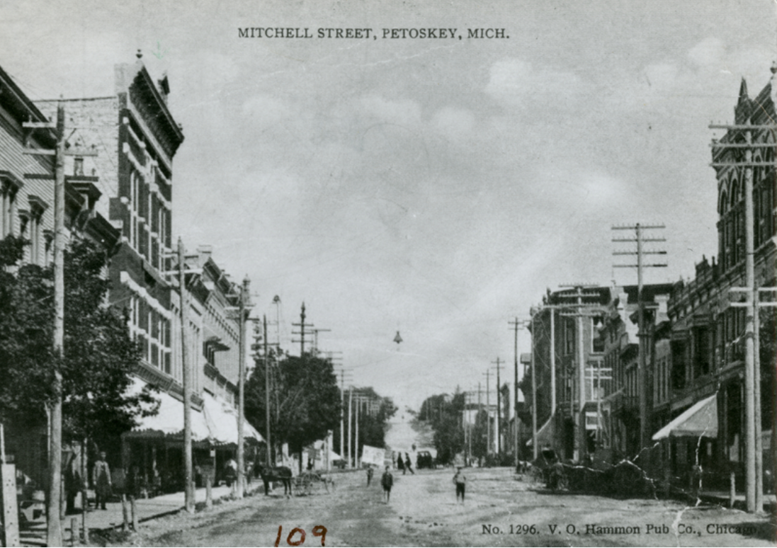
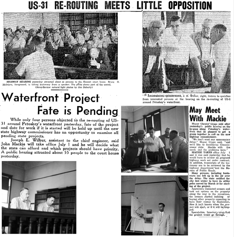
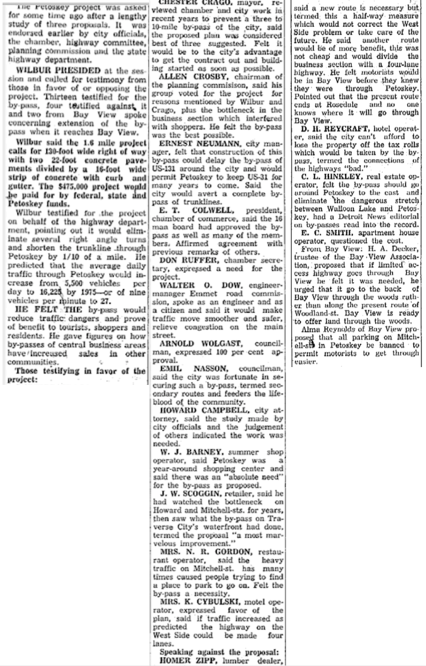
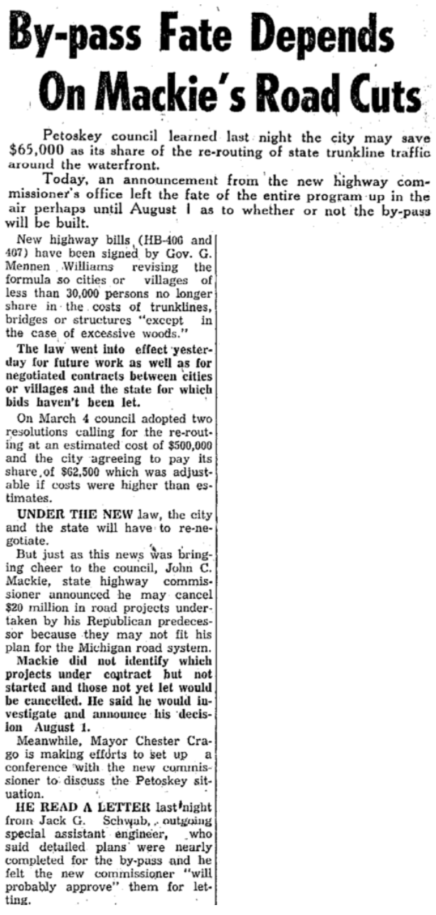
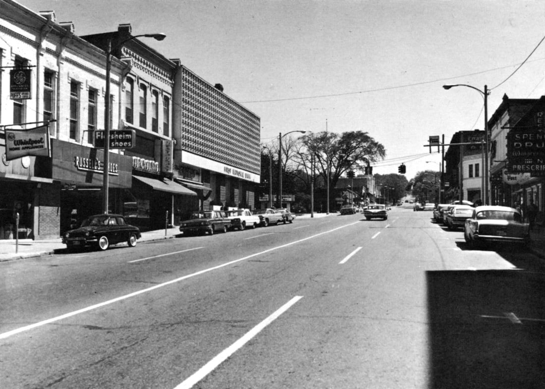
This photo below shows the intersection of Mitchell and Howard streets, with the bank on the right hand corner. Next to the bank (2022 still a bank ~ Chase) was Cole's (drugs, toys wallpaper), with Fishing Tackle next door. In the "Flatiron" block the Rosenthal sign is predominant. Across the corner from the bank is McOmber's Furniture-grocery (Years later Gittleman's, 2022 First Community Bank), next door the Grocery, and farther down the street "Oysters."
Little Traverse Historical Museum (Undated)
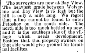
Article Below: Heaviest Grade Between Wolverine and Bay View is 75 Feet
1889
1889
20 November 1889 ~ The Petoskey Record
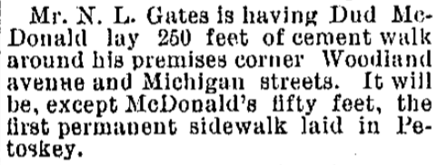
Article Below: 250 Feet of Cement Walk ~ Some of FIRST Laid in Petoskey
1893
1893
14 June 1893 ~ The Petoskey Record
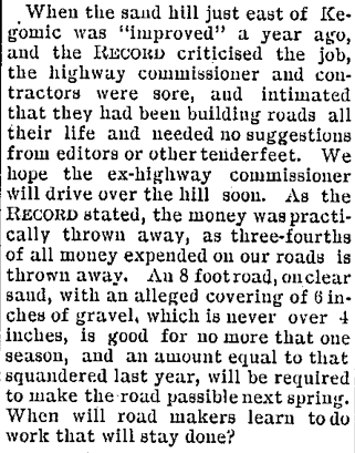
Article Below: Kegomic Sand Hill Improvement
1896 >1897
1896 >1897
28 July 1897 ~ The Petoskey Resorter
|
Article Below: Good Roads Crank
1895 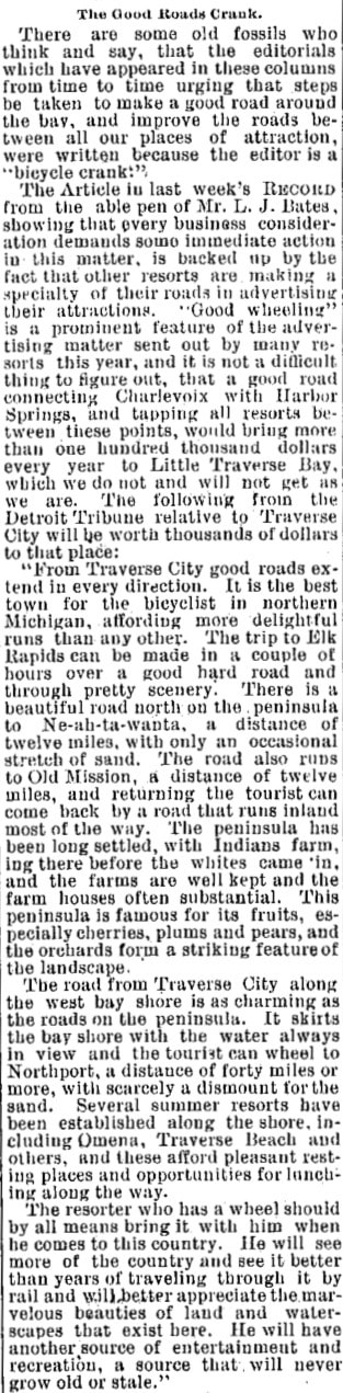
10 July 1895 ~ The Independent Democrat
|
|
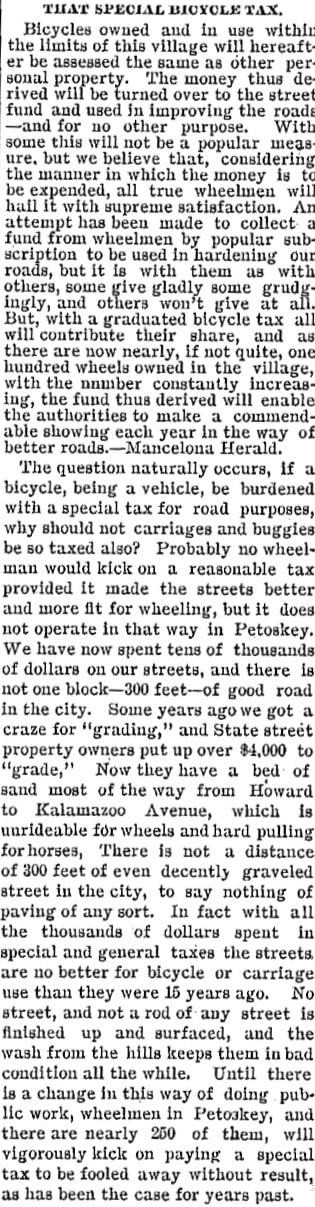
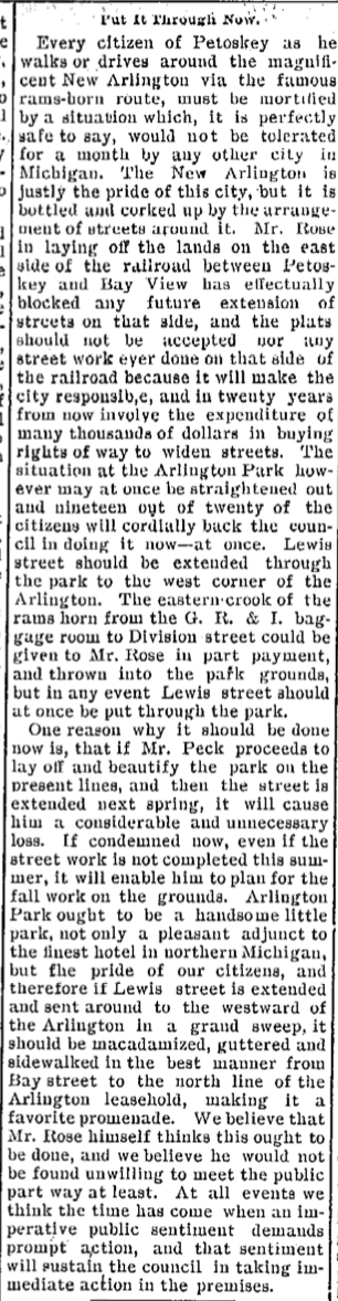
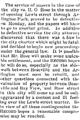
Article Below: Defective Papers for Opening Lewis Street Through Arlington Park
1899
18 January 1899 ~ The Petoskey Record
M-13 > Standish Avenue
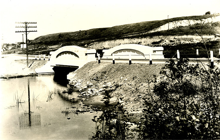
In the late 1800's, the bridge, now known as the Standish Bridge was built over Bear River.
More information about the Standish Bridge can be found on this same web site by clicking HERE.
More information about the Standish Bridge can be found on this same web site by clicking HERE.
Standish Avenue used to be M-13 just south of Petoskey
and one of the main roads leading into the city from the direction of Walloon Lake.
(NOW Bear River Road turning into Standish Avenue)
Yes, M-13... When the state highway system was first designed in 1919...
Next, M-13 became M-131 following the path of the present Bear River Road.
The Bear River Road M-131 followed the general path direction,
but a different location, from modern US 131.
The Standish Avenue Bridge was built by the Michigan State Highway Department,
using Petoskey Portland Cement.
Click HERE to access he Michigan Highways website which explains about M-13:
" 1920 – In the days before the debut of the US Highway system, M-13 ran along what was later designated US-131, from Indiana south of Mottville, northerly through Kalamazoo, Grand Rapids, Cadillac and Petoskey to end in Harbor Springs. Interestingly, the 'original' M-13 doesn't follow the later course of present-day US-131 directly from Walton to Fife Lake in southeast Grand Traverse Co, but rather running northerly along present M-113, then east along present M-186 back to Fife Lake!"
AND
"1926 – The US Highway System is finalized by the American Association of State Highway Officials (AASHO) and the new US-131 designation is to supplant the portion of M-13 from the Indiana state line via Kalamazoo, Grand Rapids, Big Rapids and Cadillac, to just west of Fife Lake in southeastern Grand Traverse Co. From Fife Lake northeasterly, through Kalkaska, Mancelona, Boyne Falls and Petoskey to Harbor Springs, the remainder of M-13 will be redesignated as M-131. This is due to Michigan State Highway Dept long-term plans to construct an all-new highway alignment for US-131 between Fife Lake and the "East Bay" area of Greater Traverse City where it would connect to its "parent route," US-31. Until that time, M-131 will provide that connection until such time as US-131 is completed."
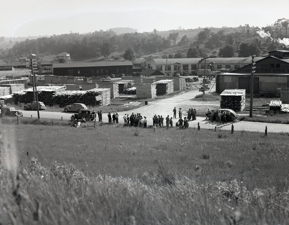
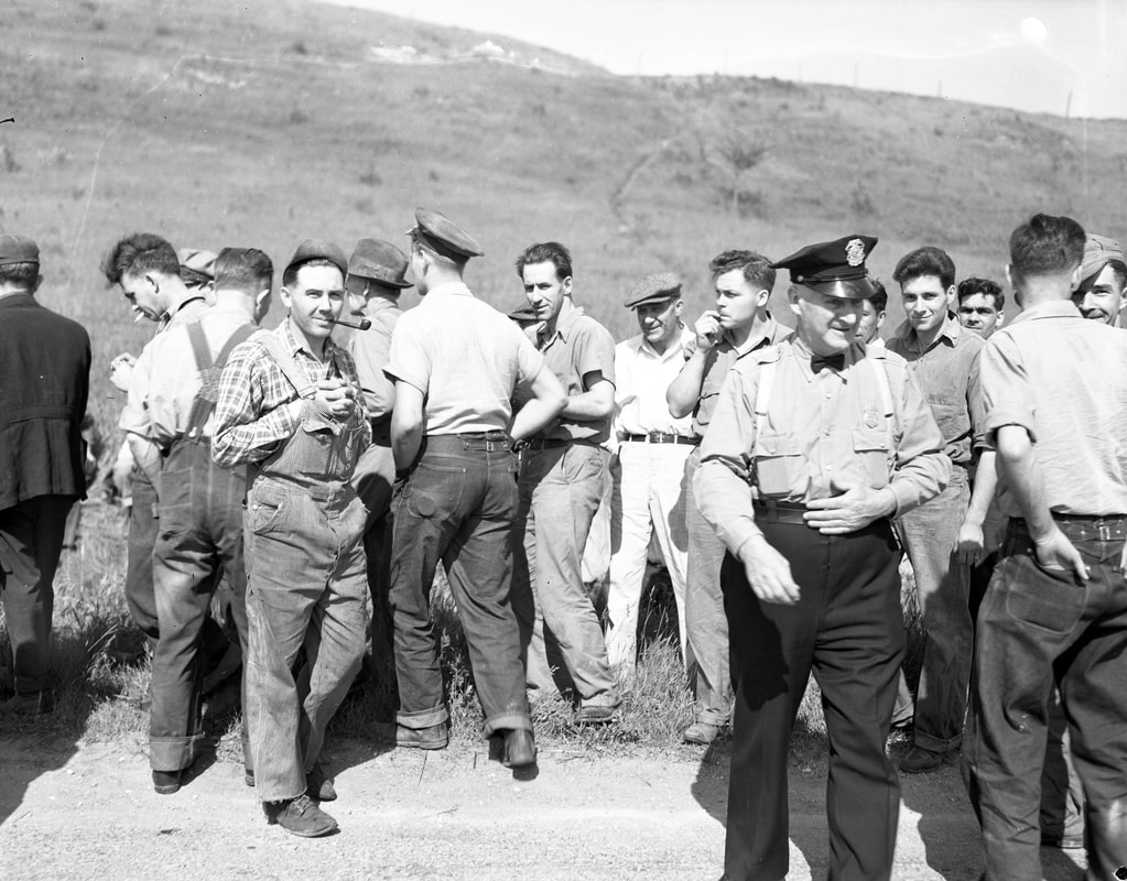
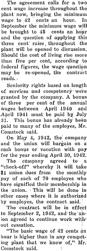
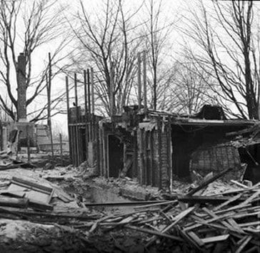
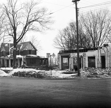
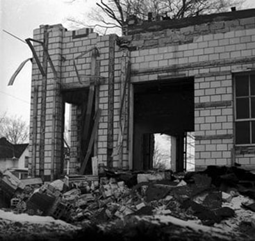
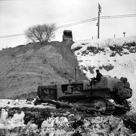
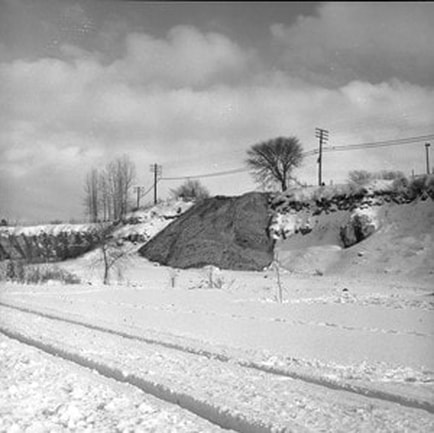
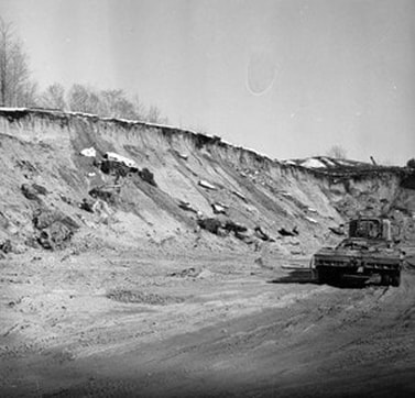
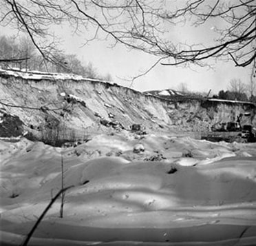
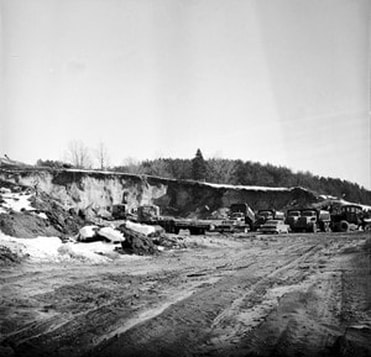
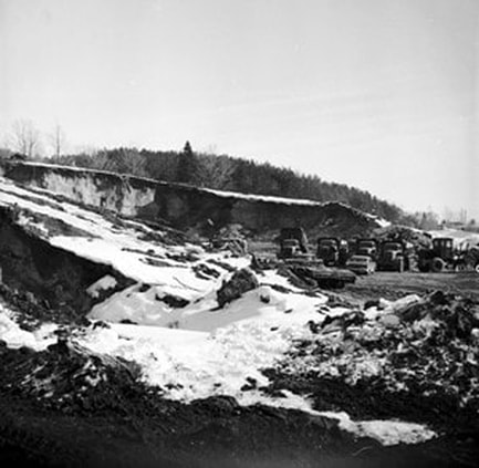
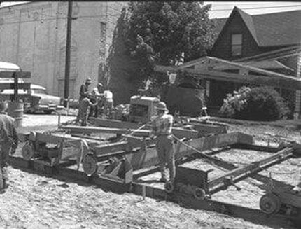
Three Photos Below dated 30 June 1941: The photos are interesting regarding Standish Avenue in that they show in the background the vacant hillside of Standish Avenue along the roadside opposite Michigan Maple Block Company where union workers were on strike. The wage-increase disagreement ended 25 August 1941 with the company giving the workers a 3-cent-an-hour raise... increasing the minimum wage from 42-cents-an-hour to 45-cents-an-hour.
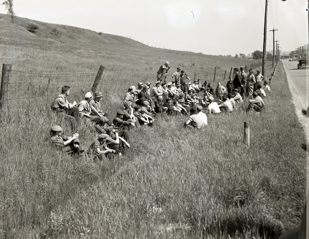
Greenwood Photo Archive Collection from Petoskey newspapers (30 June 1941)
1941 Photo Below: The perspective of the empty hillside beside Standish Avenue is viewed in perspective to Michigan Maple Block and the strikers standing opposite the plant across Standish Avenue.
Greenwood Photo Archive Collection from Petoskey newspapers (30 June 1941)
Greenwood Photo Archive Collection from Petoskey newspapers (30 June 1941)
Over the years since 1941, the hillside along Standish Avenue has completely filled in with businesses, other than Grimes Avenue which is still accessible as a footpath leading from Standish up to the south end of Howard Street.
|
30 June 1941 ~ Petoskey Evening News
|
Article Below: The Father of Asphalt Died
1903
1903

6 February 1903 ~ The Independent Democrat
Photo Below: Michigan and Howard Streets
1904
1904
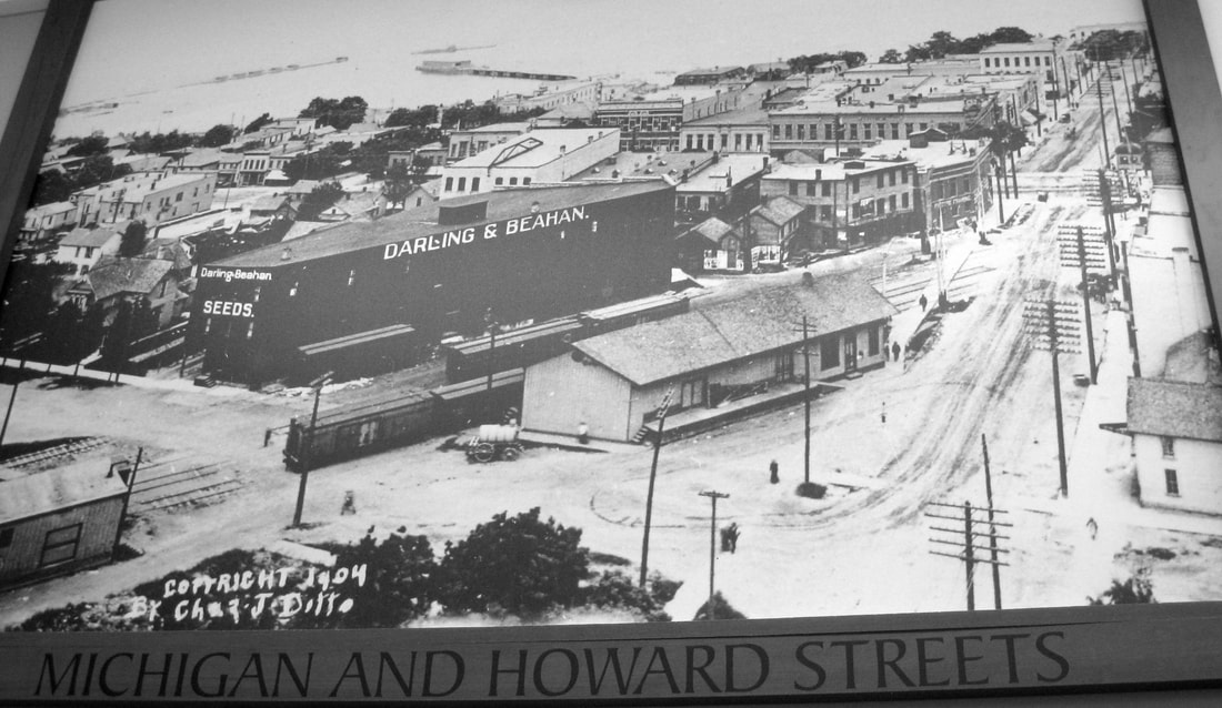
Photographed from a large photo that hung in the Glen's Supermarket in 2013...
Article Below: Petoskey Street Signs Needed
1907
1907
19 June 1907 ~ The Petoskey Record
Dudley McDonald passed away in 1932.
Dudley McDonald was noted in an 1893 news article farther above
to had laid some of the FIRST Petoskey Cement Sidewalk.
Dudley McDonald was noted in an 1893 news article farther above
to had laid some of the FIRST Petoskey Cement Sidewalk.
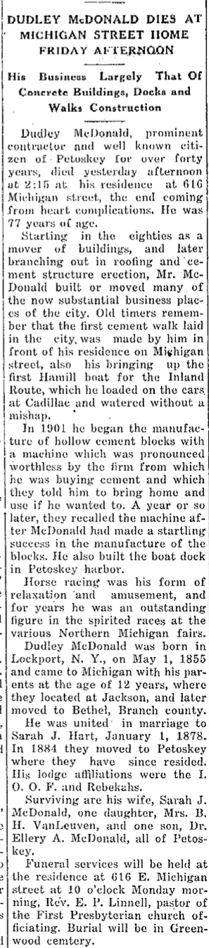
20 August 1932 ~ Petoskey Evening News
|
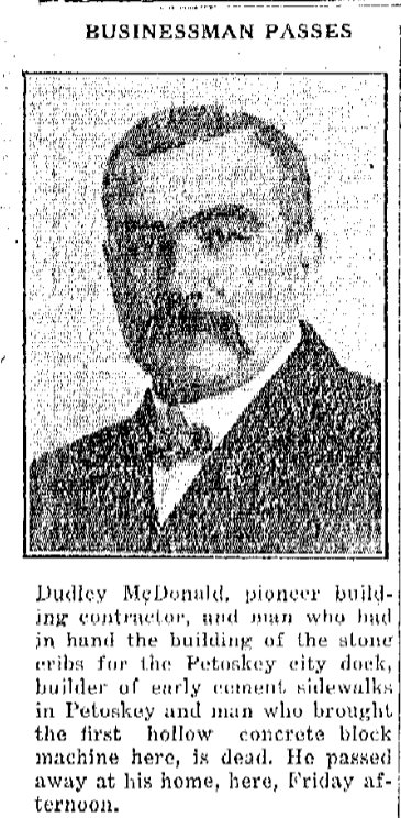
20 August 1932 ~ Petoskey Evening News accompanying photo with article to the left...

11 July 1916 ~ Petoskey Evening News
|
PRE 1911 AND 2020
2020 Photo Below: Corner of East Mitchell and Liberty streets, Petoskey, Michigan. The building on right houses Farmers Insurance (was Potts Dry Cleaners years ago). That same Potts location was once home of a gas station and garage operated by Alfred J. Brown. Previous to that, Alfred was employed for many years as a mechanic for his brother Benjamin Brown at Charlevoix. The buildings on the left house Capital Granite, Young & Meathe ~ Custom Homes Restoration, and the red building previously housed Ingrid's Hair Salon. Compare the Capital Granite building to the same building (in the next photo below) which, even before 1911, housed Comstock & Son Dry Goods. Also, next door to the Comstock store... the house with the entryway arches, of small stones, which were a landmark design, is now the Young & Meathe house/business which has been redone in the recent years. The house previously had been Flowers From Nature's Garden, a floral store.
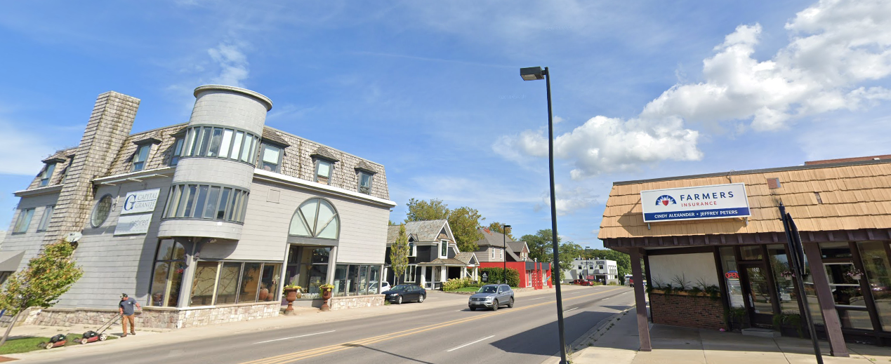
Captured (8 April 2020) from on-line Google Street View of Mitchell Street, same view as PRE-1911 photo below...
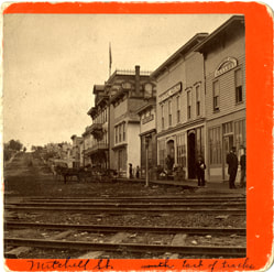
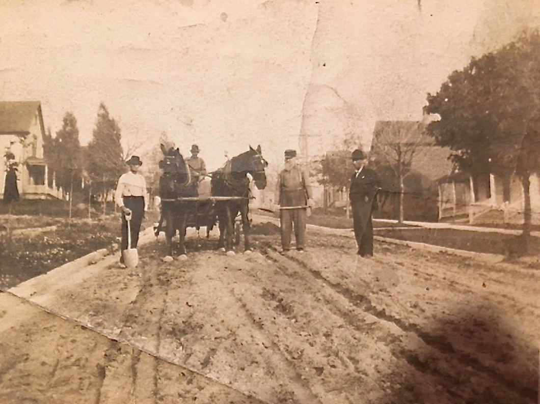
Photo Below: This photo of Herb Bartlett driving a team of horses on "unpaved" Mitchell Street was taken before 1911 because the article below the photo tells about the paving of Mitchell Street happening in 1911. Herb was a relative of Iris (Lewis) Worden's husband Earl.

Postcard Submitted by Linda Lewis with permission to use only on this Northern Mich~Mash Preserve web site...
|
Article Below: Charlevoix Avenue Principal Entrance Into, and
Exit From, the City 1905 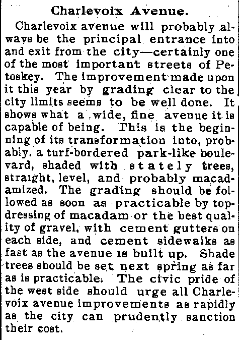
4 October 1905 ~ The Petoskey Record
|
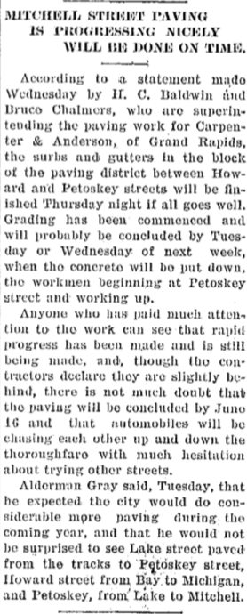
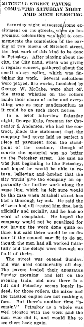
Articles Below: Mitchell Street Paving
1911
|
|
Article Below: Pavement on Mitchell Street
1912 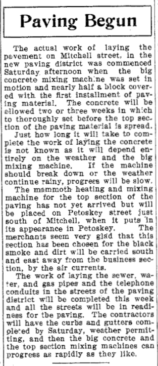
21 May 1912 ~ Petoskey Evening News
|
Article Below: Petition to Pave State Street
1912 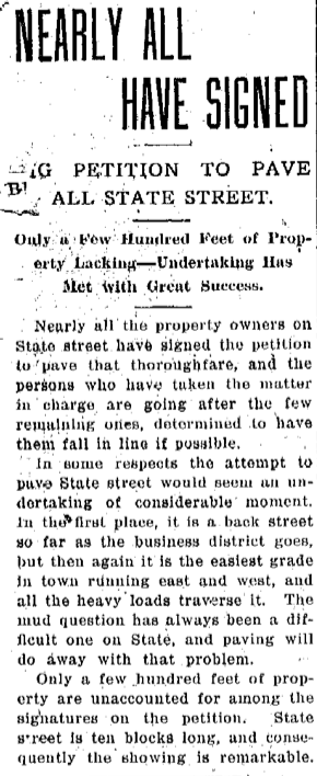
19 July 1912 ~ Petoskey Evening News
|
Photo/Text Below:
The last virgin timber on the Johnecheck farm was cleared in 1912 to make way for
Camp Daggett Road.
1912
The last virgin timber on the Johnecheck farm was cleared in 1912 to make way for
Camp Daggett Road.
1912
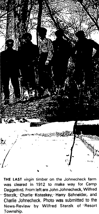
8 Apri 1977 ~ Petoskey News Review
1913
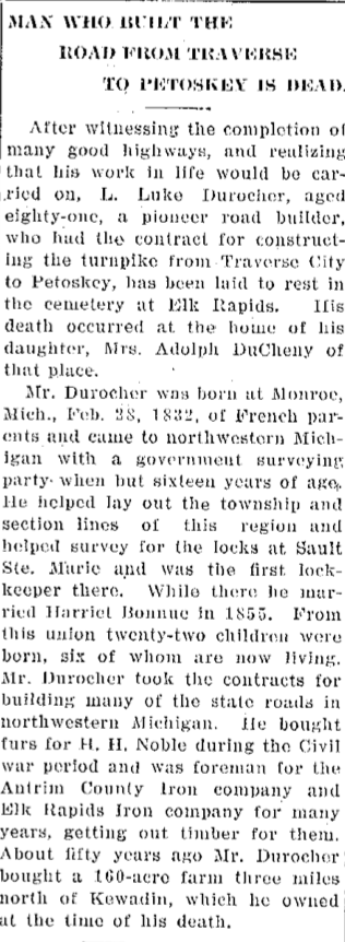
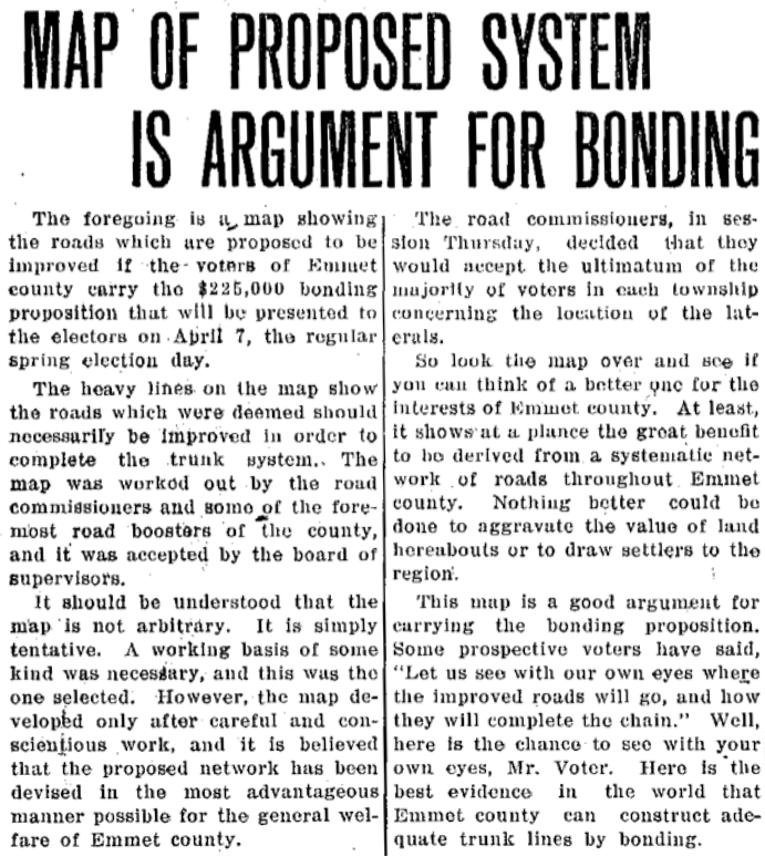
Article Below Left: Should Emmet County Bond for building better roads?
Article Below Right: "Man [L. Luke Durocher] Who Built the Road From Traverse to Petoskey is Dead"
Article Below Left: Should Emmet County Bond for building better roads?
Article Below Right: "Man [L. Luke Durocher] Who Built the Road From Traverse to Petoskey is Dead"
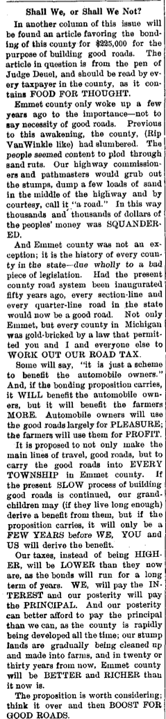
16 January 1913 ~ The Petoskey Record
|
12 June 1913 ~ Petoskey Evening News
|
22 March 1913 ~ Petoskey Evening News MAP accompanied the article below...
22 March 1913 ~ Petoskey Evening News article accompanied the MAP above...
Elm Street > Lockwood Avenue
Elm Street became Lockwood Avenue after the advent of the Lockwood Hospital on that street.
Elm Street became Lockwood Avenue after the advent of the Lockwood Hospital on that street.
The 3 January 1958 Petoskey News Review editorial reported that Mr. [Chalmers] Curtis campaigned to end the "Ram's Horn" of the state trunkline from Louis [sic Lewis] Street to Division Street which once wound around the Pennsylvania depot. This provided the straightening of the state trunkline from Louis Street to the end of Division Street near the tennis courts. I used to go around the Pennsylvania depot.
Chalmers Curtis was an original trustee of Lockwood General Hospital and was a life member of the board. Largely through Chalmers Curtis' efforts Lockwood Avenue was built. The Sanborn Fire Insurance maps for the years 1895, 1896, 1901, 1907, 1913, and 1919 do not have a Lockwood Avenue even listed on those Sanborn maps... the roadway in those times was identified as Elm Street which no longer exists in the city of Petoskey.
Chalmers Curtis was an original trustee of Lockwood General Hospital and was a life member of the board. Largely through Chalmers Curtis' efforts Lockwood Avenue was built. The Sanborn Fire Insurance maps for the years 1895, 1896, 1901, 1907, 1913, and 1919 do not have a Lockwood Avenue even listed on those Sanborn maps... the roadway in those times was identified as Elm Street which no longer exists in the city of Petoskey.
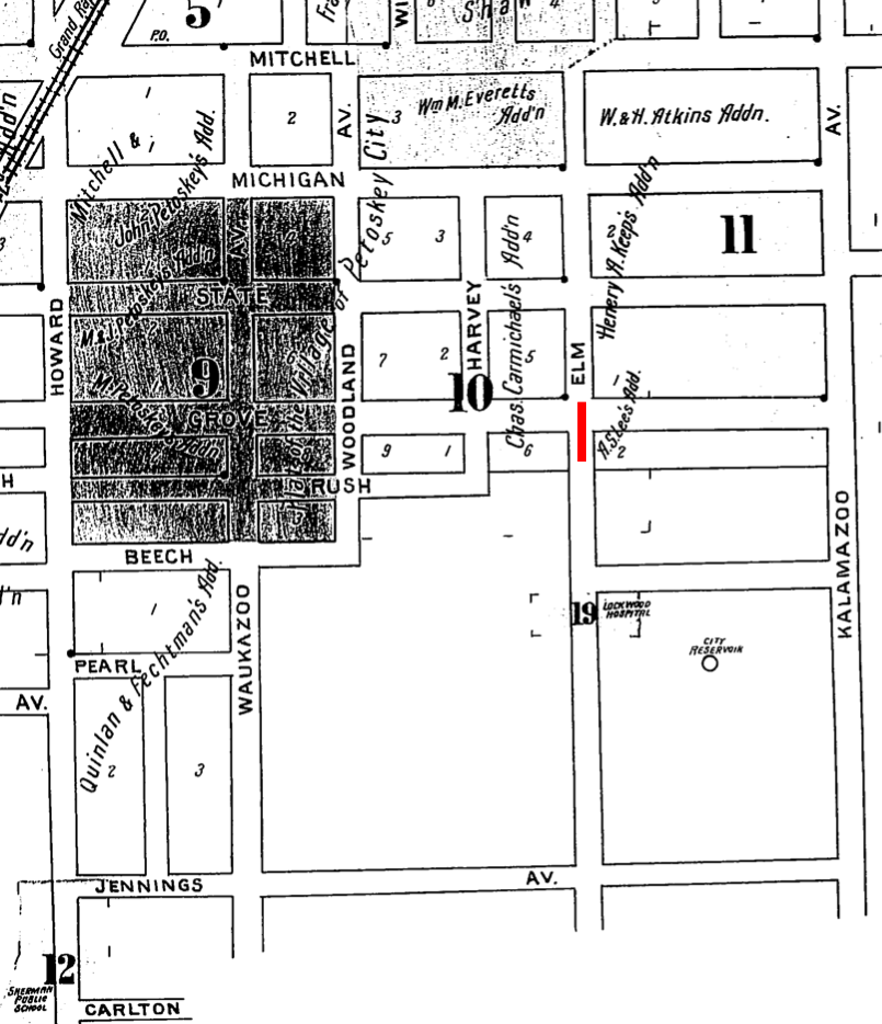
1895, 1890, 1896, 1901, 1907, 1913, 1919 Sections of Sanborn maps show Elm Street, but no Lockwood Avenue...
|
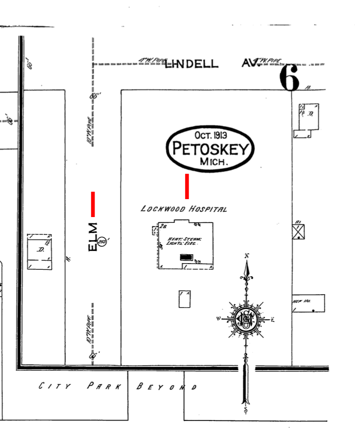
1913 Secion of Sanborn Map
|
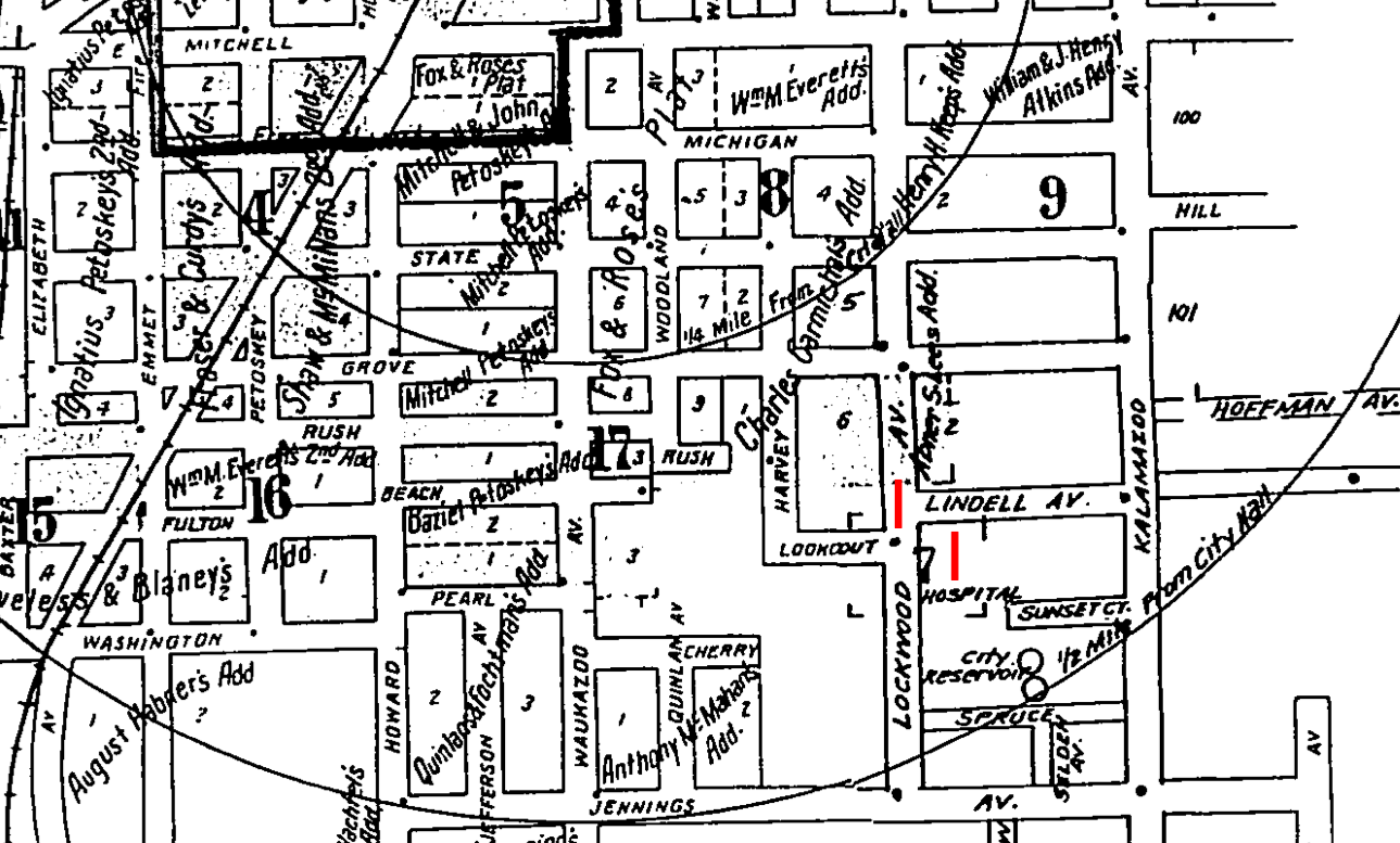
1929 Section of Sanborn Map
1915
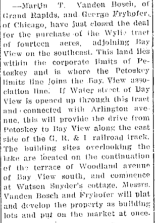
Articles Below: Construction of Road Toward Bay View by a Road Across Arlington Park
Articles Below: Construction of Road Toward Bay View by a Road Across Arlington Park
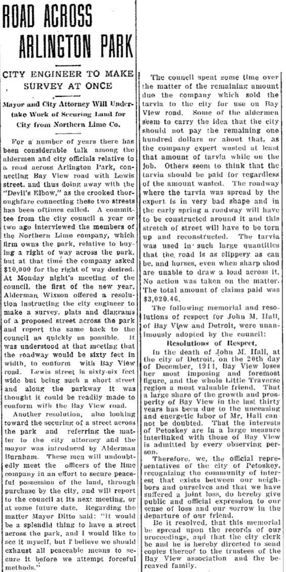
5 January 1915 ~ Petoskey Evening News
|
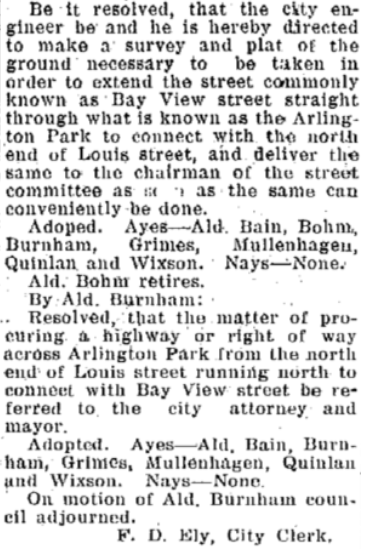
7 January 1915 ~ Petoskey Evening News
19 July 1915 ~ Petoskey Evening News & The Daily Resorter
|
1916
|
Article Below: A new street will be started from Division Street on the east side of the
Railroad to Rosedale. 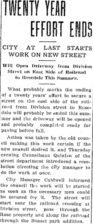
19 May 1916 ~ The Petoskey Evening News
|
Article Below: Gravel Screen from McManus Co.
for Petoskey Streets 1916 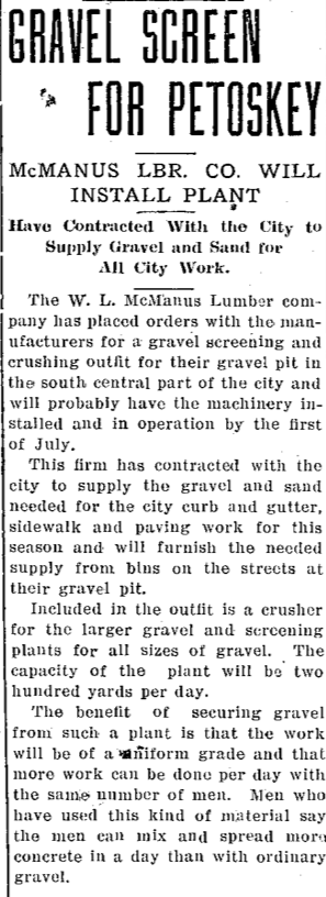
10 June 1916 ~ Petoskey Evening News
|
1916 Article Below: More Light Ordered for Safety Purposes

22 August 1916 ~ Petoskey Evening News
1919
FIRST Concrete Pavement between Petoskey and Charlevoix
FIRST Concrete Pavement between Petoskey and Charlevoix
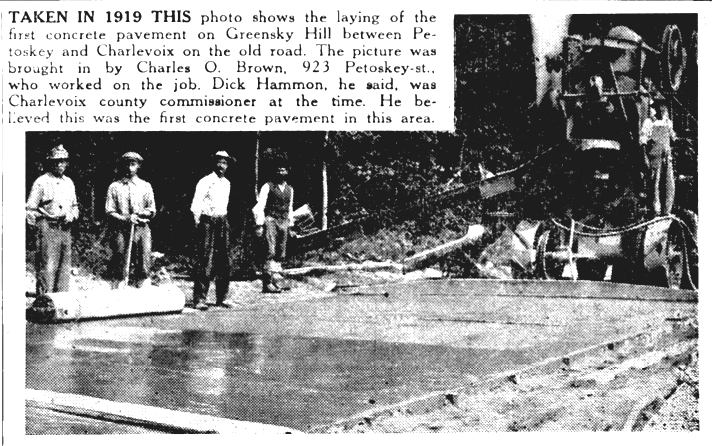
29 September 1949 ~ Northern Michigan Review
Petoskey Street Looking toward the H.O. Rose Dock out into Little Traverse Bay
Little Traverse Historical Society Photo Collection (Undated)
1919
FIRST Paving of Mitchell and Liberty streets in Petoskey
FIRST Paving of Mitchell and Liberty streets in Petoskey
Little Traverse Historical Society Photo Collection (1922)
1922
City Manager R. L. Wolff rode on Petoskey's FIRST city plow
City Manager R. L. Wolff rode on Petoskey's FIRST city plow
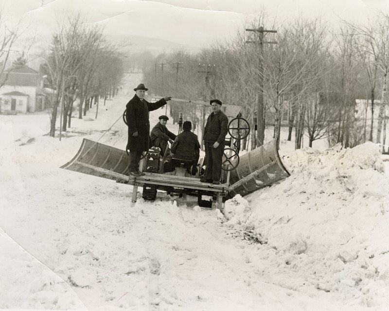
Emmet County Agriculture Extension Office photo albums submitted to the Little Traverse Historical Society
1924
Article Below: Citizens hoping for plowing service similar to that provided by Northern Auto Company
Article Below: Citizens hoping for plowing service similar to that provided by Northern Auto Company
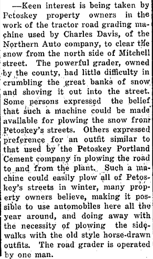
29 February 1924 ~ Petoskey Evening News
1927
Article Below: New Concrete near Arlington Park North of Petoskey
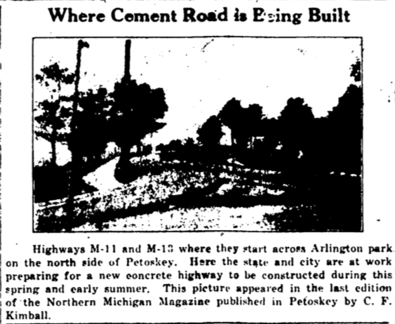
7 April 1927 ~ Petoskey Evening News
|
Article Below: "Swamp Road in Bad Shape...
Boys enjoyed the skating on the highway north of this city." 1927 
14 February 1927 ~ Petoskey Evening News
|
Article Below: Phillip J. KIrwan donated and cleared land for the road that now is Emmet street and he was the
FIRST to drive over the completed road. 1927 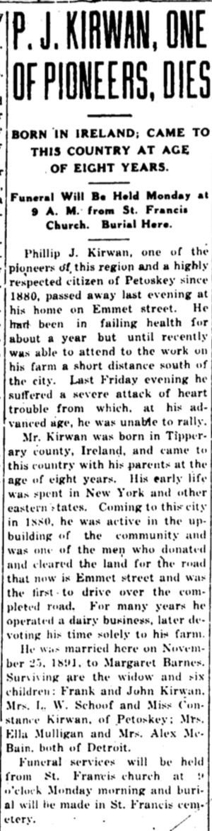
7 October 1927 ~ Petoskey Evening News
|
Winter Roadways in Winter 1927-1928
Photo Below
The photo postcard below had hand-written label on back of this postcard as: "Petoskey, Michigan Winter 1927 & 1928." The postcard front and back were printed with photographer Foley's name and "Foley's Photo Art Shop, Petoskey, Mich." Additional information and photos about J.R. Foley Photography Branch Store may be accessed by clicking HERE. The rectangular building was the OLD Petoskey Post Office located right at the corner of Petoskey and East Mitchell streets, so this snow was lining the main street of Petoskey... East Mitchell Street. Snow removal was not the best then. NOW, Petoskey trucks haul the snow to the bay side of the road heading into Magnus Park, making one wonder if the road salt just runs into Little Traverse Bay. Click HERE to access additional pictures of huge snowfalls on the county's roads on this same web site on the Emmet County Road Commission web page.
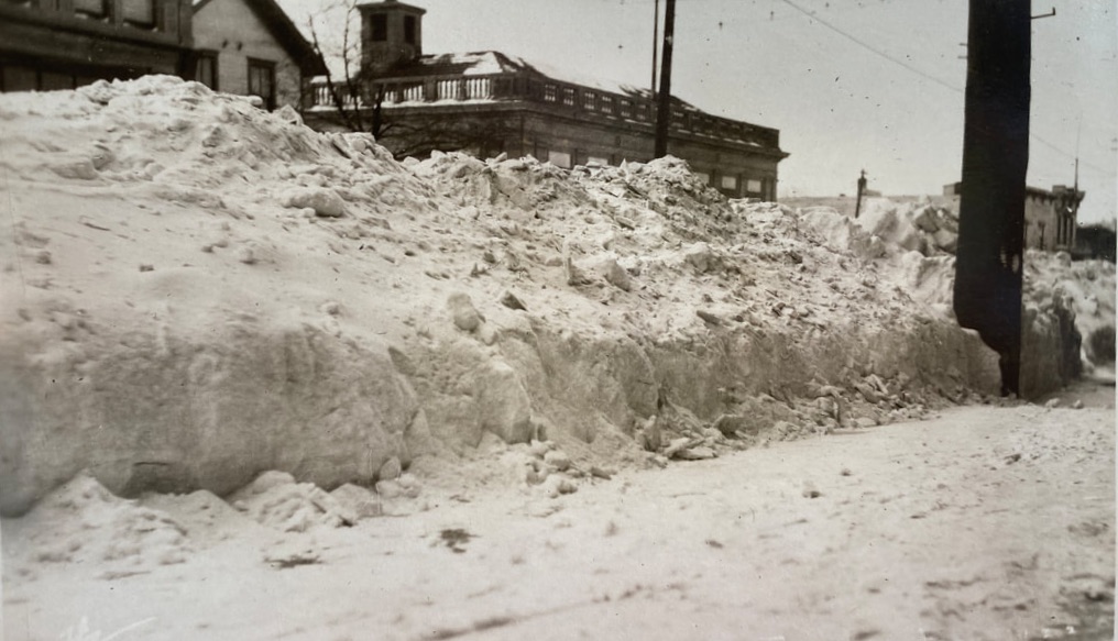
Submitted by Carrie Ludwig (Descendant of a Bay Shore, Michigan, Resident)
The 21 January 1928 Petoskey Evening News article below could be describing the two photos above
showing heavy drifting and a great deal of snow.
showing heavy drifting and a great deal of snow.
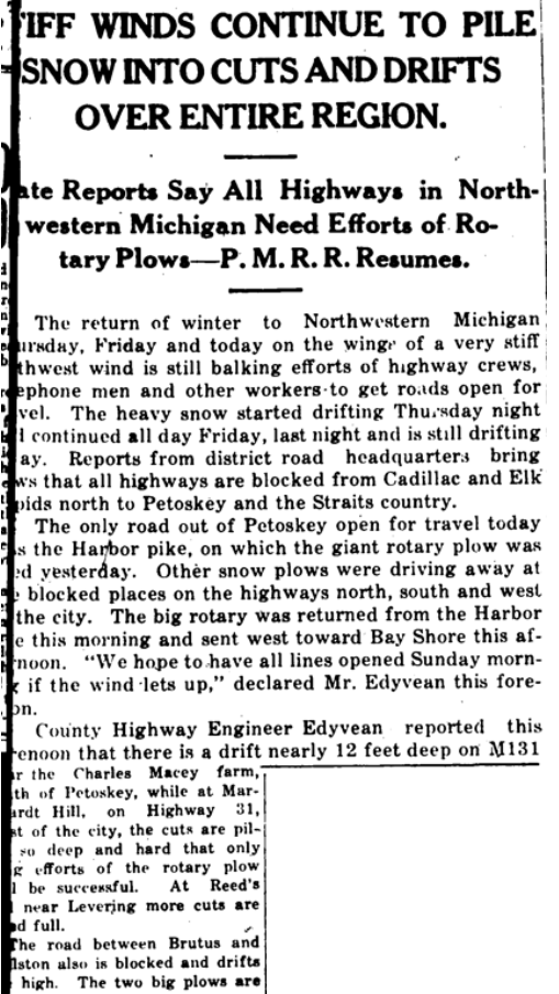
21 January 1928 ~ Petoskey Evening News (page did not copy well on the left side)
Article Below: 1928 ~ Emmet County turned over a strip of fairground land to the state highway department.
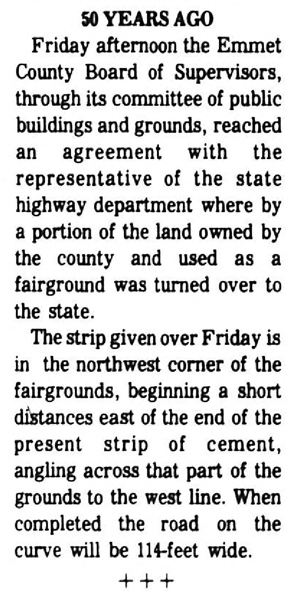
16 October 1978 ~ Petoskey News Review (50 Years ago article)
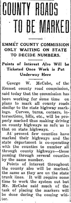
Article Below: "County Roads to be Marked."
County roads will have signs marking: points of interest, curves, turns, corners, intersections, hills, etc.
All county highways will be marked with numbers.
1929
15 October 1929 ~ Petoskey Evening News
1931 Photo Below:
~ Corner of Mitchell and Howard streets Looking West ~
~ Corner of Mitchell and Howard streets Looking West ~
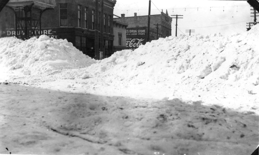
Photo submitted by Geoff Guillaume from his family's photo collection (1931)
1936 Article Below:
~ Famous Scenic Shore Drive between Harbor Springs and Cross Village Road Work to END ~
~ Famous Scenic Shore Drive between Harbor Springs and Cross Village Road Work to END ~
9 July 1936 ~ Northern Michigan Review article continued right column...
|

9 July 1936 ~ Northern Michigan Review article continued from left column...
|
1938 Article Below:
Relocation of US 31 at 131 Intersection
Prior to 1939, Mitchell Street Dead-Ended at Liberty Street, just over the Mitchell Street Bridge.
The Relocation of US 31 eliminated the Dead End.
Access additional information about the relocation of US 31 on this same web site by clicking HERE.
Relocation of US 31 at 131 Intersection
Prior to 1939, Mitchell Street Dead-Ended at Liberty Street, just over the Mitchell Street Bridge.
The Relocation of US 31 eliminated the Dead End.
Access additional information about the relocation of US 31 on this same web site by clicking HERE.
2 June 1938 ~ Emmet County Graphic
1939 Article Below:
Cherry Street only a street on paper until construction began on the "Ino" residential project.
11 May 1939 ~ Emmet County Graphic
1939 Article Below:
Changes in Roadways are a True Fairy Tale
Changes in Roadways are a True Fairy Tale
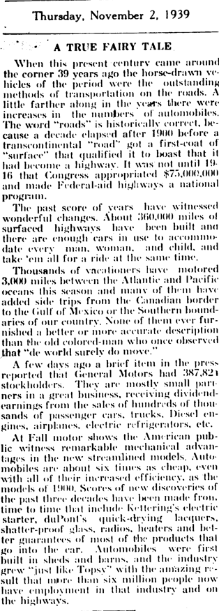
2 November 1939 ~ Emmet County Graphic
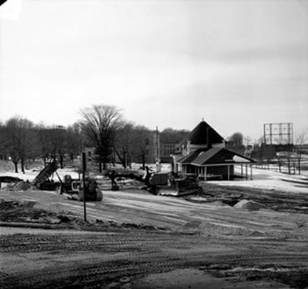
Greenwood Cemetery Hill Road To Be Paved
1940
1940
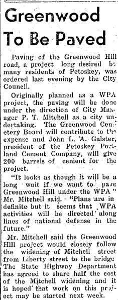
2 July 1940 ~ Petoskey Evening News
Photo/Text Below: Looking down Sheridan Street from the corner of Howard Street
shortly after the large city plow pushed back the 8 to 10 feet high drifts.
1942
shortly after the large city plow pushed back the 8 to 10 feet high drifts.
1942
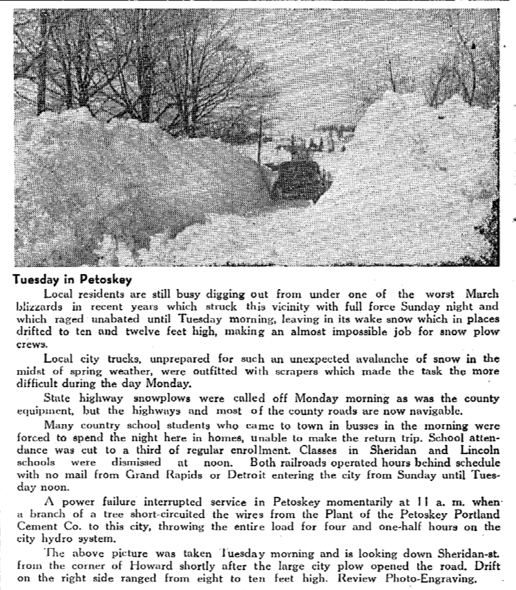
12 March 1942 ~ Northern Michigan Review
Photo Below: Intersection of Mitchell Street and Howard Street, looking north...
Kroger Grocery on the corner was in this location from about 1940 to 1946.
Kroger Grocery on the corner was in this location from about 1940 to 1946.
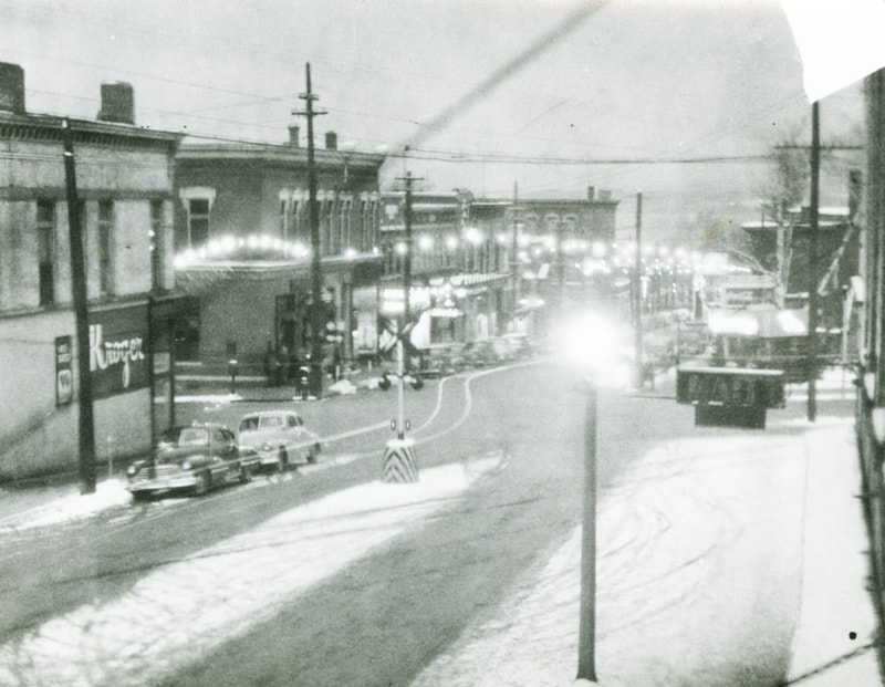
Little Traverse Historical Society Photo Collection (1940s)
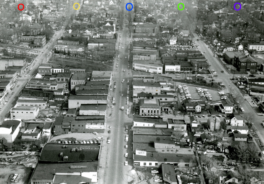
Photo Above Colored Circles on streets running east and west:
Red = Bay
Yellow = Lake
Blue = Mitchell (Main)
Green = Michigan
Purple = State
Red = Bay
Yellow = Lake
Blue = Mitchell (Main)
Green = Michigan
Purple = State
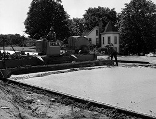
Three Photos Below: New Highway, US 31, from Petoskey to Charlevoix Closer to Little Traverse Bay
1948
1948
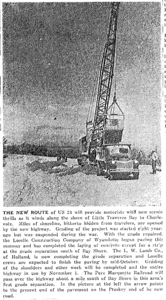
13 September 1948 ~ Petoskey Evening News
13 September 1948 ~ Petoskey Evening News
|
13 September 1948 ~ Petoskey Evening News
|
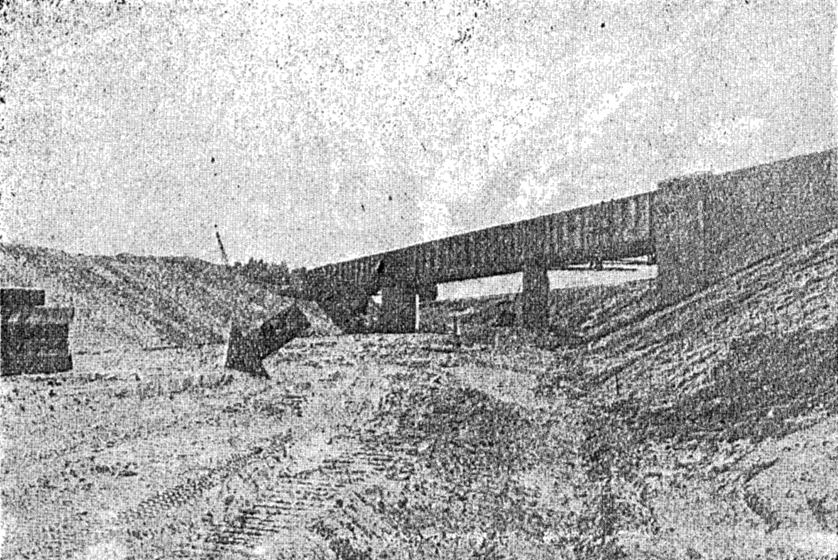
Photo/Article Below: Train glides over the new over-pass...
1948
1948
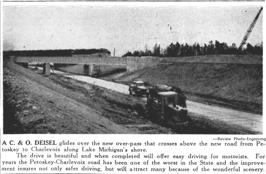
28 October 1948 ~ Petoskey Evening News
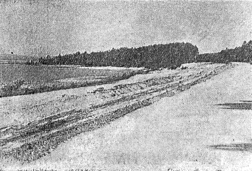
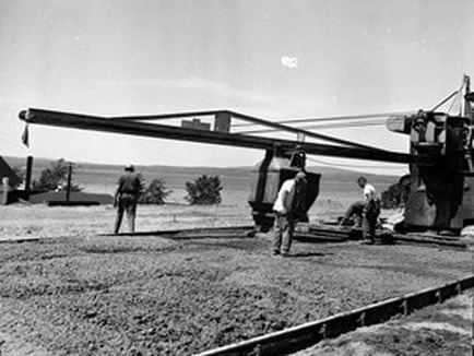
Photo/Article Below: Pavement South of Boyne Falls for traffic heading north...
1949
1949
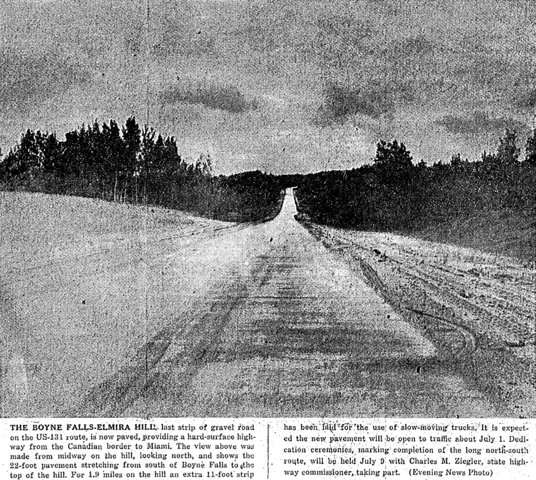
22 June 1949 ~ Petoskey Evening News
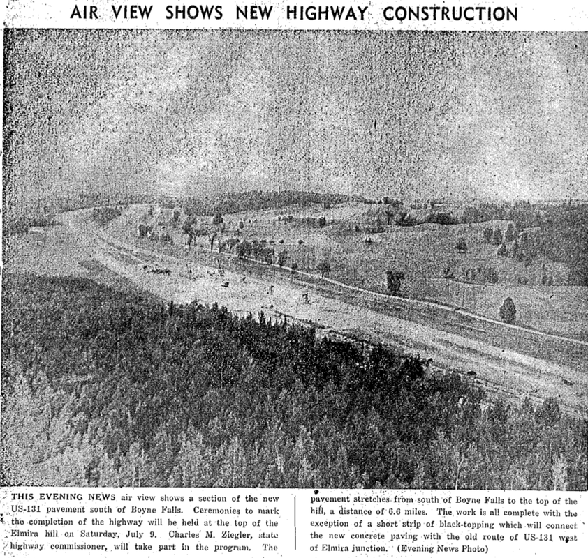
27 June 1949 ~ Petoskey Evening News
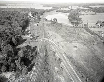
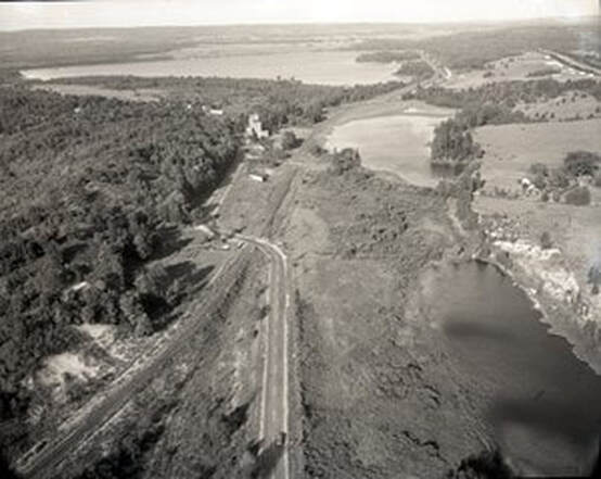
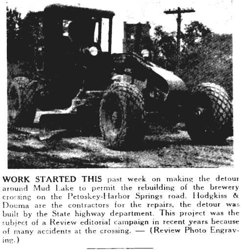
Photos Below: Need to Change Brewery Crossing?
1949
1949
Greenwood Photo Archive Collection from Petoskey newspapers (Undated)
|
Greenwood Photo Archive Collection from Petoskey newspapers (Undated)
|
Greenwood Photo Archive Collection from Petoskey newspapers (Undated)

22 September 1949 ~ Northern Michigan Review
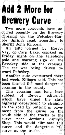
11 May 1951 ~ Northern Michigan Review
|
7 June 1951 ~ Northern Michigan Review
|
Article Below: Not clear what was being discussed in 1928 stating, "This change would eliminate the two railroad crossings at the old brewery, both of which are considered dangerous. Each crossing has had its fatal train-auto crashes in recent years and with auto travel increasing danger of further crashes also increases." Did this road improvement not happen until 1951 as noted above? Click HERE to contact the web master with any information/photo of this area of road work.
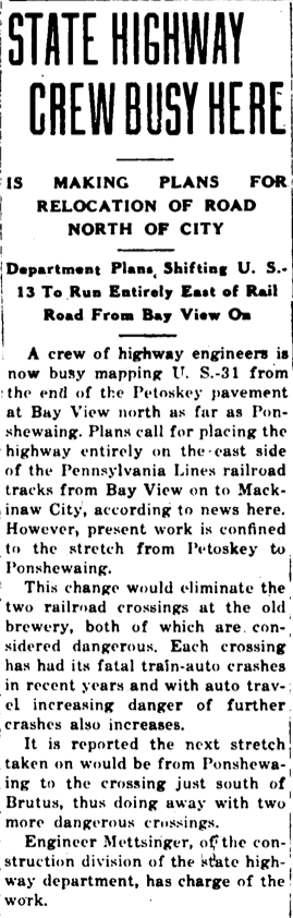
5 January 1928 ~ Petoskey Evening News
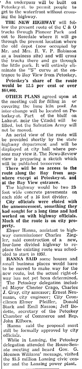
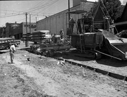
US-131 Improvements Between Emmet and Liberty Streets
1952
1952
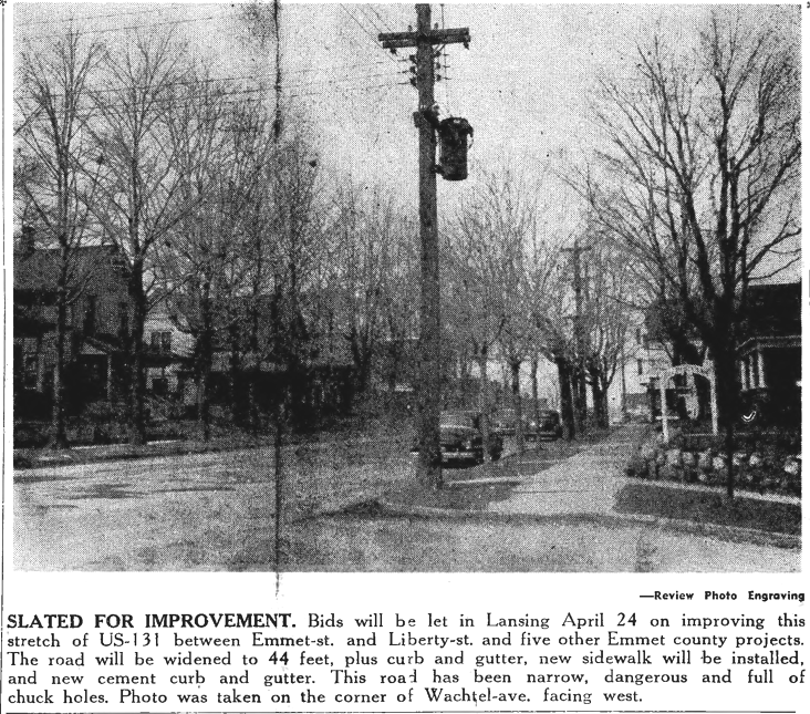
17 April 1952 ~ Northern Michigan Review
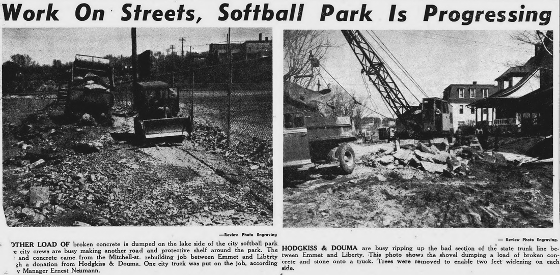
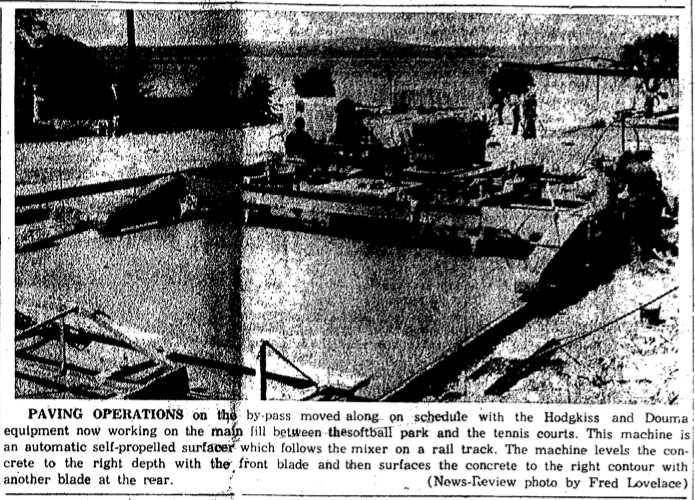
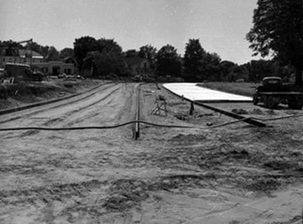
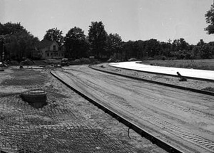
Photos/Text Below:
Street work on the State Trunk Line between Emmet and Liberty
which made the Mossback Street Dance possible.
The broken up concrete was dumped on the lake side of the city softball park.
Click HERE to read more about the 1952 Petoskey Centennial Mossback Street Dance.
Street work on the State Trunk Line between Emmet and Liberty
which made the Mossback Street Dance possible.
The broken up concrete was dumped on the lake side of the city softball park.
Click HERE to read more about the 1952 Petoskey Centennial Mossback Street Dance.
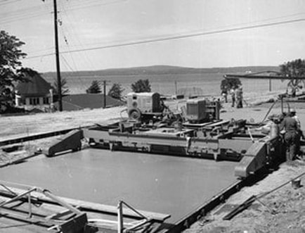
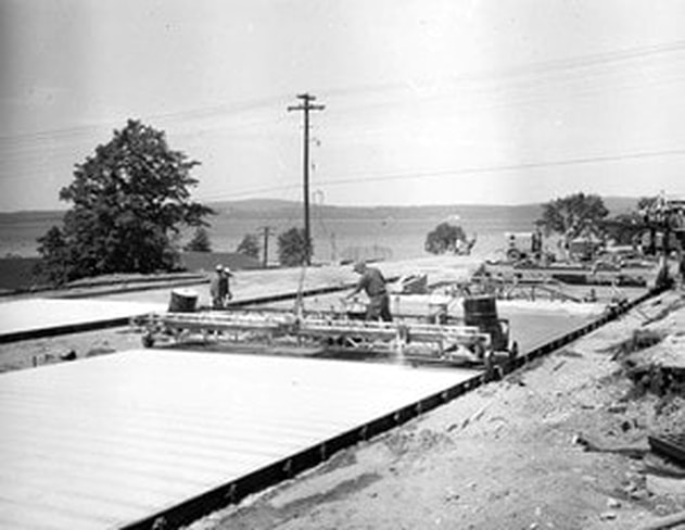
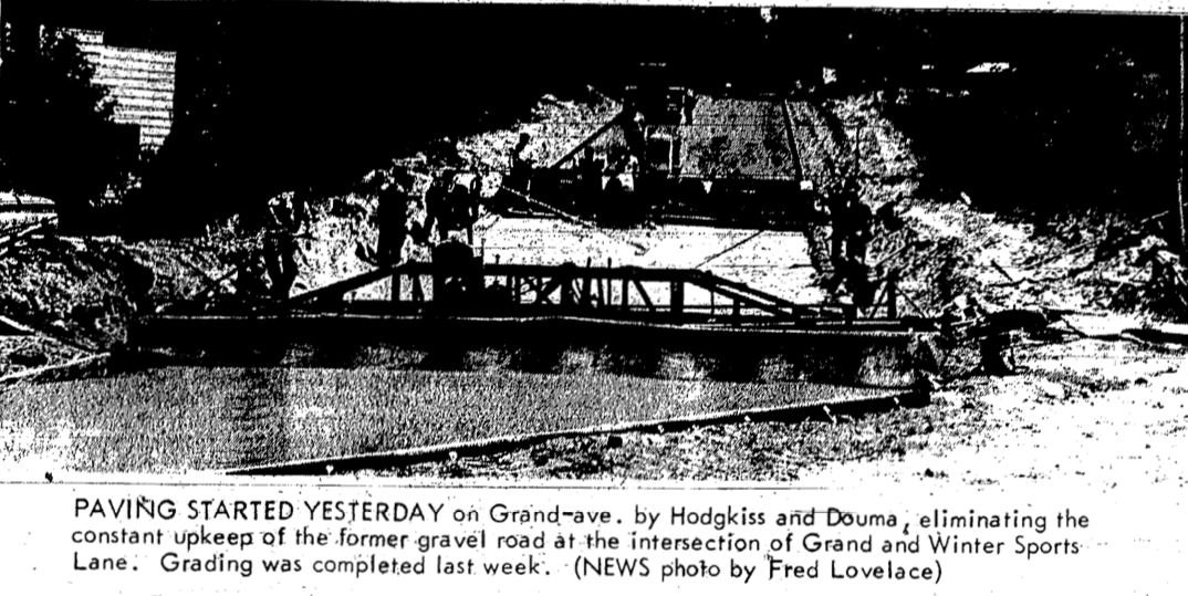
8 May 1952 ~ Northern MIchigan Review
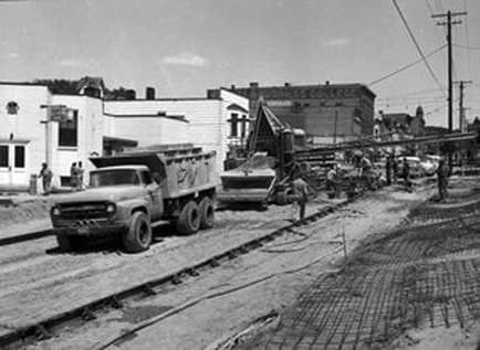
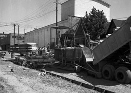
Hodgkiss & Douma are ready to roll out their caravan of road building equipment
1952
1952
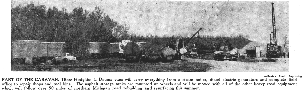
1952 05/01/52 NMR Road Building
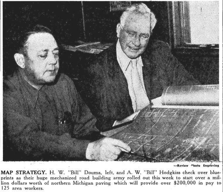
1 May 1952 ~ Northern Michigan Review
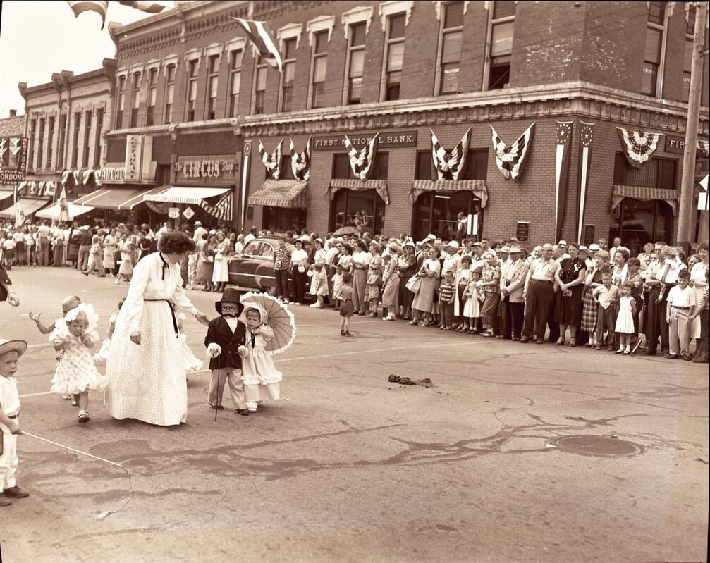
Corner of Mitchell and Howard streets was the scene of the 1952 Centennial Festival parade near the
Arcadia Restaurant, The Circus Shop and the First National Bank.
July 1952
Arcadia Restaurant, The Circus Shop and the First National Bank.
July 1952
New Pedestrian Traffic Light Installed on Corner of Howard and Mitchell Streets
1952
1952
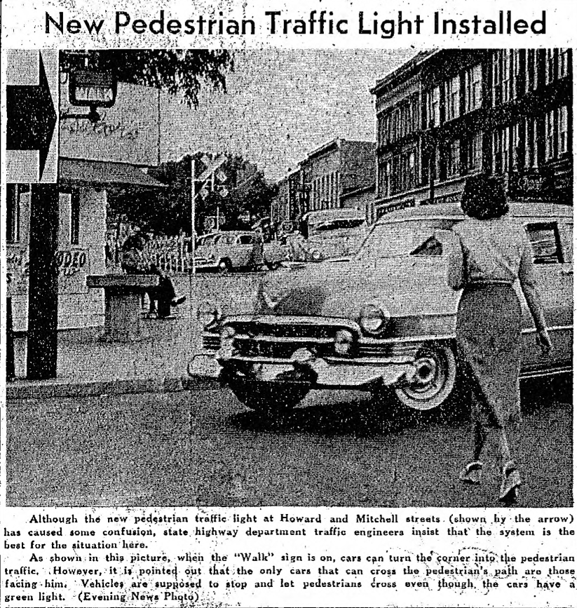
3 September 1952 ~ Petoskey Evening News
Widening Waukazoo Starts
1954
1954
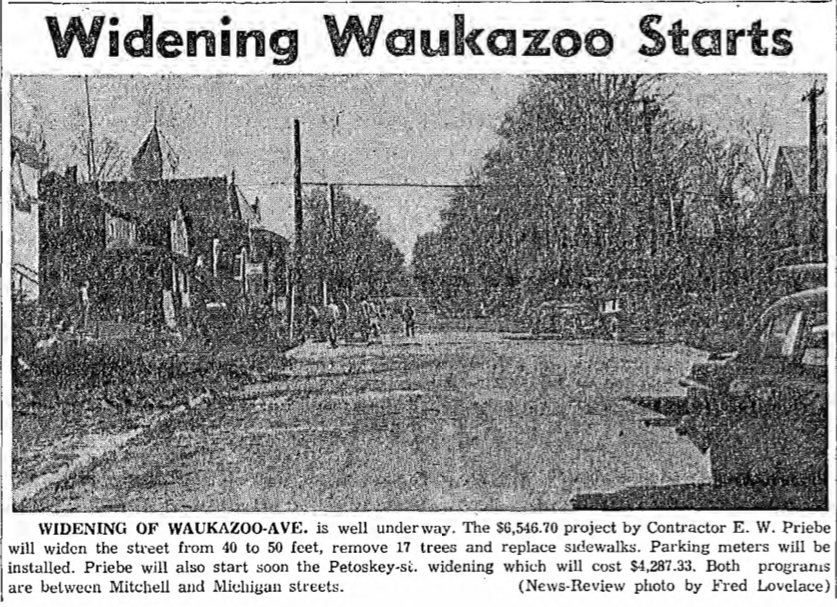
21 May 1954 ~ Petoskey Evening News & Northern Michigan Review
Article Below: Petoskey Street Projects Approved
1948 > 1950
1948 > 1950

5 October 1948 ~ Petoskey Evening News
|
24 March 1950 ~ Petoskey Evening News
|
15 June 1950 ~ Northern Michigan Review
|
22 June 1950 ~ Petoskey Evening News
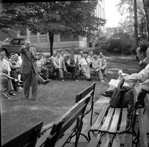
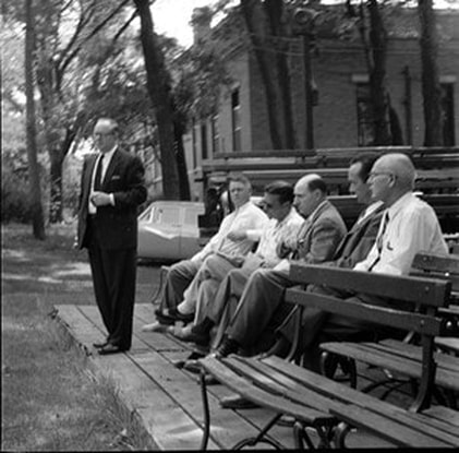
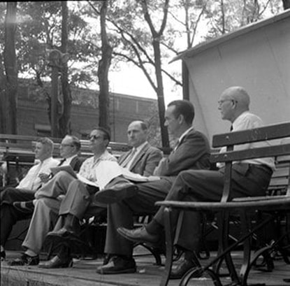
Howard and Mitchell Streets
~ A Politician Speaking to a Crowd on Mitchell Street between Howard and Petoskey Streets ~
Little Traverse Historical Society Photo Collection (Undated)
~ Mitchell Street Looking East of Railroad Tracks ~
Little Traverse Historical Society Photo Collection (Undated)
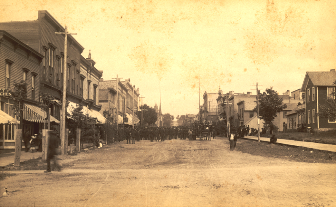
~ Mitchell Street Looking East in 1887 ~
Little Traverse Historical Society Photo Collection (1887)
~ Howard Street Looking North, Petoskey, Michigan ~
Greenwood Photo Archive Collection (Undated Postcard)
9 July 1936 ~ Northern Michigan Review (Same as colored photo/postcard above, but giving a short description)
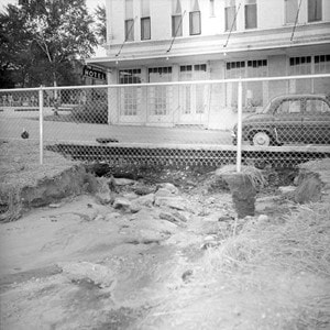
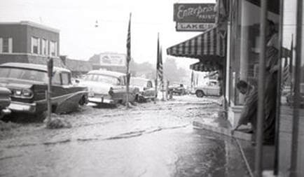
Article Below: Howard and Mitchell streets intersection flood with water
1941
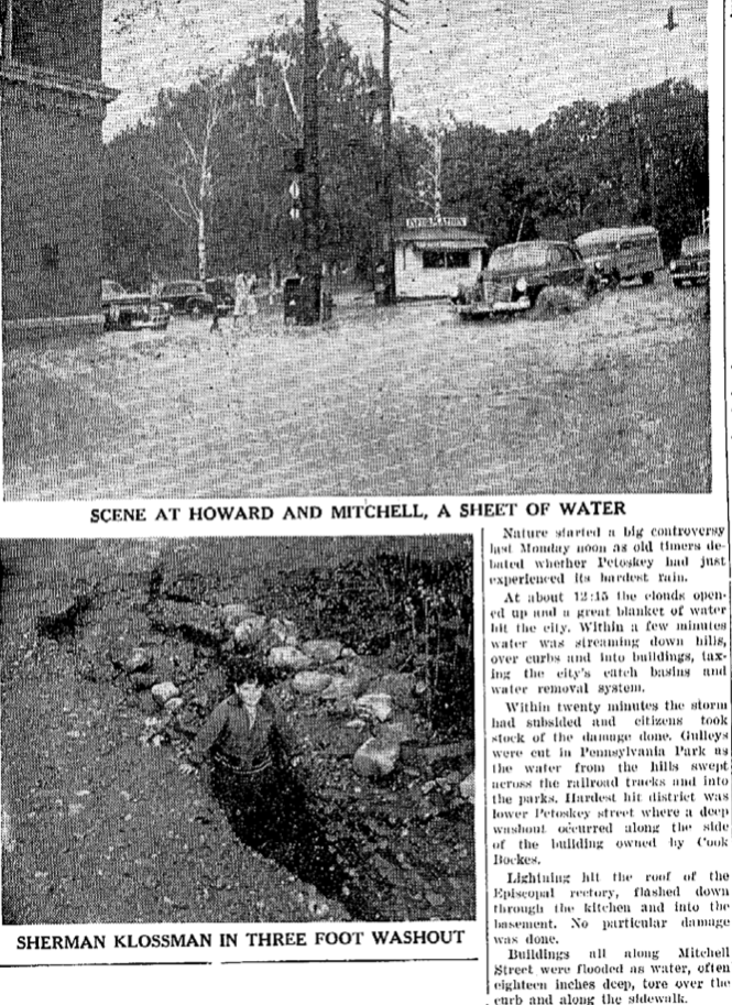
28 August 1941 ~ Northern Michigan Review
~ Mitchell Street in Petoskey at Night ~
Little Traverse Historical Society Photo Collection (Undated)
Article Below: Mitchell–Howard Traffic Lights
to be Added
1954
to be Added
1954

8 June 1954 ~ Petoskey Evening News
1956 Photo/Text Below:
Michigan Street in front of St. Francis school was being widened from 37 to 64 feet
which required the removal of trees lining the street.
Michigan Street in front of St. Francis school was being widened from 37 to 64 feet
which required the removal of trees lining the street.
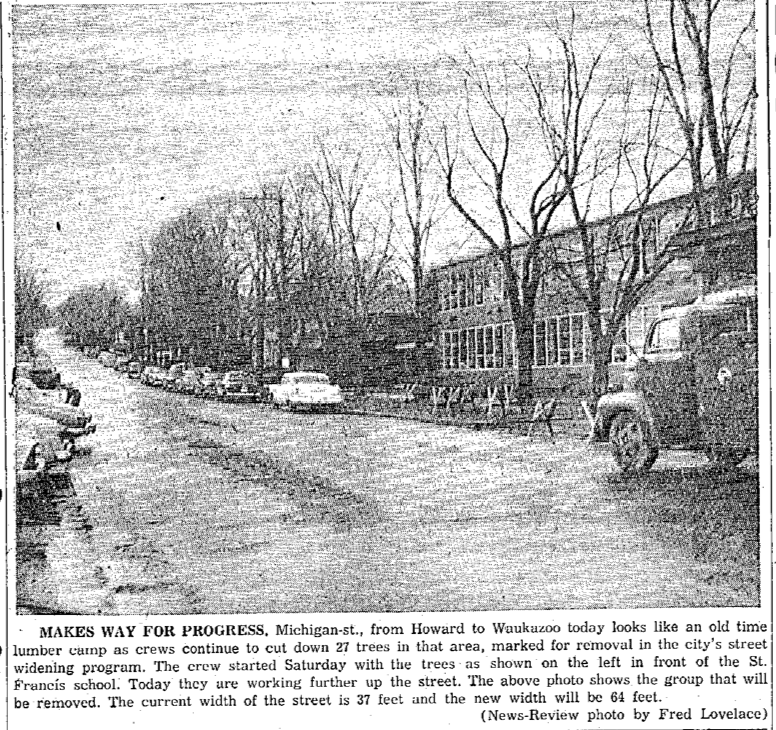
9 April 1956 ~ Petoskey News Review
Article Below: Petoskey's Snow Removal Statistics & Traffic Jam
1951 and 1956
2 August 1951 ~ Northern Michigan Review
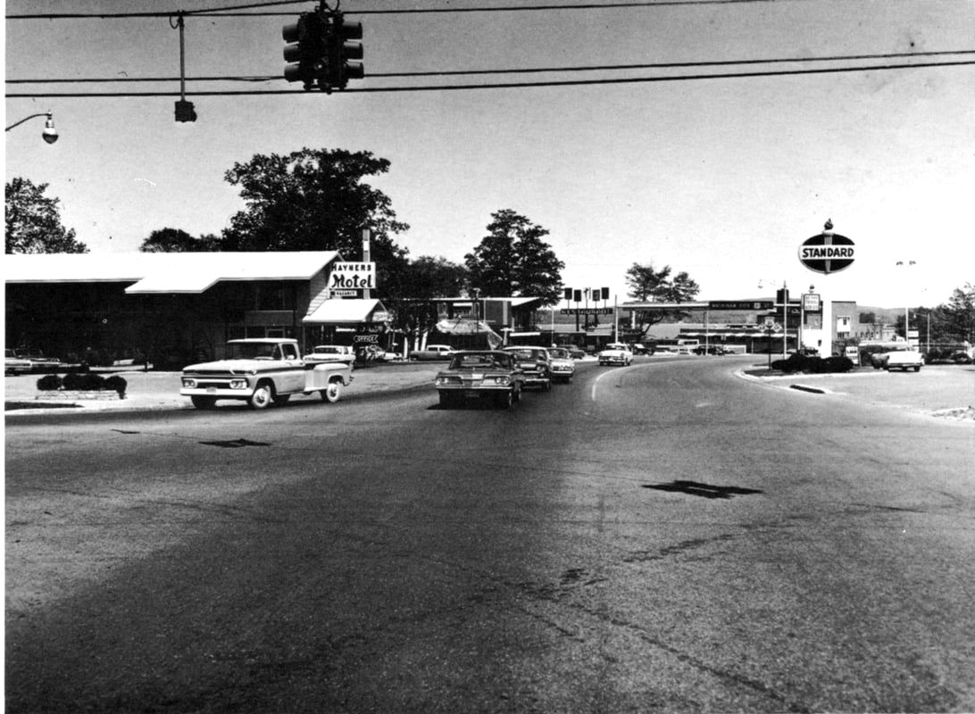
Article Below: The bottom photo is almost an identical view taken from Petoskey Street looking up Mitchell as the photo above. This was still the main route through Petoskey... no bypass yet, so traffic was heavy. The top photo (below) shows traffic on Howard Street with that being the rest of the main route through town... PRE Bypass.
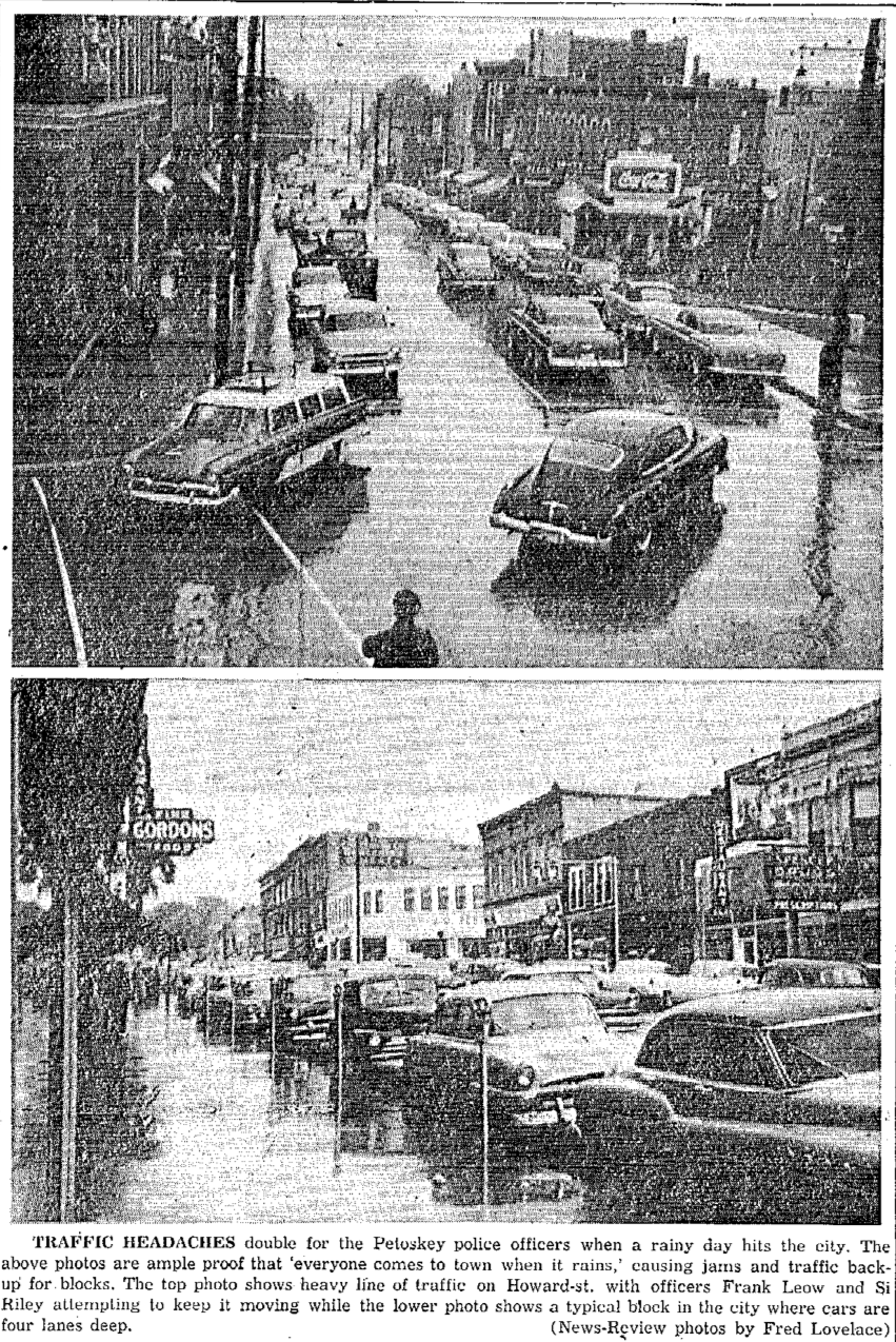
25 August 1956 ~ Petoskey News Review
Photo Below: Before Sunset Boulevard, the main road through town proceeded on East Mitchell Street, turned north on to Howard Street, turned east on to Bay Street, and proceed past the Perry Hotel on Lewis Street, heading toward Bay View...
Little Traverse Historical Society Photo Collection (Undated, but PRE-Bypass)
Photo Below: After Bypass, and after 1966,
because the new Petoskey High School which was dedicated in 1966 is in the photo.
because the new Petoskey High School which was dedicated in 1966 is in the photo.
Little Traverse Historical Society Photo Collection (Post 1966)
Article Below: Leave the Highway in Town
1955
1955
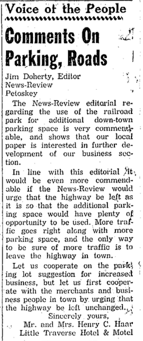
10 January 1955 ~ Petoskey News Review
TOP
Editorial Below: Pre-I-75 Talk
1958
1958
6 February 1958 ~ Emmet County Graphic
Four Photos Below: Mitchell Street Paving
(Near corner of Petoskey and Mitchell streets)
September 1958
(Near corner of Petoskey and Mitchell streets)
September 1958
Greenwood Photo Archive Collection from Petoskey Newspapers (September 1958)...
|

Greenwood Photo Archive Collection from Petoskey Newspapers (September 1958)...
|

Greenwood Photo Archive Collection from Petoskey Newspapers (September 1958)... includes Cragos Grocery store on the corner of Mitchell and Petoskey streets
|

Greenwood Photo Archive Collection from Petoskey Newspapers (September 1958)...
|
Article Below: Asphalt or Concrete
1958
1958
15 October 1958 ~ Petoskey News Review
PRE and POST US 31 Bypass
(Sunset Boulevard)
(Sunset Boulevard)
PRE US 31 Bypass, the traffic from the south crossed the Mitchell Street bridge heading straight into Downtown Petoskey. At the corner of Howard Street, the route headed north, proceeding onto Bay Street to then head west past the Perry Hotel, and then northward on Lewis Street, through Bay View.
(Aerial Photos Below; PRE Bypass and POST Bypass)
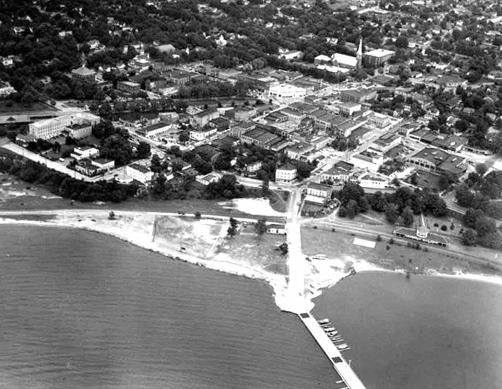
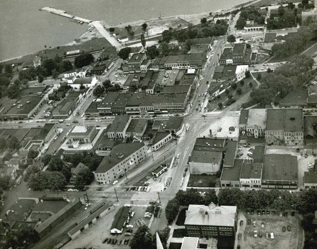
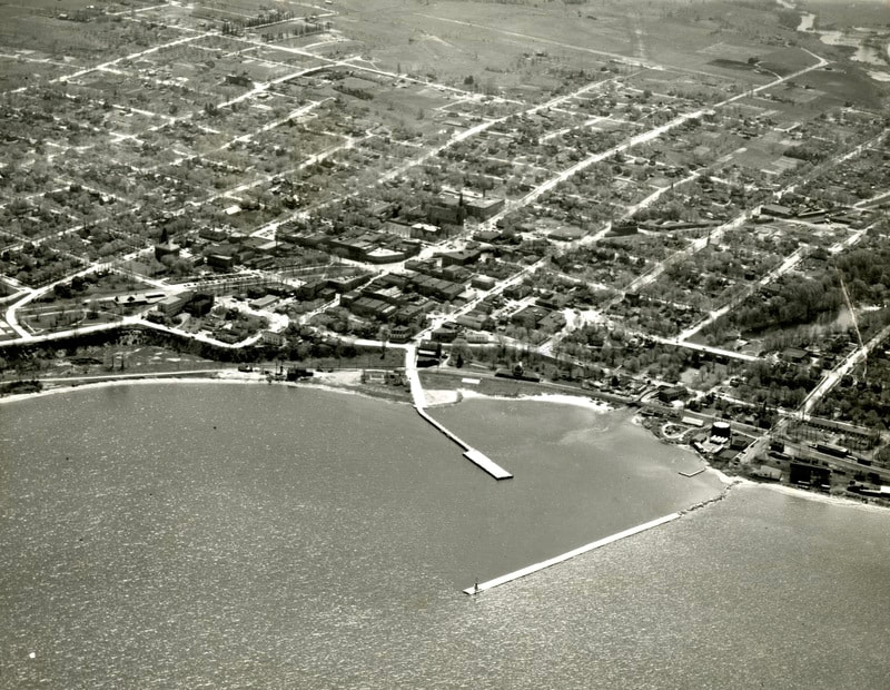
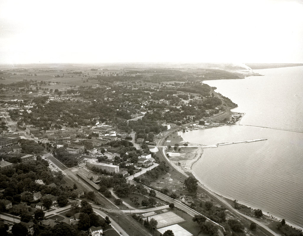
~ PRE-Bypass ~
Downtown Petoskey
~ PRE-Bypass ~
Downtown Petoskey
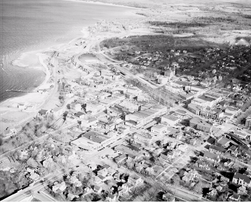
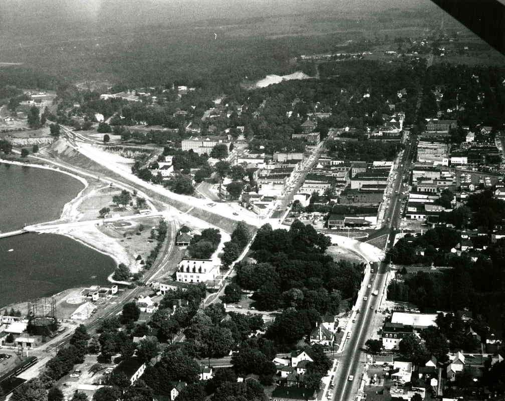
1936 Downtown Petoskey ~ Posted with permission from Virtual Motor City, Walter P. Reuther Library, Wayne State University
~ PRE-Bypass ~
Downtown Petoskey
Downtown Petoskey
PRE-Bypass
~ PRE-Bypass ~
Downtown Petoskey
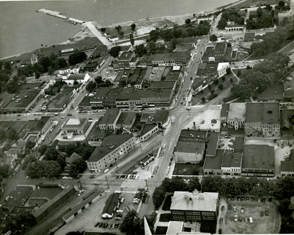
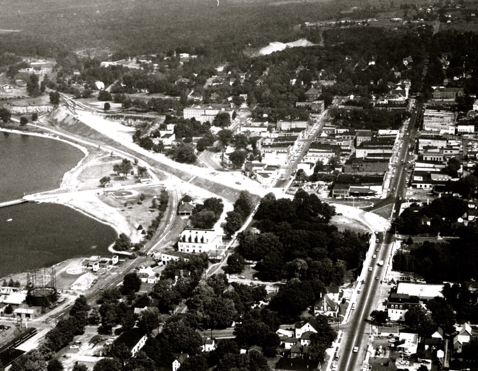
Photo Below: Aerial view of Petoskey business district featuring railroads, waterfront, and dock
Downtown Petoskey
Photo Below: Aerial view of Petoskey business district featuring railroads, waterfront, and dock
PRE-Bypass
~ PRE-Bypass ~
Downtown Petoskey
Downtown Petoskey
Little Traverse Historical Society Photo Collection (Undated)
~ PRE-Bypass ~
Downtown Petoskey
Downtown Petoskey

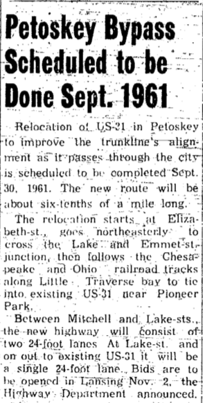
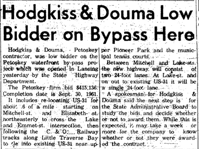
30 August 1961 ~ Petoskey News Review
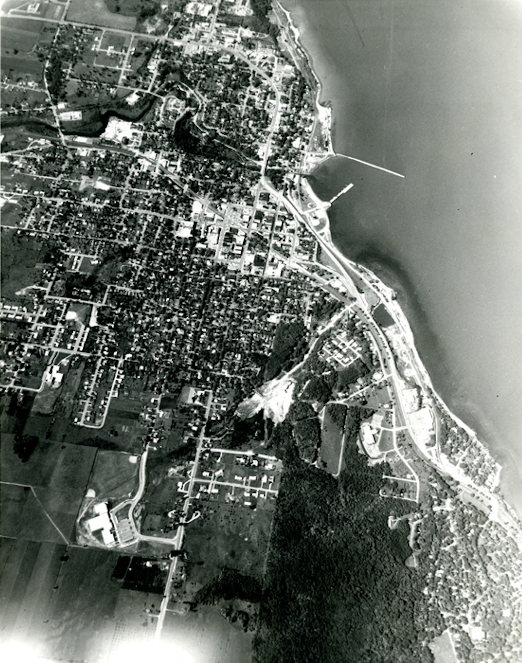
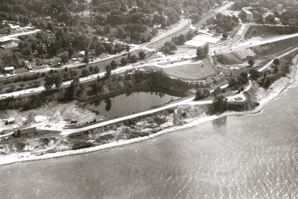
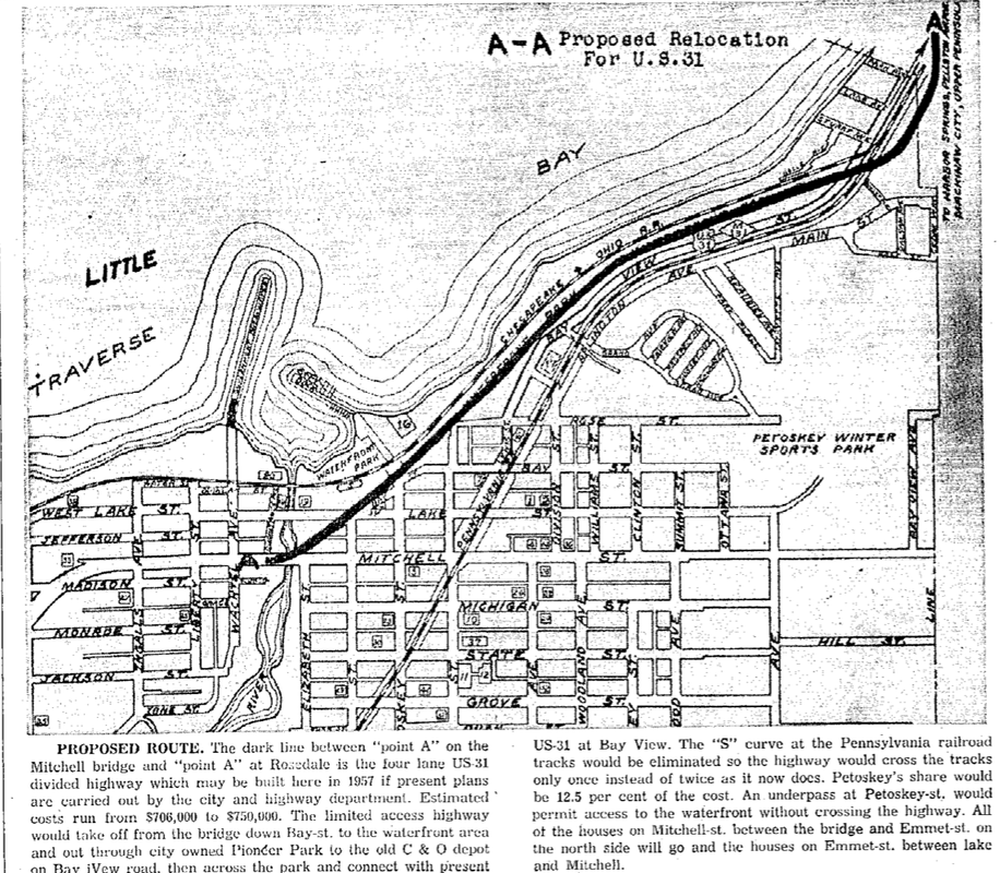
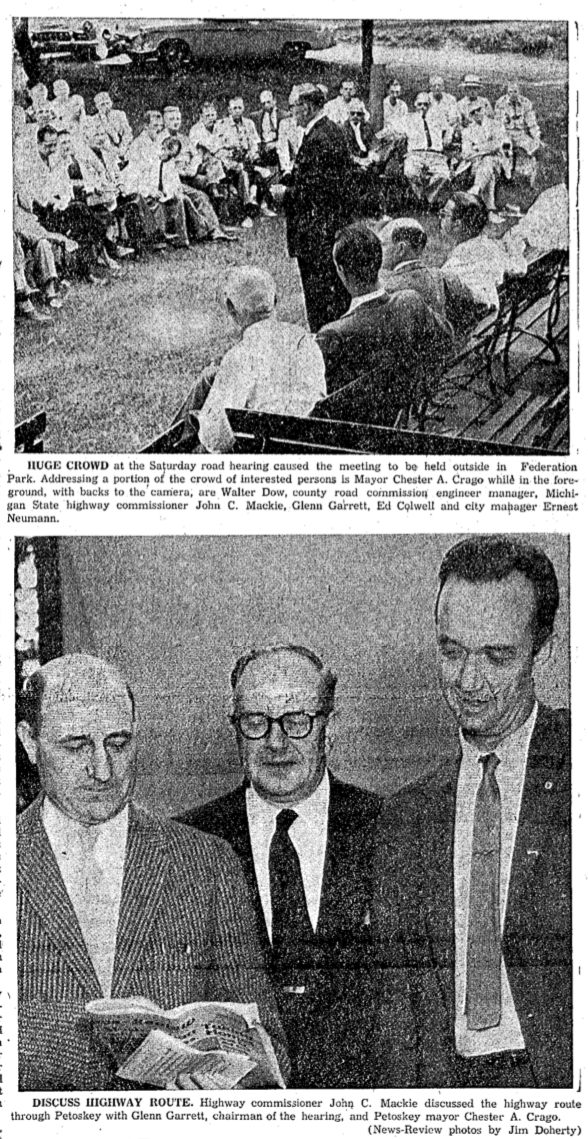
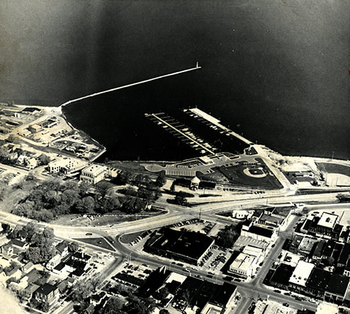
Two Photos Below taken by Petoskey News Review (reported 30 August 1961) reporter/photographer Fred Loveless had the following text below the two front page photos: "Petoskey's 'New Look' from the air was taken yesterday from the land side (top photo) and the bay side (following photo), showing the path of the trunkline by-pass. In the lower center of the top photo is Mitchell st., looking east. The division point of the by-pass can be seen at Emmet St. where it turns left, going along the waterfront to a point at the municipal tennis courts, joining US31 north. On the next photo is a view from the bay side with the two light squares in the center the tennis court property which has been in a court suit between the chamber and city over ownership. The new by-pass can be seen running to the right and down the former lime kiln pits while the old road goes past the Perry-Davis Hotel. In the upper right is the corner of Mitchell and Howard Sts. Tentative plans call for the official opening of the by-pass September 4 according to a release from state highway commissioner John Mackie."
~ Bypass Completed ~
Downtown Petoskey
(Photo Description posted above...)
Downtown Petoskey
(Photo Description posted above...)
30 August 1961 ~ Petoskey News Review
~ Bypass Completed ~
Downtown Petoskey
(Photo Description posted above...)
Downtown Petoskey
(Photo Description posted above...)
30 August 1961 ~ Petoskey News Review
~ Bypass Completed ~
Downtown Petoskey and the Bear River
Downtown Petoskey and the Bear River
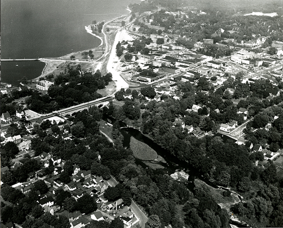
Little Traverse Historical Society Photo Collection (POST 1963)
Article Below:
This is the beginning of the continuation of the saga of Petoskey's Mitchell Street was a Dead End... click HERE.
This is the beginning of the continuation of the saga of Petoskey's Mitchell Street was a Dead End... click HERE.
7 May 1954 ~ Petoskey News Review & Northern Michigan Review
6 June 1956 ~ Petoskey News Review

6 June 1956 ~ Petoskey News Review
|
Greenwood Photo Archive Collection from Petoskey Newspaper (1956)
6 June 1956 ~ Petoskey News Review
6 June 1956 ~ Petoskey News Review
|
14 January 1956 ~ Petoskey News Review
18 January 1956 ~ Petoskey News Review
|
1 August 1957 ~ Emmet County Graphic
|
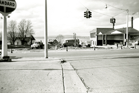
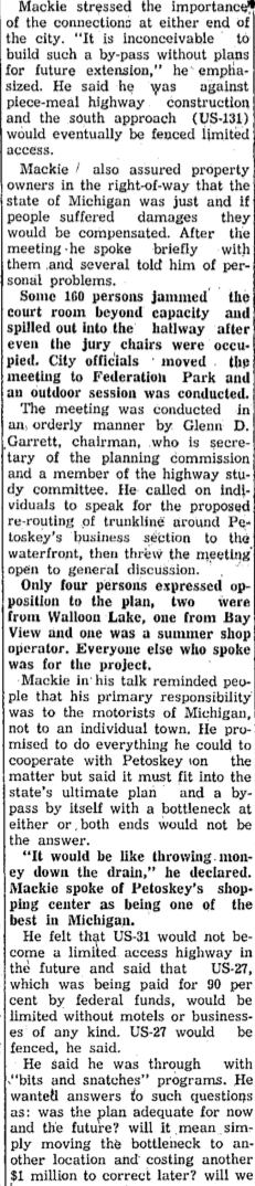
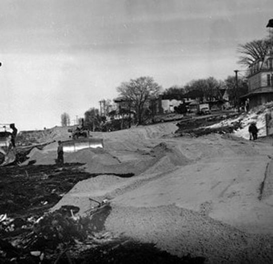
Photos Below: The Bypass location began right after the Mitchell Bridge heading northbound. Four gas stations rested on the main Mitchell and Emmet streets intersection. The Standard and Pure gas stations are in the photos below. Behind the Standard station was the funeral home at that time. That renovated Standard gas station building now (2019) houses the Family Video store at 124 East Mitchell Street, Petoskey, Michigan.

Greenwood Photo Archive Collection from Petoskey Newspapers (Undated)
|
PRE-ByPass ~ Looking West over the Mitchell Street Bridge
|
Allan McCune a successful Petoskey businessman and local historian donated several of his albums to Petoskey's Little Traverse Historical Museum which included this photo of the corner of Mitchell and Emmet streets (Just prior to the beginnning of the US 31 – US 131 bypass)
|
Greenwood Photo Archive Collection (Undated)... same building as in the photo below of the Family Video in 2020. In 2021 the Family Video Store was raised with the prospect of condos being built by Bob Berg.
|
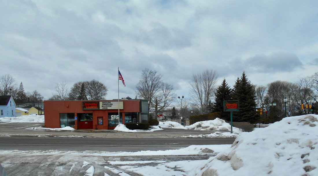
10 February 2020 ~ OLD Standard Station building... location in 2020 of Family Video (Corner of Emmet and East Mitchell streets). Bob Berg owns the property.
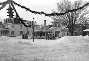
Article/Photos Below: This advertisement was announcing the "New Location" of the Pure Station which had to move its business because its previous Pure gas station building was being razed to make way for the Petoskey By-Pass which was complete in 1963 (See the slideshow farther below that shows some of the houses and buildings that were razed.).
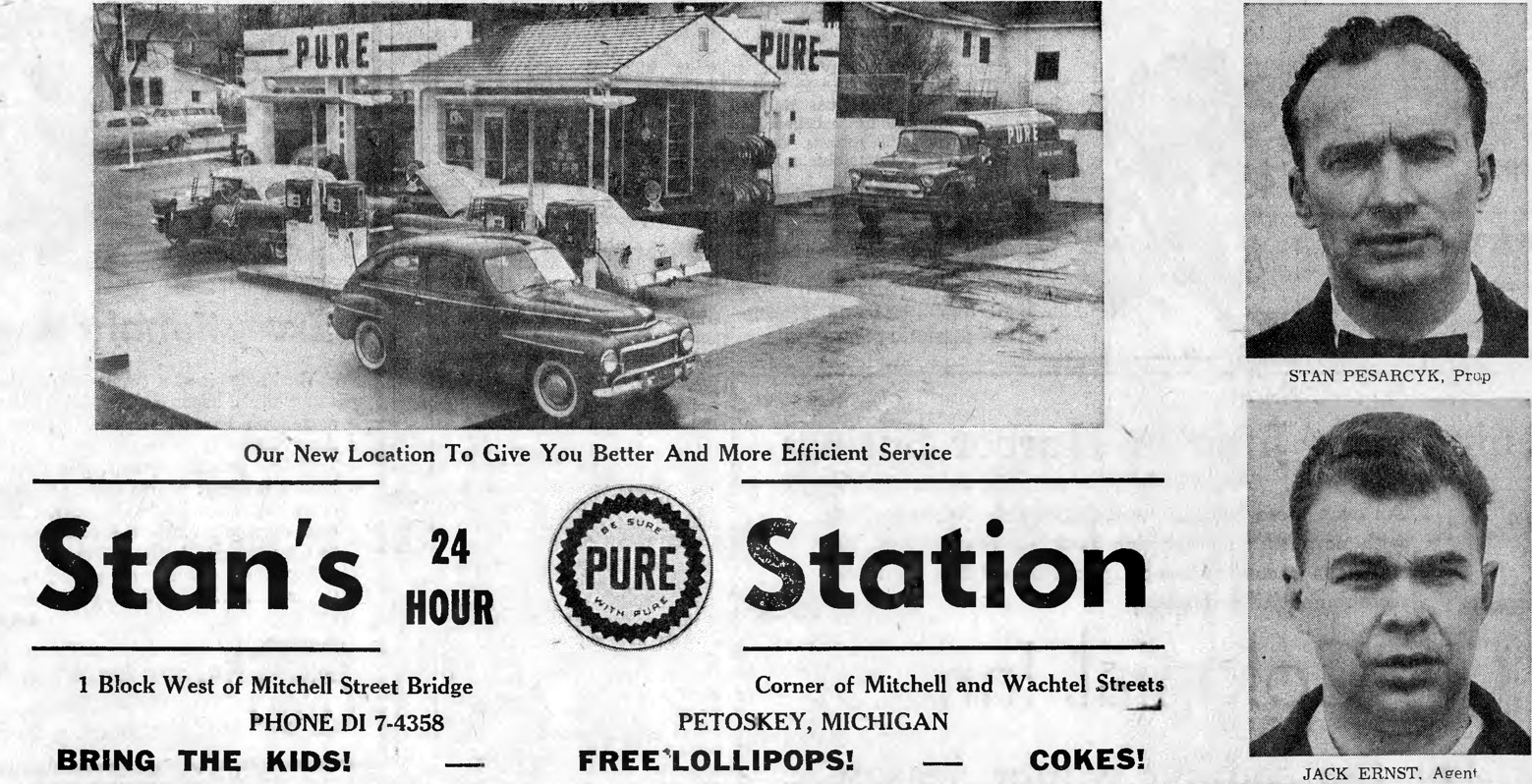
27 November 1958 ~ Emmet County Graphic
19 June 1957 ~ Petoskey News Review AND photos from Greenwood Photo Archive collection from the same newspaper... continued below
19 June 1957 ~ Petoskey News Review article continued from above...
2 July 1957 ~ Petoskey News Review
|
20 July 1957 ~ Petoskey News Review
|

29 July 1957 ~ Petoskey News Review article continued below left...
29 July 1957 ~ Petoskey News Review article continued right column...
|
29 July 1957 ~ Petoskey News Review article continued photos at right...
|
29 July 1957 ~ Petoskey News Review photos accompanied article at left and above...
The article at left included additional excerpts of remarks and may be accessed from the actual article.
|
Greenwood Photo Archive Collection from Petoskey Newspaper (29 July 1957)
|
Greenwood Photo Archive Collection from Petoskey Newspaper (29 July 1957)
|
Greenwood Photo Archive Collection from Petoskey Newspaper (29 July 1957)
|
Greenwood Photo Archive Collection from Petoskey Newspaper (29 July 1957)
|
1957 Article Below Left: The owners of Petoskey Fast Auto Wash on Bay View Road has word that the option for their property has been accepted. See a photo of the auto wash in the slideshow farther below of razed houses and business.
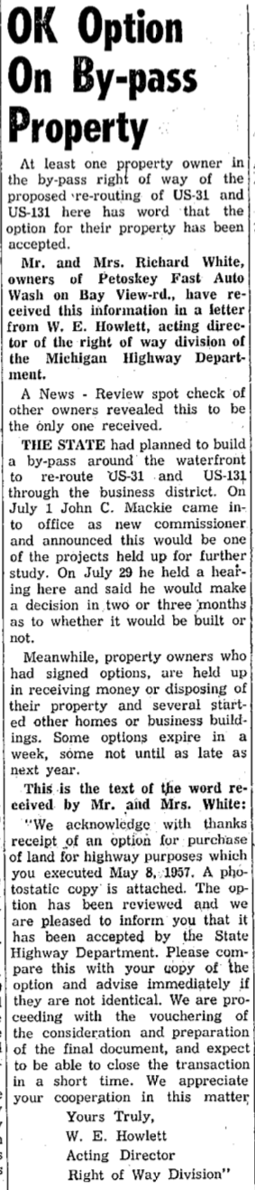
20 August 1957 ~ Petoskey News Review
|
18 October 1957 ~ Petoskey News Review
|
Planning the Bypass Construction Time Detour
1960 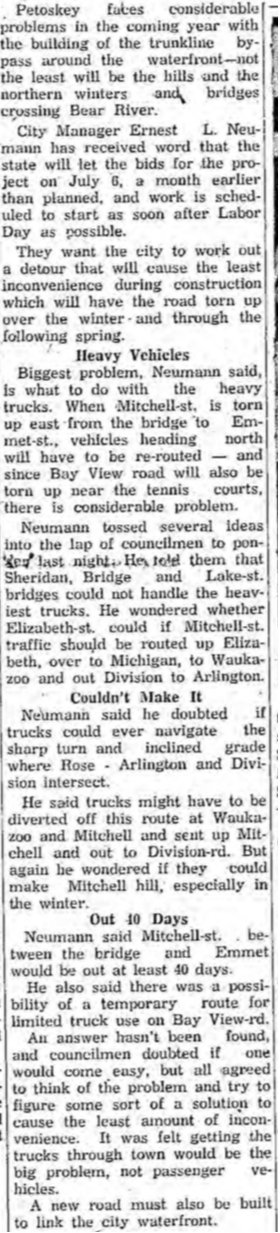
2 February 1960 ~ Petoskey News Review
|
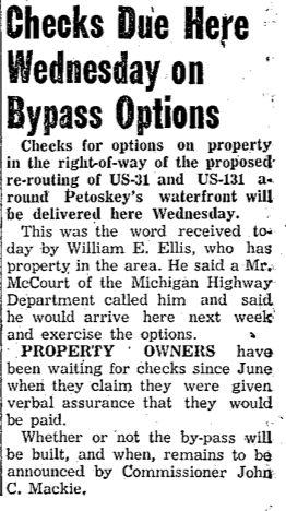
Map Below: Is By Pass to be ABOVE or BELOW the Bluff?
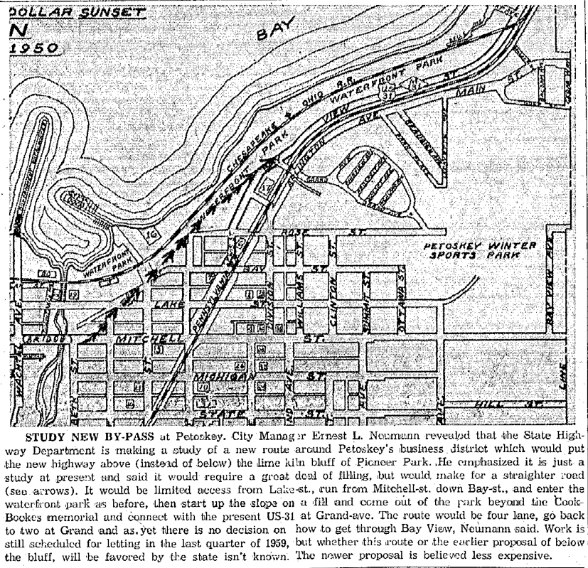
3 December 1958 ~ Petoskey News Review
Article Below Left: Plan explained in preparation for the four-lane divided highway (Sunset Boulevard)
13 January 1956 ~ Petoskey News Review article continued at right...
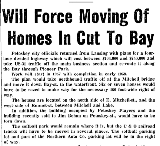
Allan McCune a successful Petoskey businessman and local historian donated several of his albums to Petoskey's Little Traverse Historical Museum. One of his albums included the copied 1957-58-59 photos in the slideshow below. Mr. McCune was foresighted enough to take "pictures of dwellings and commercial buildings (labeled) before being torn down by the State Highway Department in 1958 to make room for the New Bypass." Allan McCune wrote on the back of a photo regarding the bypass: "Proposed 01/14/56, Grading 12/10/60, Completed 08/30/61". Article below is from a complete article posted
a short way above... houses and homeowners be damned when the government has the legal right to condemn private property... 
18 January 1956 ~ Petoskey News Review
|
13 January 1956 ~ Petoskey News Review article continued from top left...
|
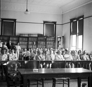
Slideshow Below of houses and buildings to be razed
PRE-Bypass...
(Click Play Upper Left Corner of Main Photo)
PRE-Bypass...
(Click Play Upper Left Corner of Main Photo)
SECTION OF 1936 Downtown Petoskey ~ Posted with permission from Virtual Motor City, Walter P. Reuther Library, Wayne State University
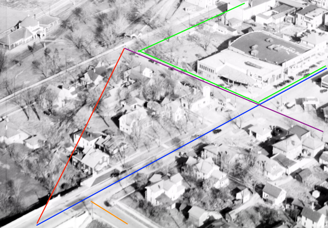
Photo Above Line Descriptions:
Orange = Elizabeth Street
Blue = East Mitchell Street
Purple = Emmet Street connecting to Lake and Bay streets
Green = Inside the green block is "The Hole"
Red/Blue/Purple Triangle = All houses that were razed for the By-Pass and houses that can be viewed in the slideshow above
Orange = Elizabeth Street
Blue = East Mitchell Street
Purple = Emmet Street connecting to Lake and Bay streets
Green = Inside the green block is "The Hole"
Red/Blue/Purple Triangle = All houses that were razed for the By-Pass and houses that can be viewed in the slideshow above
Photo Above: Right lower corner is Mitchell Street coming from Mitchell Bridge, to the Emmet Street intersection which goes left through to Bay Street. The Emmet Street connection no longer exists after the Bypass went through.
Most of the houses in the lower center were condemned and razed by the state for roadway use
and the houses can be viewed in the slideshow above.
Most of the houses in the lower center were condemned and razed by the state for roadway use
and the houses can be viewed in the slideshow above.
Two Photos Below: POST Bypass–Houses Razed
Greenwood Photo Archive Collection from Petoskey newspapers (Undated)
POST Bypass–Houses Razed
Greenwood Photo Archive Collection from Petoskey newspapers (Undated)
Photo Below: Aerial View of Pere Marquette Railroad Depot post by-pass so late 1960s...
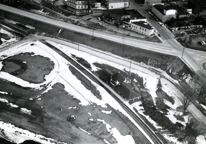
Little Traverse Historical Society Photo Collection

11 March 1960 ~ Petoskey News Review
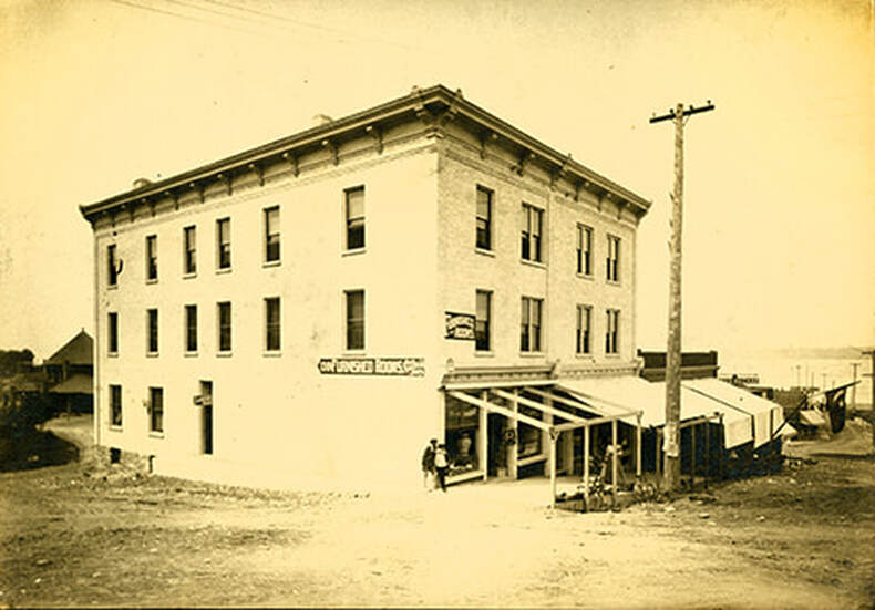
Photo Below: The Cook Bockes Building was at the start of the lower Midway to the Docks on Petoskey Street. Mr. Alton G. Cook operated the Post Card store on the Midway. It was torn down (as the Petoskey Playhouse in the photo below) when Sunset Boulevard was built along the waterfront. Note the Pere Marquette Depot in the lower left corner - the Little Traverse Historical Museum in 2020. Note the Cook Bockes name is connected to Pioneer Park (now Sunset Park) with a plaque on a rock memorial still located on the Sunset Park bluff in 2020. Click HERE for additional information about Cook Bockes and the funds he left to the City of Petoskey.
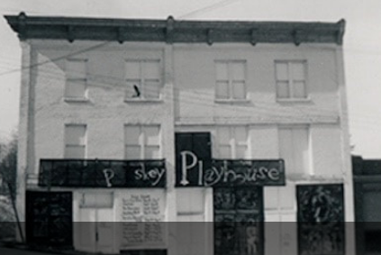
Three Photos and a Short Clipping Below: The Petoskey Playhouse on Petoskey Street was one of the buildings razed for the US31 Bypass. By 24 April 1960 fireman had to be called to a trash fire at the site of the wreckage.
|

25 April 1960 Petoskey News Review
|

Greenwood Photo Archive Collection from Petoskey Newspaper ( 24 April 1960)
|
Greenwood Photo Archive Collection from Petoskey Newspaper ( 24 April 1960)
|
Greenwood Photo Archive Collection from Petoskey Newspapers (March 1961)
|
Greenwood Photo Archive Collection from Petoskey Newspapers (March 1961)
|
Greenwood Photo Archive Collection from Petoskey Newspapers (March 1961)
|
Greenwood Photo Archive Collection from Petoskey Newspapers (March 1961)
|
Greenwood Photo Archive Collection from Petoskey Newspapers (March 1961)
|
Greenwood Photo Archive Collection from Petoskey Newspapers (March 1961)
|
Greenwood Photo Archive Collection from Petoskey Newspapers (March 1961)
|
Greenwood Photo Archive Collection from Petoskey Newspapers (March 1961)
|
Greenwood Photo Archive Collection from Petoskey Newspapers (March 1961)
|
Greenwood Photo Archive Collection from Petoskey Newspapers (March 1961)
|
21 March 1960 ~ Petoskey News Review
|
16 August 1960 ~ Petoskey News Review
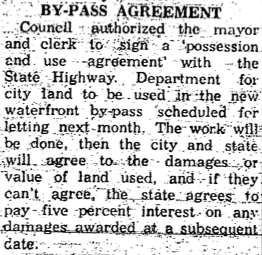
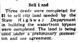
Article Above: Council to sign a "Possession and Use Agreement"
|
19 October 1960 ~ Petoskey News Review
|
3 November 1960 ~ Petoskey News Review
Article/Photo Below: The quality of copy of this clipping is not clear, but even so,
it illustrates what was happening with the Bypass at that time.
it illustrates what was happening with the Bypass at that time.
10 December 1960 ~ Petoskey News Review

29 November 1960 ~ Petoskey News Review
|
6 December 1960 ~ Petoskey News Review
|
1961
9 January 1961 ~ Petoskey News Review photo accompanied the article below right...
|
Greenwood Photo Archive Collection from Petoskey Newspapers (1961)
|
9 January 1961 ~ Petoskey News Review photo accompanied the article at right...
|

9 January 1961 ~ Petoskey News Review article
|
Greenwood Photo Archive Collection from Petoskey Newspapers (9 January 1961)
|
Greenwood Photo Archive Collection from Petoskey Newspapers (9 January 1961)
|
Greenwood Photo Archive Collection from Petoskey Newspapers (9 January 1961)
|
Greenwood Photo Archive Collection from Petoskey Newspapers (9 January 1961)
|
Greenwood Photo Archive Collection from Petoskey Newspapers (9 January 1961)
|
31 January 1961 ~ Petoskey News Review
31 January 1961 ~ Petoskey News Review
7 February 1961 ~ Petoskey News Review
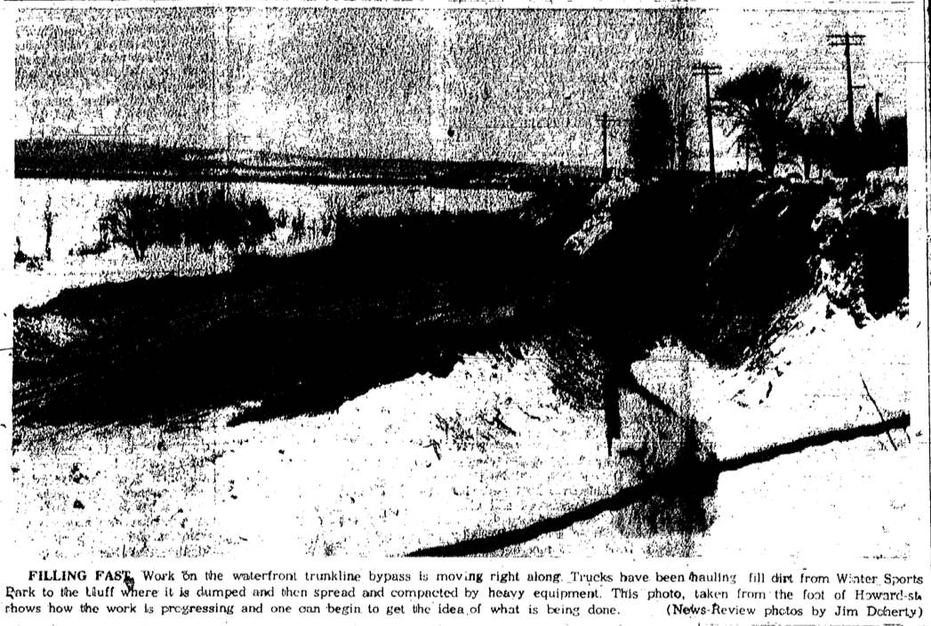
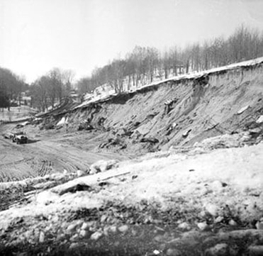
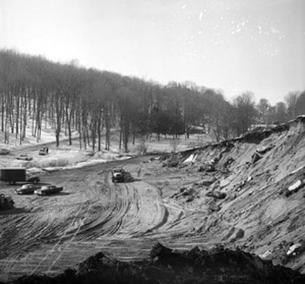
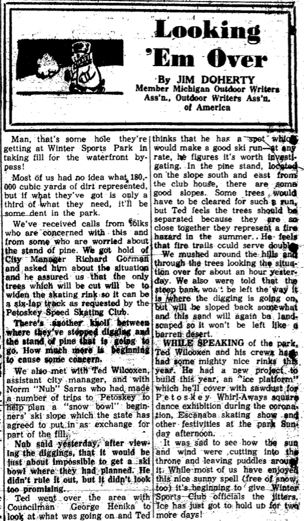
Eight Photos Below of Winter Sport Park area taken in February 1961...
Fill was removed from the park for the building of the Sunset Boulevard Bay-Pass.
Fill was removed from the park for the building of the Sunset Boulevard Bay-Pass.
Greenwood Photo Archive Collection from Petoskey Newspapers (February 1961)
|
Greenwood Photo Archive Collection from Petoskey Newspapers (February 1961)
|
Greenwood Photo Archive Collection from Petoskey Newspapers (February 1961)
|
Greenwood Photo Archive Collection from Petoskey Newspapers (February 1961)
|
Greenwood Photo Archive Collection from Petoskey Newspapers (February 1961)
|
Greenwood Photo Archive Collection from Petoskey Newspapers (February 1961)
|

10 February 1961 ~ Petoskey News Review
10 February 1961 ~ Petoskey News Review Page 7
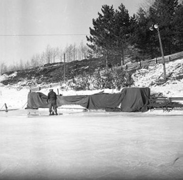
Two Photos Below: The ice rink and warming buildings remained accessible, and probably were reached
from the end of Lake Street, and then a walk down that hill where a pathway still remains in 2019...
from the end of Lake Street, and then a walk down that hill where a pathway still remains in 2019...
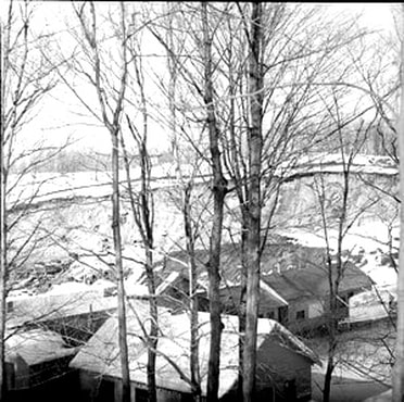
Greenwood Photo Archive Collection from Petoskey Newspapers (February 1961)
|
Greenwood Photo Archive Collection from Petoskey Newspapers (February 1961)
|
10 February 1961 ~ Petoskey News Review
|
21 February 1961 ~ Petoskey News Review
|
10 February 1961 ~ Petoskey News Review
|
21 February 1961 ~ Petoskey News Review
|
Article Below: The Chamber of Commerce was hoping to locate where the old Pure Oil Station site had been, but the C of C was told that the MI Highway Department felt it would not allow enough clear vision and they anticipated a traffic problem at the intersection when the by-pass opens. So, that edict also probably contributed to that location remaining vacant, and the Memorial Park being created.
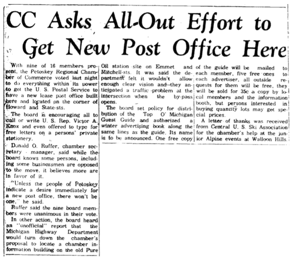
7 March 1961 ~ Petoskey News Review
11 March 1961 ~ Petoskey News Review

Greenwood Photo Archive Collection from Petoskey Newspaper (11 March 1961)
|
Greenwood Photo Archive Collection from Petoskey Newspaper (11 March 1961)
|
Greenwood Photo Archive Collection from Petoskey Newspaper (11 March 1961)
|
Greenwood Photo Archive Collection from Petoskey Newspaper (11 March 1961)
|
Greenwood Photo Archive Collection from Petoskey Newspaper (11 March 1961)
|
Greenwood Photo Archive Collection from Petoskey Newspaper (11 March 1961)
|
Greenwood Photo Archive Collection from Petoskey Newspaper (11 March 1961)
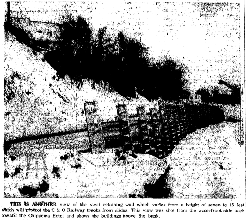
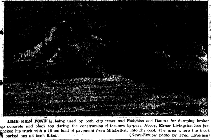
Photo/Text Below Left and Right:
The little lime kiln pond was filled in with concrete and blacktop during the construction of the By Pass.
The little lime kiln pond was filled in with concrete and blacktop during the construction of the By Pass.
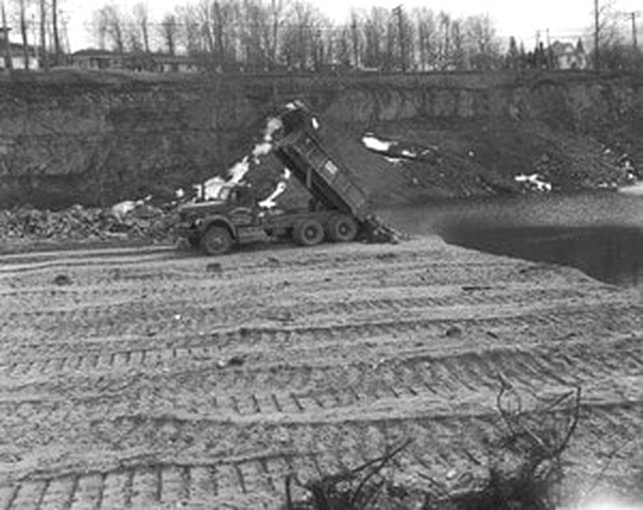
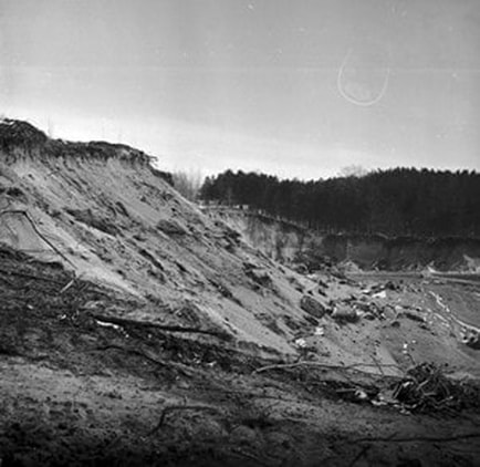
Greenwood Photo Archive Collection from Petoskey Newspaper (11 March 1961)
|
11 April 1961 ~ Petoskey News Review
|
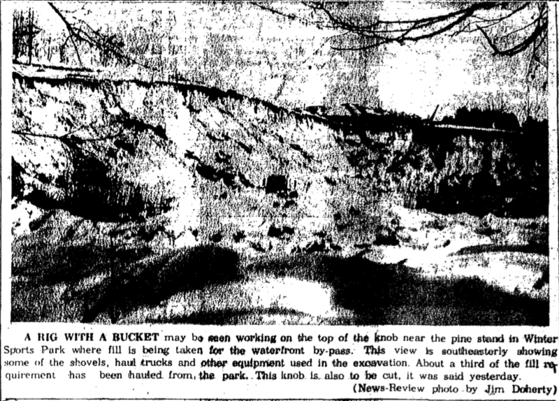
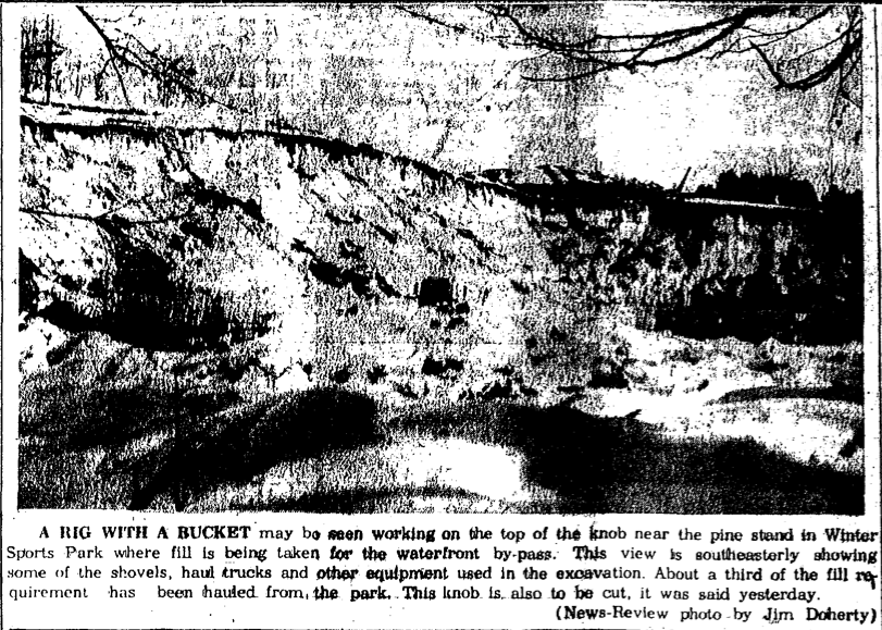
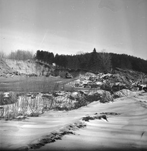
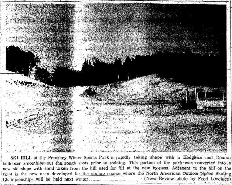
Photos Below of the Petoskey Winter Sports Park: As noted on the map way above of the "Proposed Relocation of US 31," only two roadways led back into the Petoskey Winter Sports Park... Rose Street connecting at a "V" with Grand Avenue, and at the end of Beaubein Avenue. In 1961, the Winter Sports ski hill sloped down the hill toward Beaubein Avenue, so that was the direction the skiers headed. Then, because the State Highway Department wanted to use sand from the sports park, the State Highway Department exchanged, the development of a "beginner's ski slope in the park and to re-landscape and recover the area so it won't be left a 'dust bowl', for the sand the state needed for the bypass project. That is how the winter sports park has ended up with the ski hill that exists in 2019. The Petoskey Winter Sports Park sand was used in the construction of the 1960s US 31 Bypass... which is being relocated in 2019.
In 2019 the state is using gravel from the Emmet County Road Commission sand pit on Bellmer Road in Bear Creek Township... tearing up the roads as they transport the several 100s of heavy loads even when road weight limits exist for other large trucks. Supposedly, the state is giving the county ground-up/crushed existing roadway, which is said to be valuable... but, what about the messed up roads the state leaves behind?
In 2019 the state is using gravel from the Emmet County Road Commission sand pit on Bellmer Road in Bear Creek Township... tearing up the roads as they transport the several 100s of heavy loads even when road weight limits exist for other large trucks. Supposedly, the state is giving the county ground-up/crushed existing roadway, which is said to be valuable... but, what about the messed up roads the state leaves behind?

11 March 1961 ~ Petoskey News Review
Greenwood Photo Archive Collection from Petoskey Newspaper (11 March 1961)
|

Greenwood Photo Archive Collection from Petoskey Newspaper (11 March 1961)
|
Greenwood Photo Archive Collection from Petoskey Newspaper (11 March 1961)
|
Greenwood Photo Archive Collection from Petoskey Newspaper (11 March 1961)
|
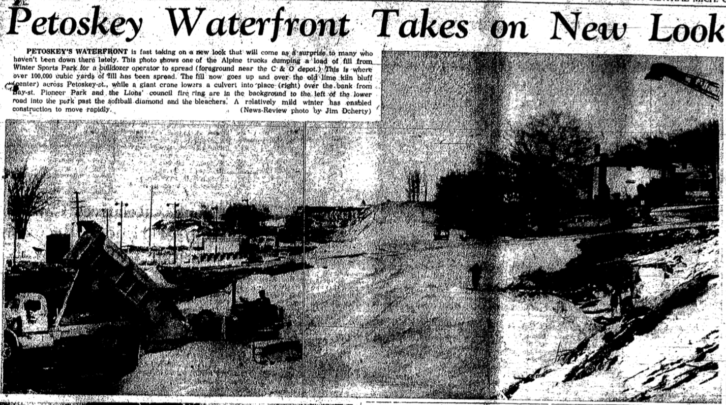
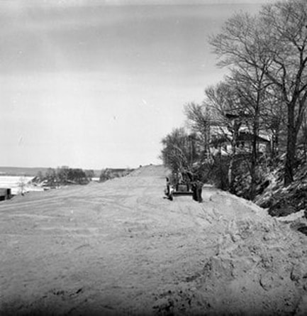
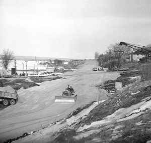
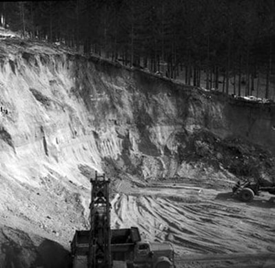
Photo Below: Little Traverse Bay in the background where Winter Sports Park sand was being removed for US 31 Bypass Construction
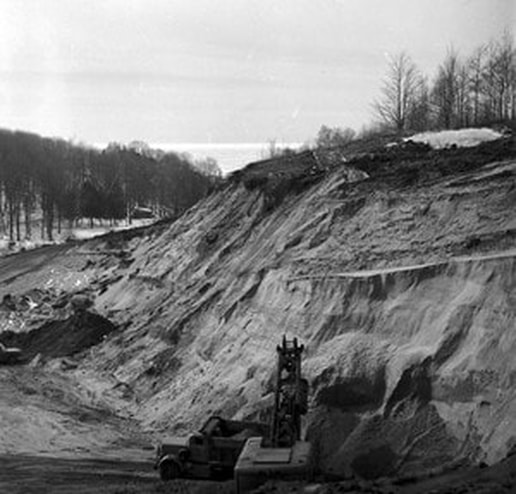
Greenwood Photo Archive Collection from Petoskey Newspaper (11 March 1961)

20 March 1961 ~ Petoskey News Review
17 June 1961 ~ Petoskey News Review
|
Greenwood Photo Archive Collection from Petoskey Newspapers (1961)
|
Greenwood Photo Archive Collection from Petoskey Newspapers (1961) ... Little Traverse Bay in background
|
19 June 1961 ~ Petoskey News Review
|
Greenwood Photo Archive Collection from Petoskey Newspapers (1961) ... looking south on US 31
Greenwood Photo Archive Collection from Petoskey Newspapers (1961)
|
Greenwood Photo Archive Collection from Petoskey Newspapers (1961) ... Landmark turret house on Lake Street in background
|
Greenwood Photo Archive Collection from Petoskey Newspapers (1961)
|
Greenwood Photo Archive Collection from Petoskey Newspapers (1961) ... LittleTraverse Bay in background
|
29 July 1961 ~ Petoskey News Review
Photo Below: Later in 1969 (compare to 1961)... the newly formed Petoskey Winter Sports Park ski hill...
Greenwood Photo Archive Collection from Petoskey Newspaper (November 1969)
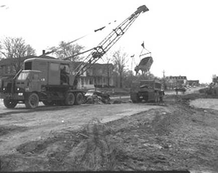
Photo Below: DURING 1961 Construction Period...
Corner of Mitchell Street and US 31 (Mitchell Bridge in Background)
Corner of Mitchell Street and US 31 (Mitchell Bridge in Background)
Greenwood Photo Archive Collection from Petoskey Newspapers (1961)
Photos Below: DURING 1961 Construction Period...
Corner of Lake Street and US 31
Corner of Lake Street and US 31
Greenwood Photo Archive Collection from Petoskey Newspapers (1961) ... Normal College in background
|
Greenwood Photo Archive Collection from Petoskey Newspapers (1961)
|
Greenwood Photo Archive Collection from Petoskey Newspapers (1961) ... Back of Temple Theatre with the house that once existed behind the theatre
|
Greenwood Photo Archive Collection from Petoskey Newspapers (1961) ... back of Temple Theatre as seen from Lake Street
|
Greenwood Photo Archive Collection from Petoskey Newspapers (1961) ... Normal College building in the background on Lake Street
|
Greenwood Photo Archive Collection from Petoskey Newspapers (1961) ... back of Temple Theatre as seen from Lake Street
|
Greenwood Photo Archive Collection from Petoskey Newspapers (1961) ... Normal College building in the background on Lake Street
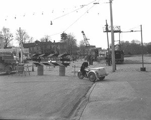
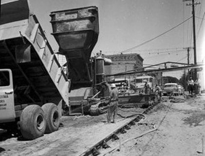
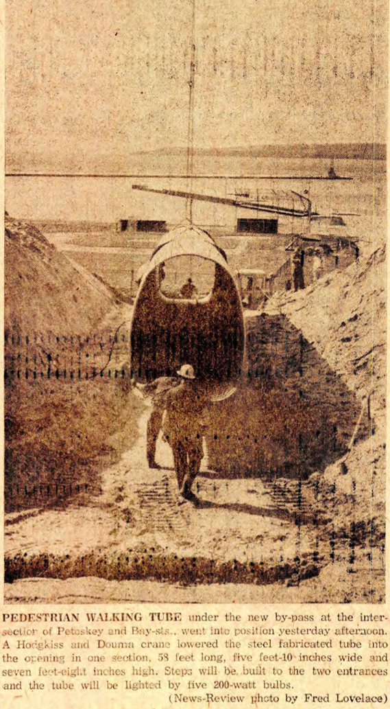
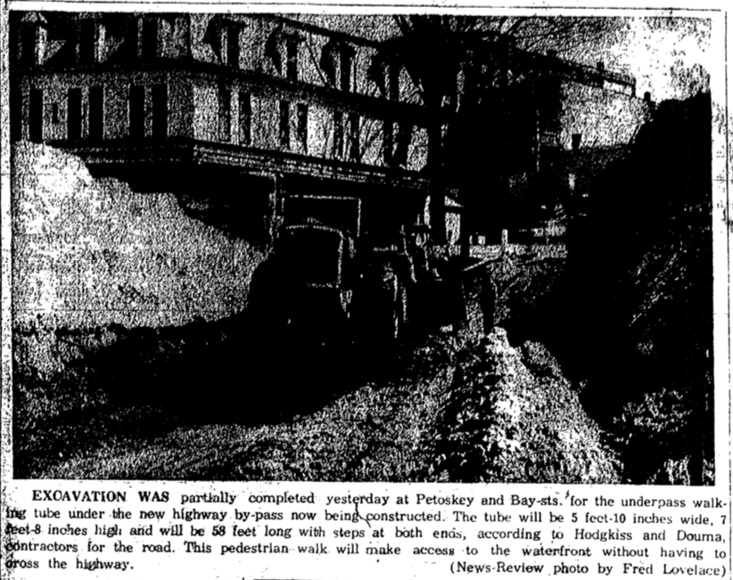
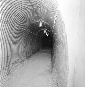
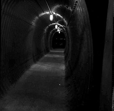
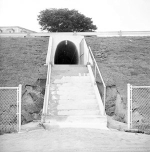
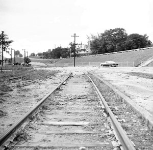
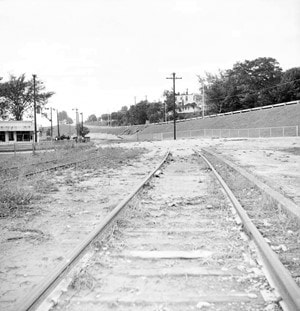
~ Underpass (Tunnel) on the By-Pass ~
1961
1961
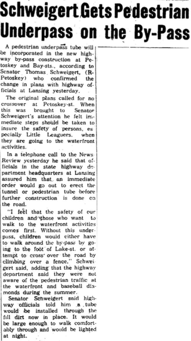
24 March 1961 ~ Petoskey News Review
Additional information may be accessed about the pedestrian tunnel by clicking HERE for the "Parks and Recreation" web page on this same web site. The information includes when this pedestrian tunnel was torn out and reconstructed in 1994-1995.
Photo Below: Little Traverse Bay in the background from the Petoskey Winter Sports Park
with Grand Avenue leading into the park
with Grand Avenue leading into the park
16 May 1961 ~ Petoskey News Review

28 March 1961 ~ Petoskey News Review
2 May 1961 ~ Petoskey News Review article continued right column...
|

2 May 1961 ~ Petoskey News Review article accompanied photo left bottom...
|
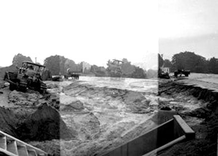
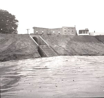
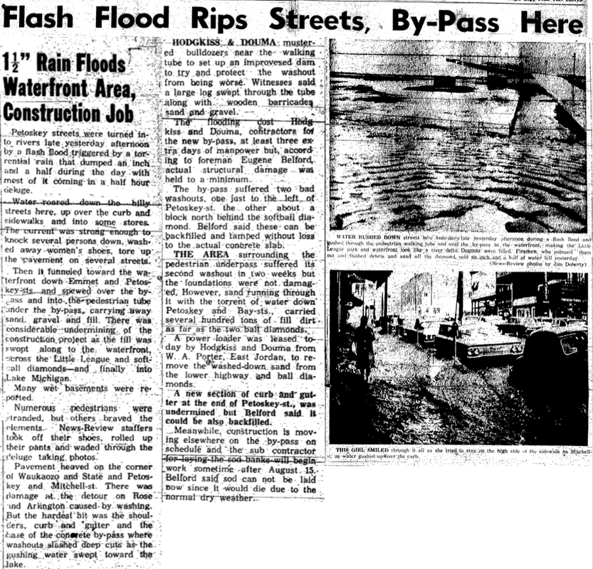
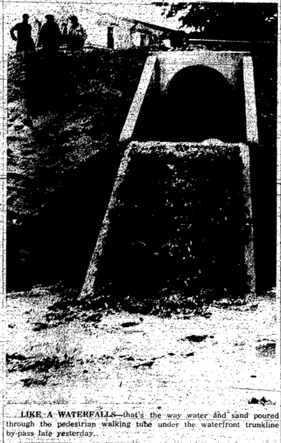
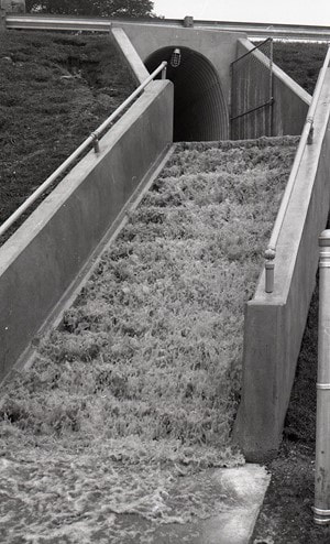
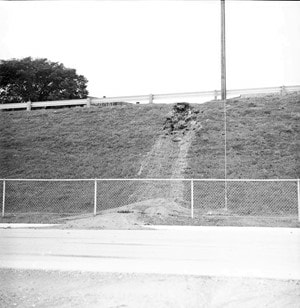
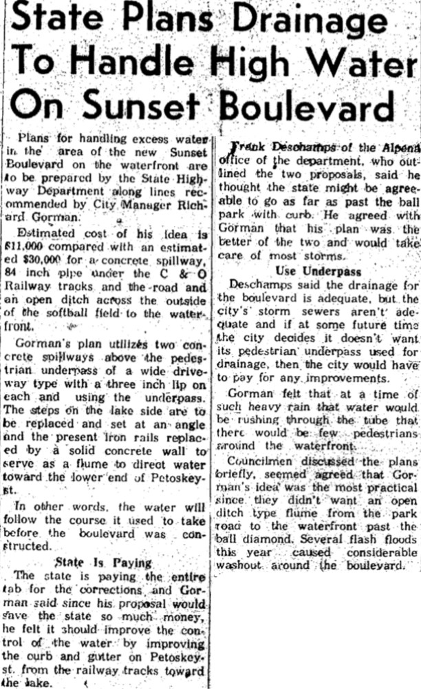
Cloudburst Hit the Tunnel
July 1961
July 1961
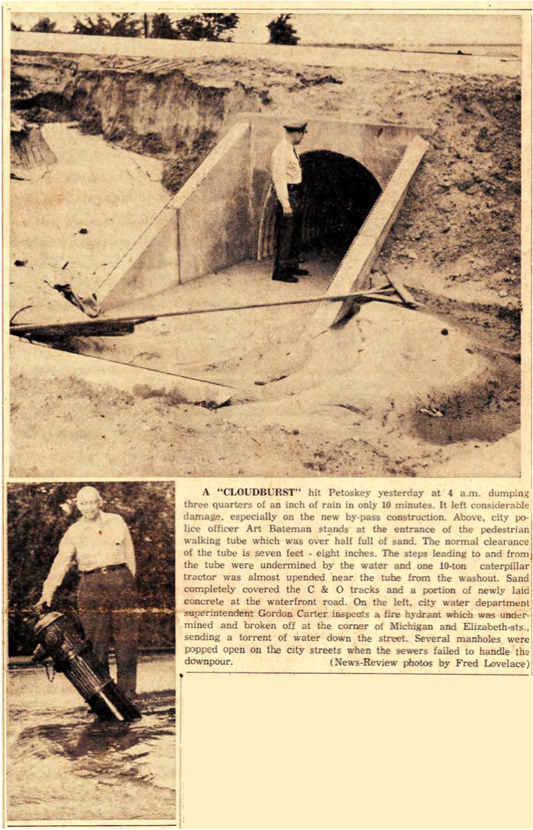
3 July 1961 ~ Petoskey News Review
Greenwood Photo Archive Collection from Petoskey newspaper (13 July 1961)
|
Greenwood Photo Archive Collection from Petoskey newspaper (13 July 1961)
|
14 July 1961 ~ Petoskey News Review article/photos accompanied photo/text below left...
14 July 1961 ~ Petoskey News Review photo/text accompanied photo/text above...
|
Greenwood Photo Archive Collection from Petoskey newspaper (13 July 1961)
Greenwood Photo Archive Collection from Petoskey newspaper (13 July 1961)
|
Two 1961 Photos Below: The new tunnel in dark and light under the new US 31 Petoskey Bypass
leading from Petoskey Street to the waterfront
leading from Petoskey Street to the waterfront
Greenwood Photo Archive Collection from Petoskey Newspaper ( August 1961)
|
Greenwood Photo Archive Collection from Petoskey Newspaper ( August 1961)
|
14 July 1961 ~ Petoskey News Review

30 August 1961 ~ Petoskey News Review
The above headline is the SAME headline farther above where
PRE and POST Bypass photos are shown with the progress made on the Bypass...
PRE and POST Bypass photos are shown with the progress made on the Bypass...

23 August 1961 ~ Petoskey News Review
Bypass Officially Named "Sunset Boulvevard"
1961
1961
15 September 1961 ~ Petoskey News Review
19 September 1961 ~ Petoskey News Review

23 September 1961 ~ Petoskey News Review Photos and Article below...
Greenwood Photo Archive Collection from Petoskey Newspaper (23 September 1961)
|
Greenwood Photo Archive Collection from Petoskey Newspaper (23 September 1961)
|

Greenwood Photo Archive Collection from Petoskey Newspaper (23 September 1961)
|
Greenwood Photo Archive Collection from Petoskey Newspaper (23 September 1961)
|

23 September 1961 ~ Petoskey News Review
Greenwood Photo Archive Collection from Petoskey Newspaper (23 September 1961)
|
Greenwood Photo Archive Collection from Petoskey Newspaper (23 September 1961)
|
Greenwood Photo Archive Collection from Petoskey Newspaper (23 September 1961)
|
Greenwood Photo Archive Collection from Petoskey Newspaper (23 September 1961)
|
19 December 1961 ~ Petoskey News Review
23 August 1961 ~ Petoskey News Review
Photo/Text Below:
Petoskey's giant Christmas Tree was erected on the island on West Mitchell Street and Sunset Boulevard.
Petoskey's giant Christmas Tree was erected on the island on West Mitchell Street and Sunset Boulevard.
7 November 1961 ~ Petoskey News Review
|
22 November 1961 ~ Petoskey News Review
|
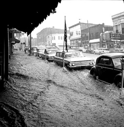
Another By Pass Flood
1962
1962
25 August 1962 ~ Petoskey News Review
|
Greenwood Photo Archive Collection from Petoskey News Review (25 August 1962)

Greenwood Photo Archive Collection from Petoskey News Review (25 August 1962)
|
TOP
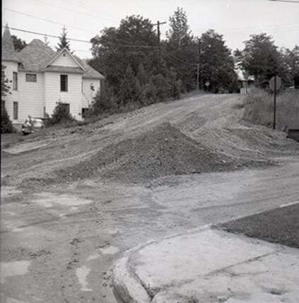
Winter Park Lane and Grand Avenue
1962 > 1968
1962 > 1968
~ Grand Avenue Washout ~
August 1964
(Intersection of Division Street, Grand Avenue, and Winter Park Lane)
August 1964
(Intersection of Division Street, Grand Avenue, and Winter Park Lane)
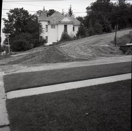
Greenwood Photo Archive Collection from Petoksey newspapers (August 1964 )
|
Greenwood Photo Archive Collection from Petoksey newspapers (August 1964 )
|
Greenwood Photo Archive Collection from Petoksey newspapers (August 1964 )
|
Greenwood Photo Archive Collection from Petoksey newspapers (August 1964 )
|
Four years later...
~ Grand Avenue leading up to "Pill Hill" next to Arlington Avenue and Winter Sports Lane ~
1968
~ Grand Avenue leading up to "Pill Hill" next to Arlington Avenue and Winter Sports Lane ~
1968
6 June 1968 ~ Petoskey News Review
21 June 1968 ~ Petoskey News Review
~ Corner of US 31 and US 131 ~
PRE 1964
PRE 1964
PRE 1964 Corner of US 31 and US 131 ~ 13 July 1964 Public Schools of Petoskey informative booklet promoting Bonds...
~ Jennings Avenue Breakup ~
1967
1967

27 March 1967 ~ Petoskey News Review
~ Hill Street ~
March 1967
March 1967
Greenwood Photo Archive Collection from Petoskey newspapers (March 1967)
~ Hill Street is most studied Petoskey, Michigan, city street. ~
1968
1968
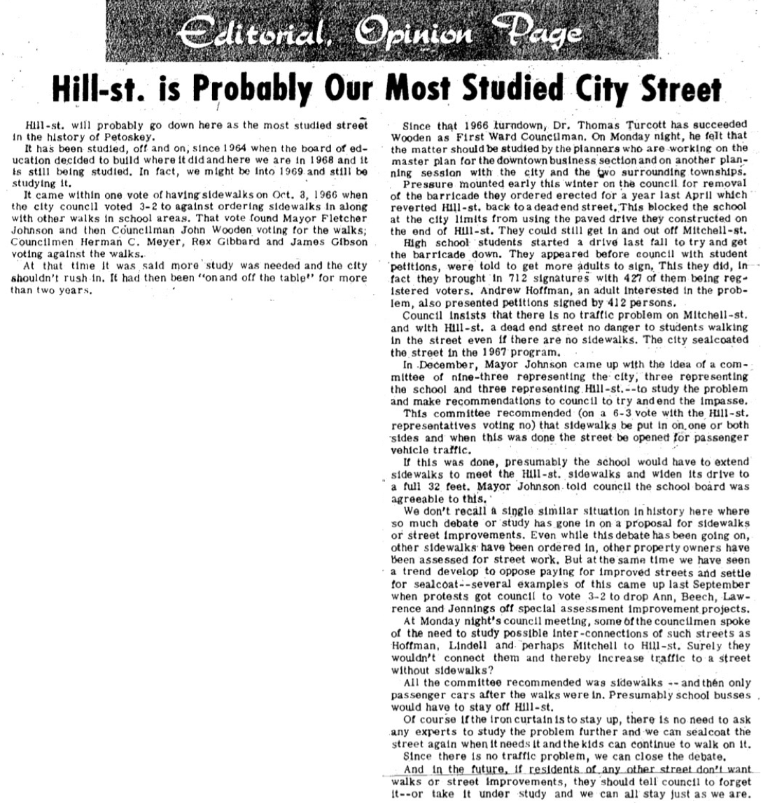
17 August 1968 ~ Petoskey News Review
~ Still Talking Hill Street ~
1969
1969

26 August 1969 ~ Petoskey News Review
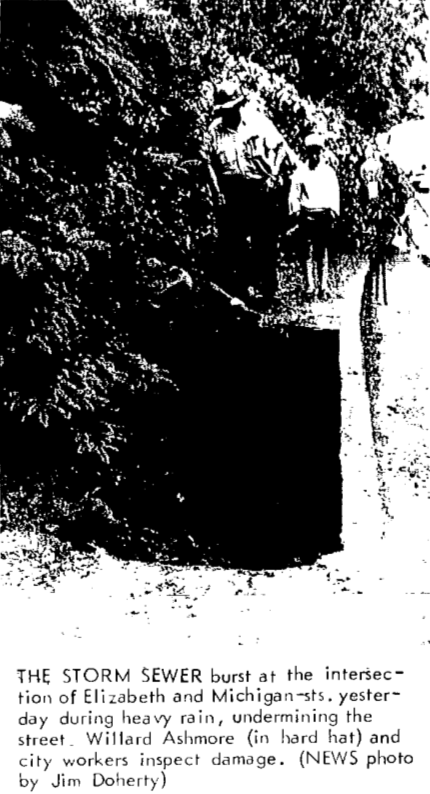
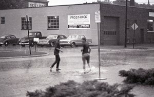
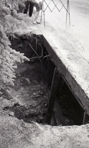
~ Storm Damage ~
Intersection of Elizabeth and Michigan streets
1969
Intersection of Elizabeth and Michigan streets
1969
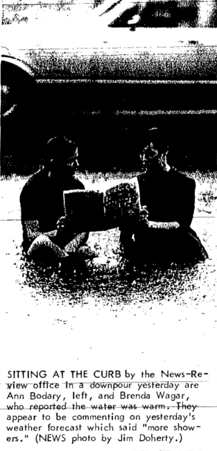
27 June 1969 ~ Petoskey News Review
|
27 June 1969 ~ Petoskey News Review
|
Geenwood Photo Archive Collection from Petoskey Newspaper (27 June 1969)
|
Greenwood Photo Archive Collection from Petoskey Newspaper (27 June 1969)... See photo description in the news clipping above.
|
~ Roads... Does Emmet Need More?
1971
1971
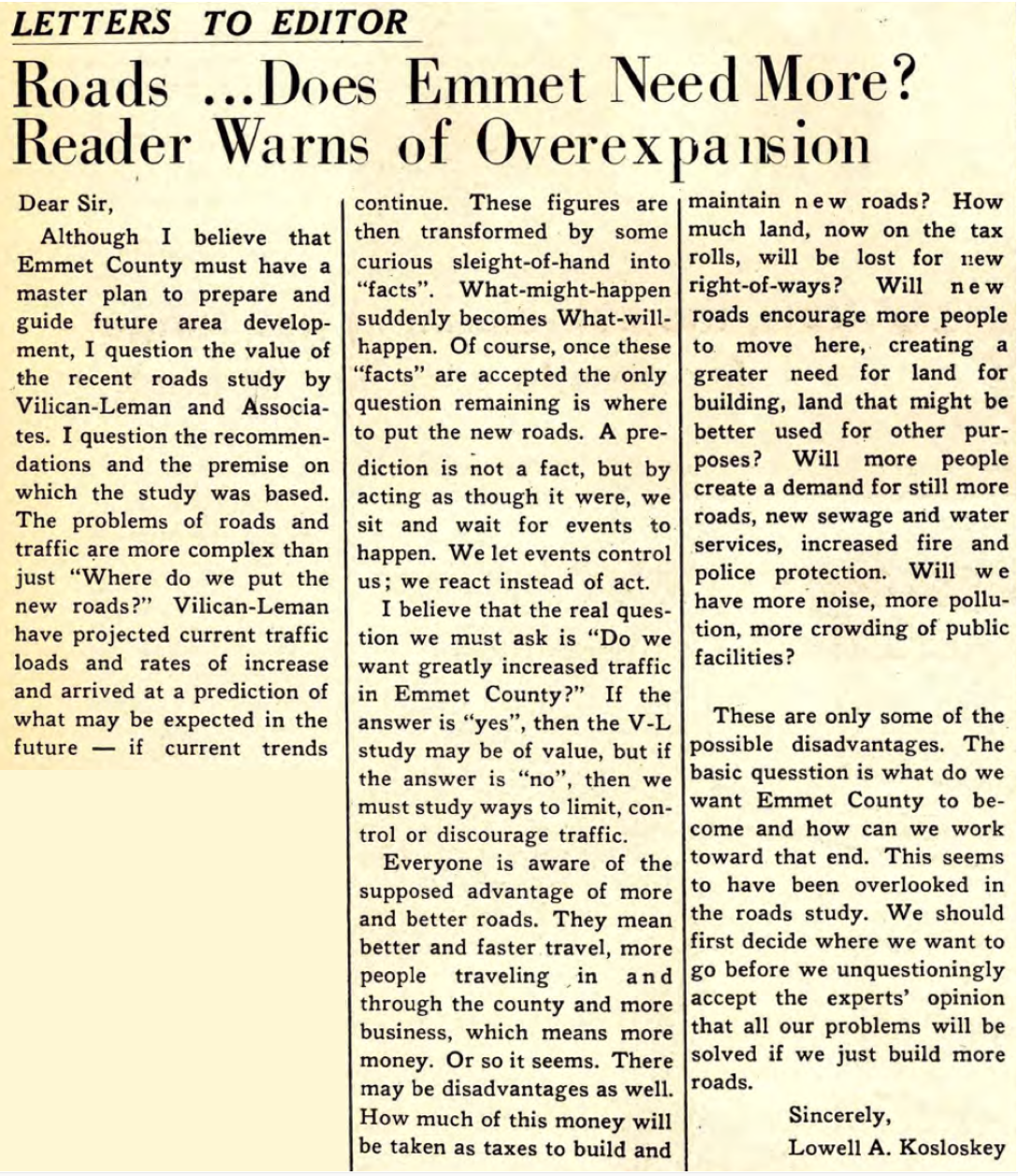
18-24 March 1971 ~ Harbor Light
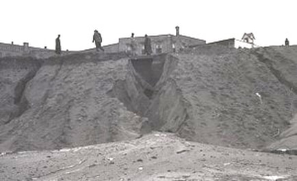
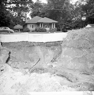
~ Sunset Boulevard By-Pass Washout ~
3 July 1974
3 July 1974
This washout should not have been any surprise because the underground fill
was all sand that had been moved from the Winter Sports Park ski hill area of sand dune...
was all sand that had been moved from the Winter Sports Park ski hill area of sand dune...
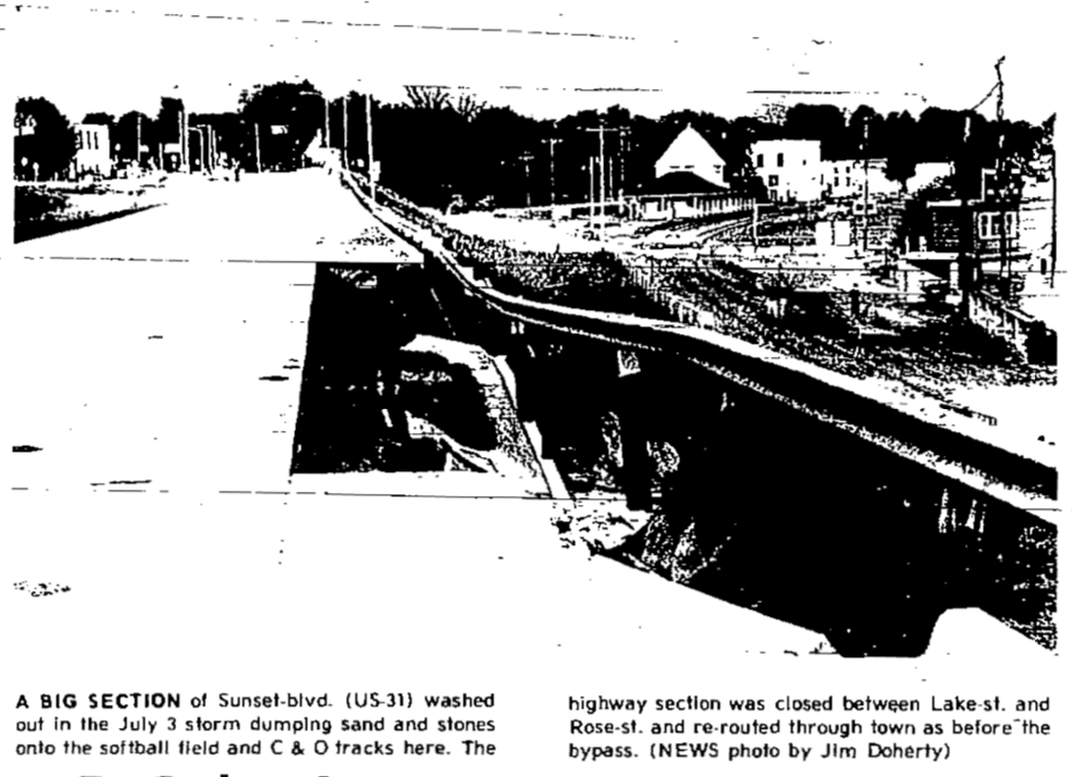
5 July 1974 ~ Petoskey News Review
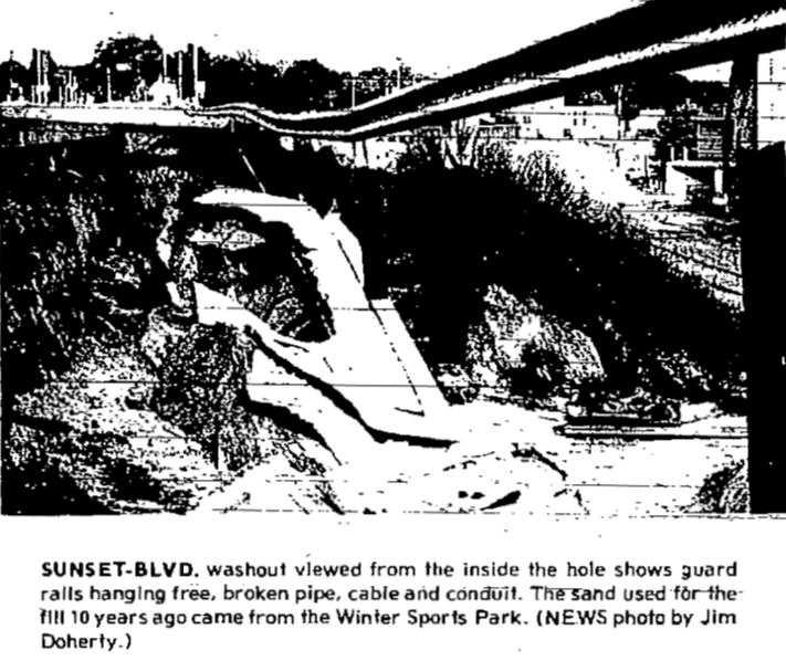
5 July 1974 ~ Petoskey News Review

5 July 1974 ~ Petoskey News Review
5 July 1974 ~ Petoskey News Review
~ Buckley Street in Petoskey, Michigan was torn up for a sewer project. ~
August, 1978
August, 1978
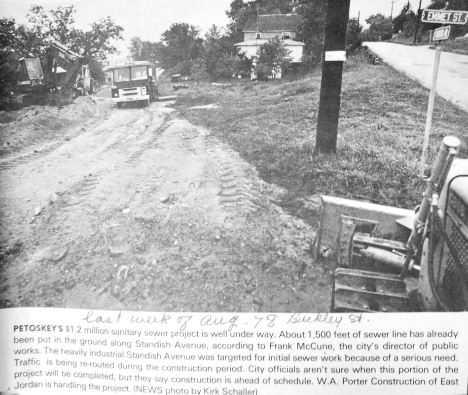
August 1978 ~ Petoskey News Review
Article Below: In 1882, it was being debated IF Buckley Avenue is a "reality or only a myth".
With the 1978 article above acknowledging Buckley Avenue, and the fact Buckley Avenue still exists,
it must have proven to be a "reality."
With the 1978 article above acknowledging Buckley Avenue, and the fact Buckley Avenue still exists,
it must have proven to be a "reality."
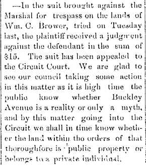
9 June 1882 ~ Emmet County Democrat
10 July 1952 ~ Centennial Newspaper
~ M-119 ~ New Highway Number ~
1979
1979
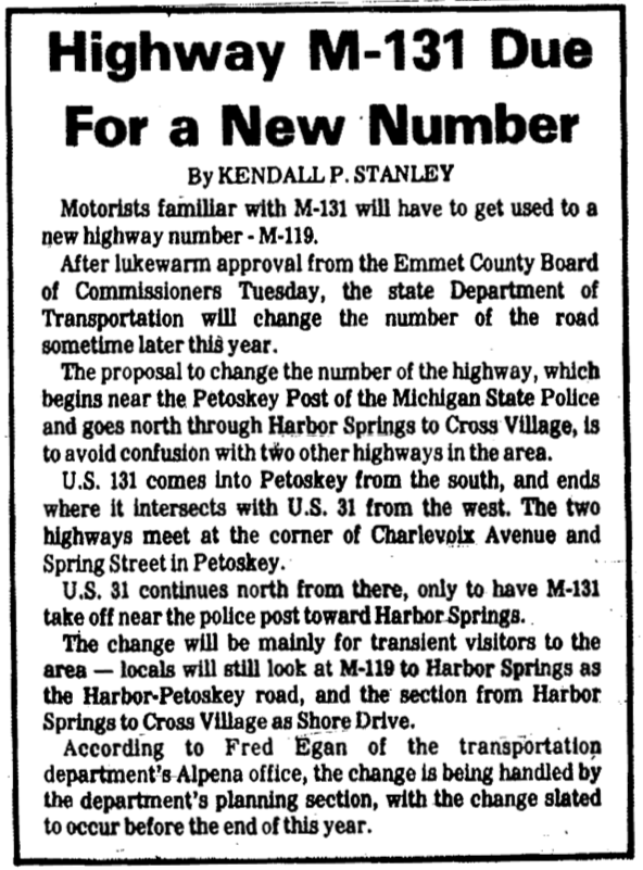
26 July 1979 ~ Petoskey News Review
~ Sheridan Street Alley Connecting Lawrence Street Closed ~
1982
1982
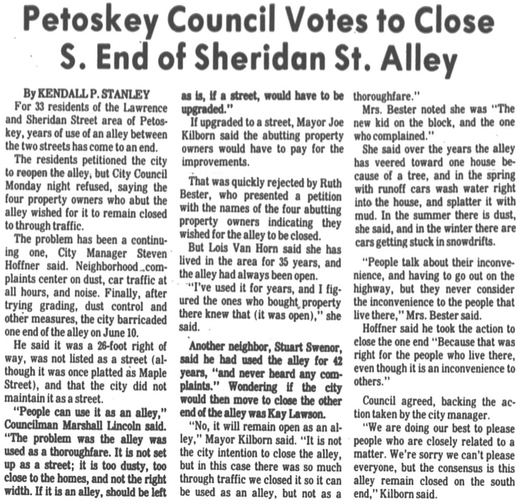
20 July 1982 ~ Petoskey News Review
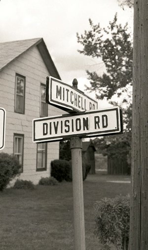
~ Corner of Mitchell Road and Division Road ~
1984
Photo Below Left: This house was moved to Chandler Township, Charlevoix County,
and in 2019 continues to be a lovely renovated residence.
In 2022 this location is the space of a drive-through bank.
1984
Photo Below Left: This house was moved to Chandler Township, Charlevoix County,
and in 2019 continues to be a lovely renovated residence.
In 2022 this location is the space of a drive-through bank.
Greenwood Photo Archive Collection from Petoskey Newspapers (1984)
|
Greenwood Photo Archive Collection from Petoskey Newspapers (1984)
|
~ Name Access Drive to new Middle School ~
NORTHMEN DRIVE
April 1990
NORTHMEN DRIVE
April 1990
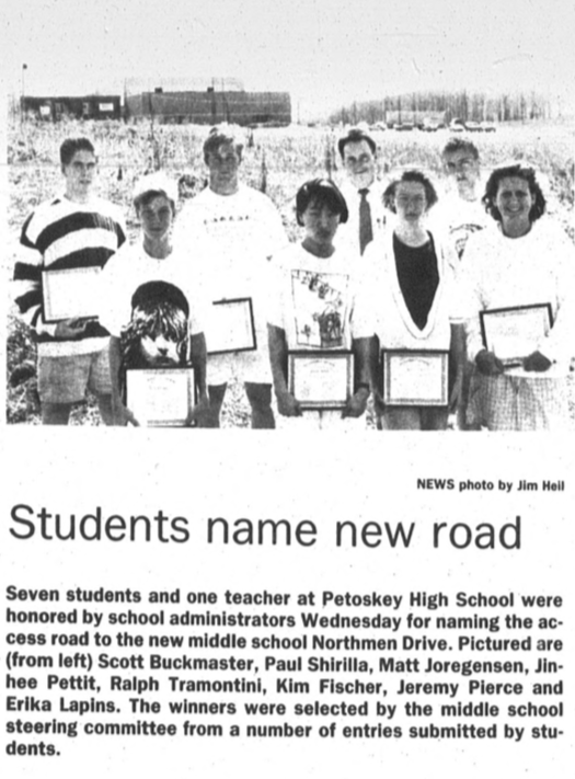
26 April 1990 ~ Petoskey News Review
~ Horton Bay Road, Petoskey, Michigan ~
Abandonment ~ 1994
Abandonment ~ 1994

26 September 1994 ~ Petoskey News Review
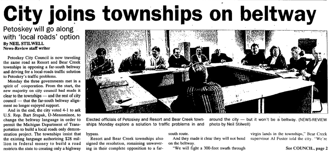
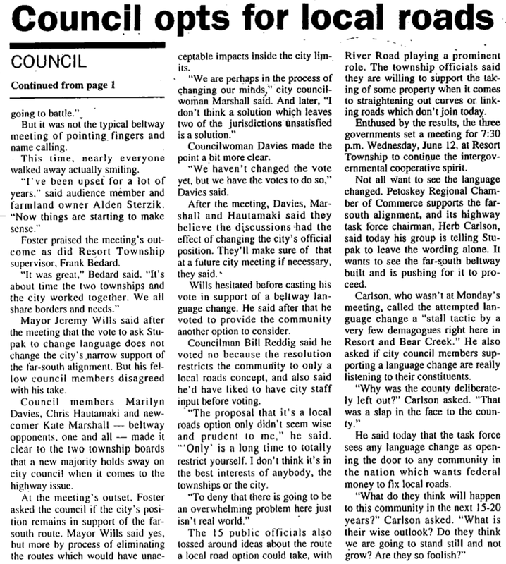
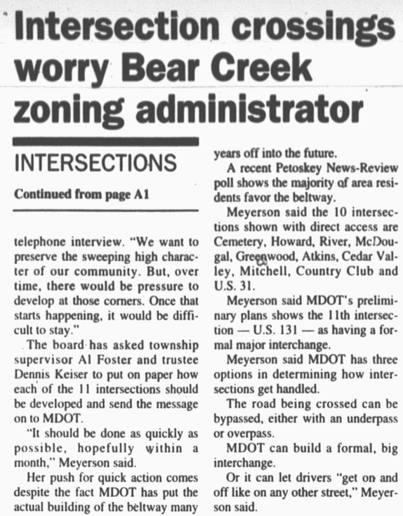
~ Beltway Options ~
1995–1999
1995–1999
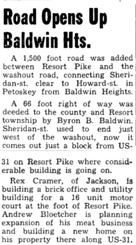
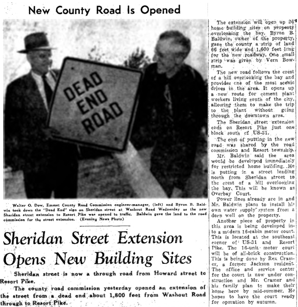
Beltway Route: Sheridan, Howard
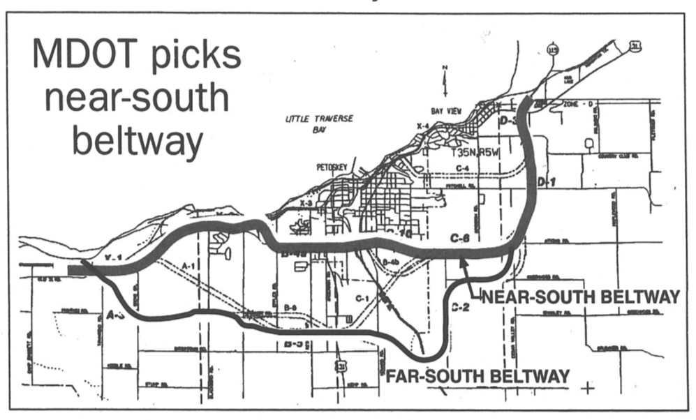
27 April 1995 ~ Petoskey News Review
23 April 1996 ~ Petoskey News Review article continued below...
23 April 1996 ~ Petoskey News Review article continued from above...

4 November 1999 ~ Petoskey News Review article continued below...
4 November 1999 ~ Petoskey News Review article continued below...
As of 2019 this (above) Beltway Routing has not happened.
~ Chandler Township, Charlevoix County, Roads ~
Many Chandler Township, Charlevoix County, Roadways may be viewed on the
Chandler Township Michigan Memories website by clicking here.
Chandler Township Michigan Memories website by clicking here.
31 August 2013 ~ Chandler Hill Road
|
18 October 2013 ~ Chandler Hill Road
|
Two Photos Above: These two photos are taken of the same stretch of Chandler Hill; taken only 1 1/2 month apart.
Photo Below: One of the directions the road at this Five Corners in Chandler Township will lead is Camp Wolverine, the CCC Road... (Civilian Conservation Corp). More CCC information may be viewed on the Chandler Township Michigan Memories website by clicking here.
Photo Below: One of the directions the road at this Five Corners in Chandler Township will lead is Camp Wolverine, the CCC Road... (Civilian Conservation Corp). More CCC information may be viewed on the Chandler Township Michigan Memories website by clicking here.
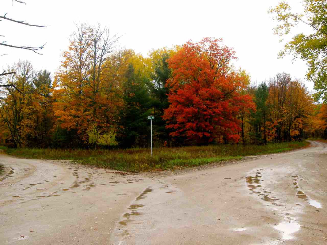
18 October 2013 ~ Five Corners in Chandler Township
Photo Above: In August of 2018 this same Charlevoix County Five-road Intersection is being readied for road work. The corners' "Witness Tree" is marked to be removed. Read about it on this webpage about the CCC Camp Wolverine.
~ Division Street, Petoskey, Michigan ~
2 October 1916 ~ Petoskey Evening News
~ Petoskey ISLANDS ~
PRE and POST
PRE and POST
1942
PRE-ISLANDS
PRE-ISLANDS

1942 Postcard looking west on downtown Mitchell Street (Personal Family postcard owned by web master. Do NOT copy)
PRE- 1964 and PRE-ISLANDS
PRE 1964 ~ 13 July 1964 Public Schools of Petoskey booklet for Refunding Bonds
|
Two Photos Below and Right:
Looking toward West Mitchell Street in Petoskey, Michigan in March PRE-ISLANDS ~ 1976 
Greenwood Photo Archive Collection from Petoskey newspaper (March 1976)
|
Greenwood Photo Archive Collection from Petoskey newspaper (March 1976)
|
16 February 1994
PRE-ISLANDS
PRE-ISLANDS
Article Below: A close connection existed between Johnson, Johnson and Roy, Ann Arbor, to the development of Bay Harbor in 1994. Did a connection also exist in its infancy as to WHY Petoskey has ended up with islands down the center of Petoskey's Mitchell (MAIN) Street now?

26 February 1994 ~ Petoskey News Review
1995 ~ Petoskey News Review
1995 ~ Petoskey News Review
25 May 1995 ~ Petoskey News Review
2001
US 31 Near the Hospital
US 31 Near the Hospital
Greenwood Photo Archive Collection from Petoskey newspapers (2001)
|
Greenwood Photo Archive Collection from Petoskey newspapers (2001)
|
2000
PRE-ISLANDS
(Downtown Petoskey)
Greenwood Photo Archive Collection from Petoskey newspaper (2000)
|
Greenwood Photo Archive Collection from Petoskey newspaper (2000)
|
29 July 2001
PRE-ISLANDS
(Downtown Petoskey)
PRE-ISLANDS
(Downtown Petoskey)
29 July 2001 ~ PRE-Islands
29 July 2001 ~ PRE-Islands
|
29 July 2001 ~ PRE-Islands
|
~ Downtown Mitchell Street, Adding Islands ~
23 April 2008
(Slideshow Below)
23 April 2008
(Slideshow Below)
~ Downtown Mitchell Street, Adding Islands ~
8 May 2008
(Slideshow Below)
8 May 2008
(Slideshow Below)
~ Downtown Mitchell Street, Adding Islands ~
22 May 2008
(Slideshow Below)
22 May 2008
(Slideshow Below)
~ Downtown Mitchell Street, AFTER "Traffic Calming" Islands ~
12 June 2008
(Traffic backed up behind the "blocking" delivery truck...
red car became tired of waiting, proceeded to drive wrong way down the left hand lane)
12 June 2008
(Traffic backed up behind the "blocking" delivery truck...
red car became tired of waiting, proceeded to drive wrong way down the left hand lane)
12 June 2008 ~ AFTER ISLANDS
FIRST Vehicle to flip over after the Mitchell Street Islands were installed...
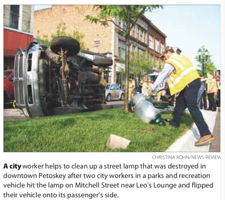
18 June 2009 ~ Petoskey News Review
Photo Below: On 18 June 2009, the FIRST vehicle to flip over on a Mitchell Street island happened in front of Leo's Lounge shortly after 8AM. It was a city "parks and recreation" pickup. Two "parks and recreation" workers were in the vehicle, when the driver fell asleep after having been up late the night before, and having begun work at 4AM. The city workers in the photo below were repairing the island damage soon after the wreck.
19 June 2009 ~ Island Repair
Photo Below: By 17 February 2012 one of the FIRST island trees was wiped out.
Two spikes sticking up on left end of island had been a tree before being wiped out.
Two spikes sticking up on left end of island had been a tree before being wiped out.
17 February 2012 ~ East Mitchell Street Island Tree Was Wiped Out
~ Main/Mitchell Street Islands ~
4 January 2017
Also notice on right, the Ben Franklin store... PRE-addition of two upper floors.
4 January 2017
Also notice on right, the Ben Franklin store... PRE-addition of two upper floors.
4 January 2017 ~ Photography of "Alex Childress Photo" posted with permission...
~ East Mitchell Street, Adding Islands ~
26 June 2008
26 June 2008
26 June 2008 ~ Heading west on East Mitchell... cannot drive through
26 June 2008 ~ Heading east on East Mitchell
|
26 June 2008 ~ Heading east on East Mitchell
|
~ Hill on East Mitchell Street, Adding Islands ~
9 September 2008
(Slideshow Below)
9 September 2008
(Slideshow Below)
~ Atkins Extension from Kalamazoo Avenue to Howard Street ~
(Past North Central Michigan College)
2011>2012
(Past North Central Michigan College)
2011>2012
~ Workers cut and remove curbing from the Howard and Lake intersection... ~
remove the existing roadway before replacing it.
4 April 2012
remove the existing roadway before replacing it.
4 April 2012

4 April 2012
~ Islands in Front of McLaren Northern Michigan on East Mitchell Street ~
Just Finished...
31 July 2014
Just Finished...
31 July 2014
31 July 2014 ~ Islands Just Finished...
C. Hayner-US 131-Anderson Intersection, Reconstruction, Petoskey, Michigan
2008
2008
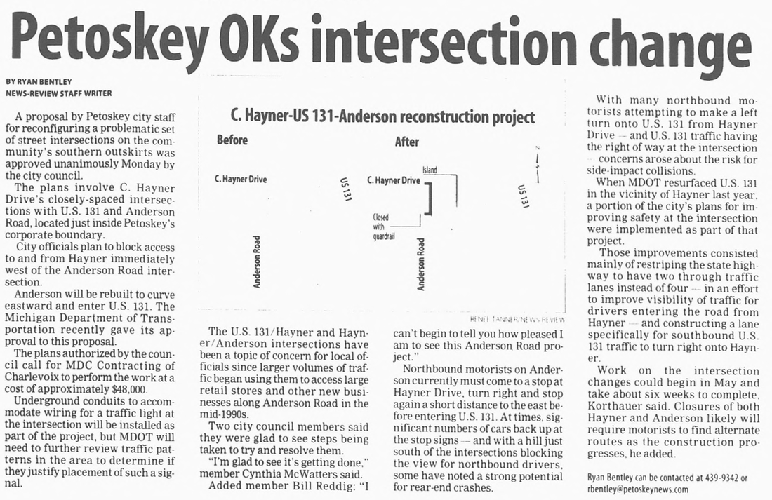
2 April 2003 ~ Petoskey News Review
Lears Road, Petoskey, Michigan
2008
2008
Major road construction, moving a massive amount of soil, near Independence Village took place.
Independence Village was allowed to keep the name of their facility's road as Hager Drive.
Independence Village was allowed to keep the name of their facility's road as Hager Drive.
7 October 2008
|
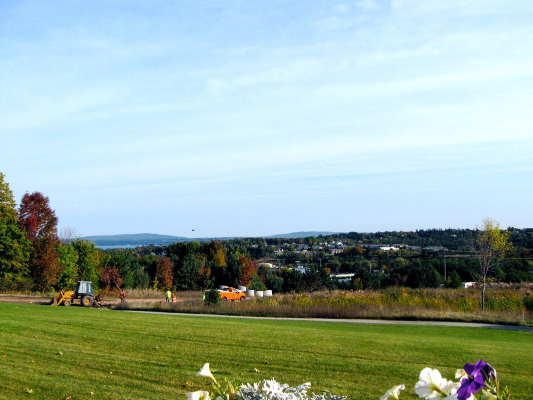
7 October 2008
|
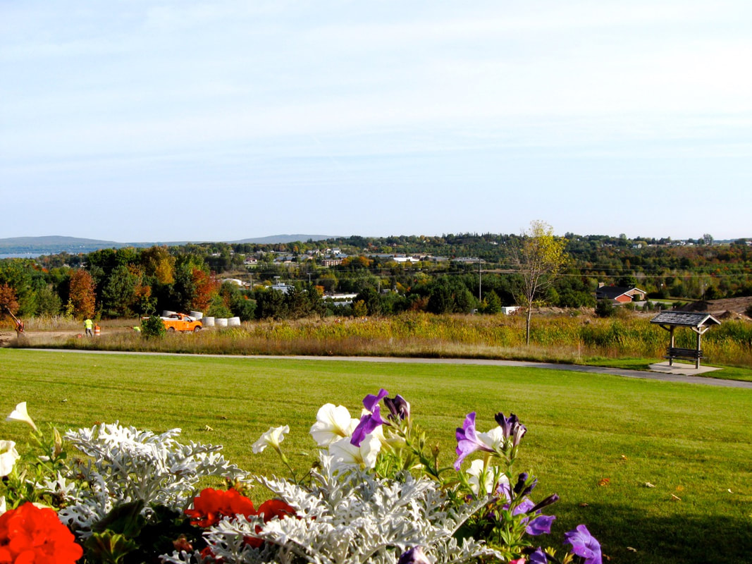
7 October 2008
25 October 2008 ~ Road near Independence Village
|
25 October 2008 ~ Road near Independence Village
|
~ VOID beneath Roadway at US-31 and M-119, Petoskey, Michigan ~
2008
2008
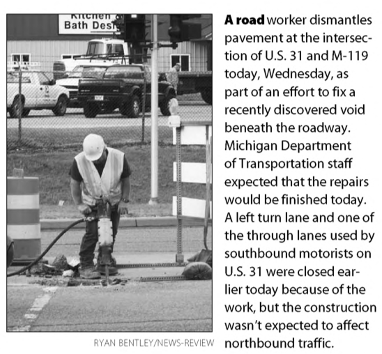
17 July 2009 ~ Petoskey News Review
~ US 31 Near Manvel Road ~
~ 8 August 2012 ~
(Slideshow Below)
(Slideshow Below)
~ 20 August 2013 ~
20 August 2013 ~ Manville Road near M-119 Corner
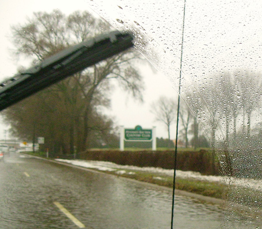
~ Water Issues near US 31 Near Petoskey - Bay View Country Club ~
12 November 1992 ~ Petoskey News Review
~ US 31 Near Petoskey - Bay View Country Club ~
18 November 2013
18 November 2013

18 November 2013 ~ Flooding
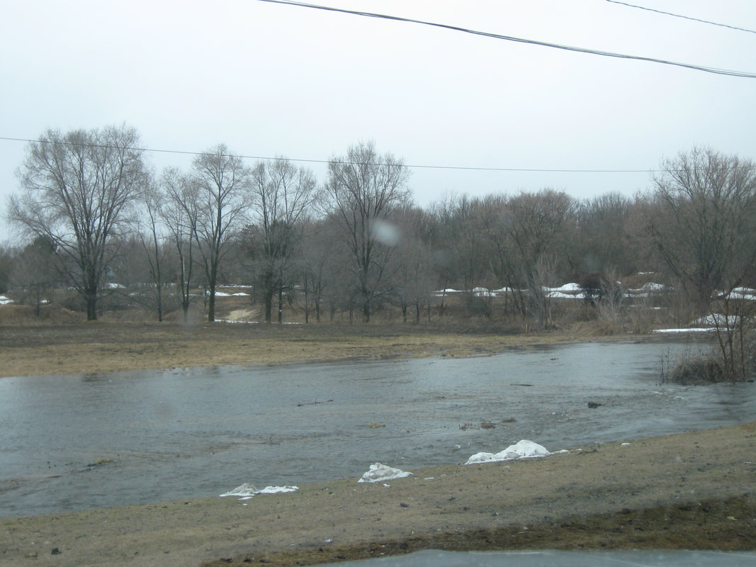
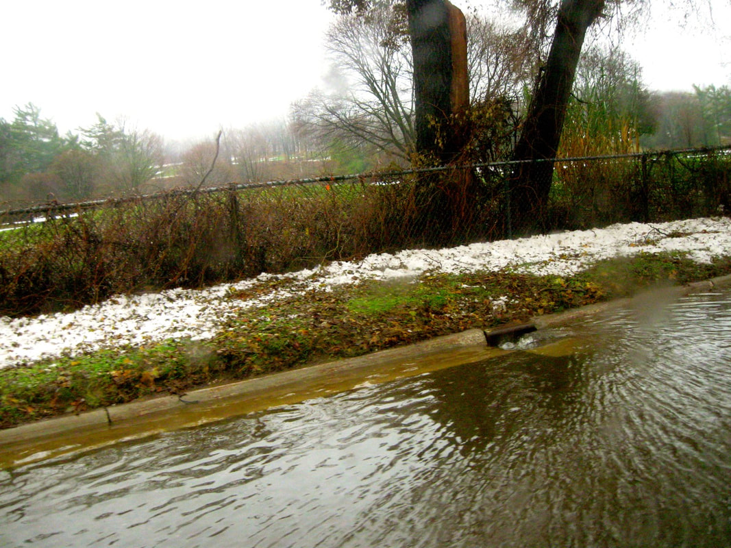
1923
Flooding was already being reported (Article Below) as being a problem near the Kegomic Creek.
This Kegomic area flooding, including the Country Club (as shown above) remains a problem in 2020.
Flooding was already being reported (Article Below) as being a problem near the Kegomic Creek.
This Kegomic area flooding, including the Country Club (as shown above) remains a problem in 2020.
20 April 1923 ~ Petoskey Evening News
~ US 31 Near Petoskey - Bay View Country Club ~
13 April 2014
13 April 2014
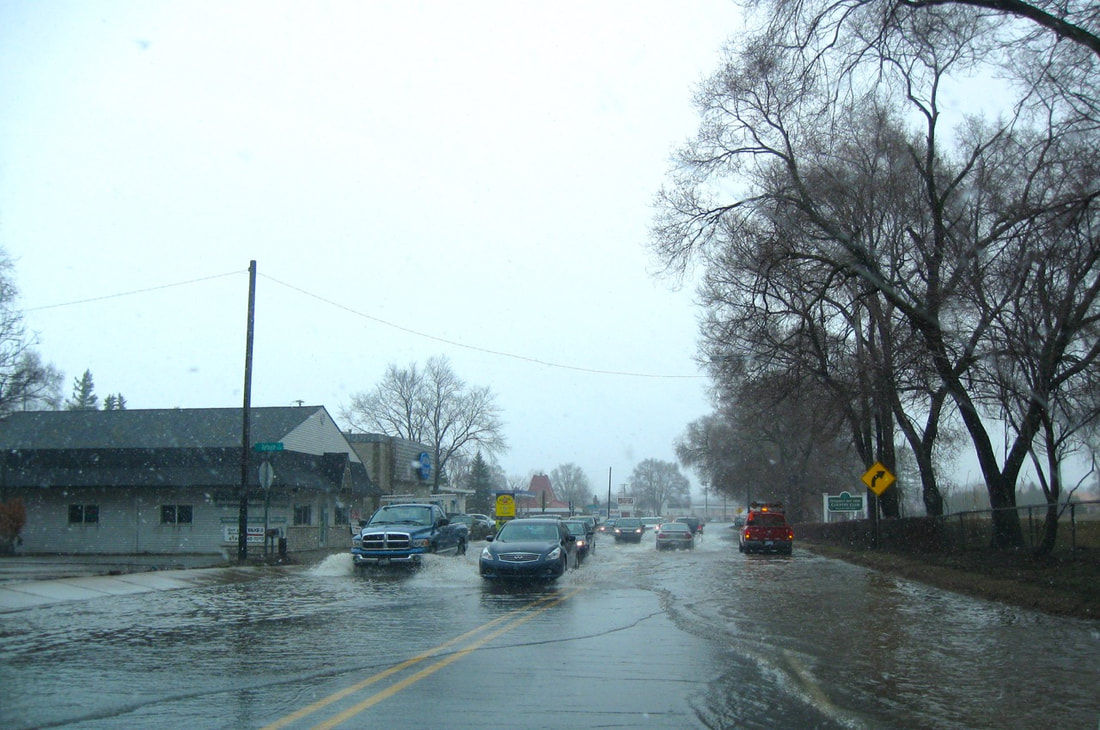
13 April 2014 ~ Flooding on the Kegomic road opposite the Petoskey-Bay View Country Club...
|
13 April 2014 ~ Flooding on the road and on Petoskey-Bay View Country Club's golf course...
|
13 April 2014 ~ Flooding behind Chase Branch Bank in Kegomic...
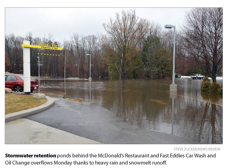
15 May 2014 ~ Petoskey News Review
~ US 31 Near Petoskey - Bay View Country Club ~
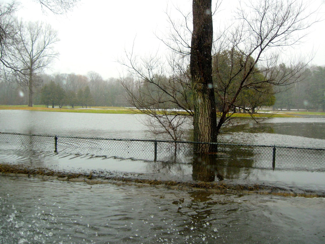
24 November 2014
24 November 2014
24 November 2014 ~ Flooding
|
24 November 2014 ~ Flooding
|
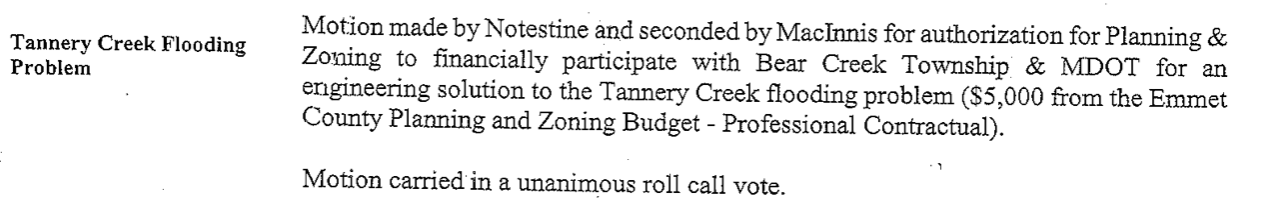
15 May 2014 ~ ECBOC Meeting to address the flooding concerns
~ US 31 & Division Road Intersection ~
2011
2011
12 May 2011 ~ US 31 & Division Road Intersection
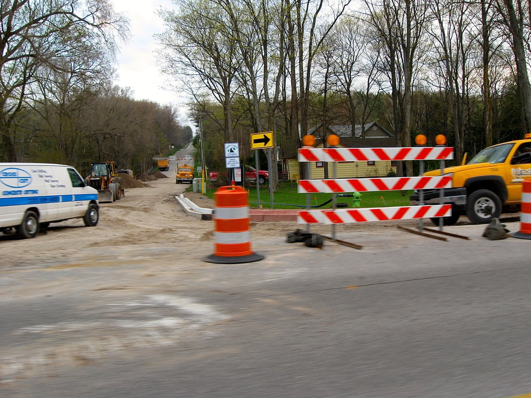
12 May 2011 ~ US 31 & Division Road Intersection
Photo Above: 2011 ~ Looking up Division Hill
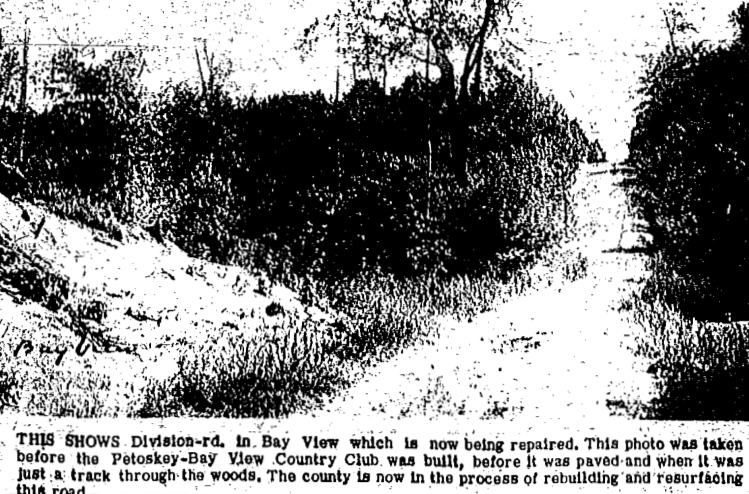
Two Photos Below: Year was before the Petoskey-Bay View Country Club was built
and before Division Hill was paved, but rather just a track through the woods.
Two Photos Below: Year was before the Petoskey-Bay View Country Club was built
and before Division Hill was paved, but rather just a track through the woods.
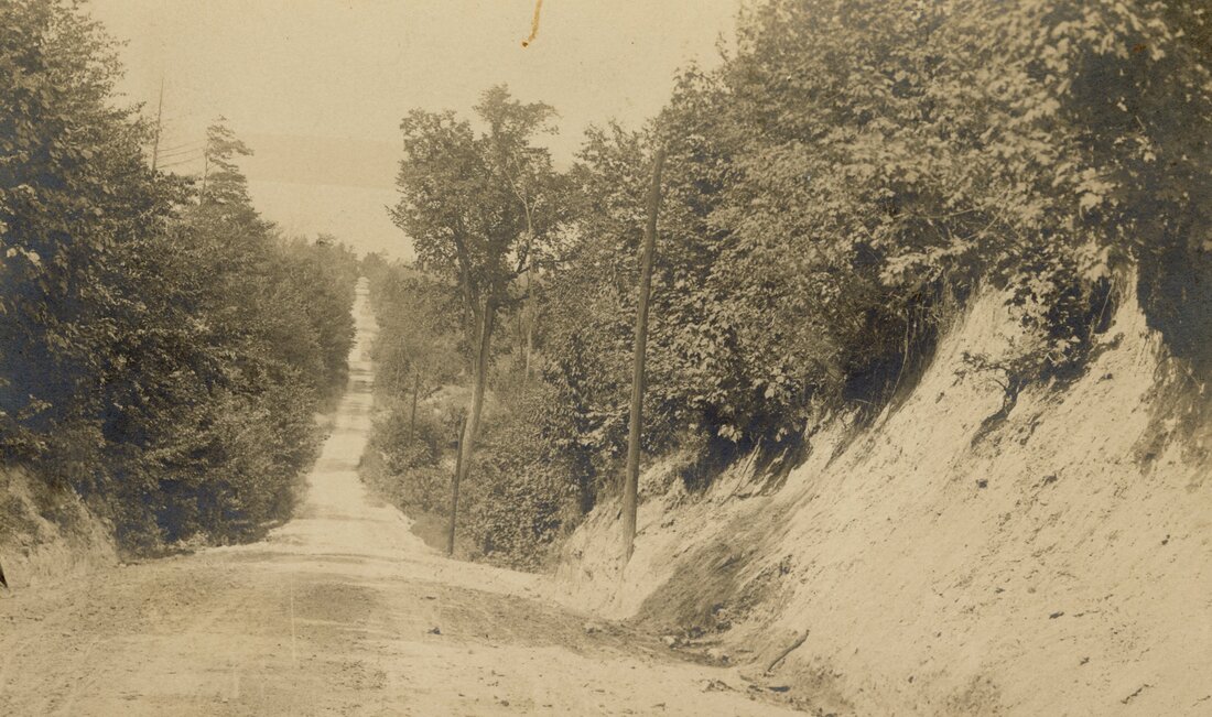
Greenwood Photo Archive Collection from Petoskey newspapers (1900)
16 November 1964 ~ Petoskey News Review
Two Photos Below: 24 November 2011 ~ Division Hill Intersection Island (Weeds & Tire Tracks)
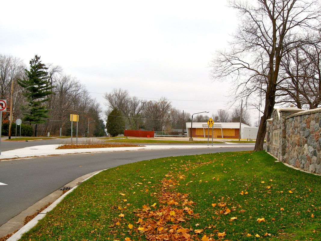
24 November 2011 ~ Division Hill Intersection Island (Weeds & Tire Tracks)
|

24 November 2011 ~ Division Hill Intersection Island (Weeds & Tire Tracks)
|
~ MDOT scraps sign at U.S. 31, Division Road ~
Reported by Petoskey News Review on 21 September 2018
The overhead cantilevered signs were removed, and replaced by smaller stand on the side of the road signs.
The first of the new smaller signs will be placed just ahead of Hampton Road.
The first of the new smaller signs will be placed just ahead of Hampton Road.
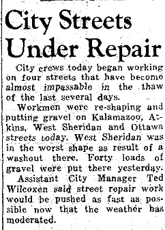
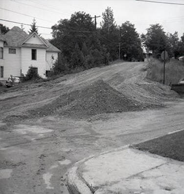
~ Sheridan / State Road (US 31) ~
~ Petoskey City Work Crew Paving Sheridan Street ~
(Undated) Submitted by Linda (Lewis) Lark for viewing only on this Northern Mich~Mash Preserve web site...
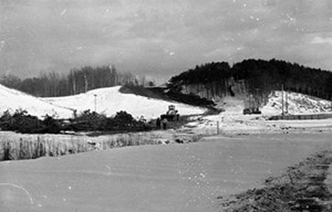
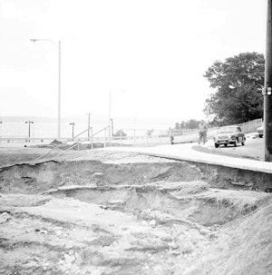
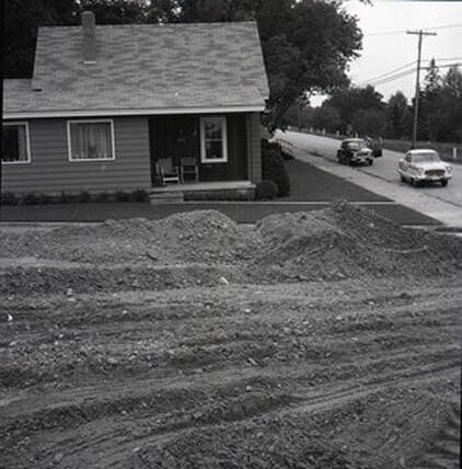
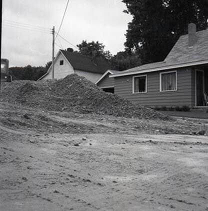
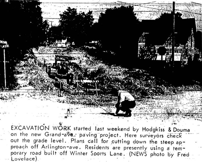
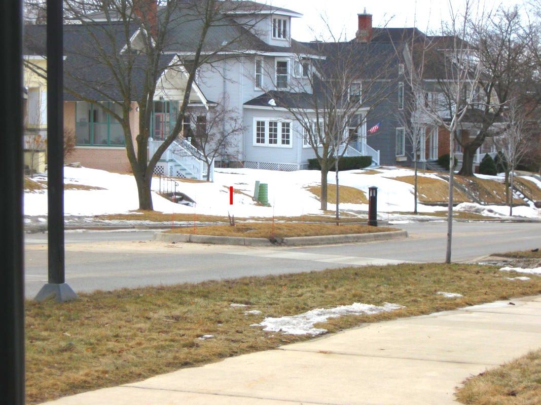
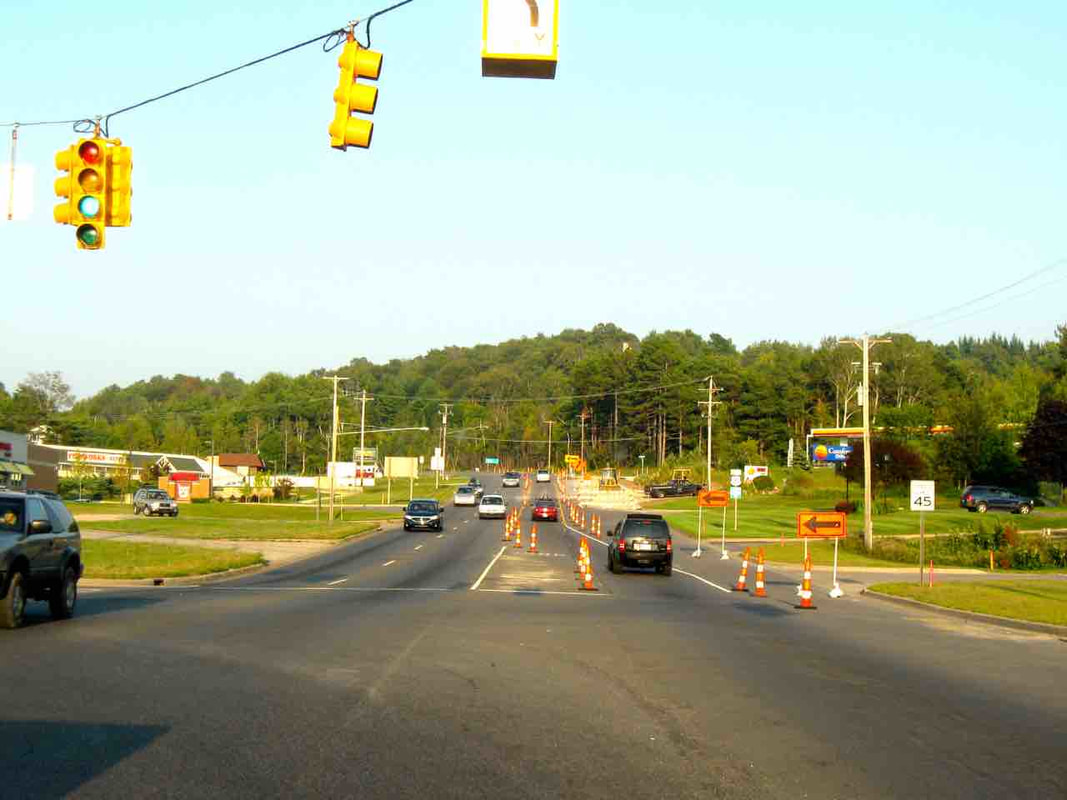
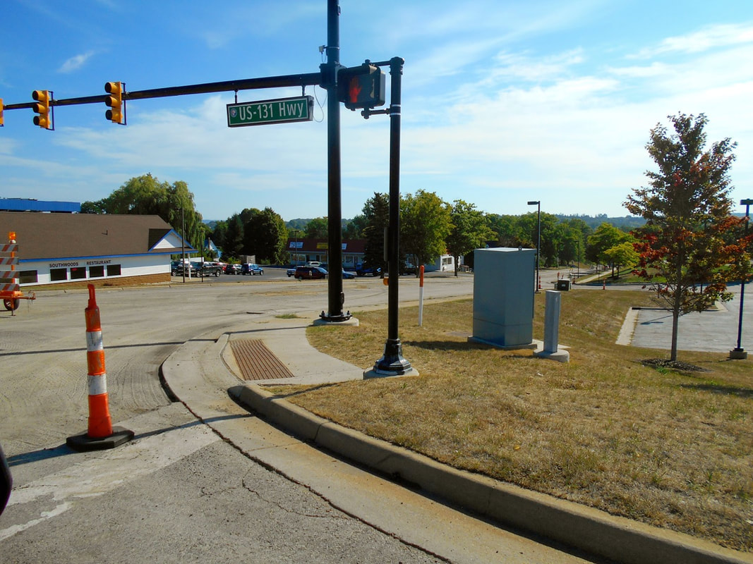
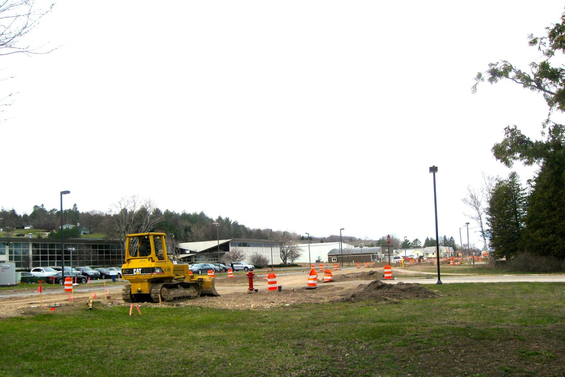
~ US 131 & Sheridan Intersection ~
2012 Pavement Rising?
20 June 2012 ~ US 131 & Sheridan Intersection Pavement Rising?
~ Sheridan Street and US 131 ~
2018 Under Repair
22 August 2018
|
22 August 2018
|
~ US 31 on Charlevoix Avenue, Petoskey, Michigan ~
Near Fletch's and Wendy's on 29 April 2015
Reconfiguring and Adding Islands...
Near Fletch's and Wendy's on 29 April 2015
Reconfiguring and Adding Islands...
29 April 2015 ~ US 31 Charlevoix Avenue... adding islands
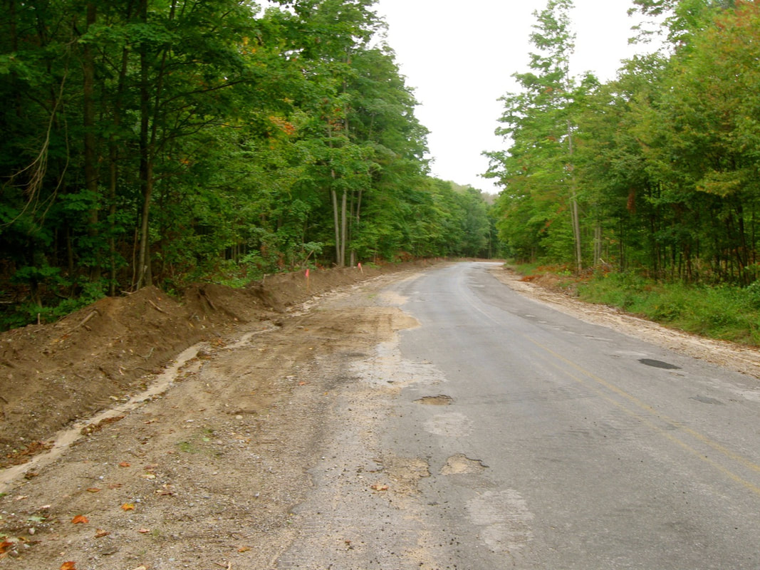
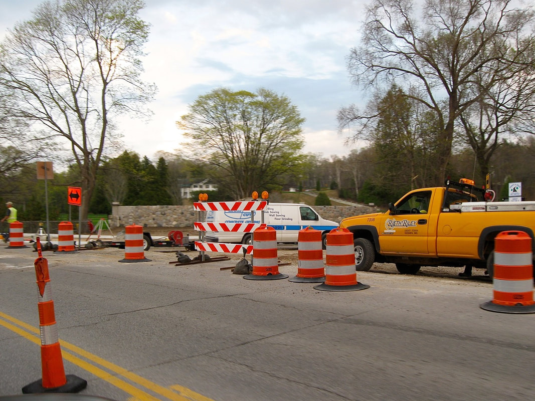
~ Major Reconstruction on the US 31 North Bypass ~
Discussion began in the late 1950s with work beginning for building this Bypass (Check those dates and information/photos farther above on this same web page, regarding the beginnings of the original US 31 Bypass). In early Spring of 2017, the REconstruction process of the Bypass has begun.
The 5 June 2018 Petoskey News Review article titled
"Road Revamp $14.8 million in US-31 Renovations still Slated for 2019"
offers an explanation of the total plan for the project.
Click HERE to access the article.
"Road Revamp $14.8 million in US-31 Renovations still Slated for 2019"
offers an explanation of the total plan for the project.
Click HERE to access the article.
~ US 31 Road Construction near Sunset Park ~
12 April 2017
The sidewalk along this section of roadway had been closed for several years
because the underneath was "giving way" as noted in the photo below looking south bound.
The roadway is to be moved to the east in the future for better support of this major roadway
leading through Petoskey, Michigan.
Photo Below: Posted on this Northern Mich~Mash Preserve web site only by permission from
remarkable photographer and videographer Charles Dawley of Up North Imaging.
remarkable photographer and videographer Charles Dawley of Up North Imaging.
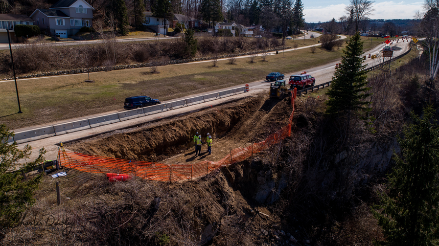
12 April 2017 ~ Charles Dawley (permission to post only on this Northern Mich~Mash Preserve web site).
A description, and additional photos, of what is happening in the photo above is noted by Team Elmer's which was the contracting firm for this delicate job. Click HERE for a full overview. The description seems a precursor to the eroding bank on the wheelway still on US 31 south of Petoskey when it states: "In 2019, the Michigan Department of Transportation plans to reconstruct a stretch of US-31 near Petoskey. Part of the highway runs along the edge of a steep slope, and the area is plagued with erosion problems. The 2019 highway reconfiguration will move part of the roadway so that it isn’t situated right on the edge of a slope. However, until then, MDOT needed a temporary solution to prevent erosion and protect the well-traveled highway.... The project involved building a retaining wall to stabilize the soils along US-31 near Petoskey, running from Winter Park Lane east to Beaubien Street... The project involved building a retaining wall to stabilize the soils along US-31 near Petoskey..."
UPDATE PHOTO BELOW: There, now isn't that safer?
19 May 2020
4 January 2019: Let the construction work begin; waterfront work at the end of Howard Street, with clearing the hill in preparation for creating a stabilizing wall.
The US 31 reconstruction area will include roadway approximately from the north edge of the Mitchell Street Bridge to Petoskey's east limit at the intersection with Fairview Avenue in Bay View, Michigan. Work will begin on 4 February 2019 with the retaining wall in Bayfront Park. The roadway near the bluff will be moved 20 feet away from the bluff. Where Lewis Street enters US 31 will be reconfigured for easier turns. Another island will appear, preventing left turns at Winter Park Lane, but presenting a safer pedestrian crossing.
After Labor Day 2019, the "Detour" of Mitchell Street from US 31 to Division Street, and Division Street to Arlington Avenue, will be repaved.
The entire bypass reconstruction area is viewed in the photo below...
PRE-Bypass Reconstruction in 2017
from Mitchell Street Bridge to Fairview Avenue in Bay View.
PRE-Bypass Reconstruction in 2017
from Mitchell Street Bridge to Fairview Avenue in Bay View.
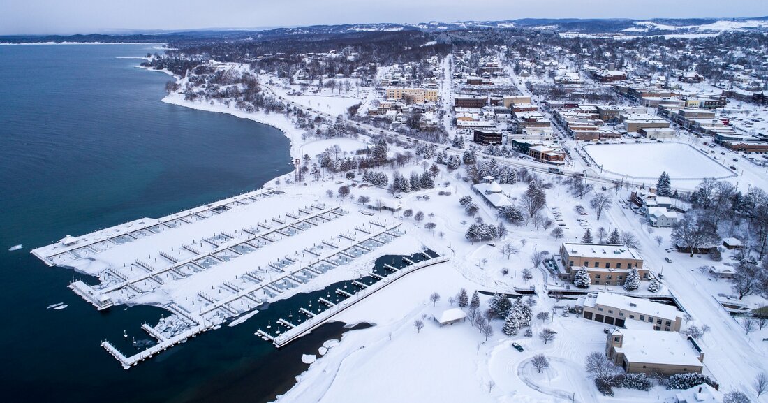
29 December 2017 ~ Photography of "Alex Childress Photo" posted here with permission...
Photo Above: Alex Childress' additional work also may be viewed at Alex Childress Photo.
Channel 9&10 reported the following on 4 February 2019 regarding the construction and repaving between Winter Park Lake and Fairview Avenue:
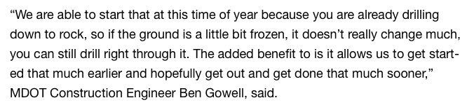
4 February 2019 ~ Channel 9&10
Article Above AND Added UPDATE: It is interesting that in September 2020 Ben Gowell is noted as the Manager of Petoskey OHM which is a receiver of taxpayer money for studies for the slope failure near Eppler Road.
As of 14 February 2019: This US-31 realignment $11.2 M project will be from the Mitchell Street Bridge to Fairview Avenue. The surface will be replaced and the highway moved away from the bluff. The eroding bed rock will be addressed with a retaining wall reconstructed. A new traffic light will be installed. Drainage and utility improvements will be made. A detour route for north bound traffic will be in place late March 2019 through 1 July 2019. The average traffic flow is 20,000 daily. The sidewalk will be widened on the north side of the road.
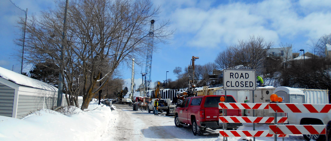
6 March 2019
Photo Above AND Photo Below: The stabilization project on the hillside, between Bay Front Park and US 31 which runs above, is on schedule with the placement of the steel pilings already placed. This is a necessary piece of the entire stabilization and realignment project for US 31 which will begin in the Spring 2019.
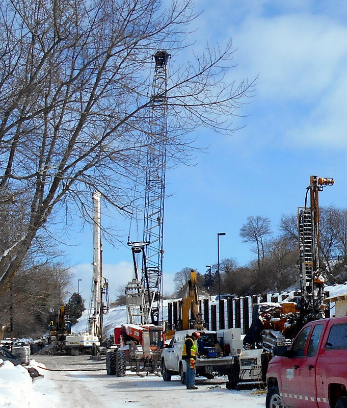
6 March 2019
Photo Below: In preparation for the US 31 realigning between Mitchell Street bridge and Fairview Avenue in Bay View, temporary traffic signal lights were being installed by workers in bucket lifts. The workers were attaching the lines to new poles at that Bay View intersection.
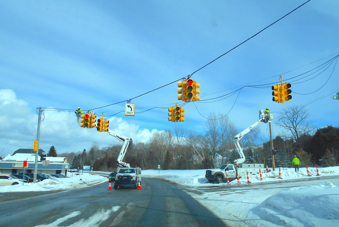
5 March 2019
~ DETOUR in Action ~
Starting March 2019
PRE signs stating "Oncoming Traffic Does Not Stop" on the corner of Mitchell and Division
Starting March 2019
PRE signs stating "Oncoming Traffic Does Not Stop" on the corner of Mitchell and Division
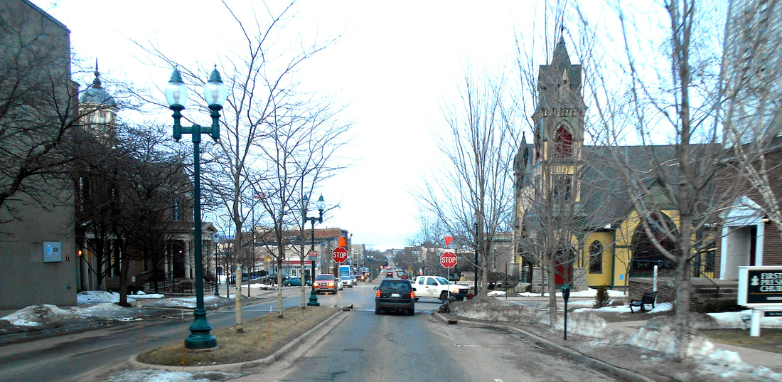
20 March 2019 ~ PRE signs stating "Oncoming Traffic Does Not Stop" on the corner of Mitchell and Division streets...
Three Photos Below: Looking at the road construction from across The Hole!
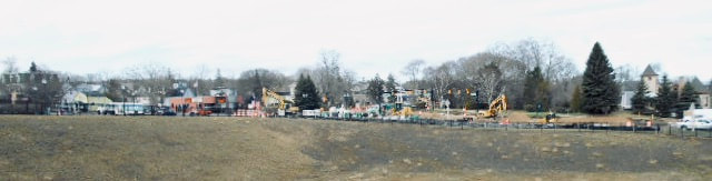
19 April 2019
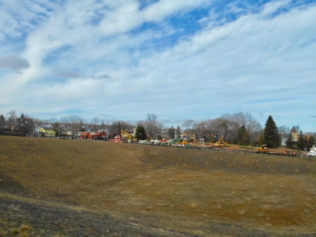
19 April 2019
|

19 April 2019
|
Slideshow Below: Click on PLAY in the upper left corner of the main photo below to view the slideshow. The photos were taken 27 April 2019 near the waterfront when the supporting foundation for the by-pass was being prepared. Some large forms to create the patterned decorative rocks to be mounted against the wall were resting on the ground at this time, with only a couple of large sections in the stand-up position. In photos farther below, the patterned decorative rocks were in an upright position.
Photo Below: Deja Vu.... Compare this 1961 photo to the 2019 photo below this one.
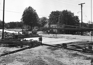
Greenwood Photo Archive Collection from Petoskey Newspaper (1961)... intersection of Lake Street and US 31
Photos Below: From the corner of Lake Street and US 31 the Waterfront construction continues...
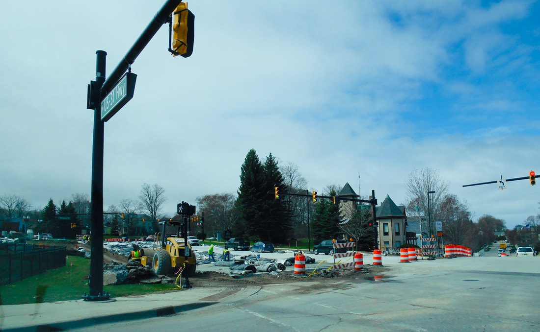
10 May 2019 ~ Intersection of Lake Street and US31... part of the "detour"
PROGRESS? Compare two photos above and below...
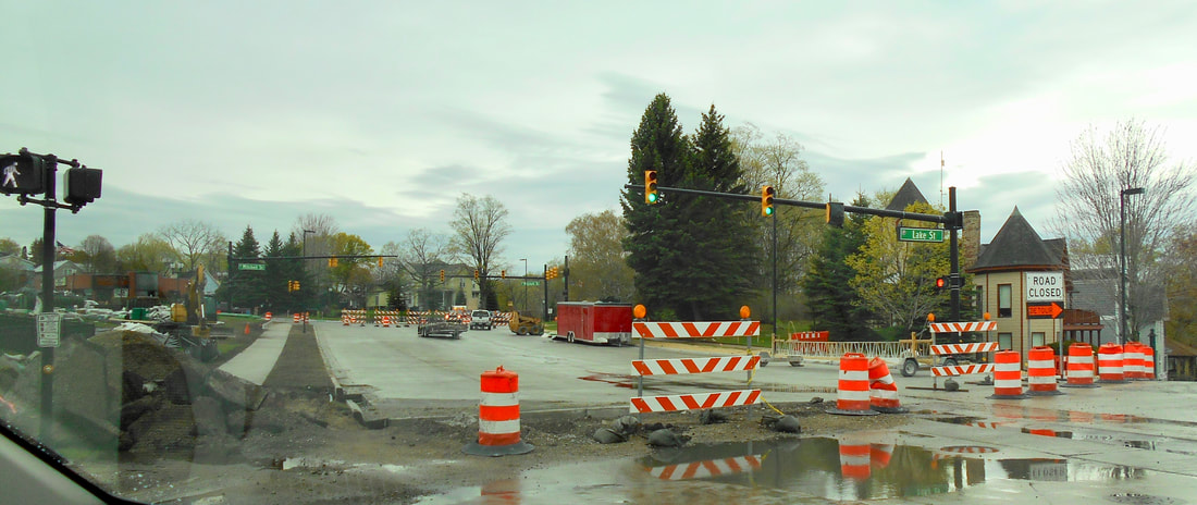
22 May 2019 ~ Intersection of Lake Street and US31... still part of "detour"
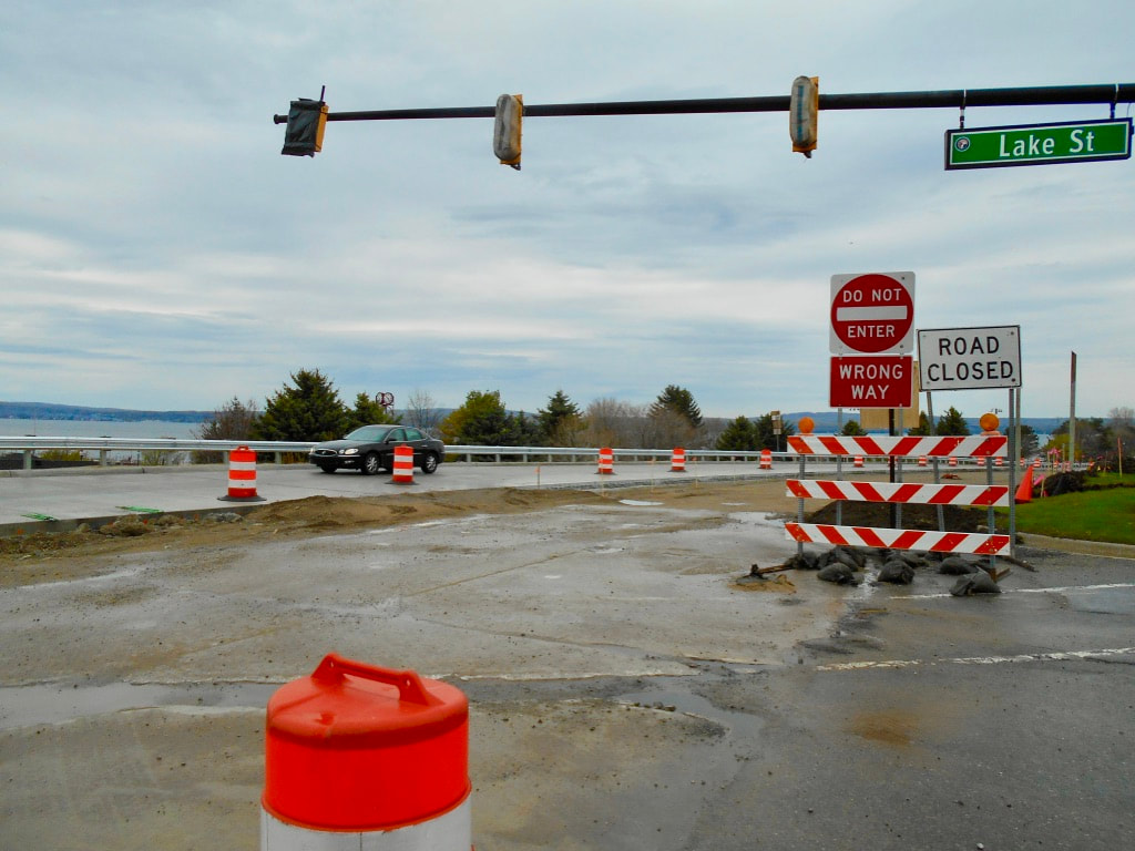
22 May 2019 ~ Intersection of Lake Street and US31...
Six Photos Below: On the waterfront beside the ball diamond...securing the bypass hillside...

10 May 2019
|
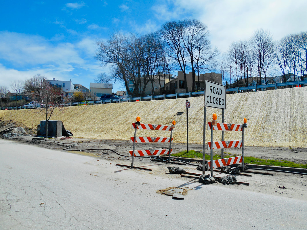
10 May 2019
|
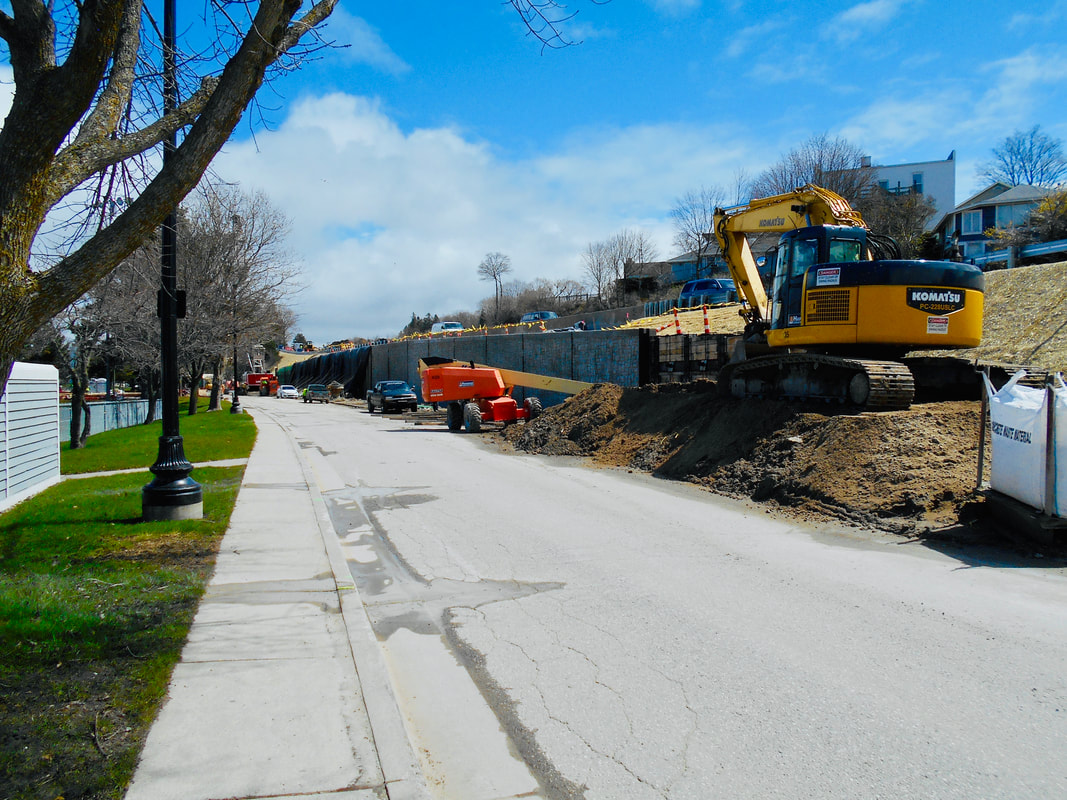
10 May 2019
|

10 May 2019
|

10 May 2019
|
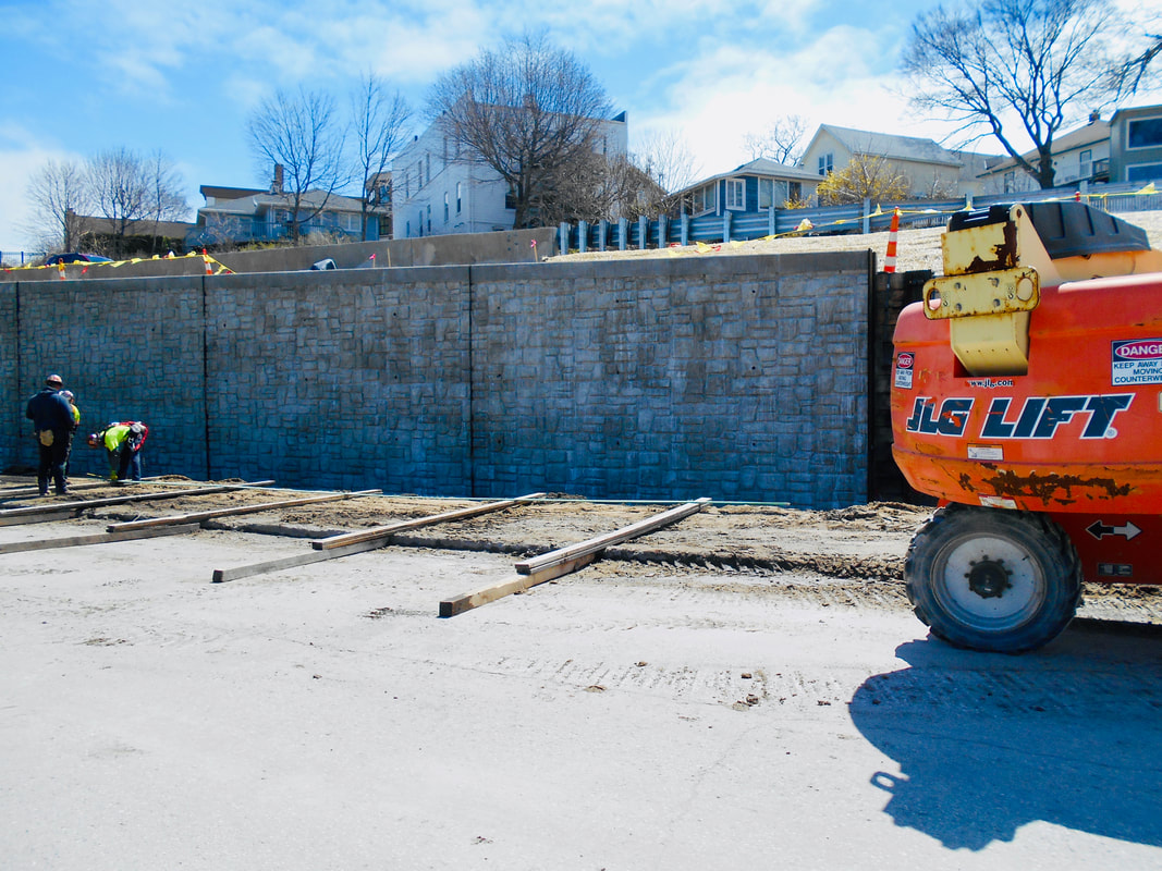
10 May 2019
|
Photo Below: The support wall part of the reconstruction project has been completed on the waterfront.
These are the patterned decorative rocks that were pre-formed right on-site shown in the photos above.
These are the patterned decorative rocks that were pre-formed right on-site shown in the photos above.
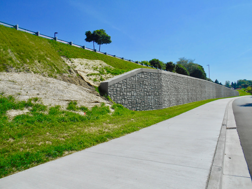
19 July 2019
Click on PLAY to view slideshow below.
Lewis Street in front of The Perry will no longer merge... Reconfiguration!
22 May 2019
Lewis Street in front of The Perry will no longer merge... Reconfiguration!
22 May 2019
Click on PLAY to view slideshow below.
ByPass In Progress
14 June 2019
ByPass In Progress
14 June 2019
Photo Below: This Michigan Department of Transportation "Picture of the Day" shows the reconfiguration of Lewis Street. The above slideshow shows the Lewis Street work in progress. So far it sounds like the only entrance and exit for Lewis Street will be a right turn IN, and a right turn OUT. It appears that enough room would have existed to put in a left turn lane so the city, and this nearby parking area, could have been entered when approaching from the north, which had been possible in the past. Now the only entry to the city before Lake Street when coming from the north will be to turn on Winter Park Lane and then right on to Arlington Avenue. This route will add traffic on to the residential part of Arlington until the first possible entrance to the downtown on Bay Street. Arlington residents very likely thought the traffic in front of their residential homes would cut back when the detour was done... will it?
UPDATE: In the 10 August 2019 Petoskey News Review, a statement projects that at a later date, a left turn IN and a left turn OUT, will be possible: "However left turns onto U.S. 31 from Lewis Street and off of U.S. 31 onto Lewis Street will not be allowed until work moves closer to completion on the nearby section of U.S. 31."
UPDATE: In the 10 August 2019 Petoskey News Review, a statement projects that at a later date, a left turn IN and a left turn OUT, will be possible: "However left turns onto U.S. 31 from Lewis Street and off of U.S. 31 onto Lewis Street will not be allowed until work moves closer to completion on the nearby section of U.S. 31."

15 July 2019 ~ MDOT "Picture of the Day"
The movement of fill in the original early 1960's US 31 Bypass came from the Petoskey Winter Sports Park with photos/text above on this same web page describing that movement process. This new 2019 reconstruction, reconfiguration, and relocation of the US 31 Bypass has required a more convoluted movement of fill, asphalt, and concrete, along with a convoluted agreement with the Emmet County Road Commission. The project contract is between the State of Michigan, the City of Petoskey, and a joint venture for DJM of Leroy, Michigan, with J&N Construction (trucking) of Gaylord, Michigan. Then, DJM made a deal with the ECRC for which the MDOT requested a "Property Use Agreement" listing how MDOT will be utilizing the Emmet County Road Commission's Bellmer Road and Powers Road Pits of the ECRC. The concrete is removed in chunks to a "staging area" in the Bellmer Road gravel pit of Emmet County Road Commission (photos below). The chunks will be crushed and reused by the state. The trucks go to Yell's pit on Evergreen Road, Petoskey, Michigan, for gravel for delivery to the project. 30,000 tons of sand will be taken from the Powers Pit with a value of $3.00 per ton equaling $90,000. in trade for... When the Bypass project reaches the location and time of removing the existing asphalt on the bypass, that will be trucked to either of the county's gravel pits. This is the trade/payment that the ECRC made for use of their staging area. The crushed asphalt will belong to the county to be recycled on shoulders on the county roadways... a valuable commodity. The agreement is posted below for more explanation.
In the meantime, the noise of "jake-braking" and the "wear n' tear" on the existing roads, especially on PIckerel Lake Road, is disturbing to the residents and taxpayers. The trucking portion of the project is supposed to be completed by 28 June 2019, or the trucking company will be fined $15,000.00 per day.
In the meantime, the noise of "jake-braking" and the "wear n' tear" on the existing roads, especially on PIckerel Lake Road, is disturbing to the residents and taxpayers. The trucking portion of the project is supposed to be completed by 28 June 2019, or the trucking company will be fined $15,000.00 per day.
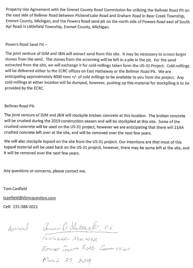
Below is a photo and a slideshow (taken 21 May 2019) of the Emmet County Bellmer Road gravel pit... accessed with permission:
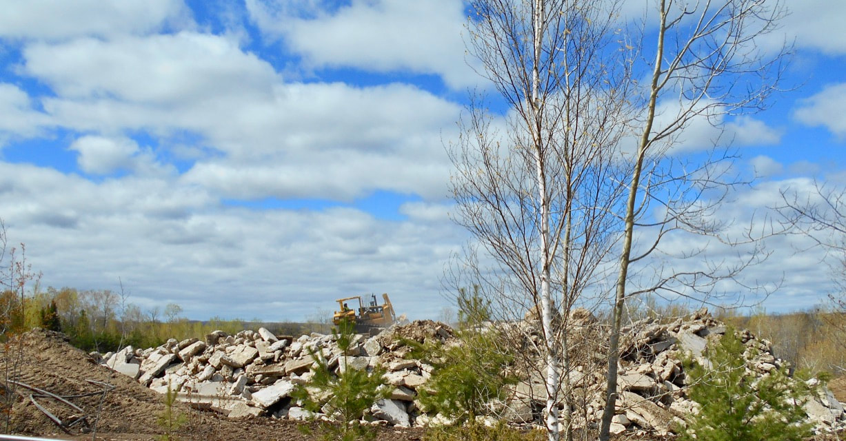
21 May 2019
Photo Below: Intersection in Downtown Petoskey of Mitchell Street and US 31, next to The People's Park
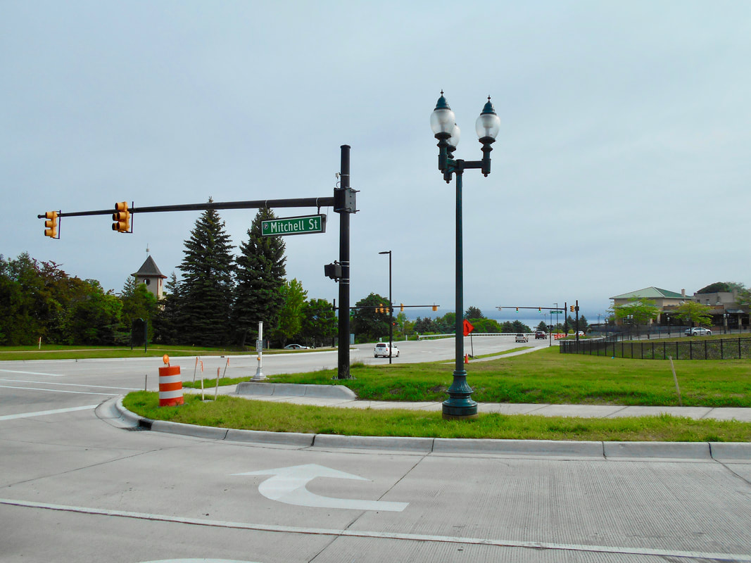
30 June 2019
Photo Below:
More of Charles Dawley's remarkable videos and photography can be viewed on
Drone Photography from Charles Dawley "Up North Imaging".
More of Charles Dawley's remarkable videos and photography can be viewed on
Drone Photography from Charles Dawley "Up North Imaging".
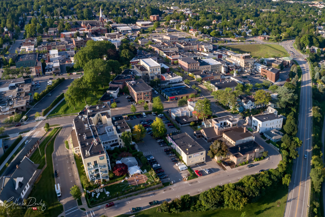
4 September 2017 ~ Posted only by Permission from Drone Photographer Charles Dawley, Up North Imaging
Three Photos Below...
After the 131 By Pass Reconstruction Detour Through Downtown Petoskey was Resurfaced by the State of Michigan.
10 October 2019
After the 131 By Pass Reconstruction Detour Through Downtown Petoskey was Resurfaced by the State of Michigan.
10 October 2019
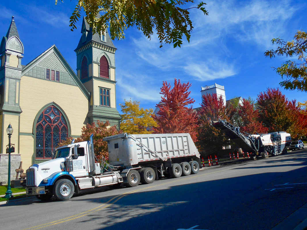
10 October 2019 ~ Staging area of the Downtown Division Street Resurfacing

10 October 2019 ~ Looking South on Division Street from near the Emmet County Building
|
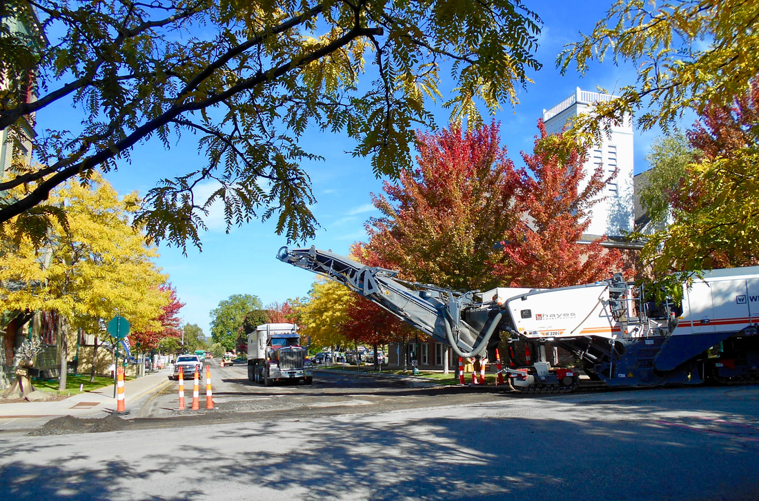
10 October 2019 ~ Looking North on Division Street from Presbyterian Church Corner
|
~ "No-Name" Alley ~
(ONE WAY Alley)
behind JC Penney between Howard and Waukazoo Streets, Petoskey Michigan
(ONE WAY Alley)
behind JC Penney between Howard and Waukazoo Streets, Petoskey Michigan
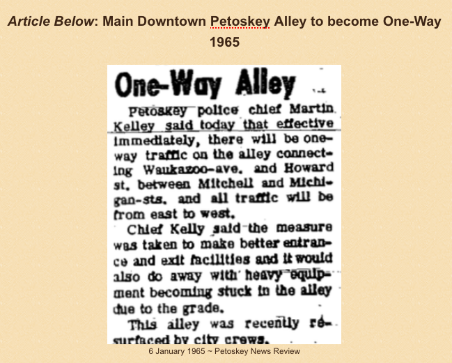
Article Below:
"Only about one out of 20 trucks has problems with the alley, resulting in a hit about once every week or two."
1983
"Only about one out of 20 trucks has problems with the alley, resulting in a hit about once every week or two."
1983
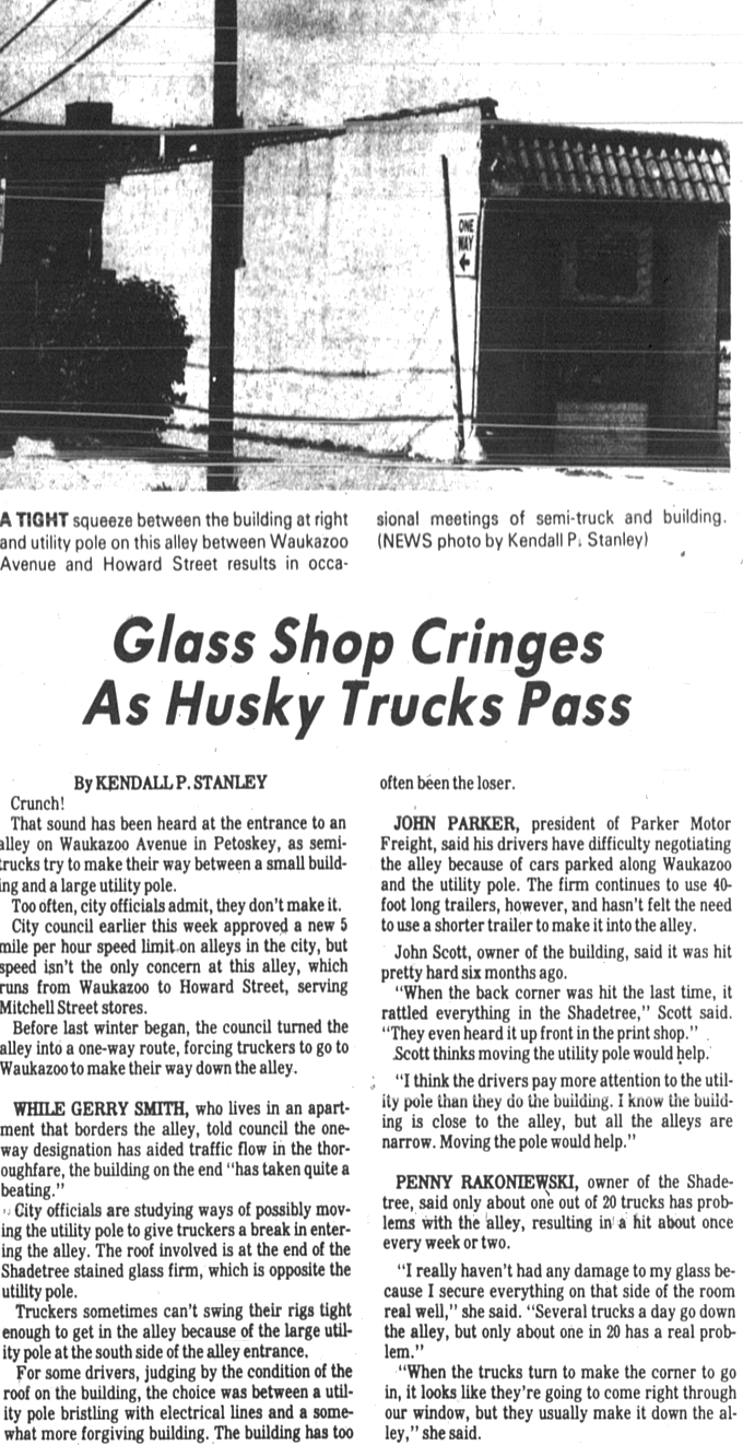
8 September 1983 ~ Petoskey News Review

17 August 2018 AND 8 June 2019
(Upper end of No-Name Alley)
(Upper end of No-Name Alley)
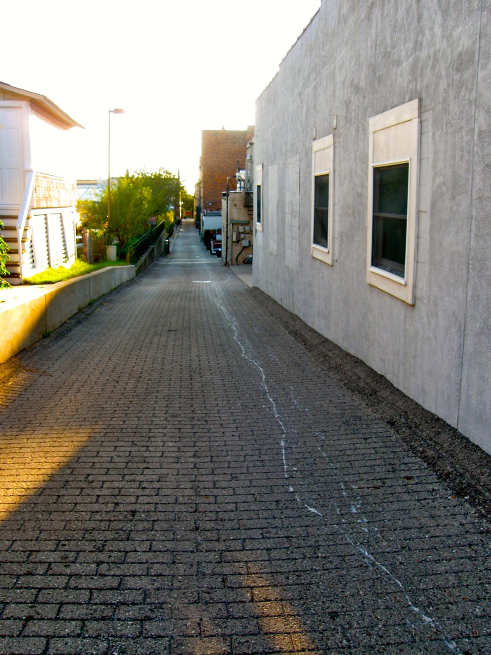
17 August 2018 ~ Looking West
|
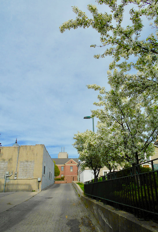
8 June 2019 ~ Looking East
|
East Mitchell Road looking west from about Alcan Drive
past the Schuill Farm, toward the Petoskey Sunset...
2018
past the Schuill Farm, toward the Petoskey Sunset...
2018
11 March 2018 ~ Photography of "Alex Childress Photo" posted here with permission...
Photo Above: Alex Childress' additional work also may be viewed at Alex Childress Photo.
East Mitchell Road looking east to about Alcan Drive,
ascending into the Hazy Clouded Sky...
2018
ascending into the Hazy Clouded Sky...
2018
26 April 2015
~ M-119 ~ Resurfacing
2018
Resurfacing to begin on Monday, 30 April 2018,
on a 1.9 mile section of M-119 between US 31 and Beach Road.
2018
Resurfacing to begin on Monday, 30 April 2018,
on a 1.9 mile section of M-119 between US 31 and Beach Road.
~ Kalamazoo Avenue Project ~
2020
2020
The City of Petoskey will pay $1.7 million to have a portion of Kalamazoo Avenue paved. This will include utility improvements such as water main and valve replacement, sewer main and manholes; reconfigured curb lines, vehicle parking and sidewalk improvements.

18 May 2020
18 May 2020
UPDATE: As of 19 October 2020 Kalamazoo Avenue still is closed between Mitchell and Jennings.
~ M-119 intersection with US 31~
September 2020
(Traffic backed up, forcing drivers to use Graham and Kolinski roads to get into Petoskey)
September 2020
(Traffic backed up, forcing drivers to use Graham and Kolinski roads to get into Petoskey)
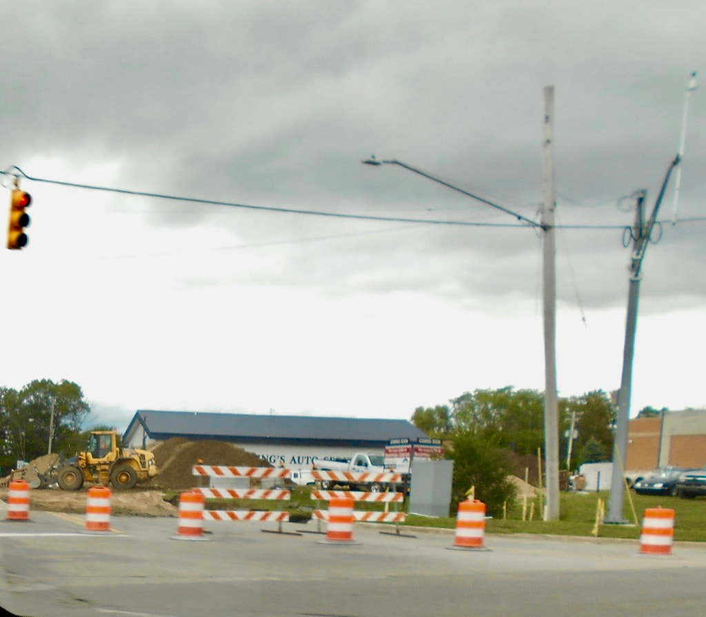
10 September 2020 ~ Intersection of M-119 and US 31
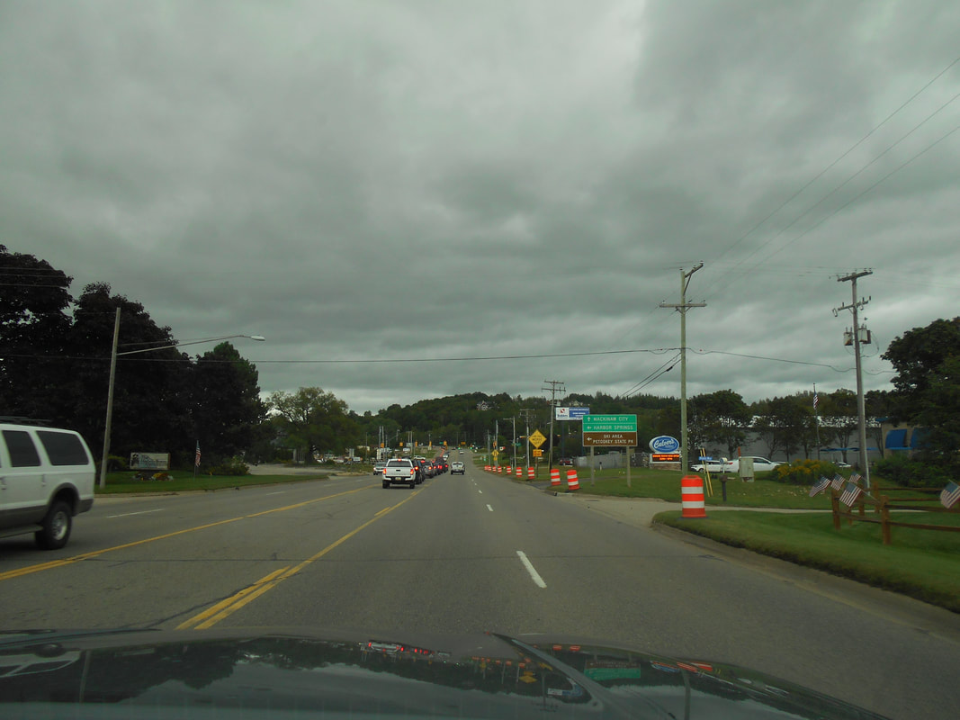
10 September 2020 ~ Heading north toward US 31
|
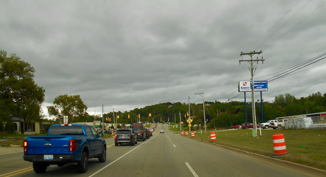
10 September 2020 ~ Heading north toward US 31
|
UPDATE: As of 31 October 2020 this road construction is still delaying traffic
at this US 131 and M119 intersection.
at this US 131 and M119 intersection.
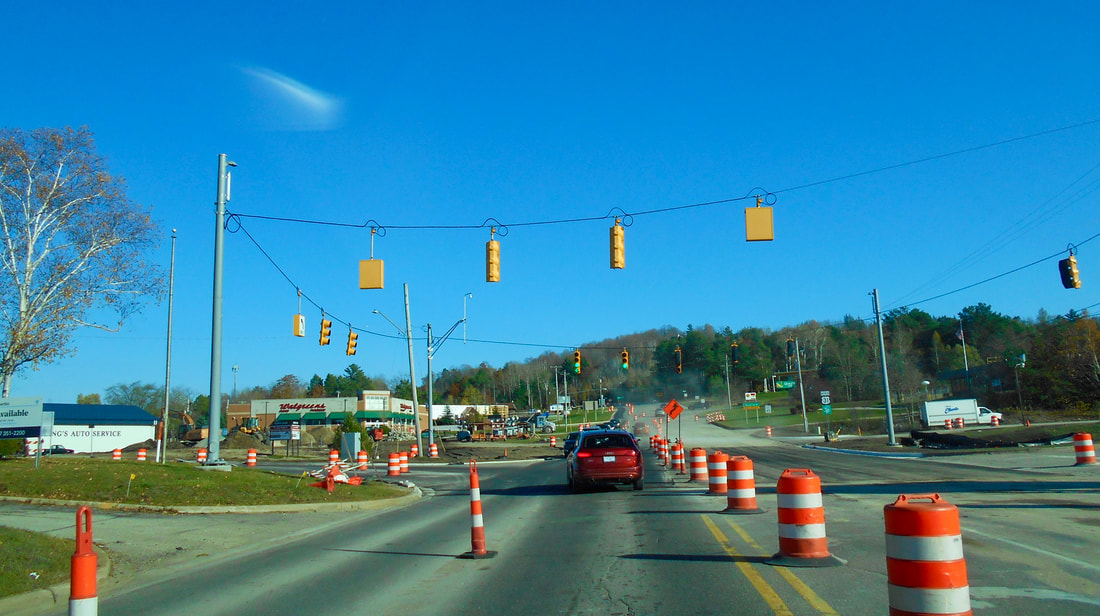
31 October 2020
|
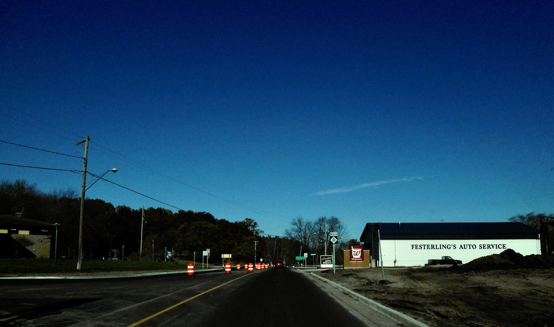
31 October 2020
|
2021 Photo Below: Bay View Road, Petoskey, Michigan
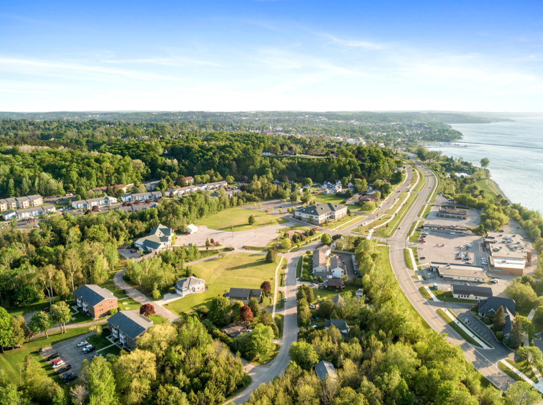
26 May 2021 ~ Posted only by Permission from Drone Photographer Charles Dawley, Up North Imaging
Photo Above of Bay View Road and Slideshow Below of Greenwood Cemetery Road:
Posted on this Northern Mich~Mash Preserve web site only by permission from
remarkable photographer and videographer Charles Dawley of Up North Imaging.
Posted on this Northern Mich~Mash Preserve web site only by permission from
remarkable photographer and videographer Charles Dawley of Up North Imaging.
~ Greenwood Cemetery Road ~
Summer 2021
(Photography by Charles Dawley ~ posted with permission)
Summer 2021
(Photography by Charles Dawley ~ posted with permission)
~ Lake Street Infrastructure from Division Street to Kalamazoo Street ~
ALL SUMMER 2022
ALL SUMMER 2022
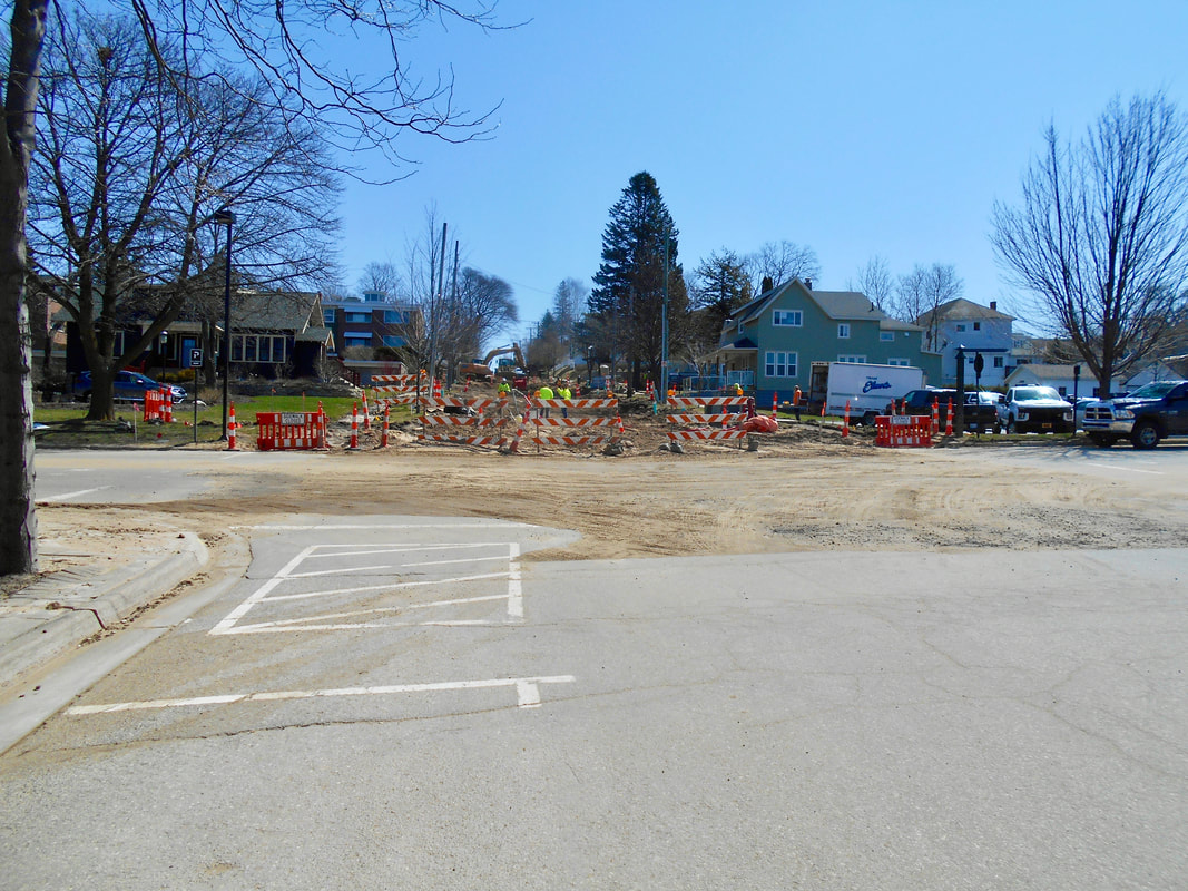
Summer 2022
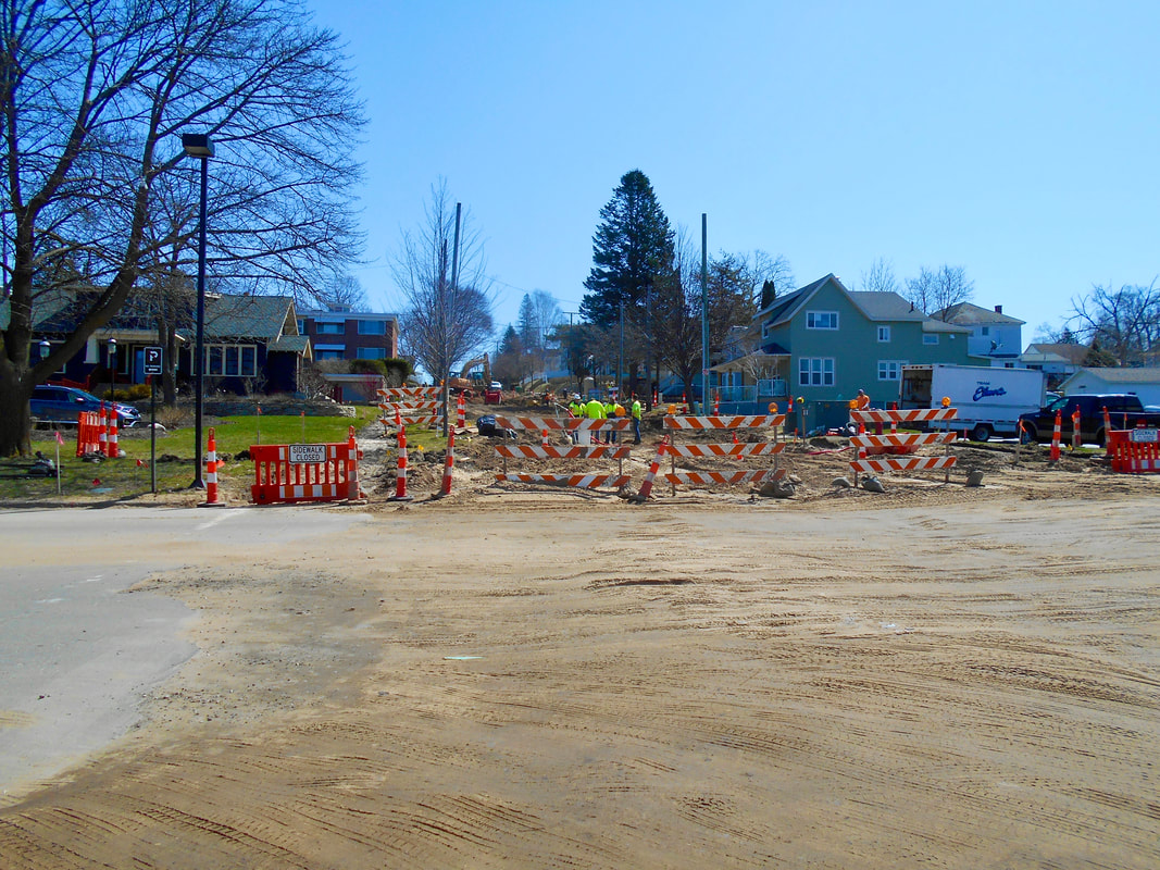
Summer 2022
~ US 31 Construction Through Alanson, Michigan ~
14 May 2023
This construction is a massive interruption to the Alanson downtown businesses, as well as those traveling to the Pellston Airport, or on to Mackinaw City;
creating a detour around downtown Alanson, or even to reach M-68 to travel to Indian River.
It appears the new roadway will do away with the Chicago st/us 31 connection and create a Bonz St. /31 connection.
14 May 2023 US 31 Construction Photos Below are posted only by
Permission from Drone Photographer Charles Dawley, Up North Imaging
Drone Photography from Charles Dawley "Up North Imaging".
Permission from Drone Photographer Charles Dawley, Up North Imaging
Drone Photography from Charles Dawley "Up North Imaging".
Photo Below: Looking north, the entire detour around Alanson's downtown is viewed;
heading east over the wold's smallest "still operating" swing bridge,
then north to M68, west back to connect to US 31 north toward Mackinaw City.
heading east over the wold's smallest "still operating" swing bridge,
then north to M68, west back to connect to US 31 north toward Mackinaw City.
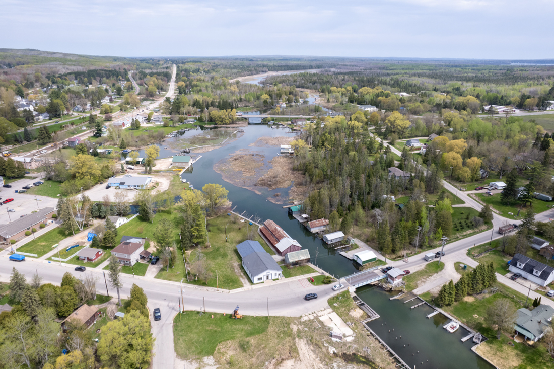
14 May 2023 ~ Permission from Drone Photographer Charles Dawley, Up North Imaging
Photo Below: Looking south toward Petoskey...
when heading north, this is the corner near Fairbairn's Hardware to begin the detour as shown in the above photo.
when heading north, this is the corner near Fairbairn's Hardware to begin the detour as shown in the above photo.
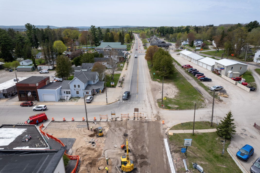
14 May 2023 ~ Permission from Drone Photographer Charles Dawley, Up North Imaging
Photo Below: The same corner as in the photo above, but looking northward...
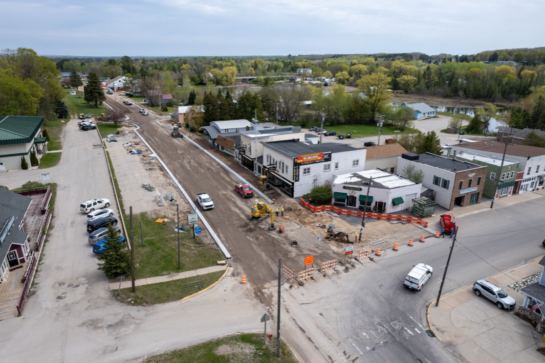
14 May 2023 ~ Permission from Drone Photographer Charles Dawley, Up North Imaging
Photo Below: Corner of US 31 and M68 where the detour meets to head north on US 31 toward Mackinaw City.
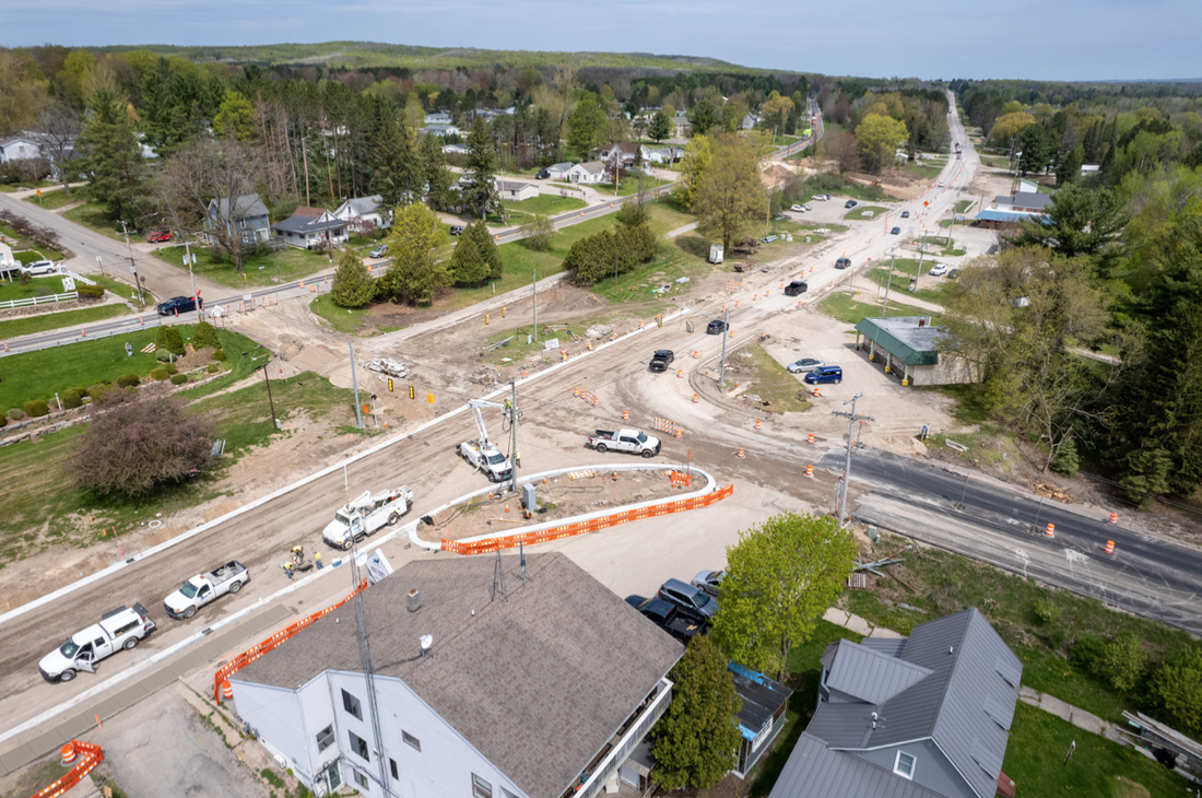
14 May 2023 ~ Permission from Drone Photographer Charles Dawley, Up North Imaging
Photo Below: Corner of US 31 and M68 where the detour meets, looking east on M68 toward Indian River.
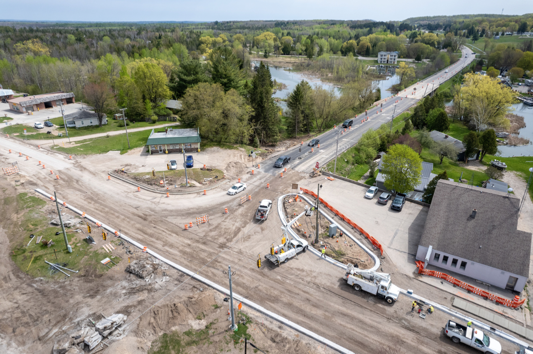
14 May 2023 ~ Permission from Drone Photographer Charles Dawley, Up North Imaging
Photo Below: Corner of US 31 and M68 where the detour meets, with the Inland Waterway in the background.
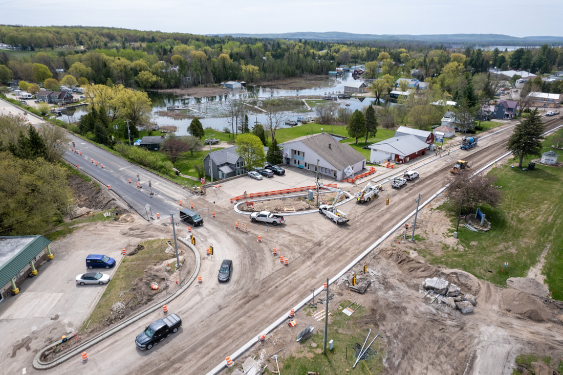
14 May 2023 ~ Permission from Drone Photographer Charles Dawley, Up North Imaging
Photo Below: Near the corner of US 31 and M68 where the detour meets, looking south,
heading through closed-off downtown Alanson, with the Hillside Garden at the right side.
heading through closed-off downtown Alanson, with the Hillside Garden at the right side.
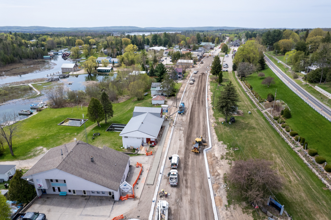
14 May 2023 ~ Permission from Drone Photographer Charles Dawley, Up North Imaging
Photo Below: Just north of the corner of US 31 and M68 where the detour meets,
looking toward Mackinaw City direction.
The paved road on the left, is the roadway being used as a detour when heading south...
connecting to US 31, just south of downtown Alanson.
looking toward Mackinaw City direction.
The paved road on the left, is the roadway being used as a detour when heading south...
connecting to US 31, just south of downtown Alanson.
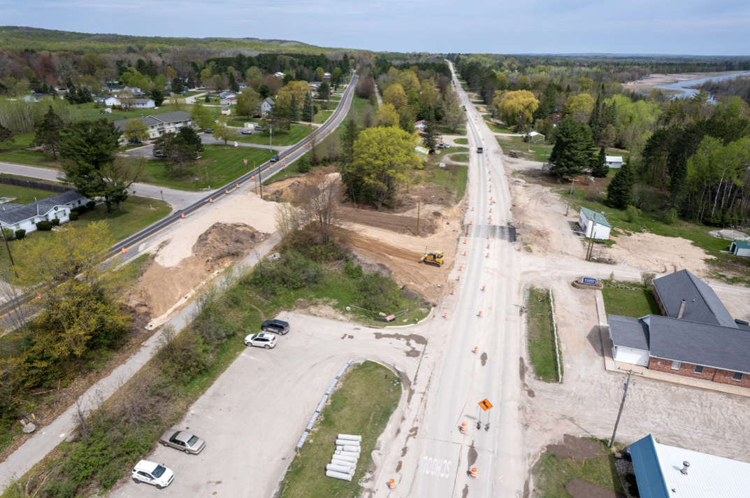
14 May 2023 ~ Permission from Drone Photographer Charles Dawley, Up North Imaging
Photo Below: Corner of US 31 and M68 where the detour meets. In the background toward the south is Crooked Lake which flows into the Inland Waterway which eventually flows across the State of Michigan to empty into Lake Huron.
Both the north and the south US 31 detour roadways are viewed.
Both the north and the south US 31 detour roadways are viewed.
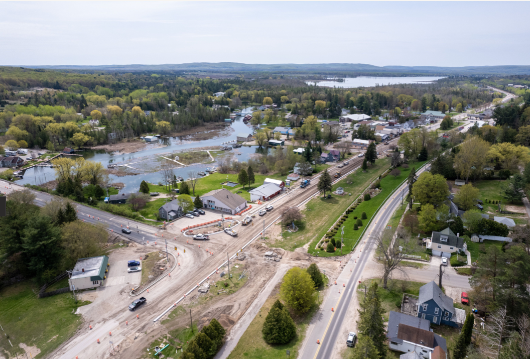
14 May 2023 ~ Permission from Drone Photographer Charles Dawley, Up North Imaging
STOP LIGHT on the Corner of Pickerel Lake Road and US 31 North
(Installation: 11 September 2023 > 16 October 2023)
(Installation: 11 September 2023 > 16 October 2023)
People have begged for attention to this corner regarding driver SAFETY in trying to enter Highway 31 North from Pickerel Lake Road. People take chances after the wait is so long trying to enter the highway. During the past YEARS of people begging, the "State" has offered many excuses for not having a traffic light at the intersection; like the levels of the roadway are such that vehicles would go into a trajectory going across the highway. The "warrants" [deaths] do not warrant a traffic light. An idea of a round-about even was toyed.
In September 2023 the surprise upon hearing that a stop light was going to be installed at the very dangerous intersection was so great that I wrote a letter to MDOT [Michigan Department of Transportation], Matt Radulski and Jason Galitis.
"6 September 2023
Jason and Matt,
Thank you for us FINALLY getting a stop light at the bottom of Pickerel Lake Hill and US 31. I truly am thankful for the light… BUT... Please tell me what has changed from your previous reasons for us not having one there in the past. Really, really, curious.
Karla [Buckmaster]
Jason Galitis replied the same day of my inquiry:
"We are mandated to approve signals according to federal warrants/analysis which is a little complex. And we have done some geometric improvements that have reduced crashes. But it still has been close in the past. Some of the technologies that we didn’t have in the past, detectors, box span, dilemma zone system, also plays a role, now-a-days more than in the past, when signals are right on the border of being warranted. Thank you!"
E.mail written 11 January 2024 to Gaylord's MDOT Post:
I am so grateful for the traffic light at Pickerel Lake and US 31. On Facebook yesterday, however, here is what someone posted:
"Heads up the new light on 31 & pickerel lake rd is covered with snow and very hard to see when it’s red. Called the non emergent line to let them know she said she will send them out shortly! Drive safe!
"Then, today about 11AM I was heading south there needing to turn left to go up Pickerel Lake Hill, and the traffic lights still were so covered in snow, the green could barely be seen, about 1/8 of the green showing at the very top of the green light. Then as we turned to head east up Pickerel Lake I noticed an Emmet County Road Commission pickup was parked there (red light flashing on back, and a man walking. What I want to know/say is that it didn’t seem that guy would be able to do anything about the snow covered lights. What can be done? Do you guys know of a solution for this problem? Please tell me."
An informative reply was heard almost immediately from MDOT's Jason Galitis: "Thank you for those comments, and letting us know about the snow cover. We are sending electricians over right now to inspect and clean out. The signal heads have louvers in the signal heads that do trap snow more, but they are required for the skew of the intersection. Our statewide signals unit is aware of LED lights not melting snow as fast and are researching measures to improve that. There are also low level lights at this location that we installed that do also help with this situation during snow events. Thank you again."
~ Petoskey's City Council Approved Spring Road Projects ~
8 January 2024
8 January 2024
- Full reconstruction of Bay View Avenue
- Street resurfacing and concrete repairs on Rose Street, Winter Park Lane and Balsam Avenue
- Pavement resurfacing and concrete repairs on East Mitchell Street. Mill and Fill starting at Division Street to just east of Bay View (includes repairs to concrete crosswalks and adjustments to water valve boxes and sewer manhole structures, involving a detour)
