HEADER Photo Above taken 26 September 2017:
Alex Childress' additional work also may be viewed at Alex Childress Photo.
Alex Childress' additional work also may be viewed at Alex Childress Photo.
Northern Mich~Mash Preserve
Petoskey's Bear River
~ LAKE STREET BRIDGE ~
and
City Buildings Nearby
(Toward Bottom of this page: Foot Bridge and Railroad Bridge)
The design and compilation of the text and photos on this site are copyrighted 2017.
Most posted items will enlarge by "clicking" on them.
"Clicking" on some color highlighted words may access additional information.
Most posted items will enlarge by "clicking" on them.
"Clicking" on some color highlighted words may access additional information.
Please do not copy the photos on this site, many of which have been submitted by private individuals...
just come back and visit the site often to view the photos.
just come back and visit the site often to view the photos.
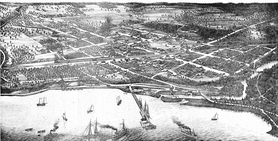
Below: 1880 Map of Petoskey... click to enlarge. Note the Mitchell Street bridge did not yet exist. The settlement existed mostly east of the Bear River. The river outlet at the mouth was in a different location from 2019. This 1880 map shows where the Bear River outlet ran until 1891 when the outlet was realigned. Lake Steet did not extend across the river, although Bay Street did with a bridge, thus Bay Street Bridge... no Lake Street Bridge on this 1880 Map of Petoskey. Railroad tracks had not yet arrived either, so no depot.
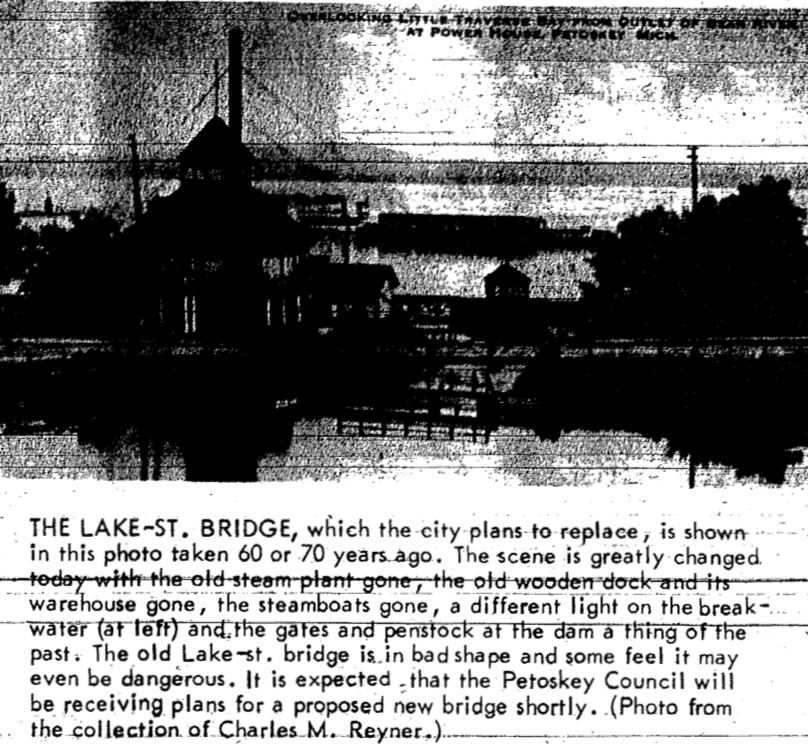
1 January 1952 ~ Newspaper Supplement
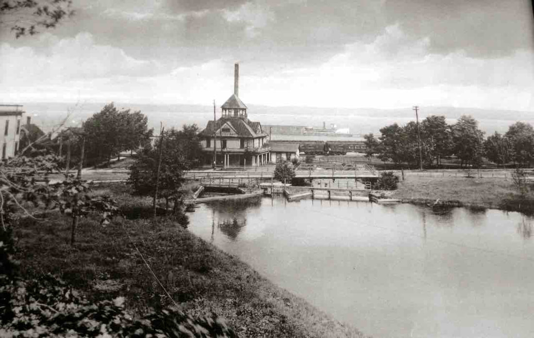
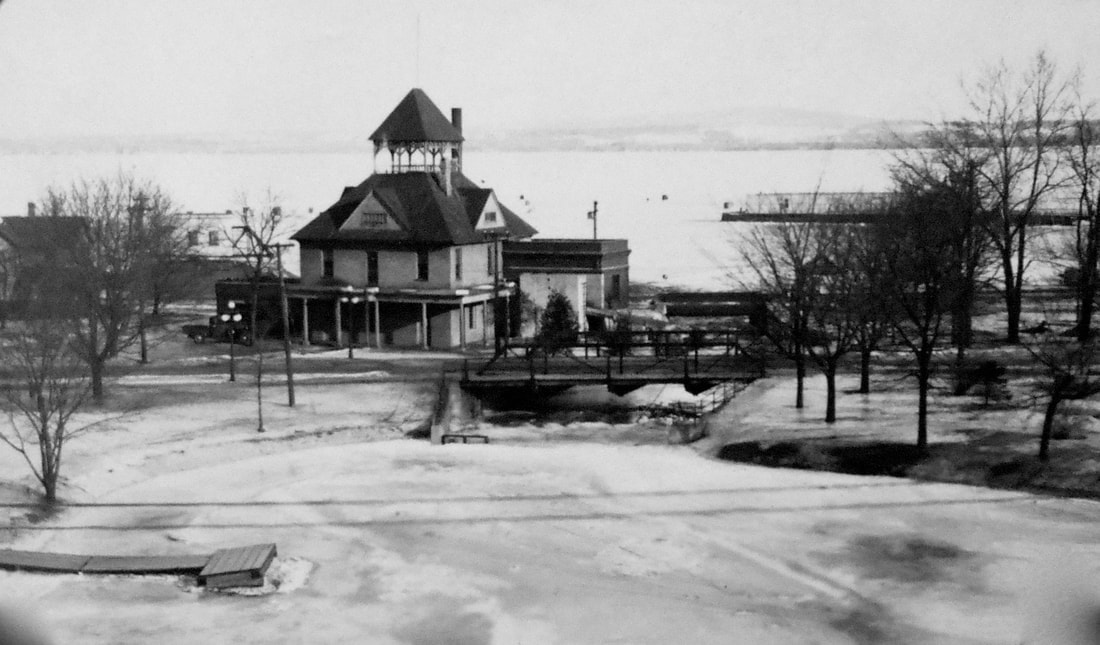
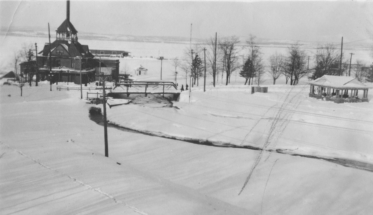
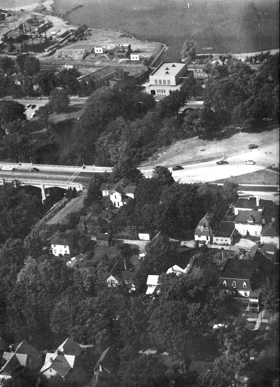
Lake Street Bridge near Bear River Dam and the Petoskey Utility Plant... Pere Marquette train in background (Old Waterworks Building about 1936)
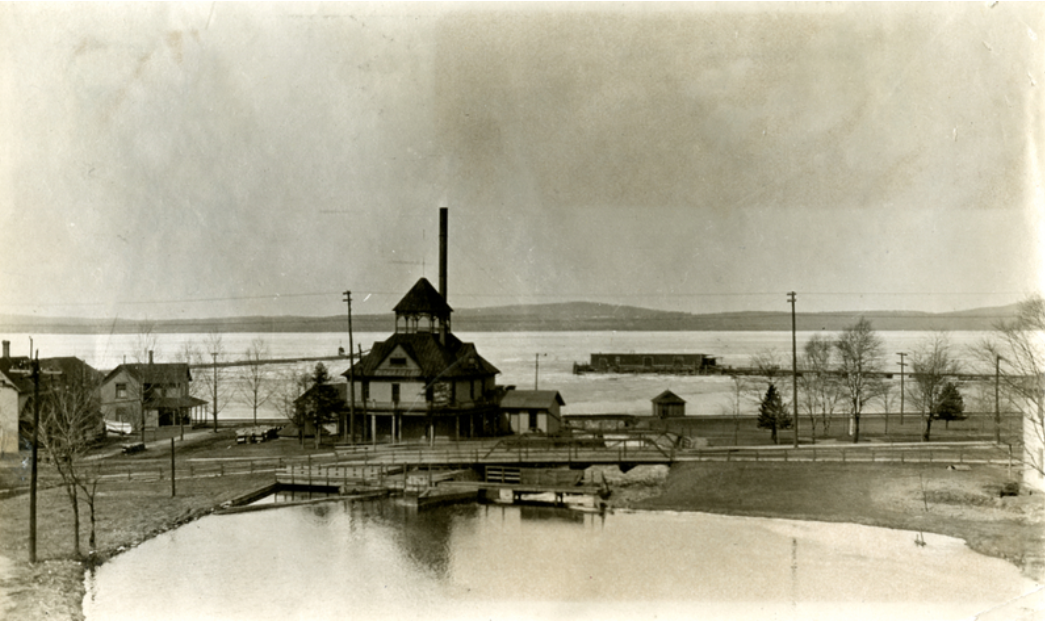
Allan McCune a successful Petoskey businessman and local historian donated several of his albums to Petoskey's Little Traverse Historical Museum which included this photo of the OLD Water Works Building erected about 1881...
Greenwood Photo Archive Collection from Petoskey newspapers (1890)
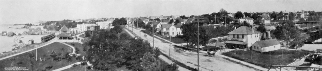
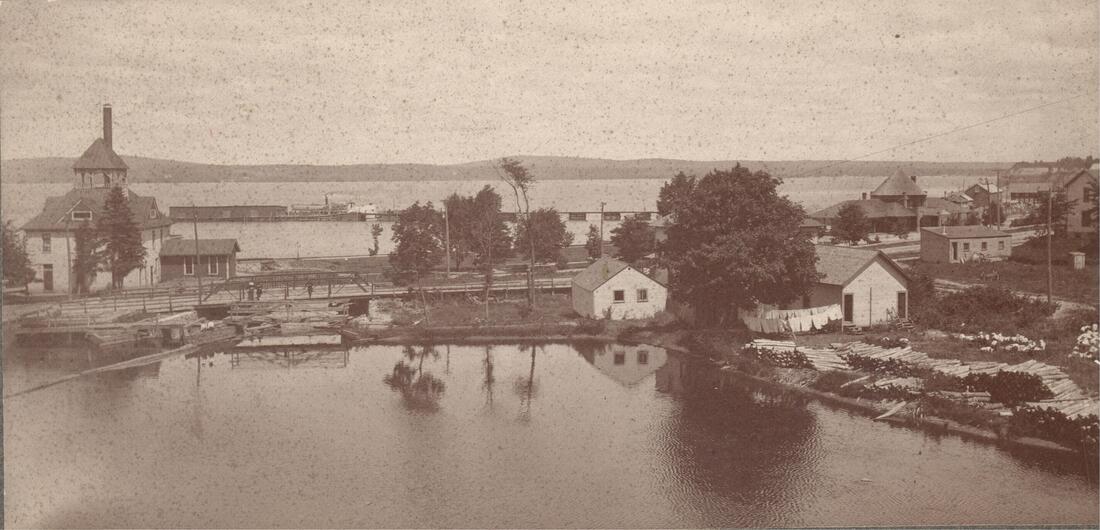
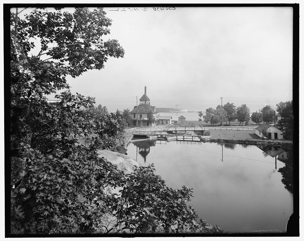
Allan McCune a successful Petoskey businessman and local historian donated several of his albums to Petoskey's Little Traverse Historical Museum which included this photo of the Lake Street Bridge with the Mitchell Street Brige to the far right in the background. The Pere Marquette Railroad depot shows on the left with a train at the station beside the bay... Mineral Well Park shows lower right beside the Low Head Dam/Weir... about 1890
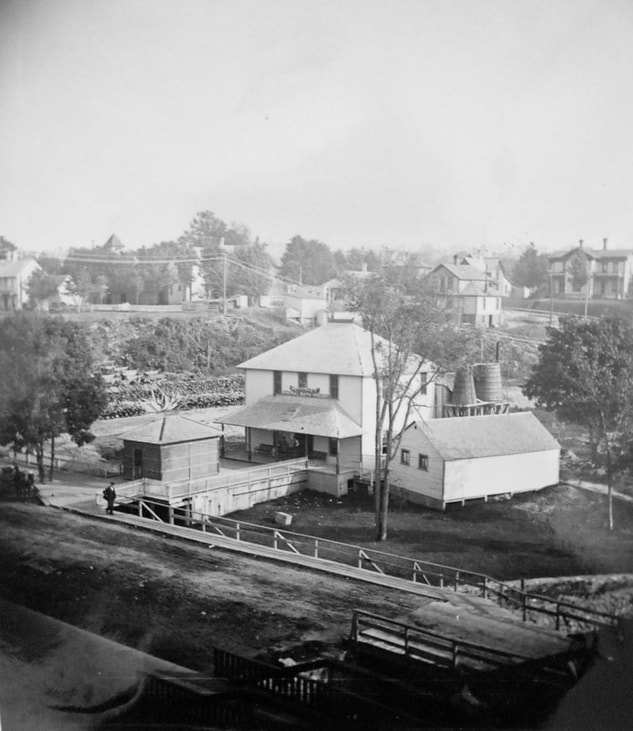
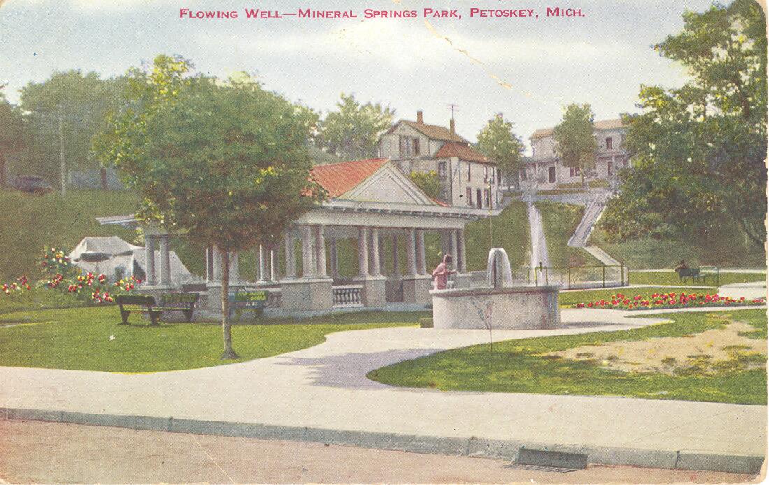
Allan McCune a successful Petoskey businessman and local historian donated several of his albums to Petoskey's Little Traverse Historical Museum which included this photo of Mineral Well Park beside the Low Head Dam/Weir on Lake Street... (Labeled 1890)
1890s ~Mineral Springs And Bath House Beside the extension of the bridge over the Bear River
|
26 June 1890 ~ The Petoskey Record
|
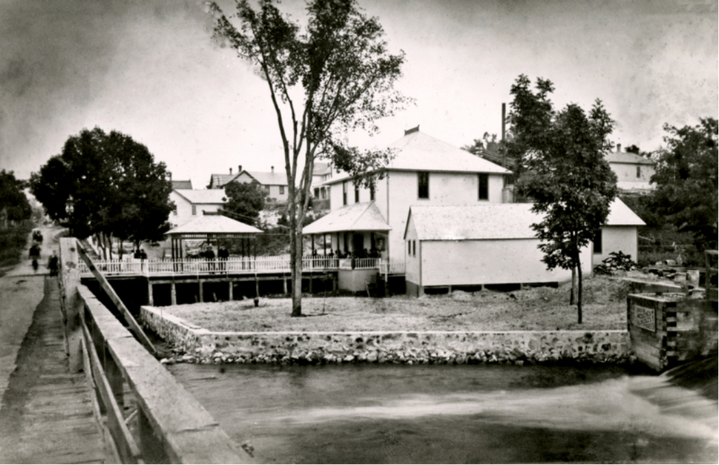
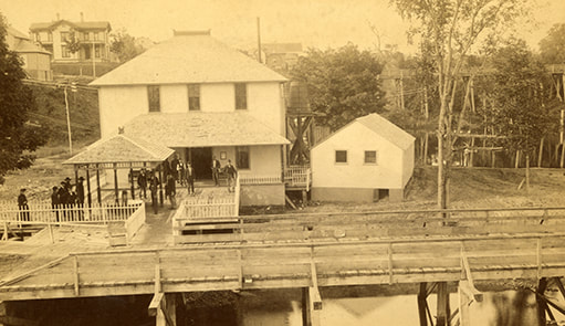
Little Traverse Society Photo Collection (Undated) Mineral Springs And Bath House Beside the extension of the bridge to the east over the Bear River
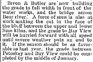
18 November 1891 ~ The Petoskey Record
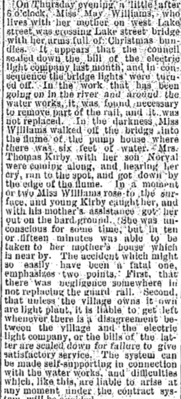
30 December 1891 ~ The Petoskey Record
14 Auguste 1900 ~ The Petoskey Resorter
10 July 1968 ~ Petoskey News Review
Little Traverse Historical Society Photo Collection (Undated)
Lake Street Bridge near Bear River Dam and the Petoskey Utility Plant ~ Library of Congress, Detroit Publishing Company Collection
Little Traverse Historical Museum Photo Archive (Undated) Lake Street Bridge across the Bear River with the Waterworks in the background...
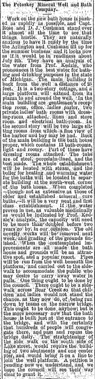
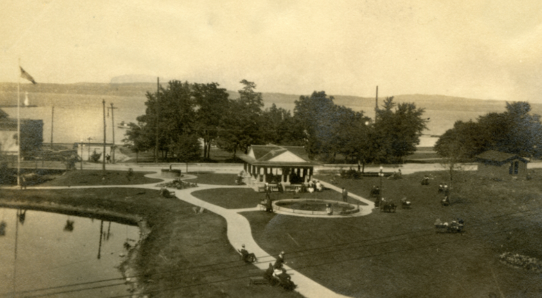
A booklet titled "Petoskey's Colorful Past A Historical Sketch of the City" on page 31 explained: "Bear River Gazebo (Mineral Well Park) West Lake Street ~ Built in 1915 the current Gazebo replaced a wood pavilion which surround the well in 1890 and provided a place for people to fill their water jugs. A bath house stood behind the pavilion where visitors could bathe away their ills in the highly acclaimed mineral waters. Though the bath house lost popularity around 1900, the mineral well continued to attract visitors from all over the country. In 1917, Vice-President Marshall and his wife spent a month in Petoskey and went to the well daily to partake of the 'health-giving' waters. Luxury hotels encouraged their guests to use the well during their stays.
The Gazebo is constructed of reinforced concrete, wood and shingles. Service clubs and private construction companies restored the structure in 1981."
The Gazebo is constructed of reinforced concrete, wood and shingles. Service clubs and private construction companies restored the structure in 1981."
Lake Street Bridge near Bear River Mineral Well ~ Submitted by Geoff Guillaume from the collection of his grandfather Harold Guillaume
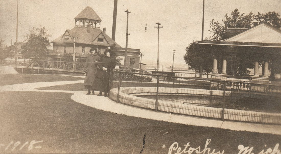
Greenwood Photo Archive Collection from Petoskey newspapers (1918)
Little Traverse Historical Society Photo Collection (Undated)
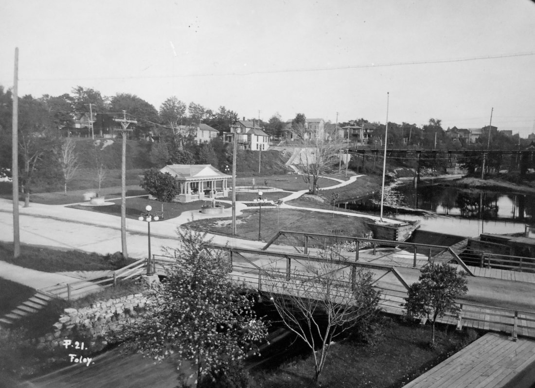
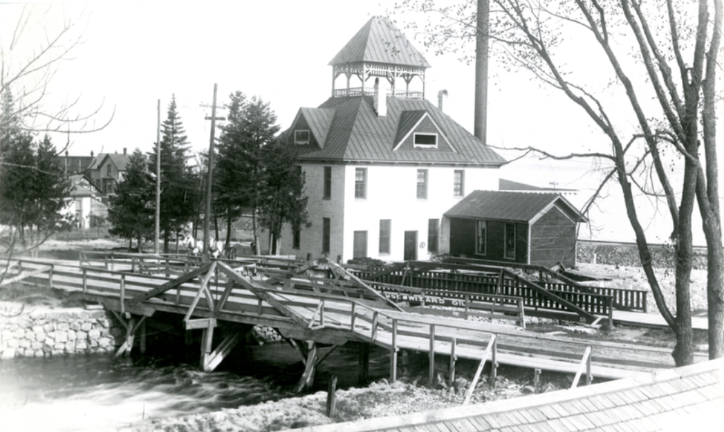
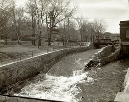
Allan McCune a successful Petoskey businessman and local historian donated several of his albums to Petoskey's Little Traverse Historical Museum which included this photo of a Foley postcard shows the Lake Street bridge AND dam, maybe the sluice on the lower right, PLUS the Mitchell Street bridge in the background...
Greenwood Postcard Archive Collection from Ball Collection...

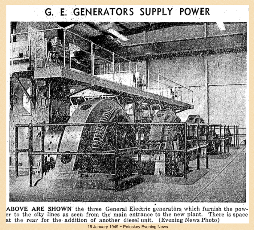
Allan McCune a successful Petoskey businessman and local historian donated several of his albums to Petoskey's Little Traverse Historical Museum which included this photo of the OLD Water Works Hydro Room (1931)...

Little Traverse Historical Society Photo Collection
Greenwood Photo Archive Collection from Petoskey newspapers (Undated)
Postcard Below: Labeled as Mineral Well Park showing the Lake Street Bridge
just beyond the Lake Street Dam.
just beyond the Lake Street Dam.
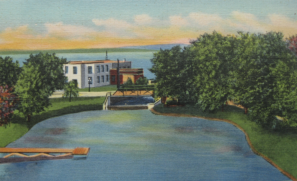
Mineral Well Park postcard from a photo album belonging to the Geoff Guillaume Family
1947
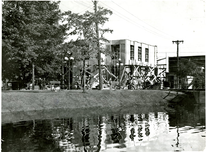
Ground Breaking for Diesel Plant
Ground Breaking for Diesel Plant

13 November 1947 ~ Northern Michigan Review photo/text accompanied article right column...
|
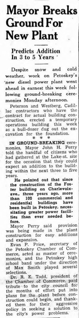
13 November 1947 ~ Northern Michigan Review article accompanied photo/text at left...
|
Little Traverse Historical Society Photo Collection (Undated)
Little Traverse Historical Society Photo Collection (Undated)
1951
Soooooo, is the answer to POLLUTION, DILUTION?
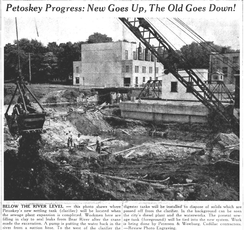
5 July 1951 ~ Northern Michigan Review
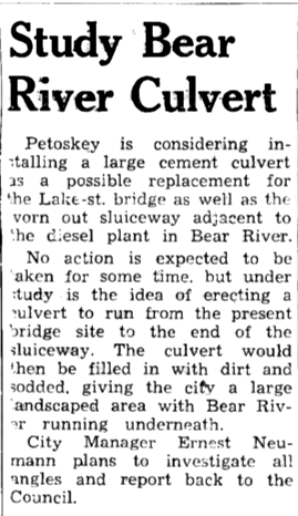
6 December 1951 ~ Northern Michigan Review
1954
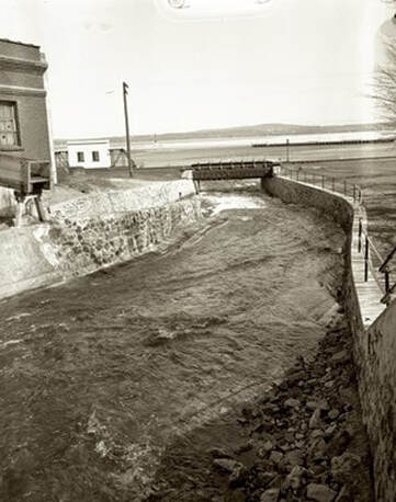
Photo Below: Lake Street Bridge UNDER Water...
Photo Below: Lake Street Bridge UNDER Water...
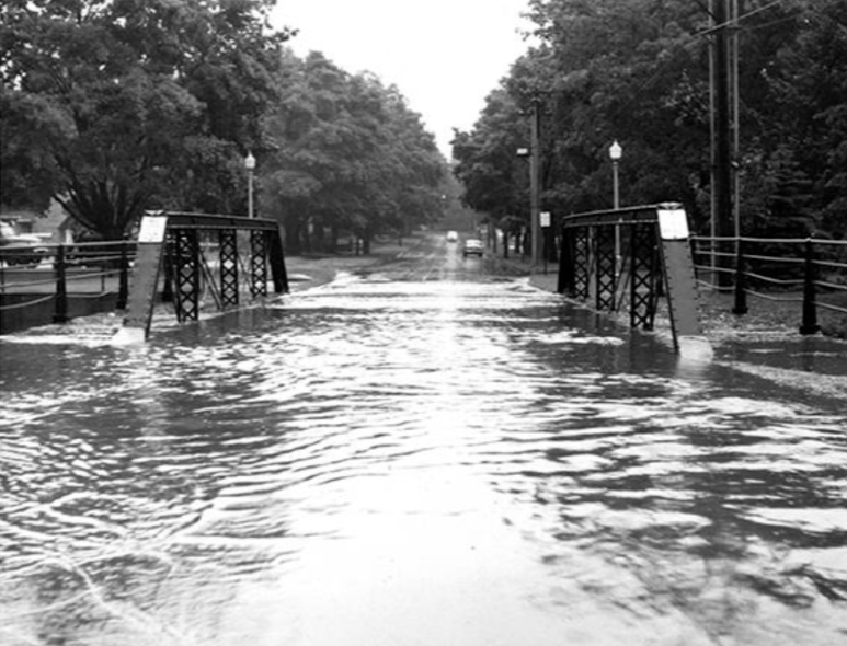
1954 ~ Lake Street Bridge, Petoskey, Michigan
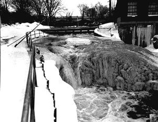
1959
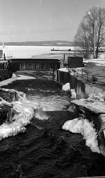
Clipping Below: Notice the water/ice level UNDER the Lake Street Bridge...
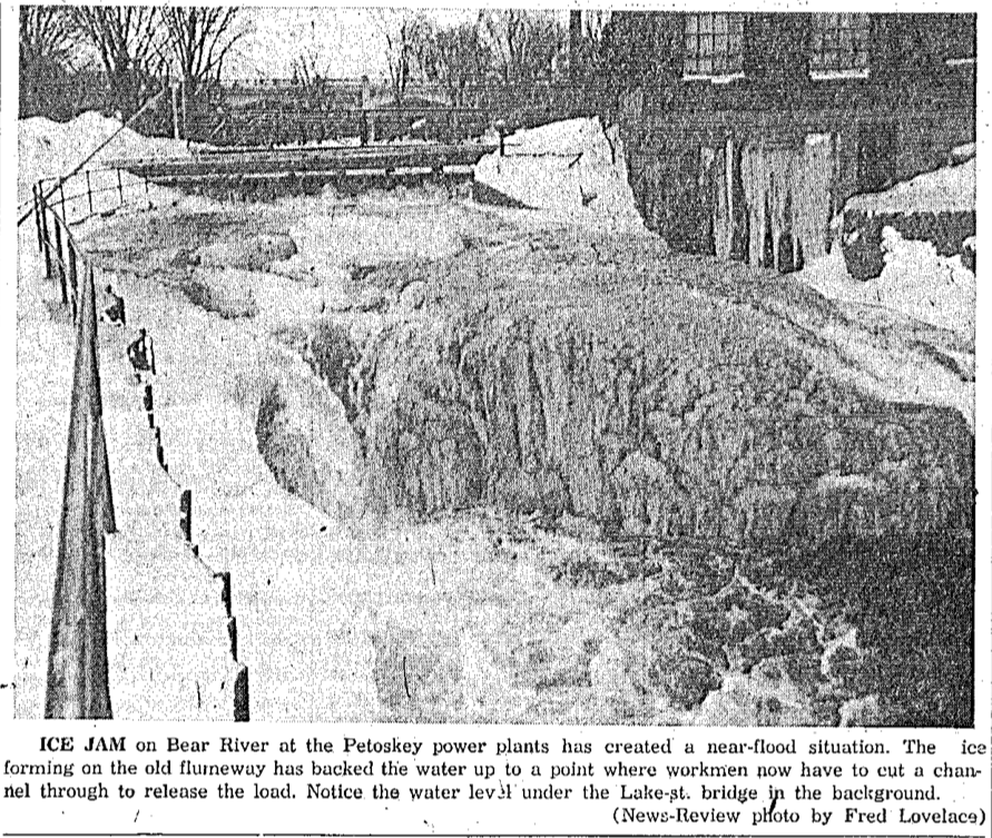
Picture
3 February 1959 ~ Petoskey News Review
Greenwood Photo Arcive Collection from Petoskey Newspapers (Undated)
|
Greenwood Photo Archive Collection from Petoskey newspapers (1968)
|
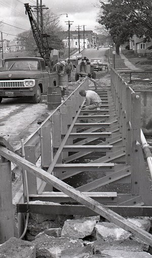
23 August 1968 ~ Petoskey News Review
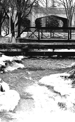
1966
Photo Below Left: Looking north at the Lake Street Foot Bridge in foreground
and the railroad bridge closer to the bay...
Photo Below Right: Looking south at the Lake Street Foot Bridge and Bridge
with the Mitchell Street Bridge in the background...
and the railroad bridge closer to the bay...
Photo Below Right: Looking south at the Lake Street Foot Bridge and Bridge
with the Mitchell Street Bridge in the background...

Greenwood Photo Archive Collection from Petoskey newspapers (11 March 1966)
|
Greenwood Photo Archive Collection from Petoskey newspapers (11 March 1966)
|
1967
Greenwood Photo Archive Collection from Petoskey Newspapers (March 1967)
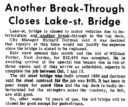
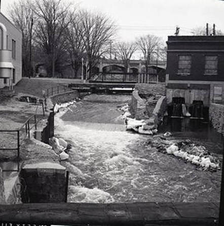
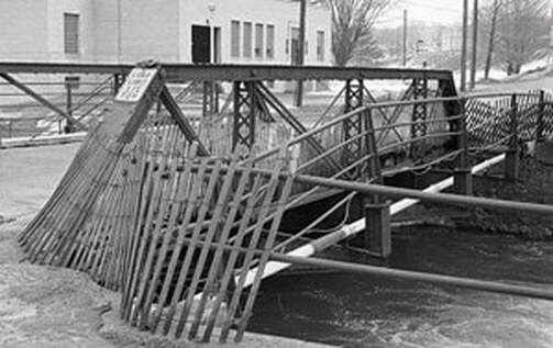
1968
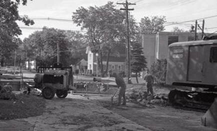
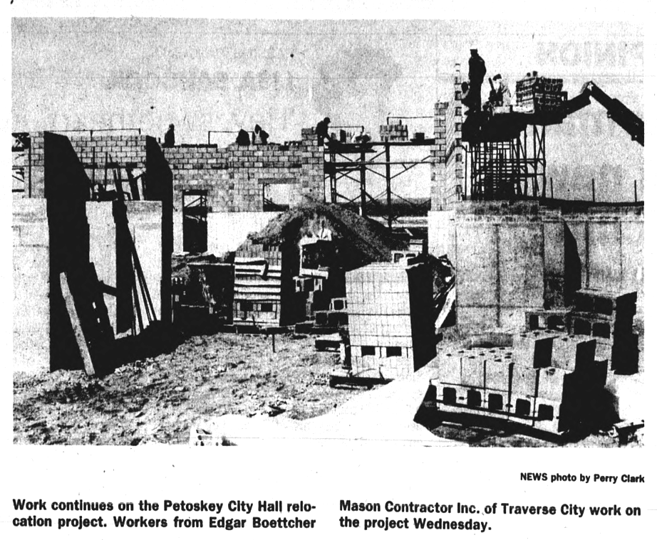
Greenwood Photo Archive Collection from Petoskey newspapers (1968)
|

Greenwood Photo Archive Collection from Petoskey newspapers (1968)
|
Greenwood Photo Archive Collection from Petoskey newspapers (October 1968)
|
Greenwood Photo Archive Collection from Petoskey newspapers (October 1968)
|
Greenwood Photo Archive Collection from Petoskey newspapers (October 1968)
|
Greenwood Photo Archive Collection from Petoskey newspapers (October 1968)
|
Greenwood Photo Archive Collection from Petoskey newspapers (October 1968)
|
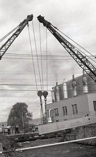
Greenwood Photo Archive Collection from Petoskey newspapers (October 1968)
|
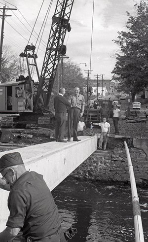
Greenwood Photo Archive Collection from Petoskey newspapers (October 1968)
|
Greenwood Photo Archive Collection from Petoskey newspapers (October 1968)
|
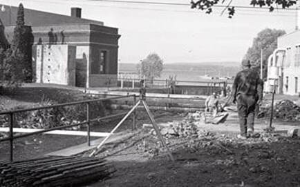
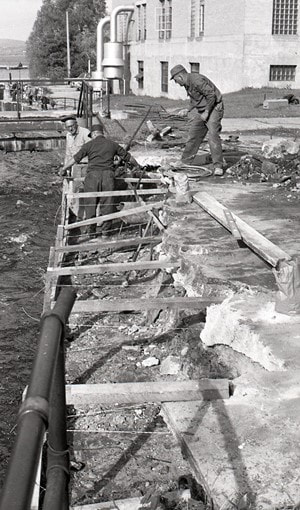
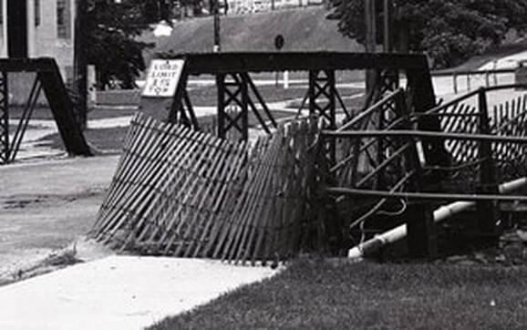
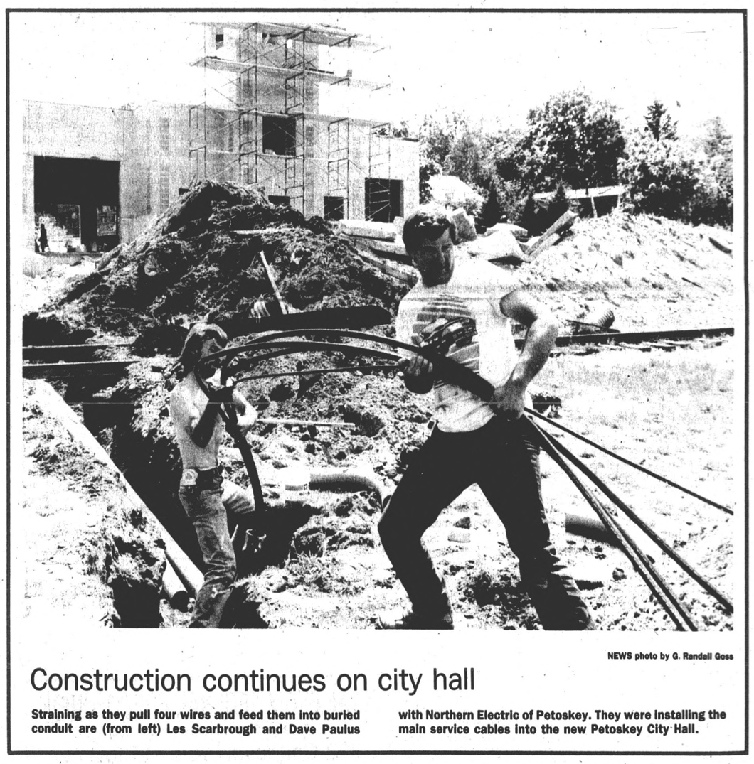
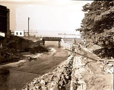
Greenwood Photo Archive Collection from Petoskey newspapers (Undated but AFTER the 1963 By-Pass)
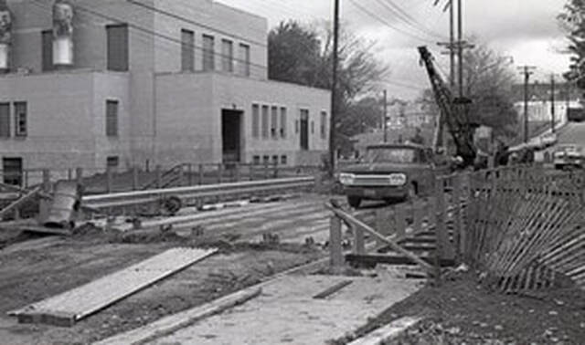
1987
The Petoskey News Review editorial below lists the advantages to the river location for the new city facilities.
The Petoskey News Review editorial below lists the advantages to the river location for the new city facilities.
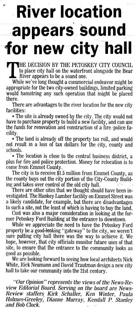
9 September 1987 ~ Petoskey News Review
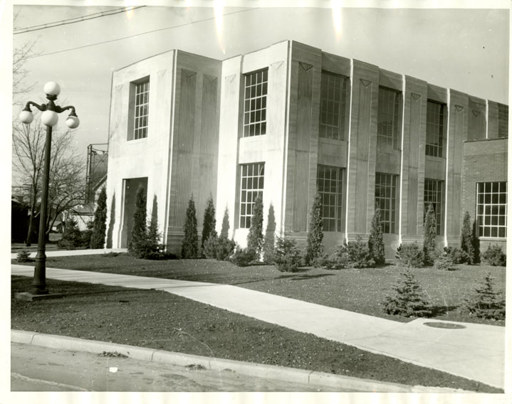
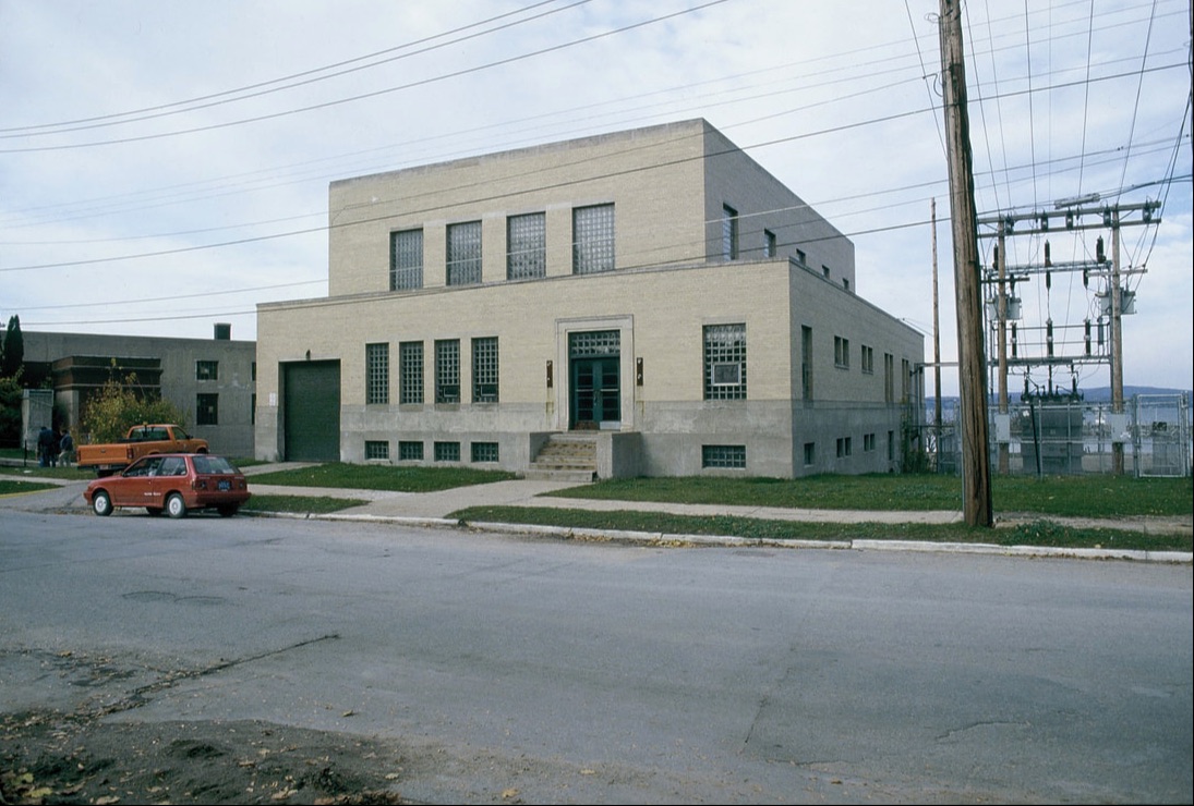
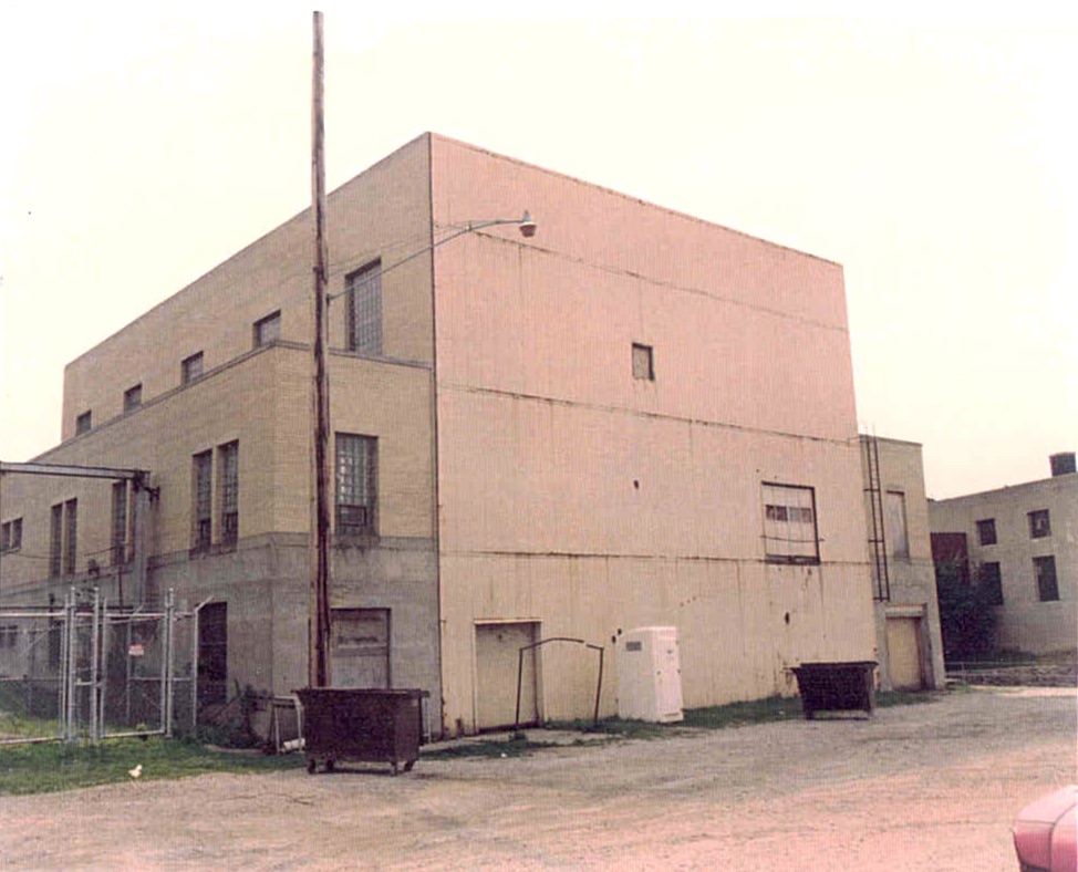
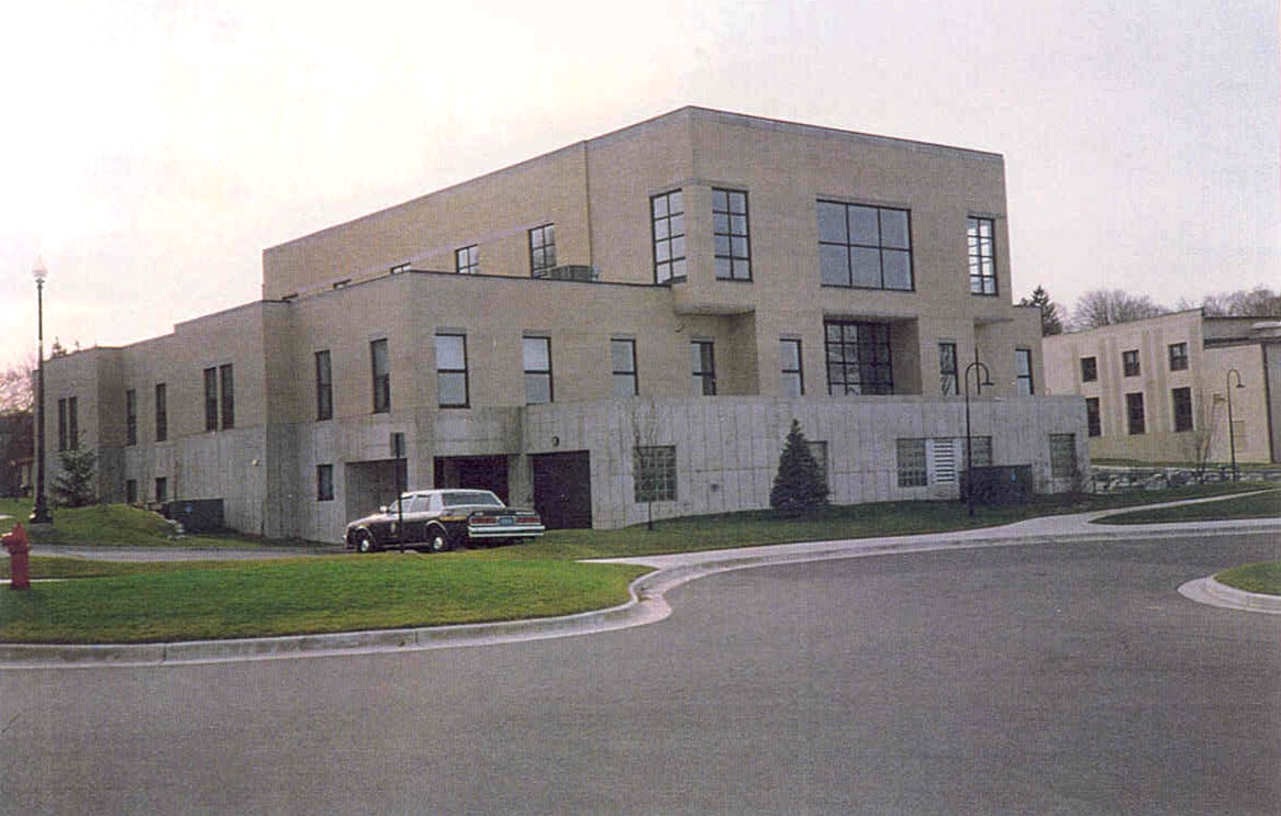
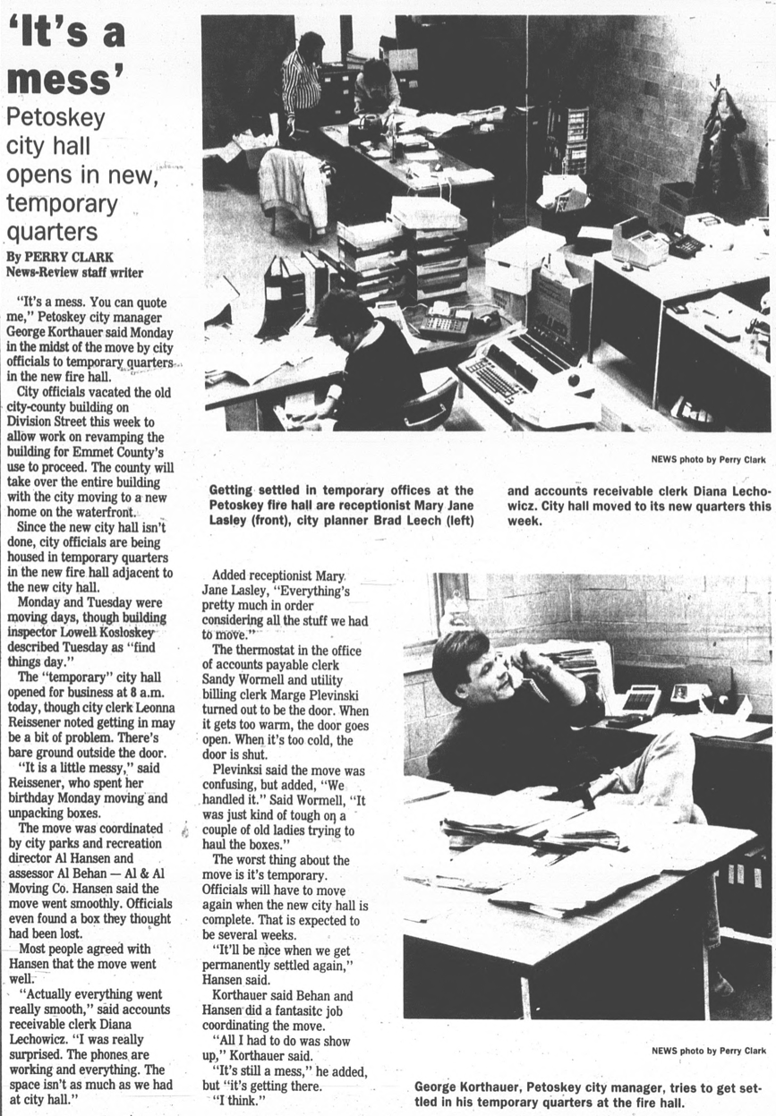
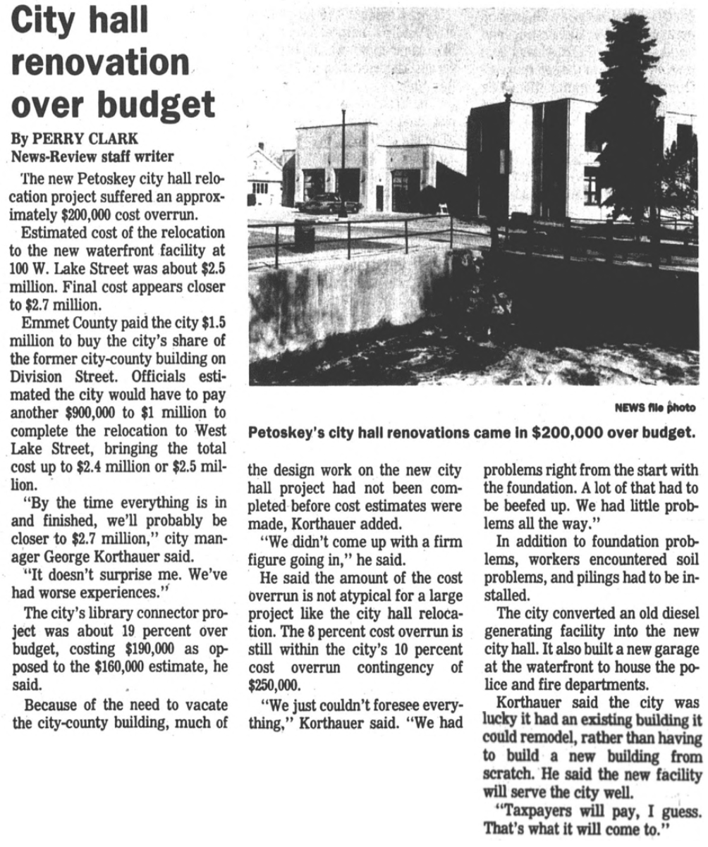
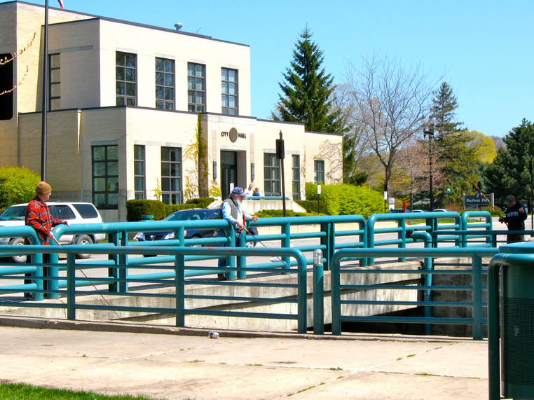
The old diesel plant was transformed/renovated into offices in a new City Hall,
and the old utility plant, across Bear River was transformed
into a fire station with the addition of bays for the fire trucks.
The preliminary designs were presented by Richard Neumann, David Trautman, and Nicholas White.
Petoskey City Council approved the agreement for the County to acquire the City interest in the Emmet-Petoskey Building Authority for $1,500,000 with the City to proceed immediately with City Hall construction,
with conveyance of the City's former Municipal Building to the County.
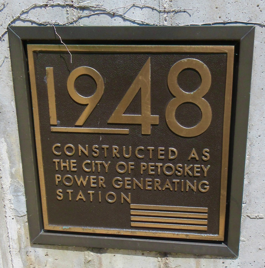
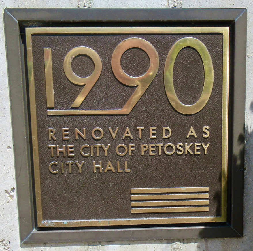
Plaques on the City Hall for both Construction and Renovation dates...
28 May 2023
|
28 May 2023
|
PRE and POST 1990 RENOVATION
Petoskey City Hall
(Six Photos Below submitted by Petoskey Architect Rick Neumann)
Petoskey City Hall
(Six Photos Below submitted by Petoskey Architect Rick Neumann)
Below: City Hall PRE Renovation
Submitted by Petoskey Architect Rick Neumann
Below: City Hall POST Renovation
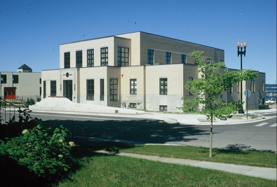
Submitted by Petoskey Architect Rick Neumann
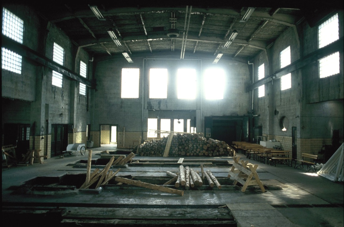
Below: City Hall Rear of Building PRE Renovation
Submitted by Petoskey Architect Rick Neumann
Below: City Hall Rear of Building POST Renovation
Submitted by Petoskey Architect Rick Neumann
Below Photo Text: City Hall Interior in 1949
Below: City Hall Interior PRE Renovation
Submitted by Petoskey Architect Rick Neumann
Below: City Hall Interior POST Renovation after second floor addition
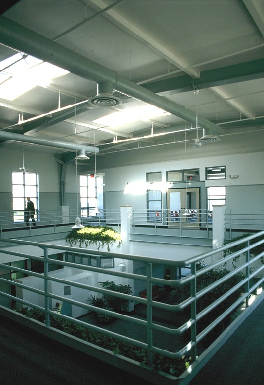
Submitted by Petoskey Architect Rick Neumann
Construction
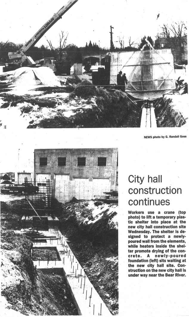
3 February 1989 ~ Petoskey News Review
30 March 1989 ~ Petoskey News Review
15 June 1989 ~ Petoskey News Review
15 November 1989 ~ Petoskey News Review
21 June 1990 ~ Petoskey News Review
2012
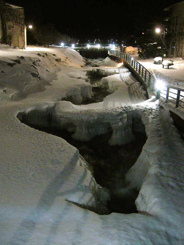
5 March 2012 ~ Lake Street Bridge, Petoskey, Michigan
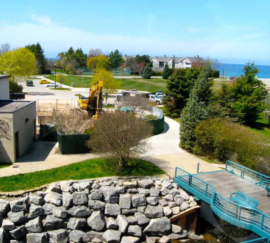
3 May 2012
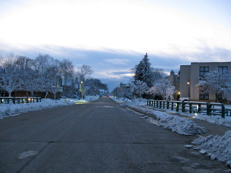
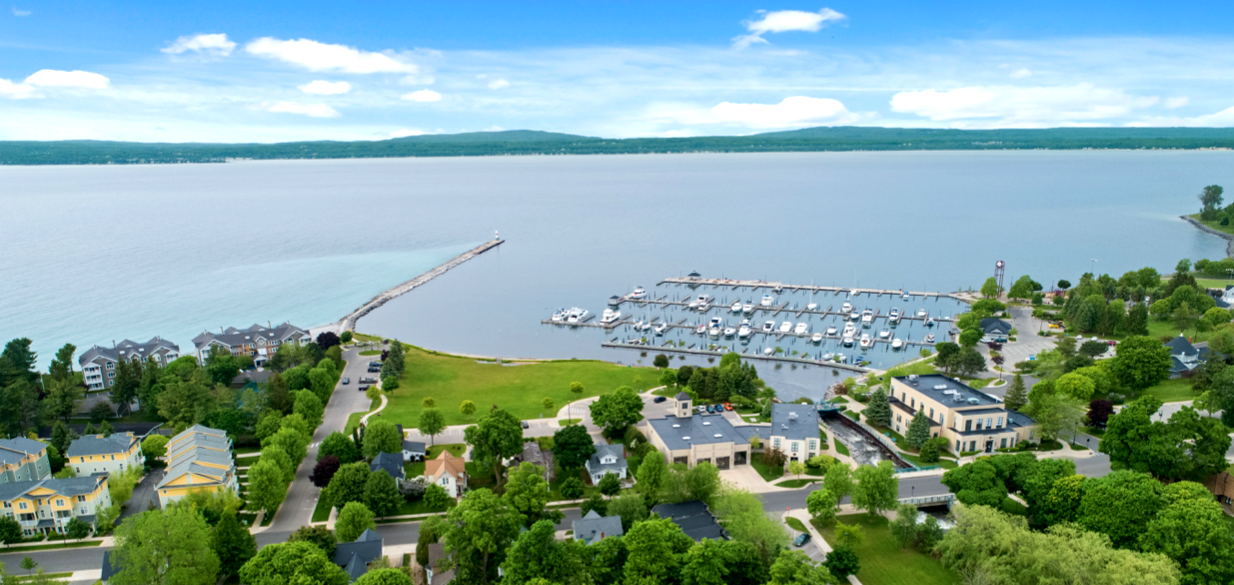
26 September 2017 ~ Photography of "Alex Childress Photo" posted here with permission...
Photo Above: Alex Childress' additional work also may be viewed at Alex Childress Photo.
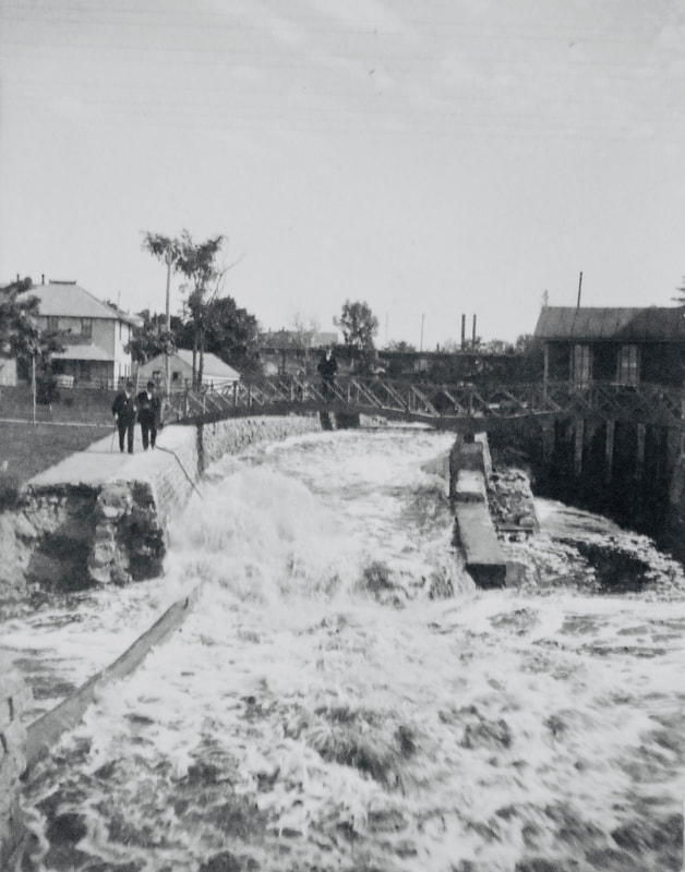
~ Foot Bridge and Railroad Bridge ~
(located between Lake Street and the river outlet...)
Photo Below: Old Bridge Between Lake Street and Pere Marquetee Railroad Tracks
1898
1898
Allan McCune a successful Petoskey businessman and local historian donated several of his albums to Petoskey's Little Traverse Historical Museum which included this photo of the Mitchell Street bridge leading into downtown Petoskey...
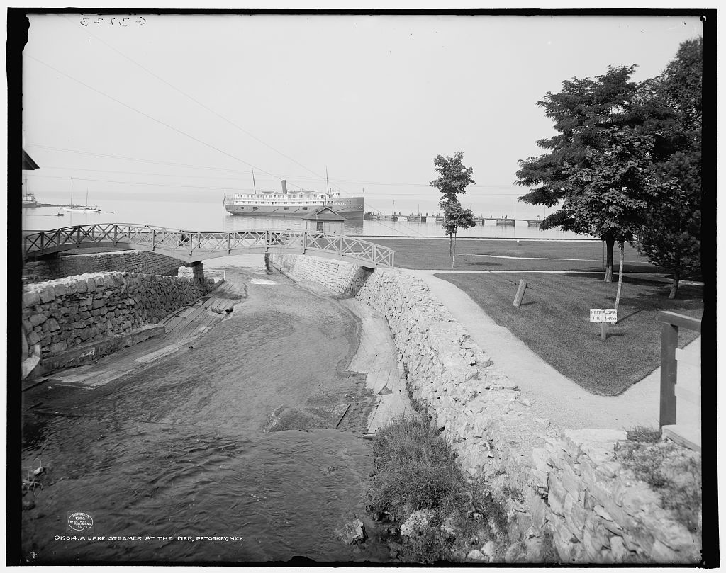
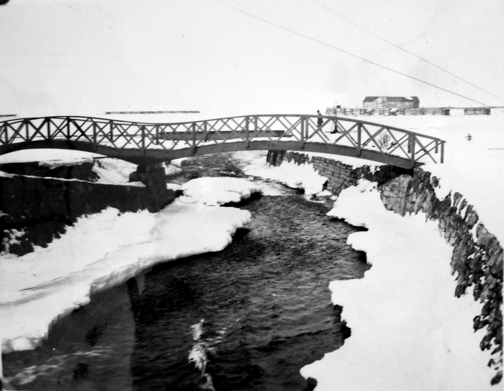
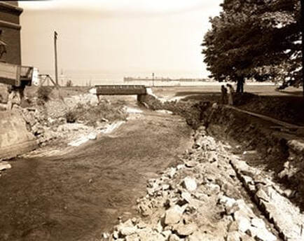
1904 Foot Bridge over the Bear River at the Outlet ~ Library of Congress, Detroit Publishing Company Collection
Little Traverse Historical Museum (Undated)
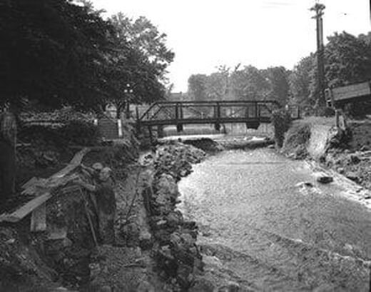
Photos Below: Railroad Bridge
1960s
Greenwood Photo Archive Collection from Petoskey newspapers (11 March 1966)
Greenwood Photo Archive Collection from Petoskey newspaper (November 1967)
Greenwood Photo Archive Collection from Petoskey newspapers (Undated)
|
Greenwood Photo Archive Collection from Petoskey newspapers (1969)
Greenwood Photo Archive Collection from Petoskey newspapers (Undated)
|
Greenwood Photo Archive Collection from Petoskey newspapers (Undated)
|
Greenwood Photo Archive Collection from Petoskey newspapers (Undated)
|
Two Photos Below: The Railroad and Foot Bridge behind the Petoskey City Hall,
BEFORE and AFTER the railroad tracks were removed, and new foot bridge installed
about in the 1990's...
BEFORE and AFTER the railroad tracks were removed, and new foot bridge installed
about in the 1990's...
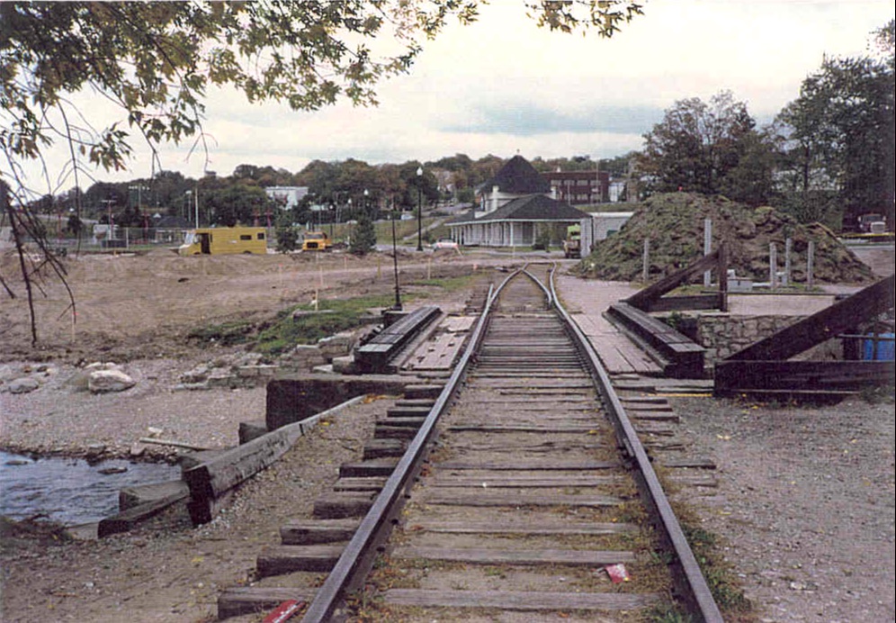
Submitted by Petoskey Architect Rick Neumann ~ 1990's or later
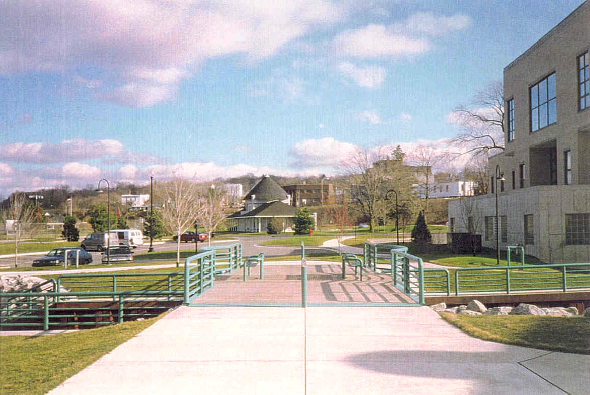
Submitted by Petoskey Architect Rick Neumann ~ 1990's or later
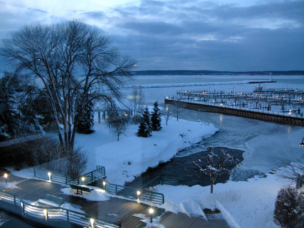
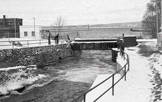
5 March 2012 ~ Foot Bridge
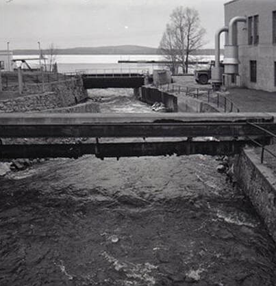
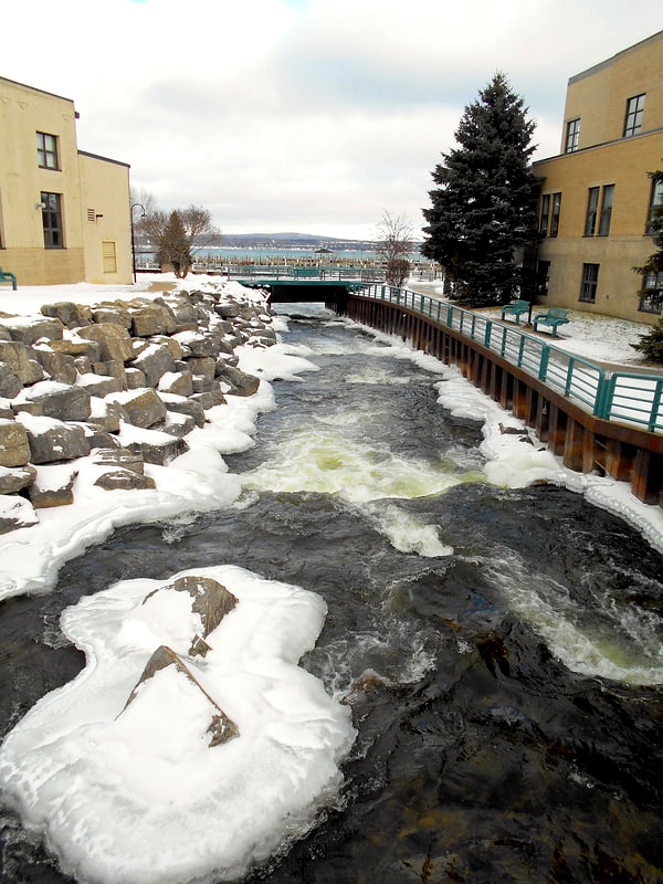
Photo Below: From the Spillway toward the Foot Bridge...
3 February 2014 ~ Foot Bridge

3 May 2015 ~ Foot Bridge over Bear River Outlet
|
3 May 2015 ~ Foot Bridge over Bear River Outlet
|
Photo Below:
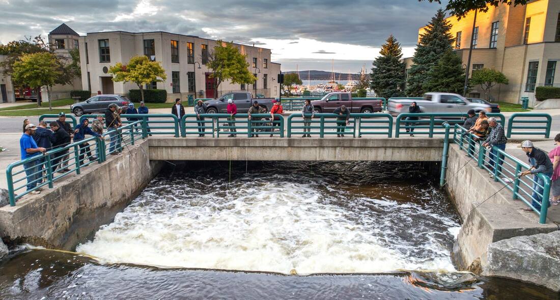
GOING UPRIVER: Foot Bridge > Lake Street Bridge > Low Dam/Wier > Mitchell Street Bridge...
GOING UPRIVER: Foot Bridge > Lake Street Bridge > Low Dam/Wier > Mitchell Street Bridge...
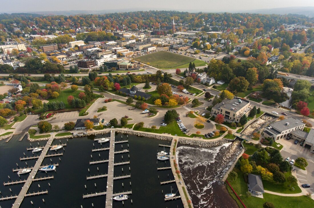
10 October 2018 ~ Photography of "Alex Childress Photo" posted here with permission...
16 January 2019
11 June 2020 ~ Posted only by Permission from Drone Photographer Charles Dawley, Up North Imaging
