Northern Mich~Mash Preserve
~ WATER ~
(Chronological Order)
The design and compilation of the text and photos on this site are copyrighted 2017.
Most posted items will enlarge by "clicking" on them.
"Clicking" on some color highlighted words may access additional information.
Most posted items will enlarge by "clicking" on them.
"Clicking" on some color highlighted words may access additional information.
Please do not copy the photos on this site, many of which have been submitted by private individuals...
just come back and visit the site often to view the photos.
just come back and visit the site often to view the photos.
FEATURED WATER PHOTO
By Ken Lewis
~ Swan Sailing into the Sunset ~
2024
By Ken Lewis
~ Swan Sailing into the Sunset ~
2024
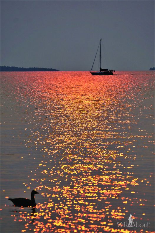
Photo By Ken Lewis posted here with his permission... (2024)
Access additional photos by Ken Lewis on his Facebook Page by clicking HERE.
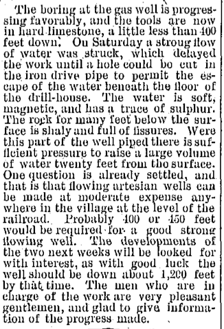
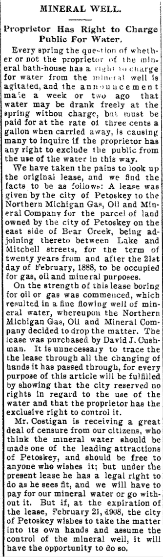
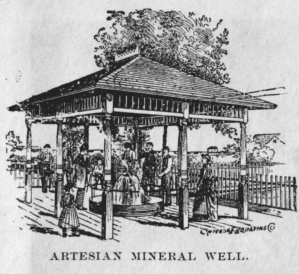
1875 > ~ Artesian Wells
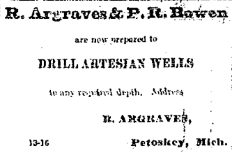
13 August 1875 ~ Emmet County Democrat
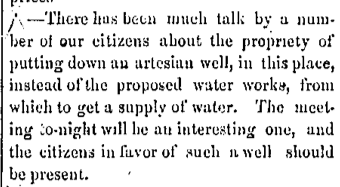
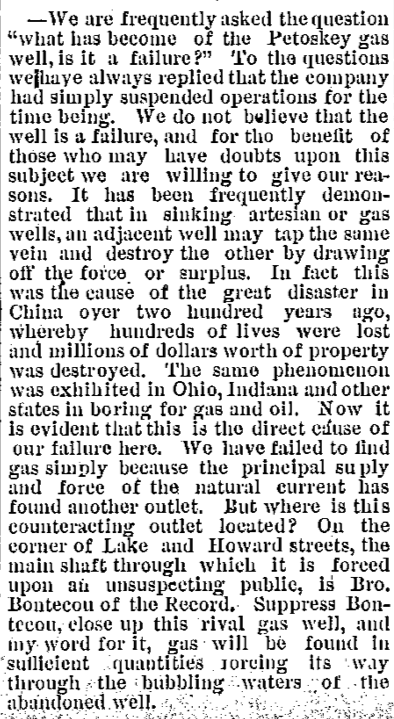
10 March 1881 ~ Petoskey City Record
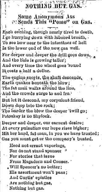
The corpulant man was H.O. Rose, the president of Petoskey.
Politics were erupting during the drilling for gas... per the POME below.
Eventually, hitting mineral water!
Politics were erupting during the drilling for gas... per the POME below.
Eventually, hitting mineral water!
30 May 1888 ~ The Petoskey Record
30 May 1888 ~ The Petoskey Record
|
Little Traverse Historical Society Photo Collection (Undated)
|
22 August 1888 ~ The Daily Resorter
|
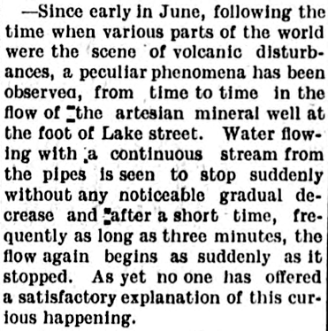
20 August 1902 ~ The Daily Resorter
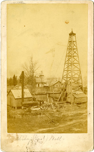
Photo Below: Well being drilled on the south side of Lake Street Bridge with Mitchell Street Bridge in the background. Click HERE to access additional information about the gas/mineral well. |
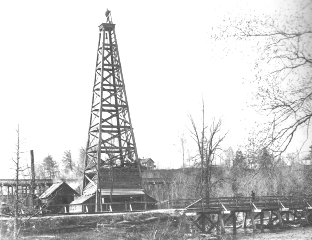
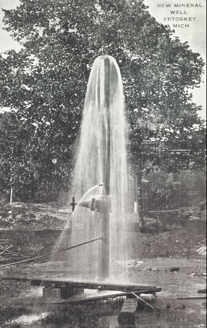
About 1878 ~ Drilling the Mineral Well
3 May 1905 ~ The Petoskey Record
|
Greenwood Photo Archive Collection (Undated)
Greenwood Photo Archive Collection (Undated)
|

Greenwood Photo Archive Collection (Undated)
Greenwood Photo Archive Collection (Undated)
1881 ~ The New McManus Water Supply
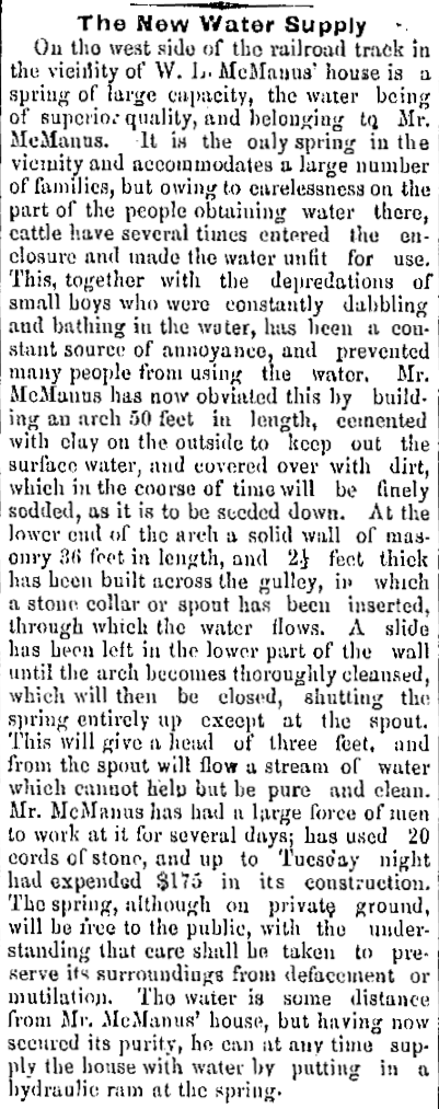
14 July 1881 ~ Petoskey City Record
1899 ~ Area Lighthouses
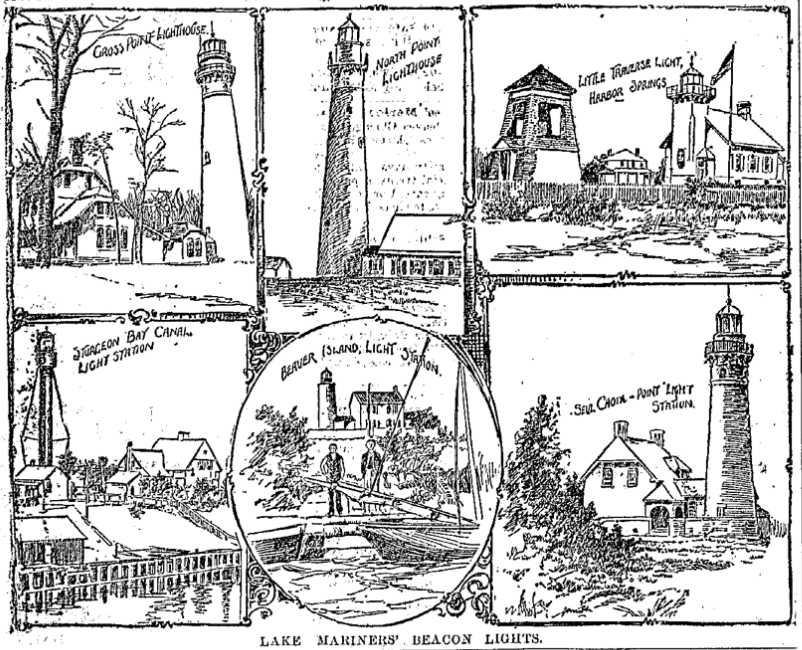
11 January 1899 ~ The Petoskey Record... Area Lighthouses
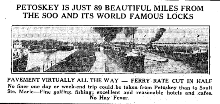
Early 19th Century ~ Resorters Found Sailing Popular
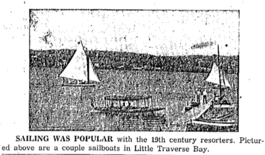
22 August 1958 ~ Petoskey News Review
1903 ~ New Fangled Public Water Fountain
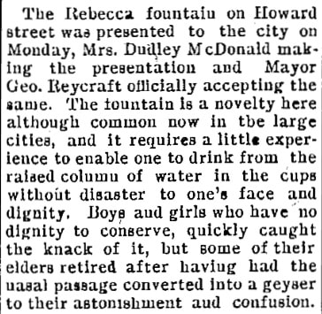
5 August 1903 ~ The Petoskey Record
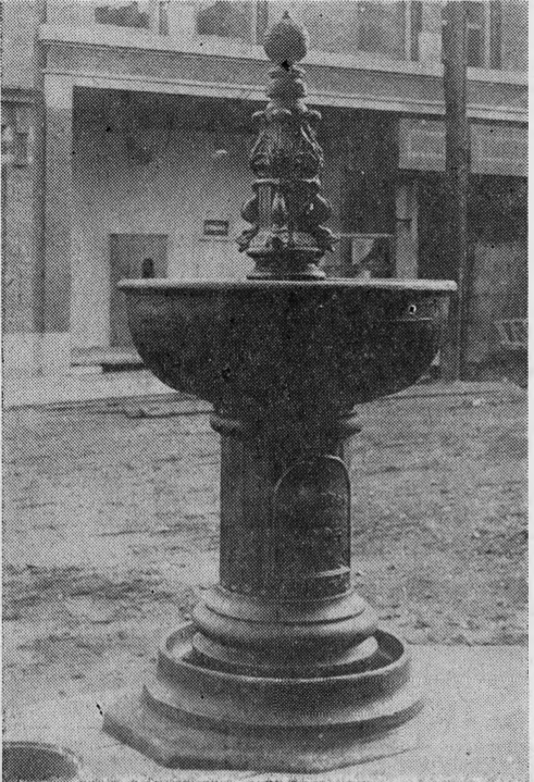
1907 ~ New Sanitary Drinking Fountain
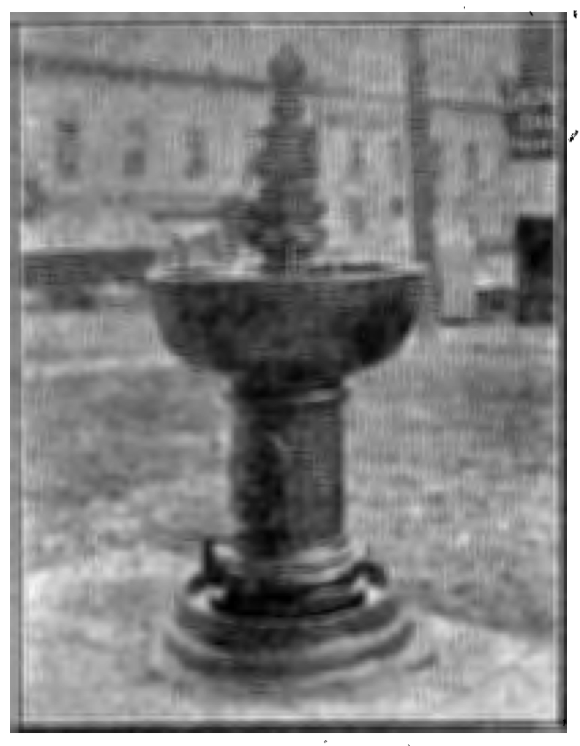
7 August 1907 ~ The Petoskey Record photo accompanied the article below left...
|
23 June 1949 ~ Northern Michigan Review photo accompanied the article below right...
|
7 August 1907 ~ The Petoskey Record (Each column continues to the section below)
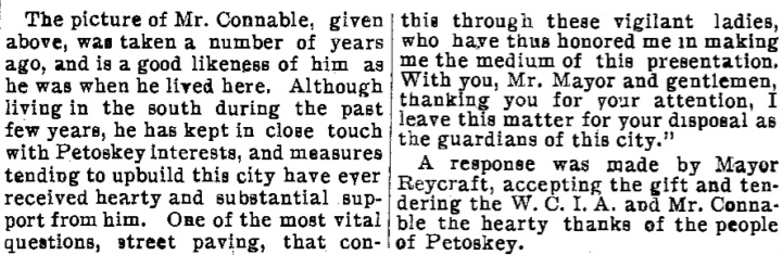
7 August 1907 ~ The Petoskey Record (Each column continues from above, to the section below)
|
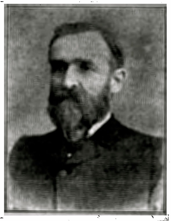
Ralph Connable, Sr.
Clipping below: Could Robert Tripp have been mistaken about the year of fountain removal when reading the 1932 article below? 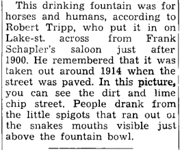
23 June 1949 ~ Northern MIchigan Review
|
Clipping Below: The removal and dumping of a landmark fountain may have been referencing the same fountain noted above; especially noting the location of Lake and Petoskey streets for each mentioned fountain.
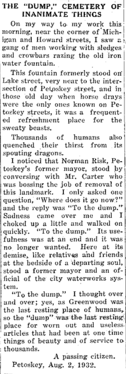
2 August 1932 ~ Petoskey Evening News
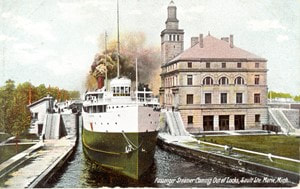
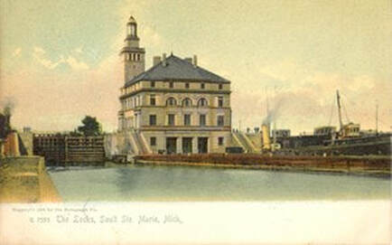
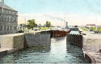
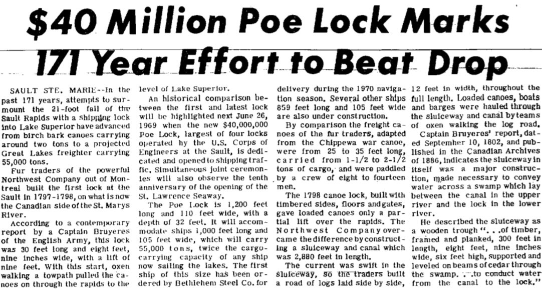
~ Soo Locks ~
In Raymond W. Kalbfleisch's Yesterdays' People Revisited on page 308 it is aptly explained:
"In 1855 the Soo Canal was opened and the FIRST ship was locked through the new canal.
The next land transaction to take place in the present day McKinley Township has to do with the Soo Canal and deserves a detailed explanation of facts. On 26 August 1852, Congress granted the State of Michigan 750,000 acres of land for the purpose of financing the building of a canal around the falls of the St. Mary's River.
In February of 1853, officials of the Michigan State Land Office appointed agents to select acreage from the public domain. Selected land was to be free from taxes for a period of five years. In Emmet County 3520 acres (0.47% of the total) were located not far from the vicinity of the present day village of Pellston. On 25 May 1855, land enumerated below was deeded by the state to the St. Marys Falls Ship Canal.
Canal Company holdings in the present McKinley Township amounting to 2720 acres were located in Section 25 through 29, and 32 through 36. In adjoining Maple River Township selected lands, amounting to 800 acres, were located in Sections 2 through 4, and 10 through 112. In no case was a complete section owned by the Canal company. Details of the above transactions are to be found in the Emmet County Register of Deeds Office in Petoskey, Liber 1 page 364."
These Soo Locks photos in the slideshow below
were submitted by Geoff Guillaume from the collection of his Grandfather.
This OLD American & Canadian Soo photo booklet (view as slideshow below) was submitted by Geoff Guillaume
from the collection of his Grandfather. Pages may be "paused" for reading...
from the collection of his Grandfather. Pages may be "paused" for reading...
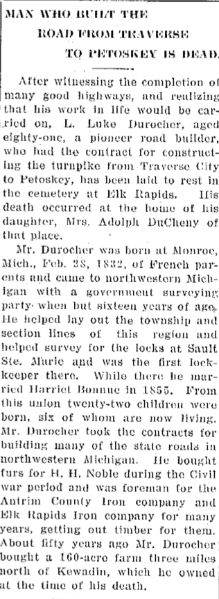
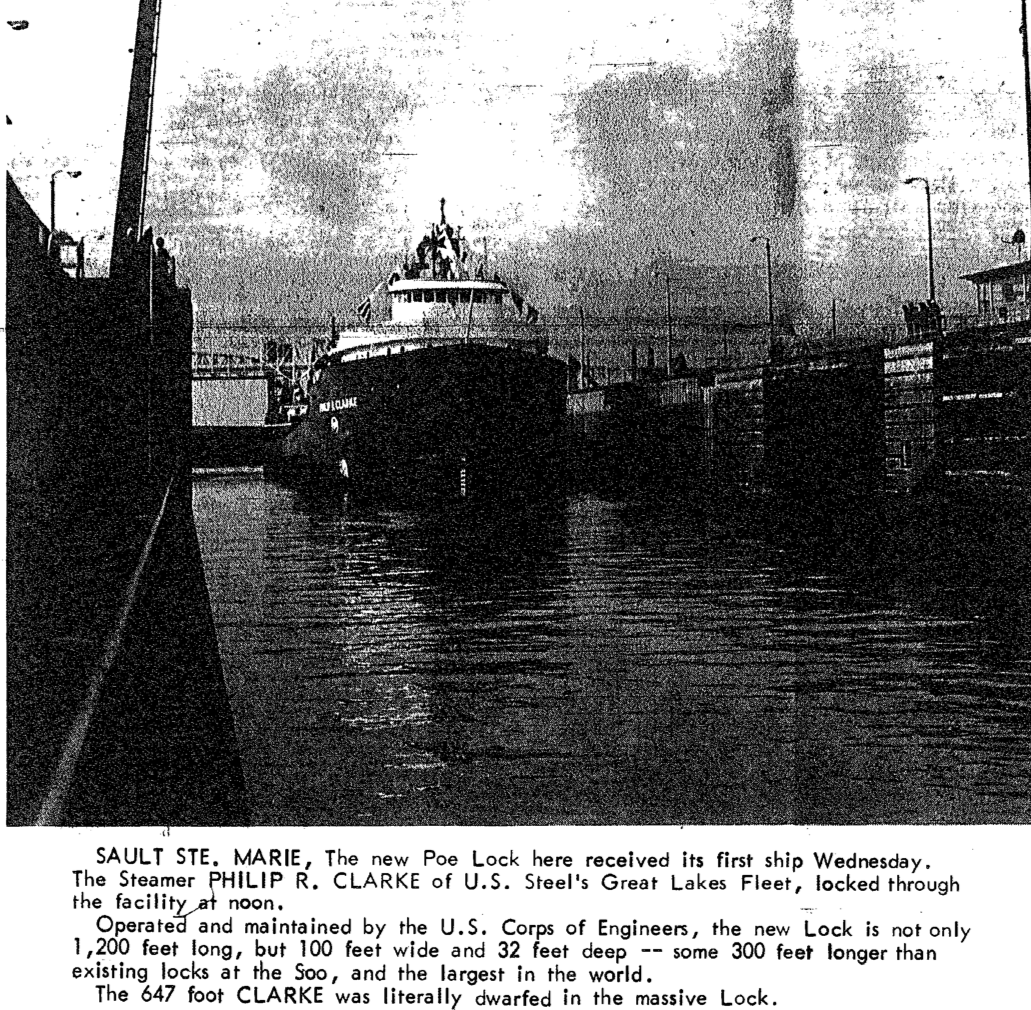
12 June 1913 ~ Petoskey Evening News
|
Obituary Left: Mr. Durocher who helped survey for the locks
at Sault Ste. Marie and was the FIRST Lock Keeper there, died in 1913. Photo Clipping Below: Gamble Moore, helped to build the Poe Lock. He started working on the four lock Sault complex in 1910 and worked in the labor force which built all four locks. 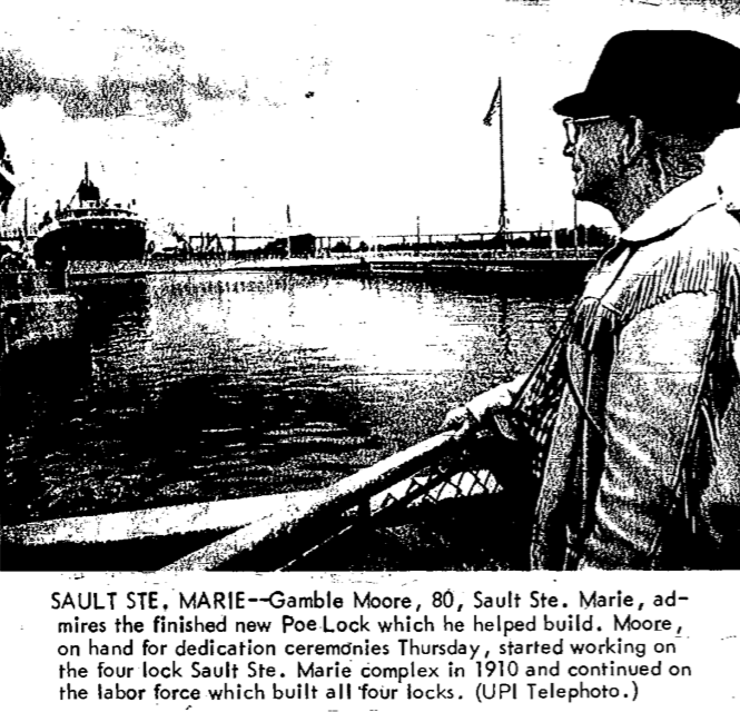
27 June 1969 ~ Petoskey News Review
|
Greenwood Photo Archive Collection
Greenwood Photo Archive Collection
|
Greenwood Photo Archive Collection
|
14 August 1933 ~ Petoskey Evening News
12 September 1963 ~ Petoskey News Review
1 November 1968 ~ Petoskey News Review
30 April 1969 ~ Petoskey News Review article continued below left...
30 April 1969 ~ Petoskey News Review article continued right column...
|
30 April 1969 ~ Petoskey News Review article continued from left column...
|
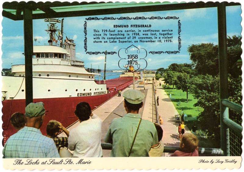
Postcard Below: The 729 foot ore carrier Edmund Fitzgerald was going through the Locks at Sault Ste. Marie, upbound from Lake Huron, entering the MacArthur Lock to be raised 22 feet to the level of Lake Superior. The Edmund Fitzgerald sank in a violent storm on Lake Superior on 10 November 1975, losing all 29 crewmen.
A Quick History of the Soo Locks presented by the US Army Corps of Engineers may be accessed by clicking HERE.
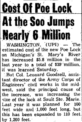
The Corps of Engineers is building a new "Poe-sized" lock to provide much needed resiliency
in the Great Lakes Navigation System.
The new lock is being built on the existing Sabin and Davis Locks sites.
in the Great Lakes Navigation System.
The new lock is being built on the existing Sabin and Davis Locks sites.
On 21 January 2022 it was announced that the USArmy Corps of Engineers will receive $479 million for the Soo Locks expansion project from the 2021 infrastructure bill. The project involves constructing a second Poe-sized lock (110 feet by 1,200 feet) on the existing decommissioned Davis and Sabin locks site. The original Poe Lock was built in 1896, located on the St. Marys River at Sault Ste. Marie, Michigan. The Second Poe Lock, and the last lock built in the present Soo Lock system, opened in 1968/69.
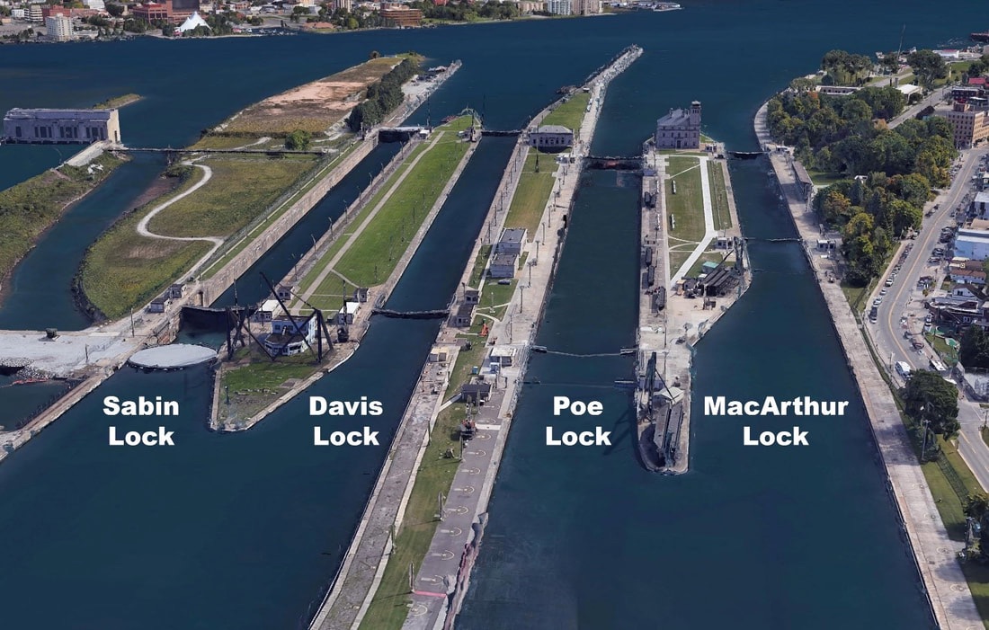
Detroit District, Soo Locks, USACE (Early 2022)
Search Google for additional information about the proposed new lock.
~ Little Traverse Bay viewed from the corner of Madison Street and Ingalls Avenue... (undated) ~
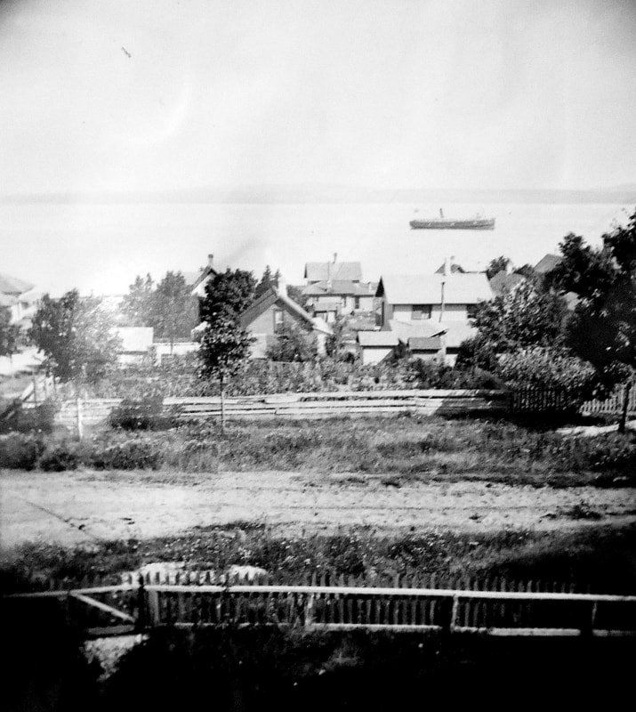
Allan McCune a successful Petoskey businessman and local historian donated several of his albums to Petoskey's Little Traverse Historical Museum which included this photo of LIttle Traverse Bay viewed from the corner of Madison Street and Ingalls Avenue...
~ Big "Little Traverse Bay" Wave Drives Him From Bed–He Sleeps in Canoe ~
1913
1913
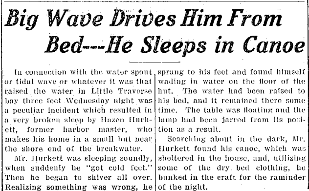
21 June 1913 ~ Petoskey Evening News
~ Emmet County Clerk Mr. and Mrs. Madlem Stranded in Lake Superior ~
1916
1916

21 July 1916 ~ Petoskey Evening News
~ Top of Kalamazoo Street for Water System Being Improved ~
1932
1932
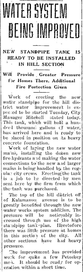
2 July 1932 ~ Petoskey Evening News
~ Car Ferry "City of Petoskey" Christened ~
1941
1941
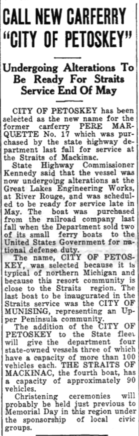
15 May 1941 ~ Emmet County Graphic
|
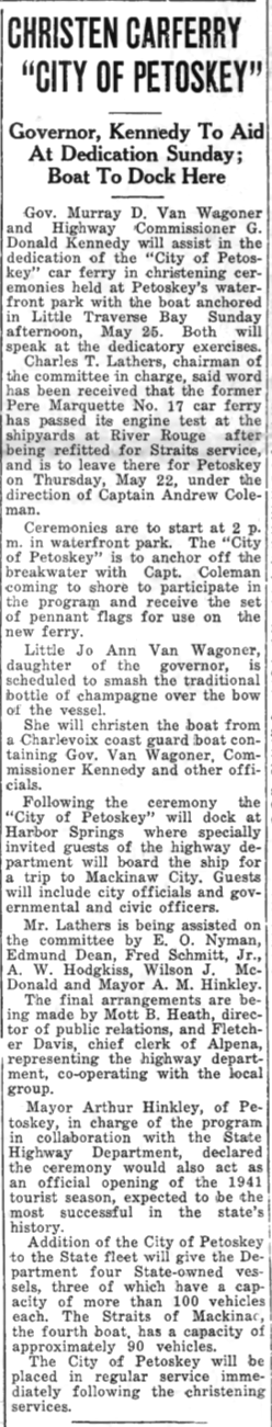
22 May 1941 ~ Emmet County Graphic
|
~ Carp River Lamprey Weir Nears Completion ~
1948
1948
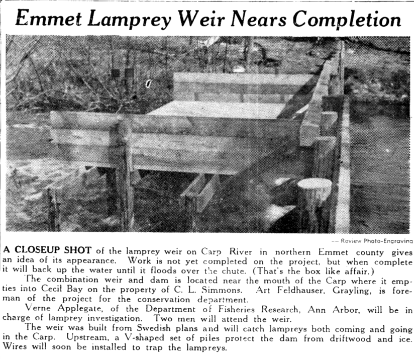
1 April 1948 ~ Northern Michigan Review
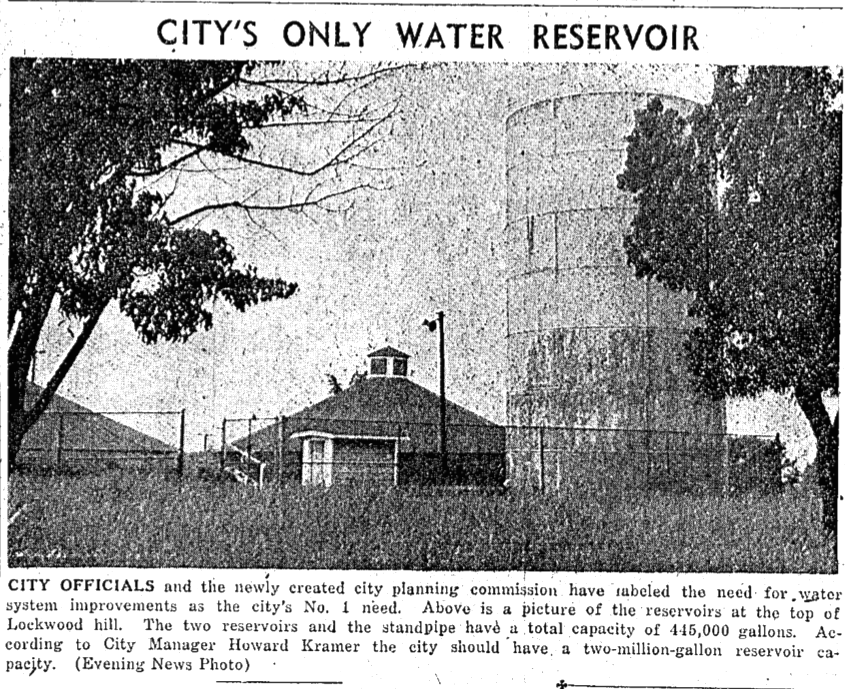
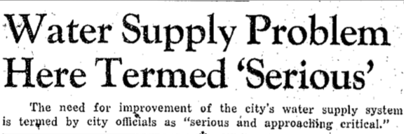
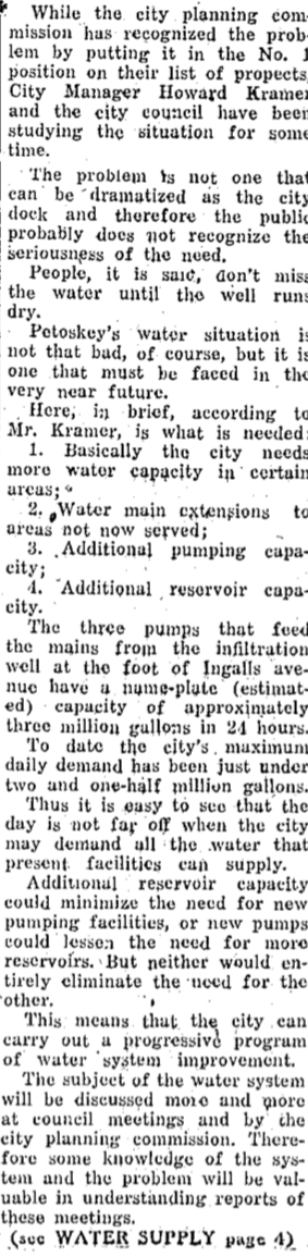
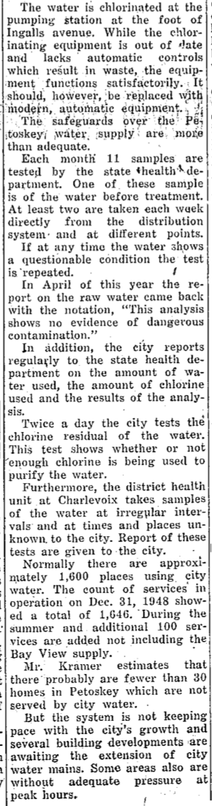
~ City's Only Water Reservoir has Serious Problems ~
1949
1949
This city playground location was referred to as "Lockwood Field" or "The Tanks."
27 June 1949 ~ Petoskey Evening News article continued below...
27 June 1949 ~ Petoskey Evening News article continued below...
27 June 1949 ~ Petoskey Evening News article continued column right...
|

27 June 1949 ~ Petoskey Evening News article continued column right...
|
27 June 1949 ~ Petoskey Evening News article continued from column left...
|
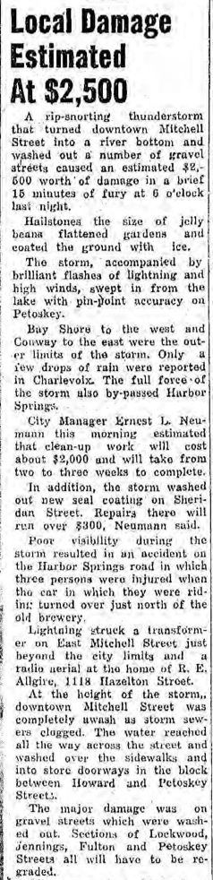
~ Hailstone and Storm Water ~
1951
(Notice Dew Drop Inn below photo in 1958)
1951
(Notice Dew Drop Inn below photo in 1958)
19 July 1951 ~ Petoskey Evening News photos accompanied article at right...
|
19 July 1951 ~ Petoskey Evening News article continued at right...
|
19 July 1951 ~ Petoskey Evening News article continued from left column/photos...
|
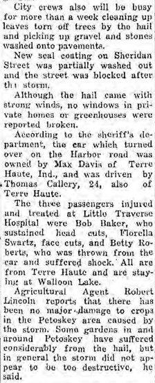
~ Little Traverse Bay Seiche with Harbor Springs Repercussions ~
1953
1953
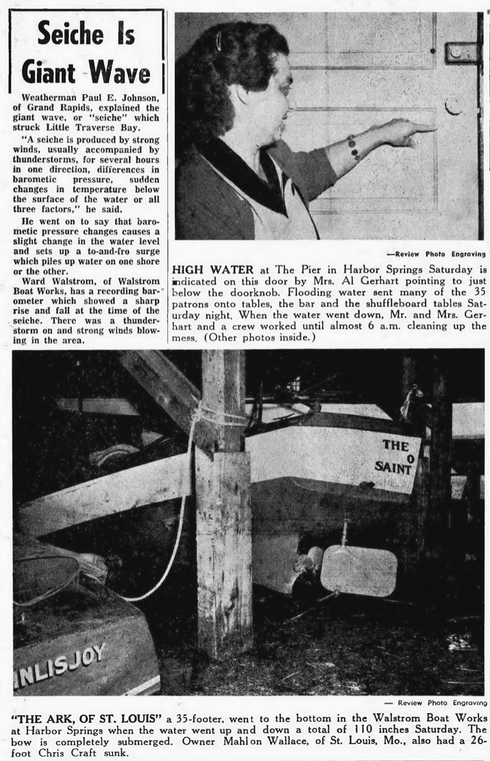
4 June 1953 ~ Northern Michigan Review
4 June 1953 ~ Northern Michigan Review
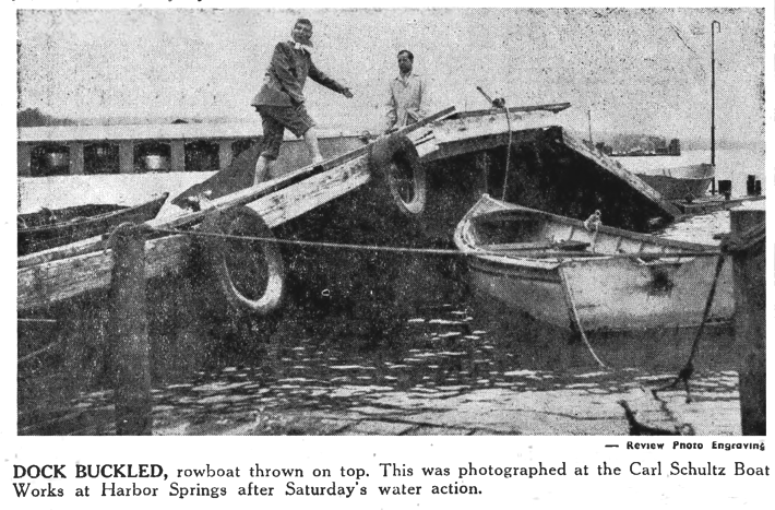
4 June 1953 ~ Northern Michigan Review
~ Petoskey Bathing Beach ~
1958
1958
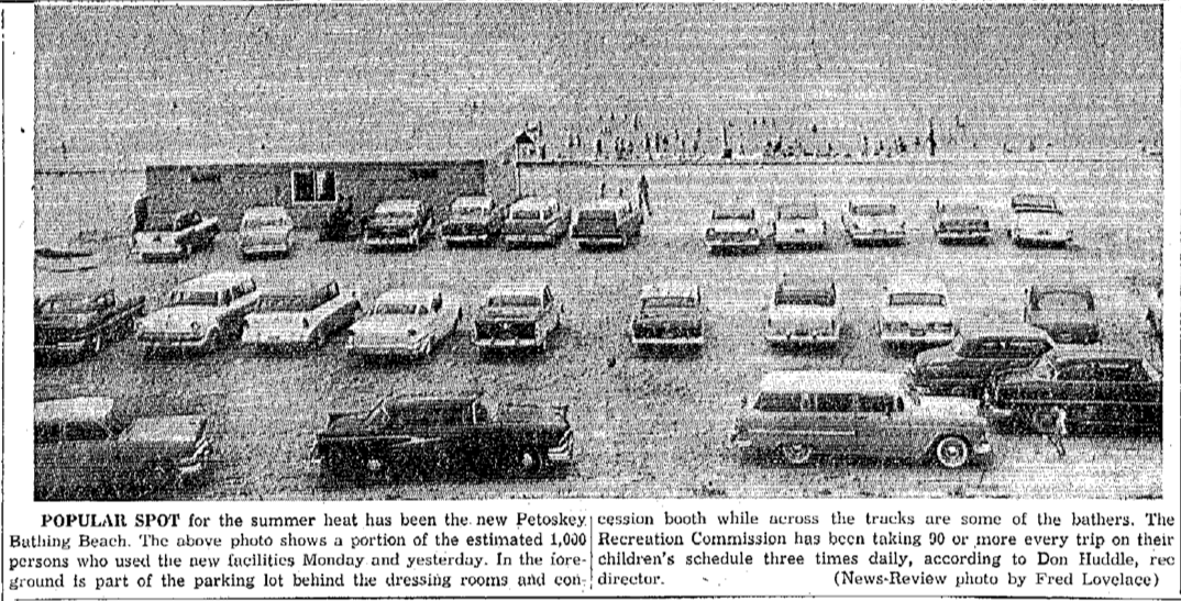
16 July 1958 ~ Petoskey News Review
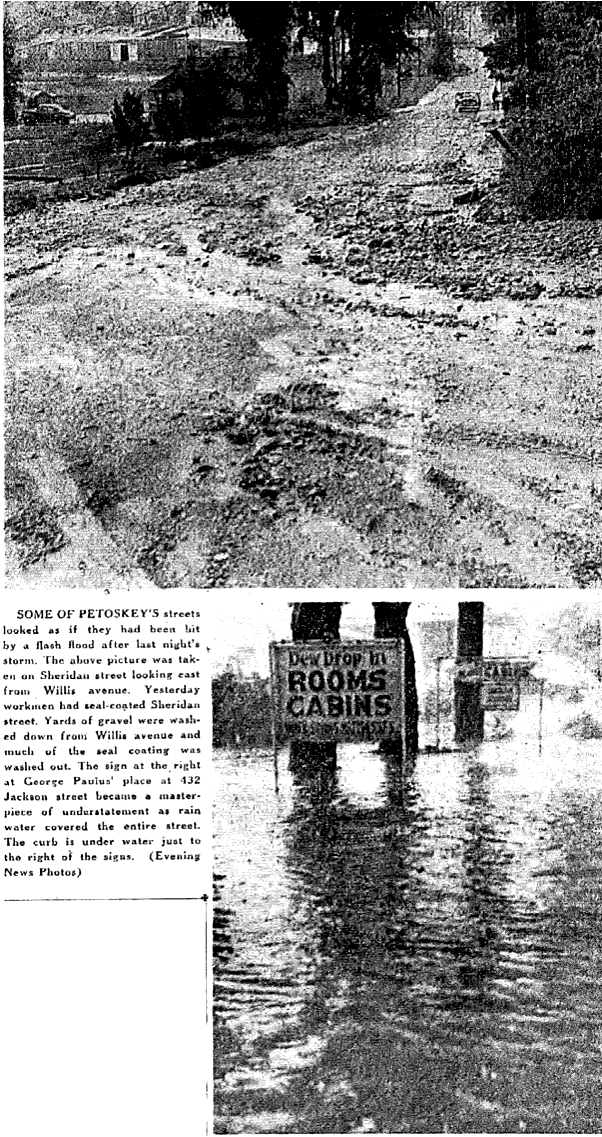
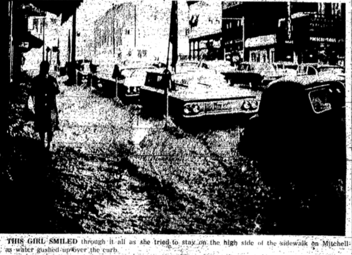
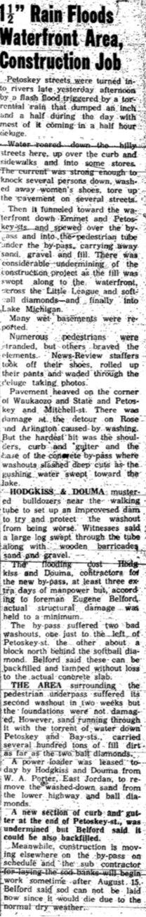
~ Flash Flood ~
1958
(Notice Dew Drop Inn above photo in 1951)
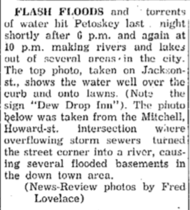
4 September 1958 ~ Petoskey News Review article with two photos below...
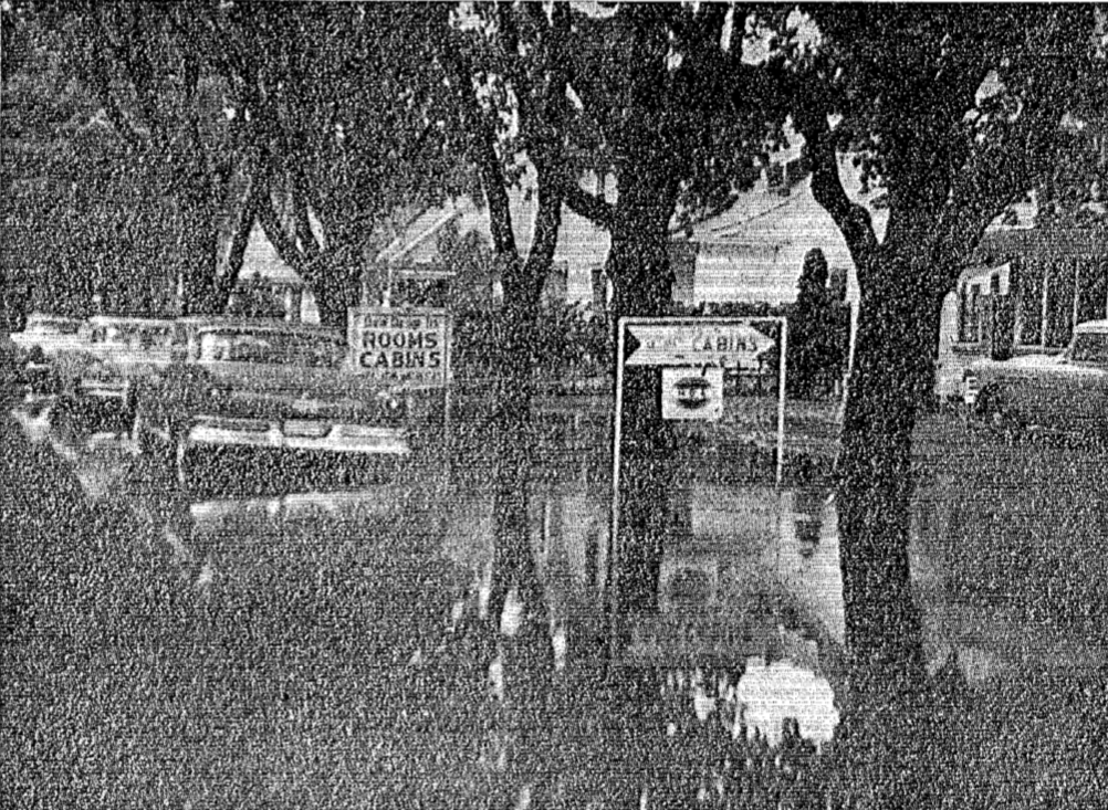
4 September 1958 ~ Petoskey News Review
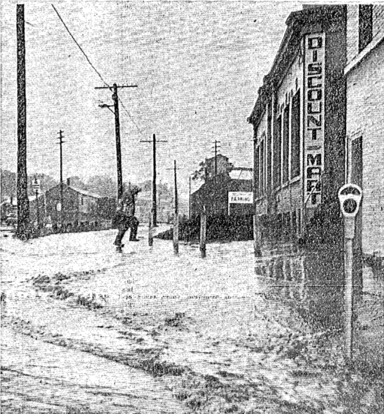
4 September 1958 ~ Petoskey News Review
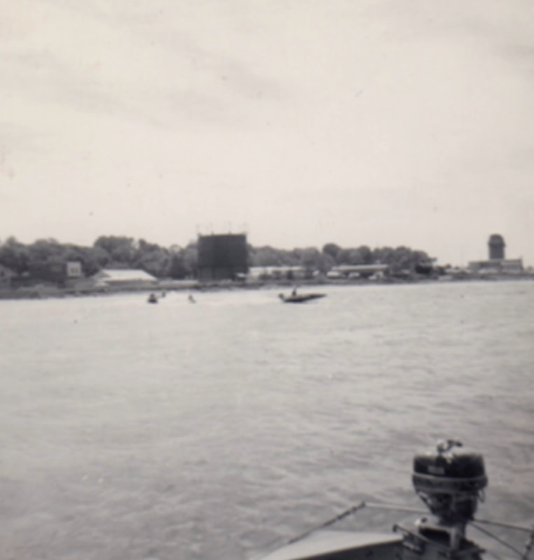
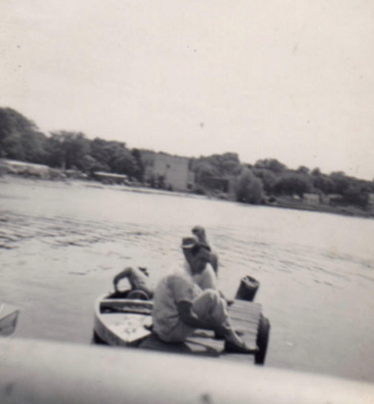
~ Top O' Michigan Speedboat Racing ~
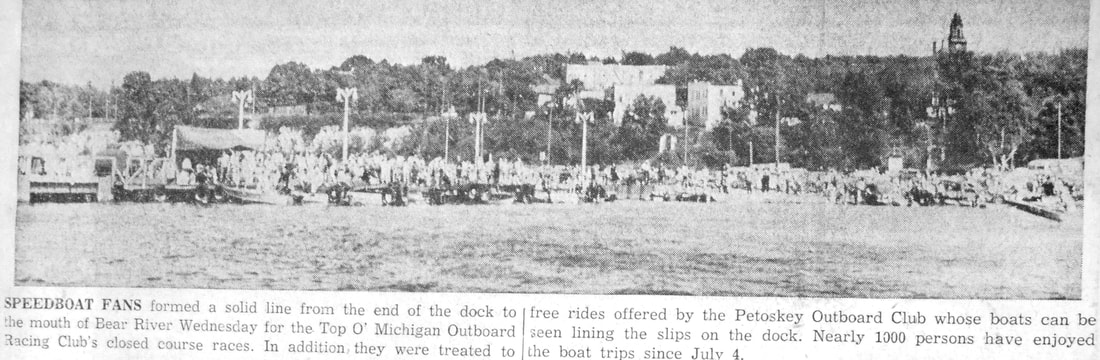
Undated article ~ Petoskey News Review
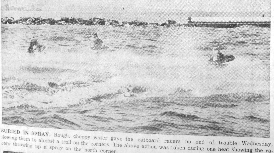
Undated article ~ Petoskey News Review
Three Photos Below: Like the article above explains, it was quite the viewers' event to watch the Petoskey Outboard Club races held at the Petoskey Waterfront. The huge Wells Fuel Storage Tanks can be view in the background on the shore.
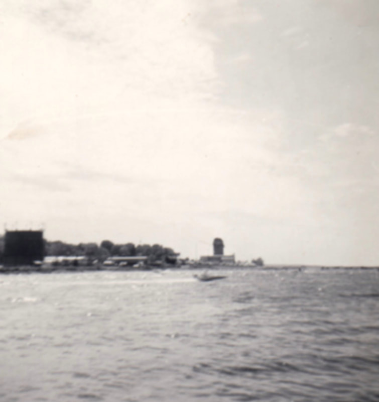
About 1956 or 1957 ~ Submitted by S. Buckmaster
|
About 1956 or 1957 ~ Submitted by S. Buckmaster
|
About 1956 or 1957 ~ Submitted by S. Buckmaster
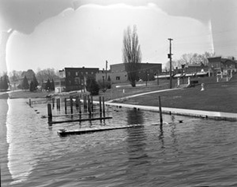
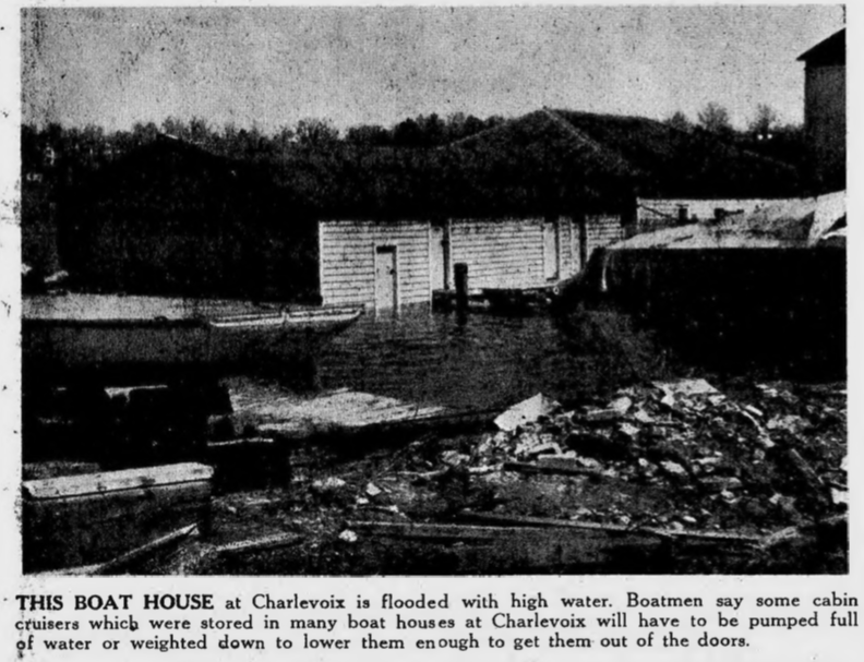
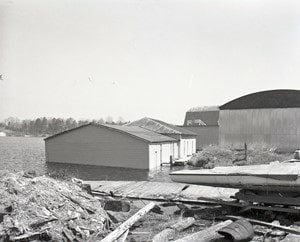
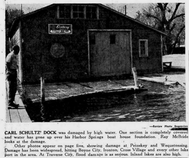
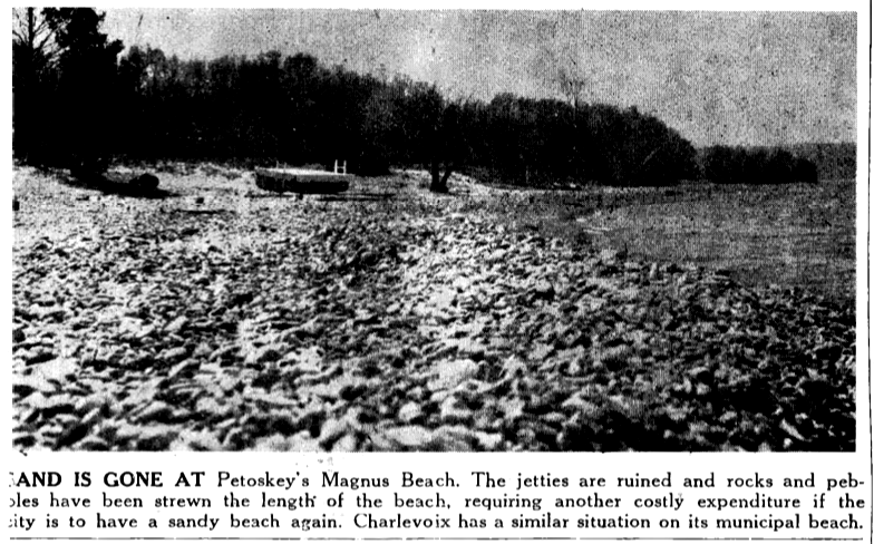
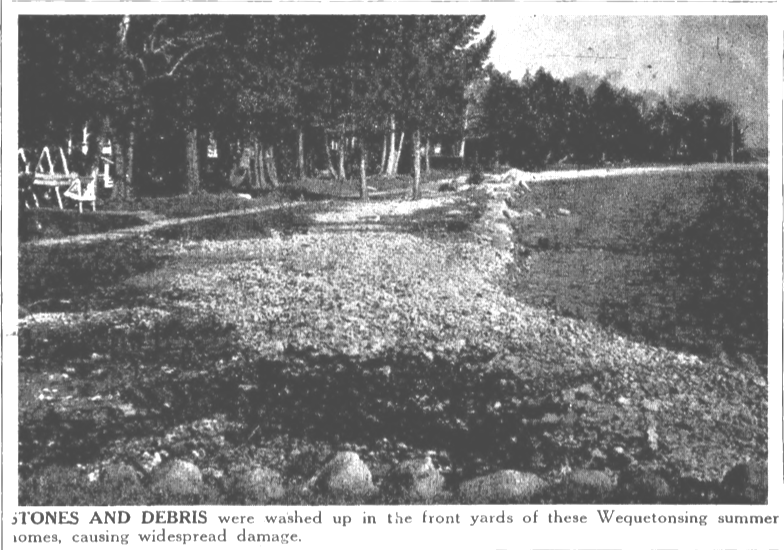
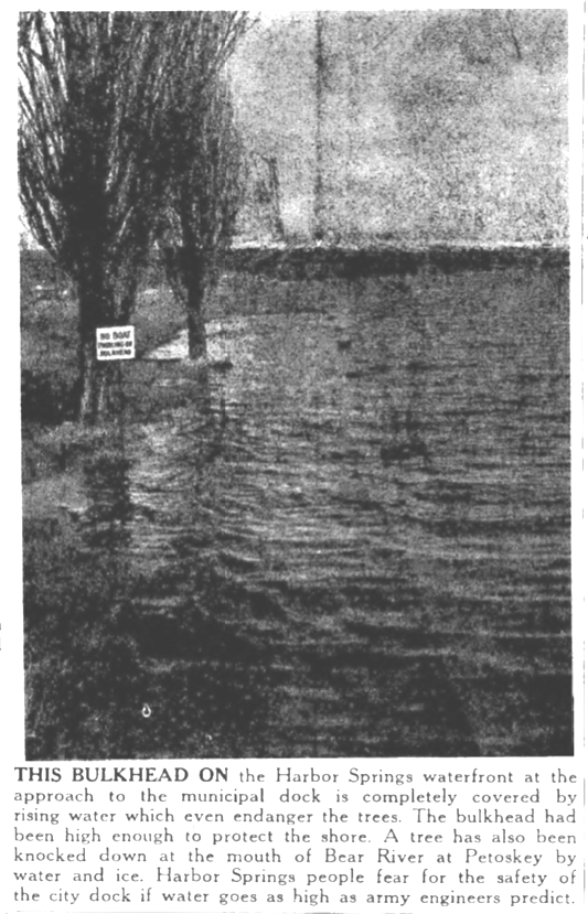
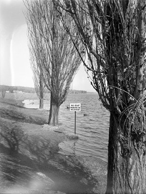
~ HIGH Water Damage in the Area from Lake Michigan ~
1952
1952

24 April 1952 ~ Northern Michigan Review
Greenwood Photo Archive Collection from Petoskey Newspaper (24 April 1952)
24 April 1952 ~ Northern Michigan Review
|
Greenwood Photo Archive Collection from Petoskey Newspaper (24 April 1952)
|
24 April 1952 ~ Northern Michigan Review
|

Greenwood Photo Archive Collection from Petoskey Newspaper (24 April 1952)
|
24 April 1952 ~ Northern Michigan Review
24 April 1952 ~ Northern Michigan Review
24 April 1952 ~ Northern Michigan Review
|
Greenwood Photo Archive Collection from Petoskey Newspaper (24 April 1952)
|
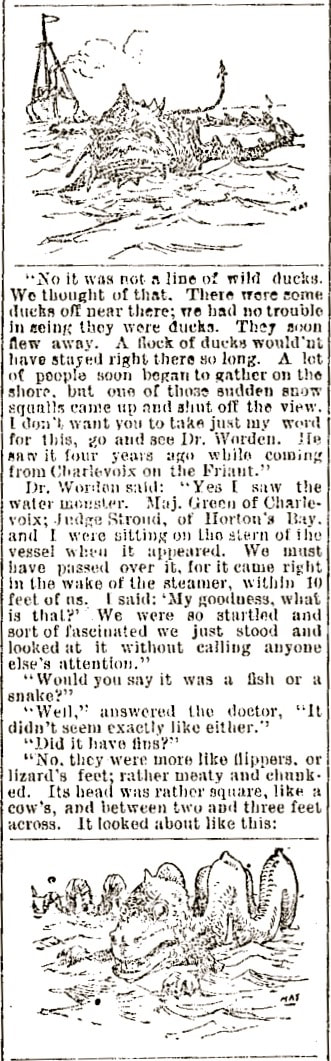
~ Sea Serpent of Little Traverse Bay~
View additional Information about Little Traverse Bay's Sea Serpent on the
"Flora and Fauna" web page on this same web site by clicking HERE.
"Flora and Fauna" web page on this same web site by clicking HERE.
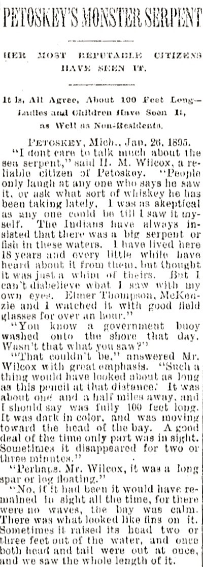
30 January 1895 ~ The Petoskey Record... continue next column
|
30 January 1895 ~ The Petoskey Record... continue next column
|

30 January 1895 ~ The Petoskey Record... continued from previous column
|
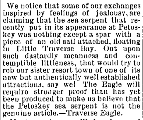
6 February 1895 ~ The Petoskey Record (First Printed in the Traverse Eagle)
|

6 February 1895 ~ The Petoskey Record (First Printed in the Traverse Eagle)
|
8 May 1901 ~ The Petoskey Record
|

10 May 1901 ~ The Independent Democrat
|
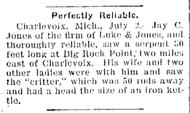
5 July 1901 ~ The Independent Democrat
|

15 May 1954 ~ Petoskey Evening News
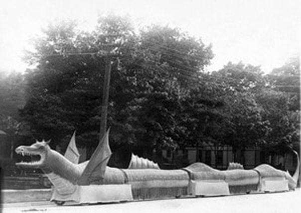
Greenwood Photo Archive Collection ~ OLD Petoskey undated postcard of sea serpent in parade...
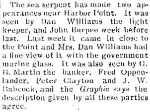
14 July 1961 ~ Petoskey News Review

14 July 1961 ~ Petoskey News Review
|
14 July 1961 ~ Petoskey News Review
|
~ Drilling for Water ~
1982
1982
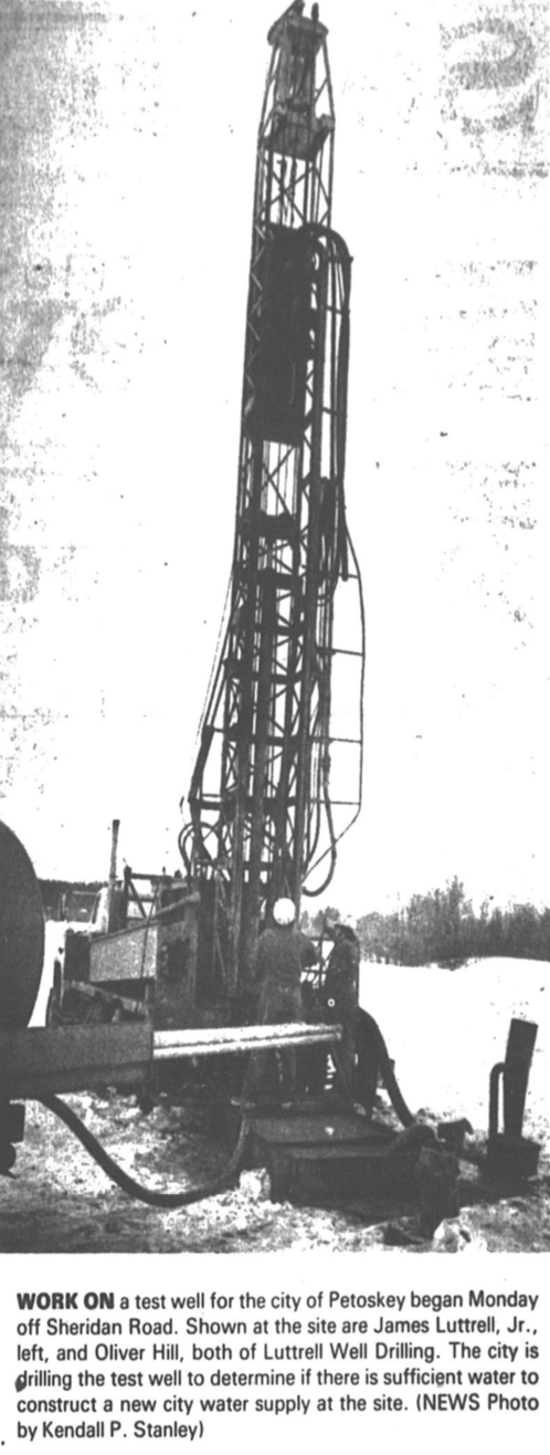
17 February 1982 ~ Petoskey News Review
~ The Little Traverse Bay tug of war declared the world's longest ~
1988
1988
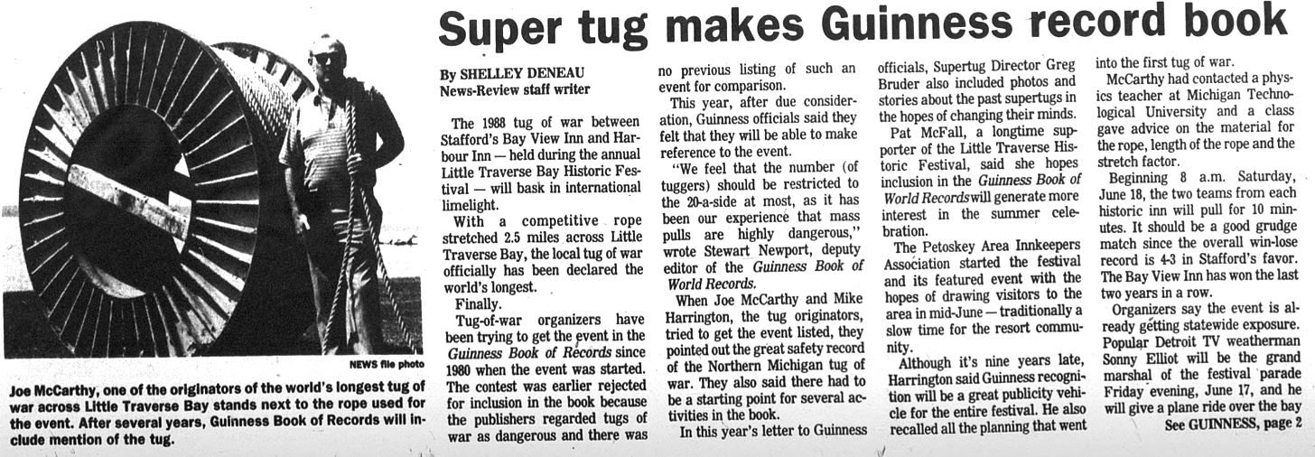
25 April 1988 ~ Petoskey News Review article continued below...
25 April 1988 ~ Petoskey News Review article continued
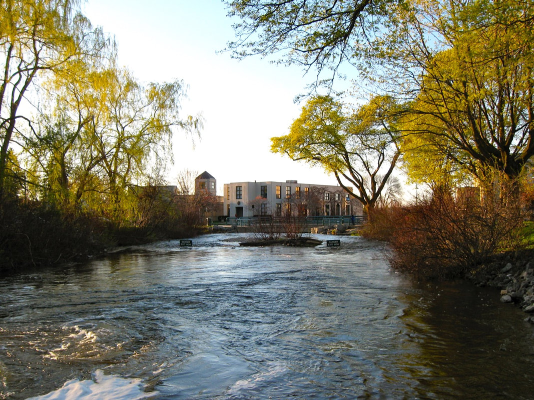
~ Bear River ~
20 May 2011
Two Signs say
DANGER EXIT NOW
20 May 2011
Two Signs say
DANGER EXIT NOW
20 May 2011 ~ Bear River Signs
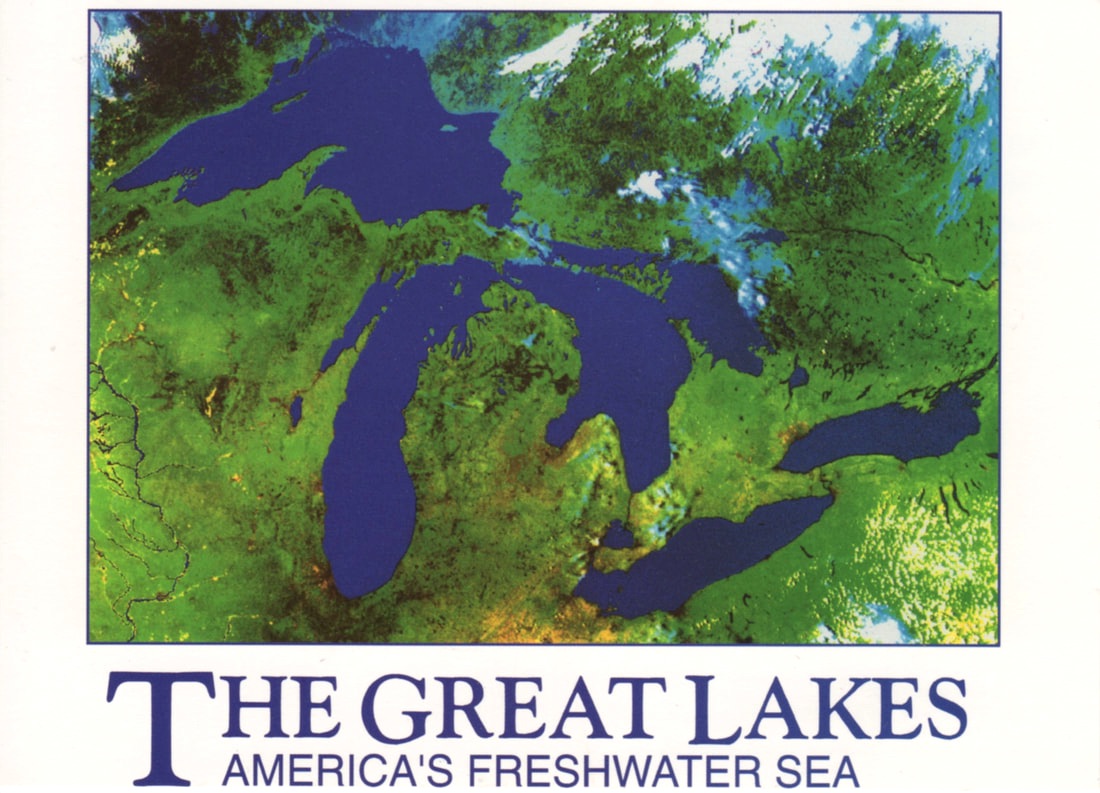
Great Lakes Satellite Map (Undated)
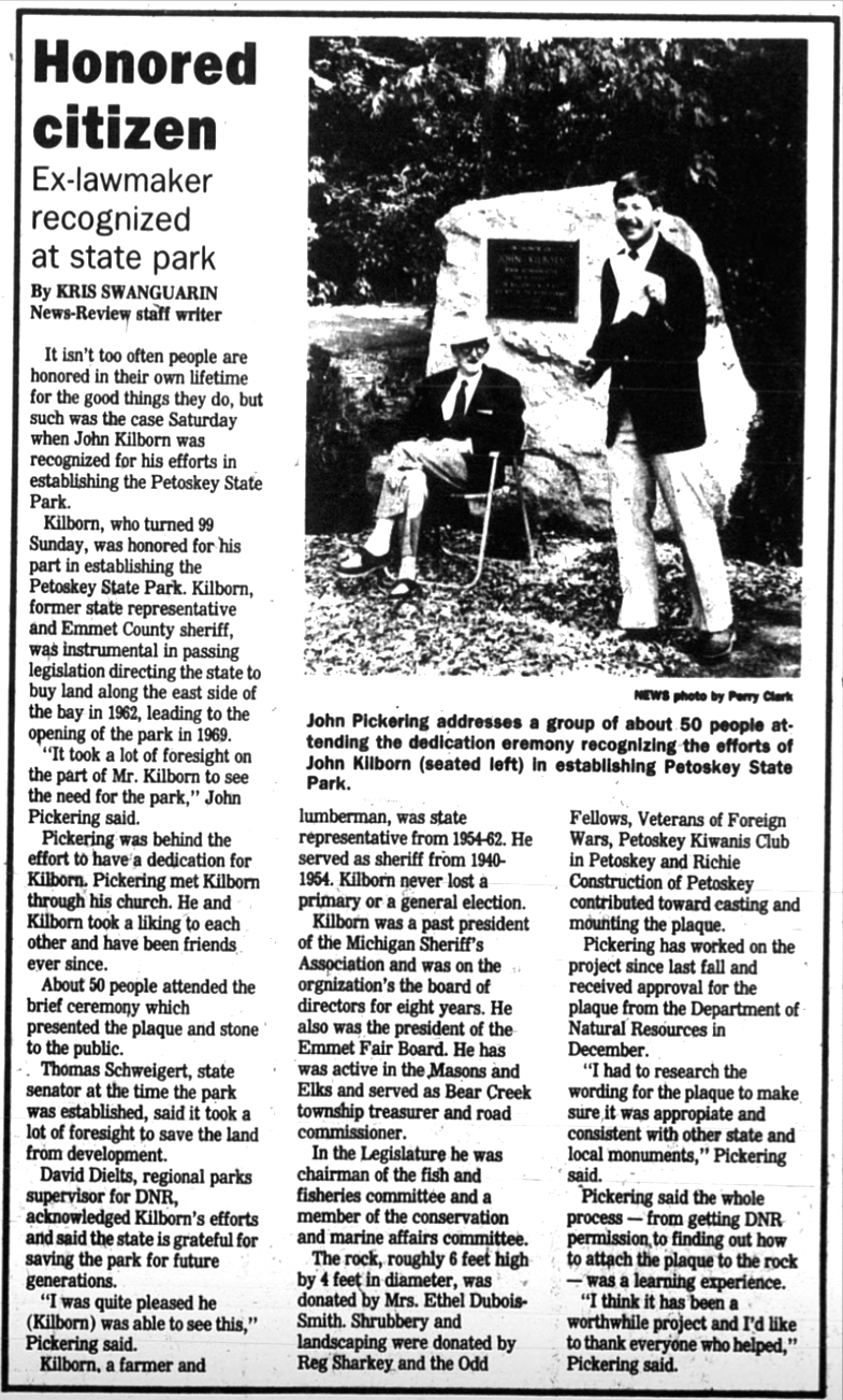
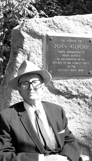
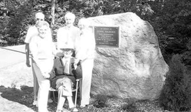
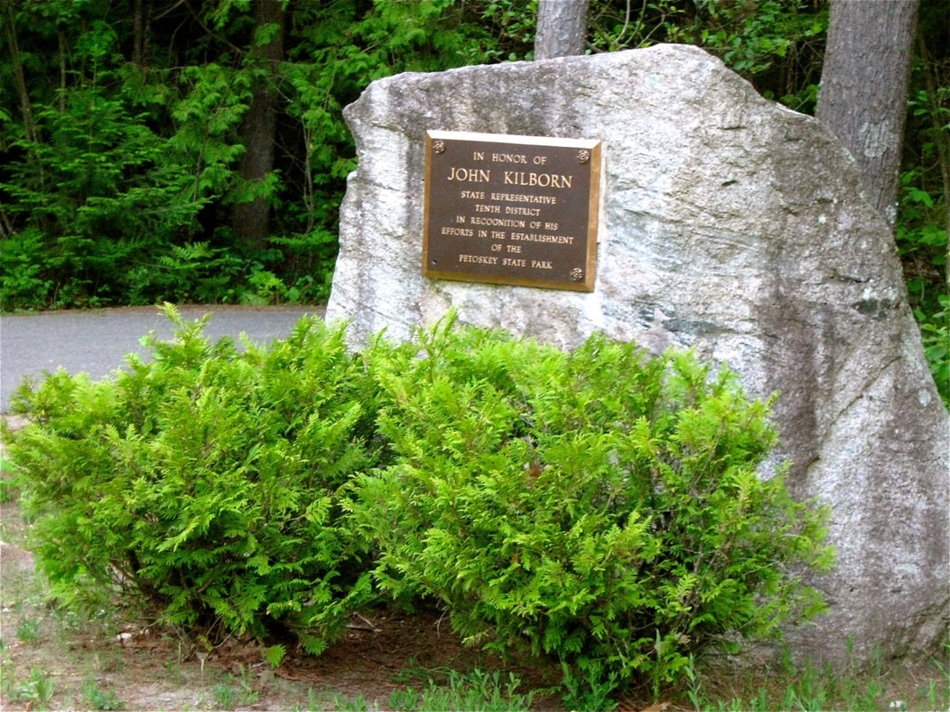
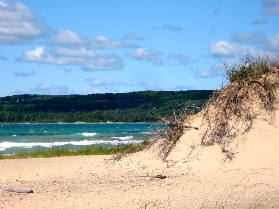
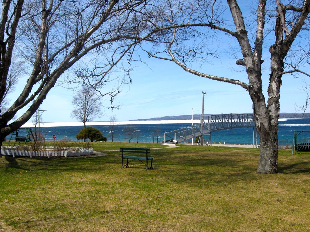
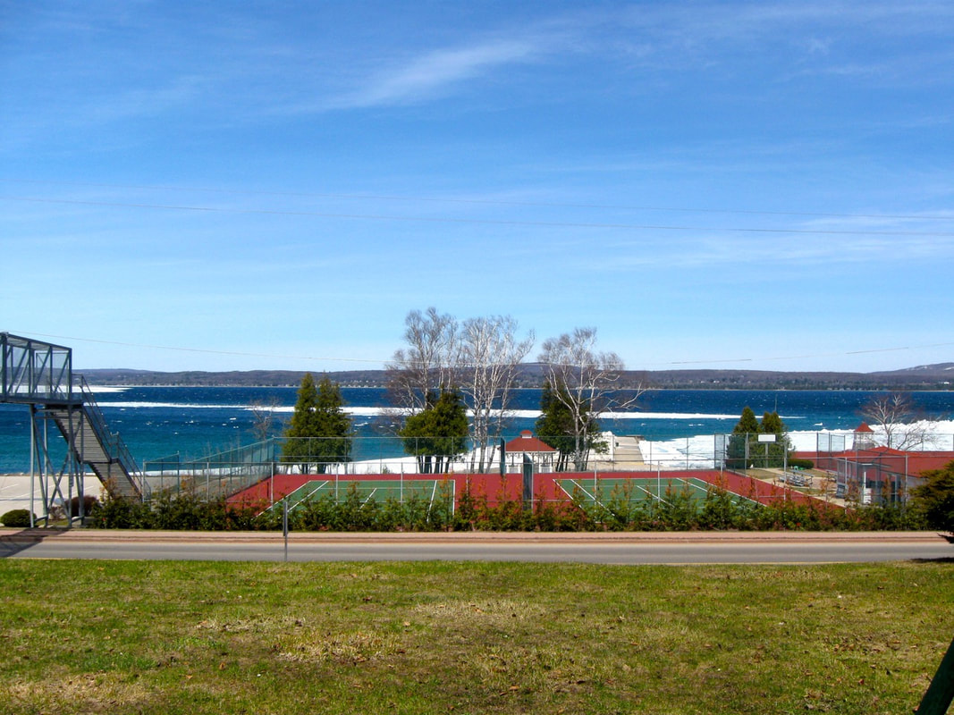
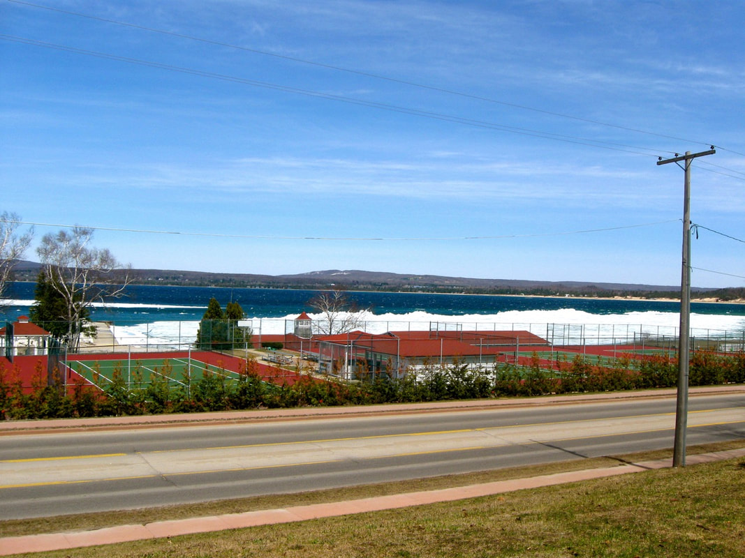
~ Petoskey State Park on Little Traverse Bay ~
~ Petoskey Bathing Beach was sold to the State of Michigan April 1968 ~
(Petoskey State Park opened its campsites to the FIRST campers in July 1970)
(Petoskey State Park opened its campsites to the FIRST campers in July 1970)

25 July 1957 ~ Petoskey News Review
6 April 1965 ~ Petoskey News Review
~Map Used by Representative John Kilborn to Develop Petoskey State Park~
1961
1961
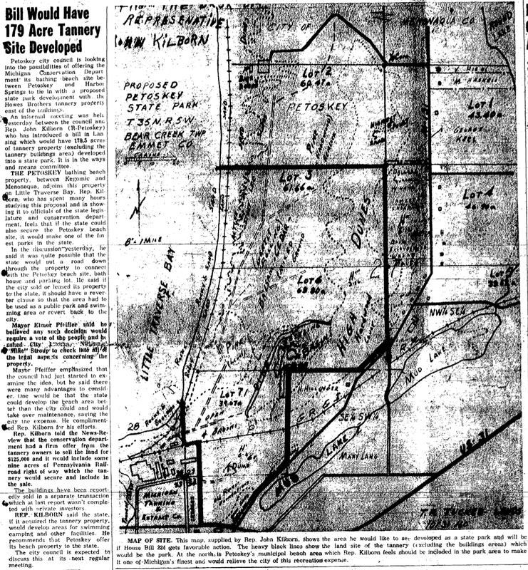
14 April 1961 ~ Petoskey News Review
25 July 1988 ~ Petoskey News Review
Greenwood Photo Archive Collection from Petoskey Newspaper (25 July 1988)
|
Greenwood Photo Archive Collection from Petoskey Newspaper (25 July 1988)
|
25 May 2012
10 August 2011 ~ Karla Buckmaster
20 August 2013 ~ Petoskey State Park on Little Traverse Bay, Petoskey, Michigan
~ Just Waiting for Winter ~
31 October 31 2018
~ Slide Slipping into the Sand ~
(Slip-Sliding Away)
Petoskey State Park by the Waters of Little Traverse Bay
2018
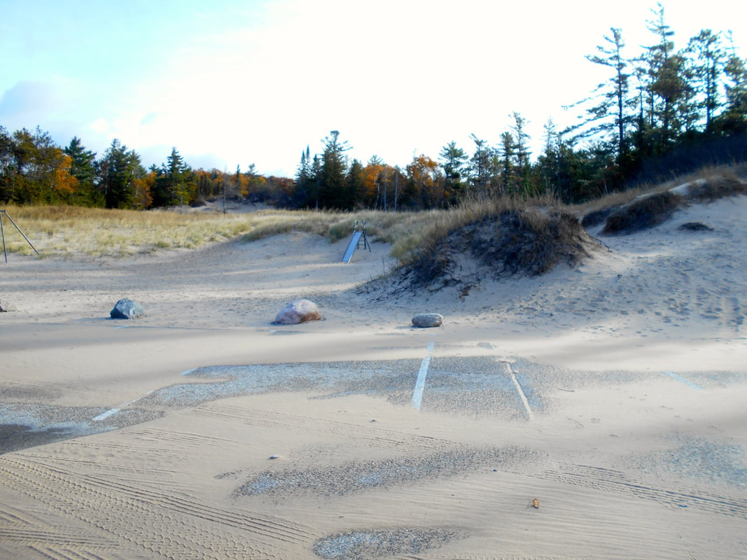
31 October 2018
|
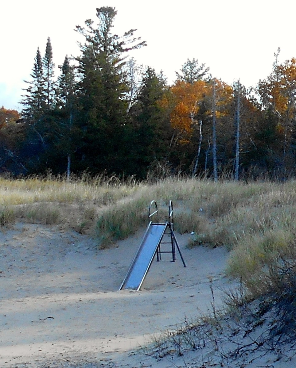
31 October 2018
|
~ Wequetonsing by Little Traverse Bay ~
17 February 2001 ~ Duck Pond by Wequetonsing... looking toward Harbor Point
5 December 2013 ~ From Wequetonsing, Michigan, looking toward Harbor Point
|
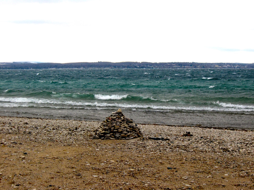
5 December 2013 ~ From Wequetonsing, Michigan, looking over a cairn toward Petoskey across Little Traverse Bay
|
~ Ice Going Out of Little Traverse Bay ~
28 April 2014
28 April 2014
|
28 April 2014
|
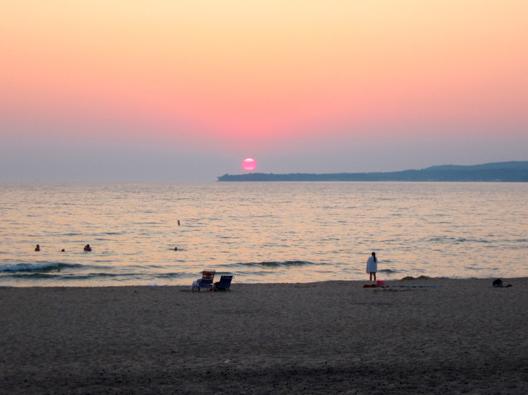
~ Million Dollar Sunset over Little Traverse Billion Dollar Bay ~
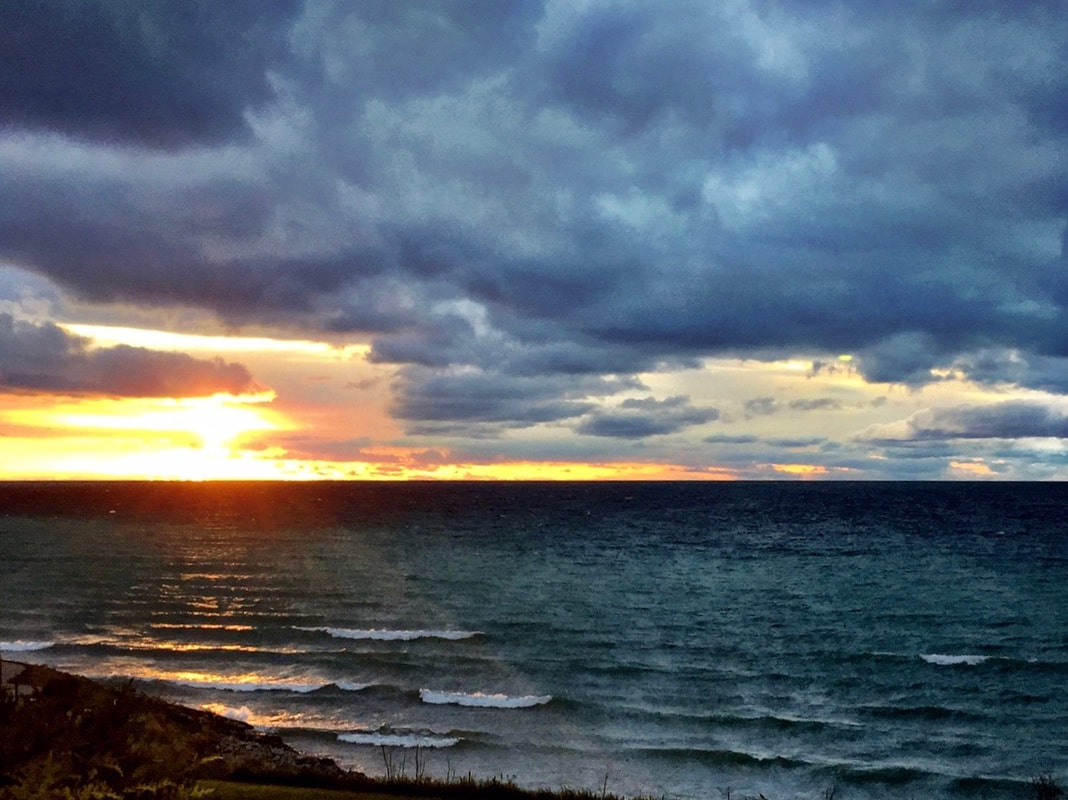
16 May 2016 ~ Million Dollar Sunset over Little Traverse Bay
~ Petoskey's Bay VIEW ~

4 August 2017
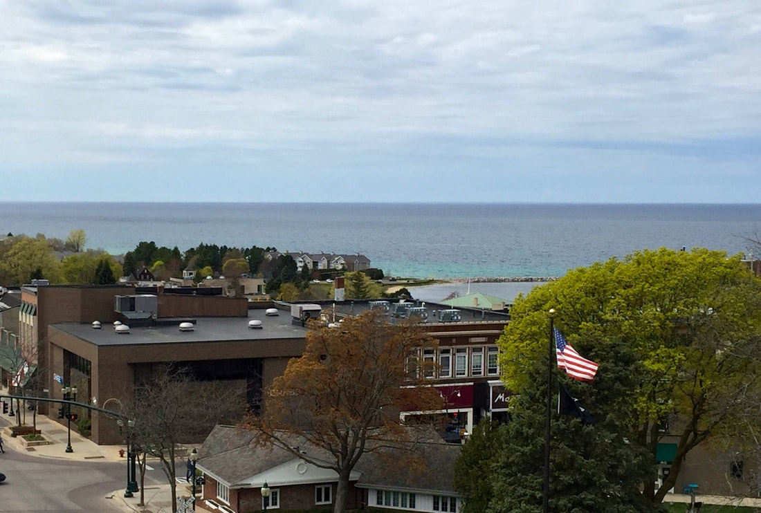
4 August 2017 ~ Welcome to Petoskey's bay VIEW
~ Frozen Water on Crooked Lake ~
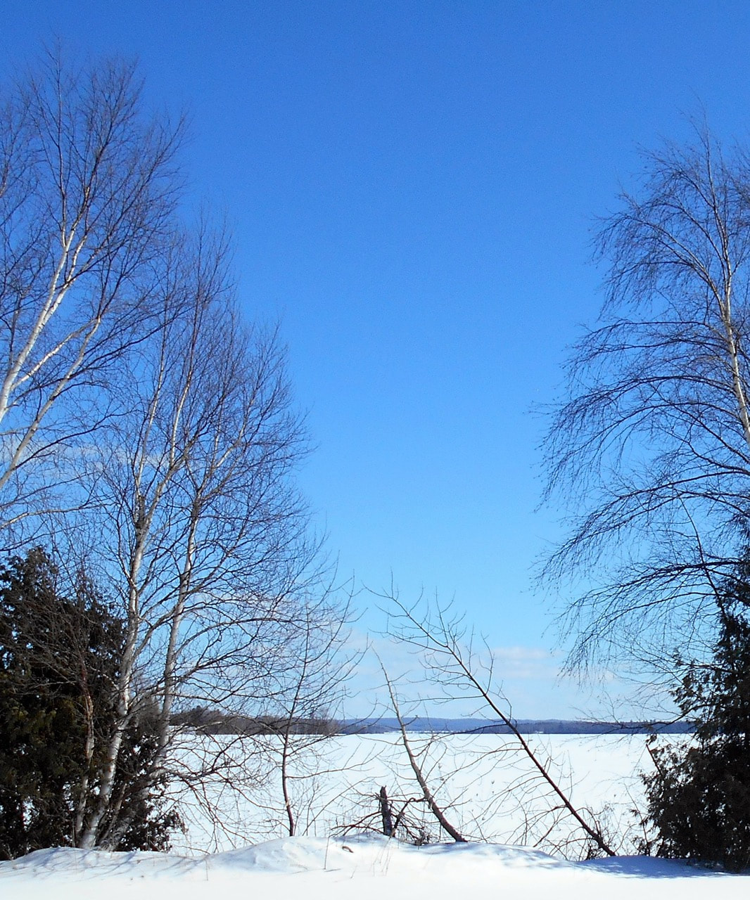
12 February 2018 ~ Frozen Water on Crooked Lake at the Little Traverse Township Boat Launch...
~ Little Traverse Bay's Sunset Toward Harbor Springs ~
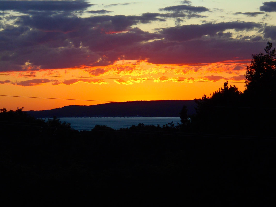
16 July 2018
~ Blustery Fall Day with Waves Shooting over the Breakwall ~
The red barberry was planted to deter the geese from landing and leaving a mess by the water...
so, instead, the geese land and make their mess in the grass on the land side of the barberry.
The red barberry was planted to deter the geese from landing and leaving a mess by the water...
so, instead, the geese land and make their mess in the grass on the land side of the barberry.
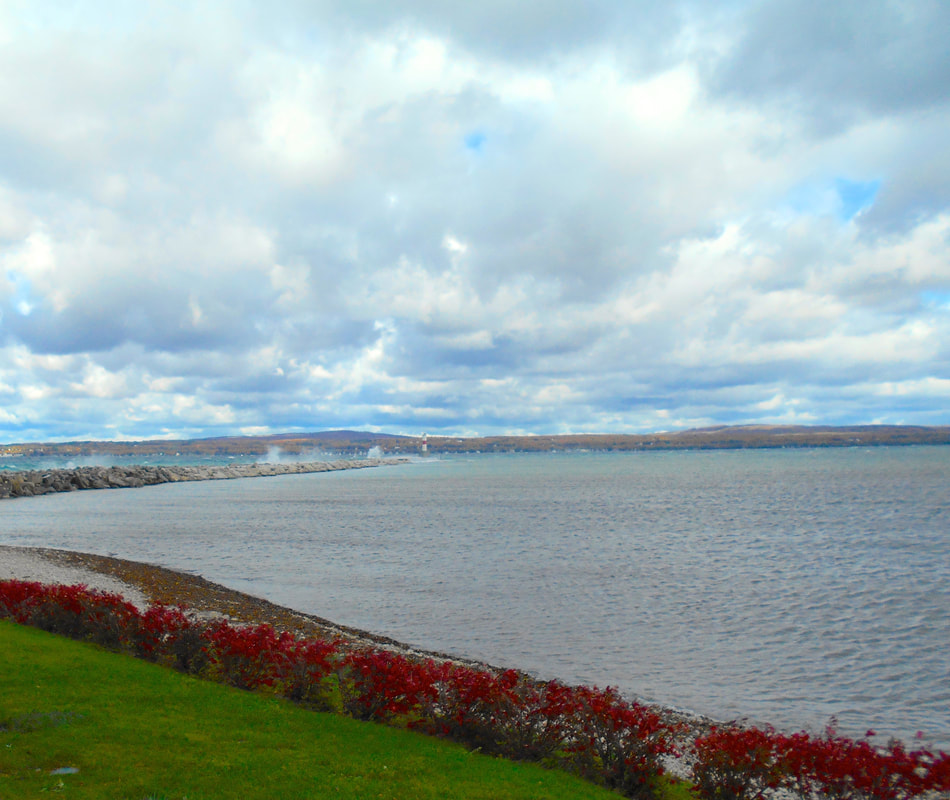
17 October 2018
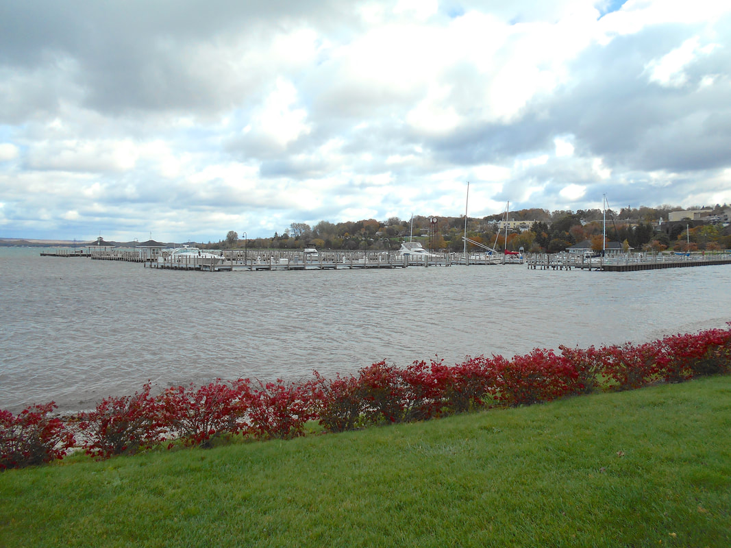
17 October 2018
|
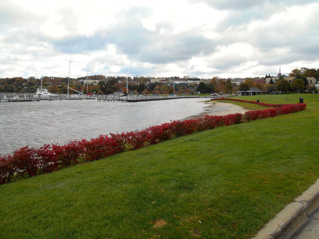
17 October 2018
|
~ Emmet County Water Resource Data ~
Undated
Undated
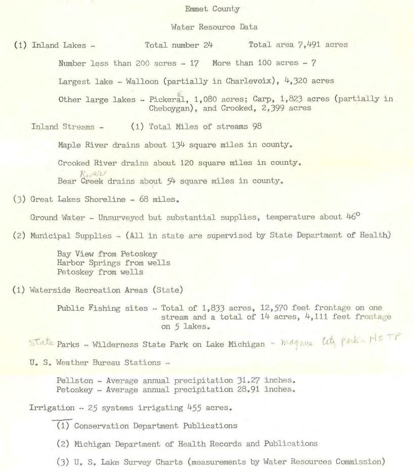
Undated ~ Old papers with Petoskey News Review items...
