Northern Mich~Mash Preserve
Petoskey's Bear River
~ BRIDGES ~
&
~ DAMS ~
Nowhere in the whole region is there so grand a water power as is furnished by Bear river. Bear lake [Walloon lake], Bear River's source is twelve miles long, and one mile in width, and is situated 100 feet above the level of the bay, into which it empties. Bear River's chief falls are all in the near neighborhood of Petoskey, Michigan. The various mills and factories upon its banks do not begin to utilize its force. Surrounded by the choicest timber, including the much-sought black birch, bird's eye and curly maple, and with the advantage of cheap transportation by land and water, every inducement to the manufacturer to locate is here. ~ "Historical Sketch of the Village of Petoskey combined with a City Directory for 1882"
The design and compilation of the text and photos on this site are copyrighted 2017.
Most posted items will enlarge by "clicking" on them.
"Clicking" on some color highlighted words may access additional information.
Most posted items will enlarge by "clicking" on them.
"Clicking" on some color highlighted words may access additional information.
Please do not copy the photos on this site, many of which have been submitted by private individuals...
just come back and visit the site often to view the photos.
just come back and visit the site often to view the photos.
Bridges and Dams listed in order from the river's upper flow heading toward the mouth of the river at the bay...
CLICK on any of the names below
to access information for that particular Bridge or Dam!
CLICK on any of the names below
to access information for that particular Bridge or Dam!
Petoskey's Bear River BRIDGES:
Standish Street Bridge
Sheridan Street Bridge
McManus and/or Bridge Street Bridge
Mitchell Street Bridge
Lake Street Bridge (plus... Foot Bridge and Railroad Bridge)
Standish Street Bridge
Sheridan Street Bridge
McManus and/or Bridge Street Bridge
Mitchell Street Bridge
Lake Street Bridge (plus... Foot Bridge and Railroad Bridge)
Petoskey's Bear River DAMS (with Removal Dates):
McManus Dam – 1973 Removal
Mitchell Dam – 1991 Removal
Hankey Dam – April 1951 Washout
Penstock Dam – April 1959 Washout ~ October 1968 Removal
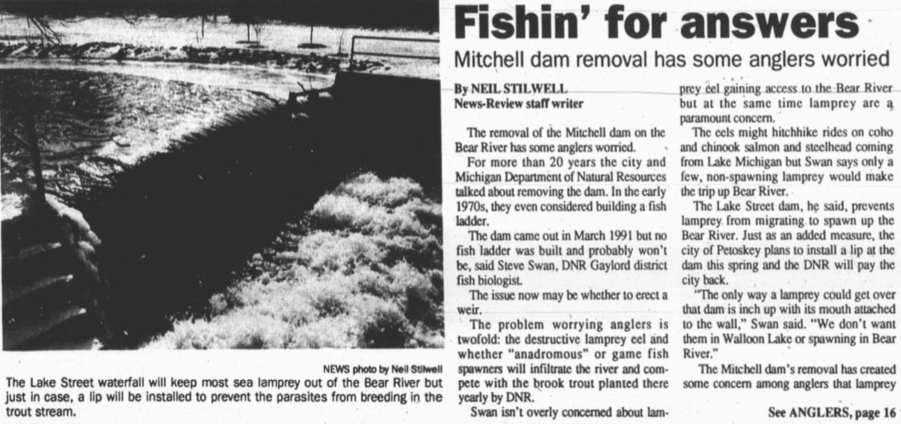
Bear River Low Head Dam/Weir (Lake Street)
– 2019 Options to remove being discussed...
McManus Dam – 1973 Removal
Mitchell Dam – 1991 Removal
Hankey Dam – April 1951 Washout
Penstock Dam – April 1959 Washout ~ October 1968 Removal
Bear River Low Head Dam/Weir (Lake Street)
– 2019 Options to remove being discussed...
1855 ~ First Bear River Mill
Andrew Porter, missionary and a permanent white settler,
built the first Petoskey mill, a gristmill, on the Bear River.
Andrew Porter, missionary and a permanent white settler,
built the first Petoskey mill, a gristmill, on the Bear River.
Photo Below: Mouth of the Bear River 1877-78 (Later... the Chicago & West Michigan Railroad Park)
Wading in the Bear River was a Pastime of Tourists in the early days.
Wading in the Bear River was a Pastime of Tourists in the early days.

c
1961 ~ Bear River
Little Traverse Historical Museum Photo Archive ~ Labeled 1 September 1961 Petoskey News Review "Your Daily Picture" Petoskey, Michigan
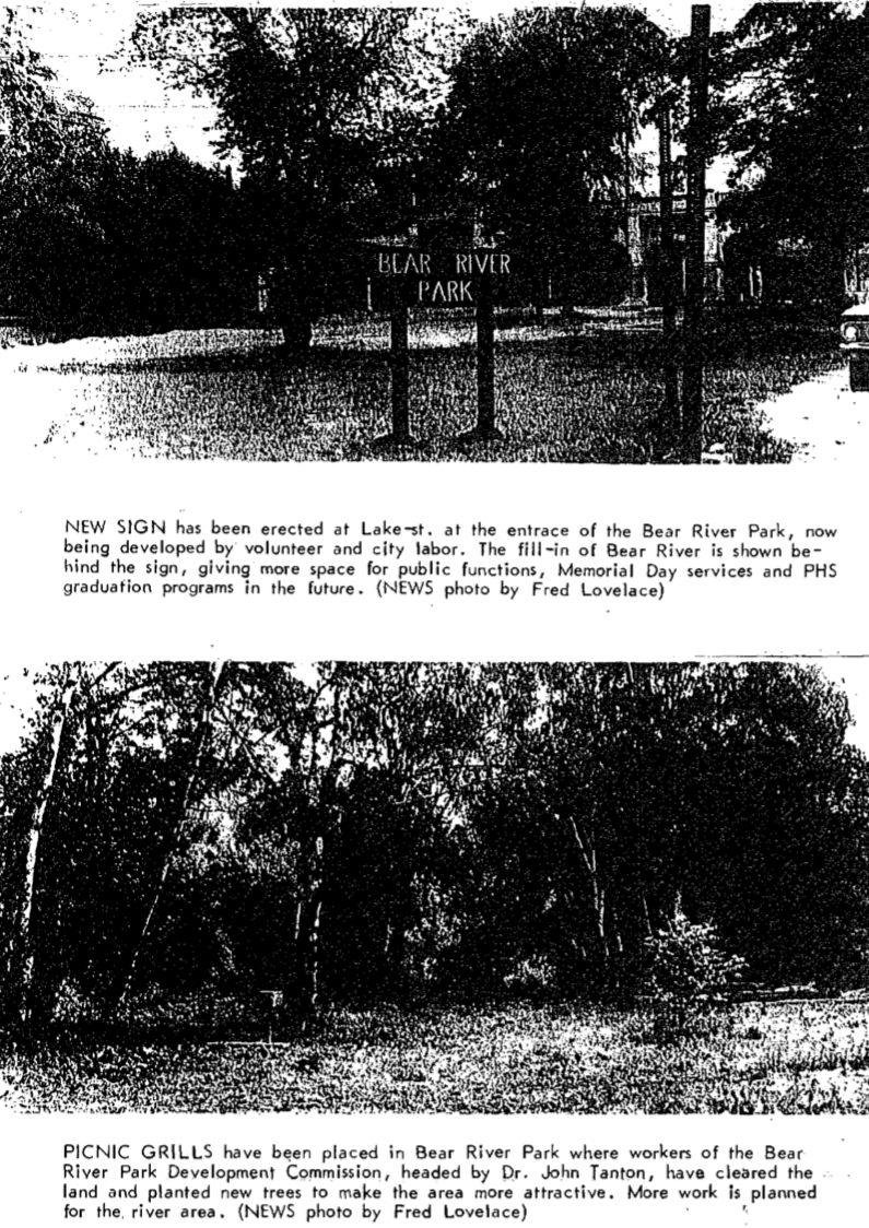
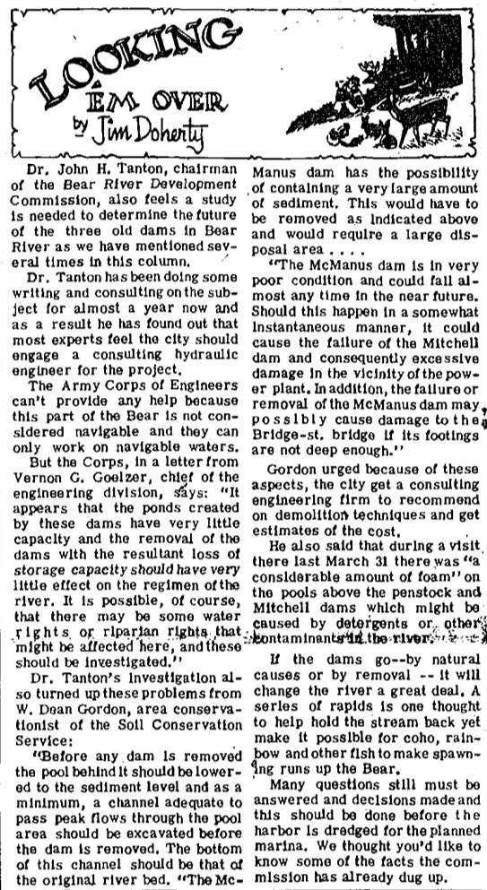
Today [2022] the only remaining one of Petoskey's Bear River five dams listed above is the Lake Street Dam (Bear River Low Head Dam/Weir) as noted above. With the four dams removed, the Bear River drops about 75 feet from Sheridan Street to reach Little Traverse Bay. Much of the river bottom is sand and gravel, with the banks lined with boulders. Much concrete in and near the river are remnants of the old dams, but some is placed riprap from the 1960s when the old Mitchell Street concrete post office was torn down and the debris was placed beside the river near the Lake Street Dam to narrow and straighten the course of the river at the Mineral Well Park area.
Harnessing the power of the Bear River saw early vying for industrial sites.
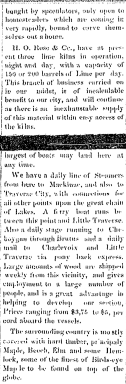
1867 ~ Hiram O. Rose bought the Andrew Porter Sawmill
while
Rose also was beginning to process the lime along the Petoskey Waterfront.
(Hiram Rose became the FIRST Village of Petoskey president.)
1875 ~ Hiram Rose leased his waterfront power rights to Loveless Blayney, who established a sawmill.
1875 ~ Mr. Gemmil and Mr. Kilborn built a sawmill on the old Porter gristmill site.
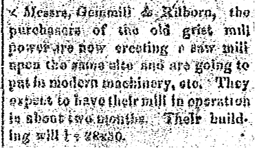
18 June 1875 ~ Emmet County Democrat
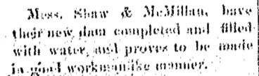
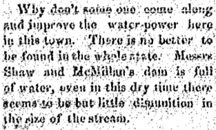
1875 ~ Water Power from Bear River was offered for free to interested manufacturers...
by Shaw & McMillan per article below
by Shaw & McMillan per article below

4 June 1875 ~ Emmet County Democrat
|
Transcription of article at left:
"The enterprising firm of Shaw & McMillan have recently purchased a tract of land bordering upon Bear River, and includes a portion of the best water power to be found in the State of Michigan. The jobbers are already at work clearing the ground and getting ready to erect a dam upon the upper portion of their land which will turn the river from its natural course into a race where will be mills erected from time to time. They make this generous offer to manufacturers that any corporation or firm that will come here and erect manufacturing interests that will employ 25 men the entire year, they (Shaw & McMillan) will give them water to drive their machinery and land to build on without money and without price. This truly generous offer cannot not be accepted by some firm ere long for a water power which is so complete as this is, can seldom be found. Bear River is the outlet of Bear Lake [Walloon Lake], a lake about 15 miles in length which affords a never failing supply of water even during the driest portion of the year. There is an inexhaustible supply of cedar about here suitable for wooden ware of all kinds, also any quantity of handsomest birds-eye maple that ever grew and will make the finest kind of furniture." 
12 August 1875 ~ Emmet County Democrat
|
Article Below: Water supply controlled by dam owners can create a water famine
that affects the safety of the village from property fire.
that affects the safety of the village from property fire.
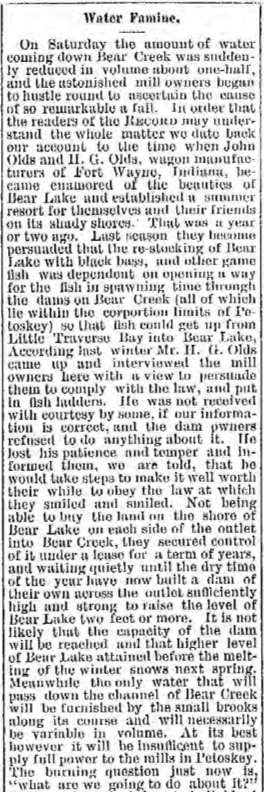
14 August 1889 ~ The Petoskey Record article continued column at right...
|

14 August 1889 ~ The Petoskey Record article continued from left column...
|
1881 ~ Original Bear "Creek" Outlet into Little Traverse Bay
(river originally angled to the east)
(river originally angled to the east)

Image 1 of 1885 Sanborn Fire Insurance Map from Petoskey, Emmet County Michigan
1891 ~ Bear River Outlet into Little Traverse Bay was Realigned...
Compare 1885 Map Above to 1896 Map Below
Compare 1885 Map Above to 1896 Map Below
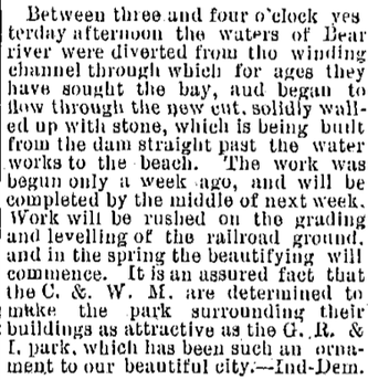
11 November 1891 ~ The Petoskey Record
1891 ~ Bear "Creek" Outlet into Little Traverse Bay was Realigned
(river realigned to shoot straight north into the bay)
(river realigned to shoot straight north into the bay)
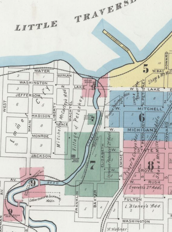
Image 1 of 1896 Sanborn Fire Insurance Map from Petoskey, Emmet County Michigan
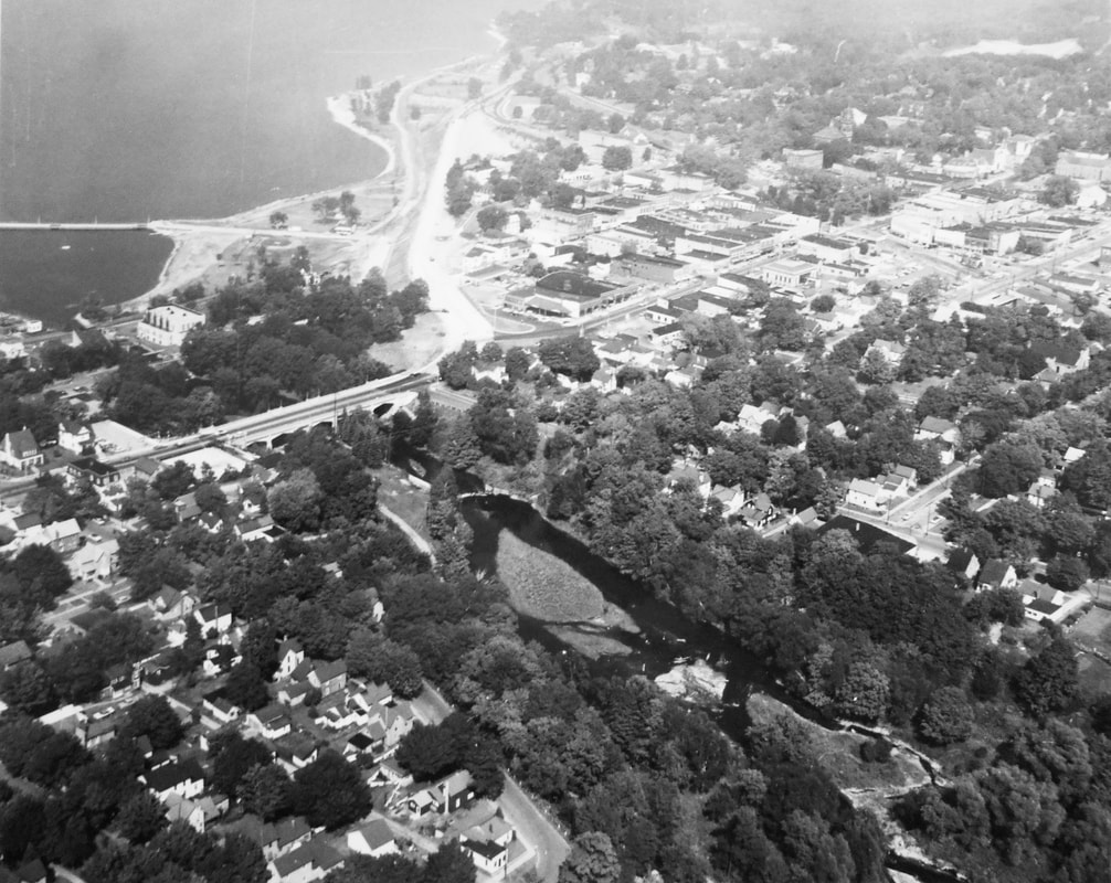
OLD Bridges at Mitchell Street and Lake Street
AND Lake Street Dam
AND Lake Street Dam
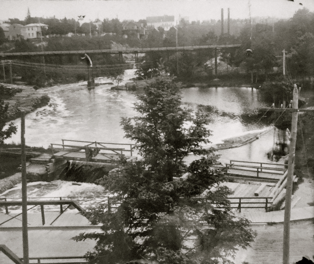
Little Traverse Historical Society Photo Collection (McCune Album)
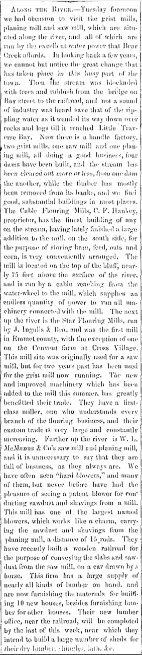
17 September 1875 ~ Emmet County Democrat article continued column at right...
|
17 September 1875 ~ Emmet County Democrat article continued from left column...
Articles Above, Left and Below: Already of note is that "One large dam which has lately been thrown across the stream by Shaw & McMillan, affords a splendid chance for some enterprising firm as they offer to give to any Manufacturing Co., which will employ 25 hands..."
17 September 1875 ~ Emmet County Democrat
28 July 1876 ~ Emmet County Democrat
|
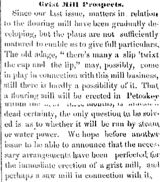
28 December 1877 ~ Emmet County Democrat
|
19 April 1878 ~ Emmet County Democrat
21 June 1878 ~ Emmet County Democrat
|
25 July 1878 ~ Petoskey City Record
|

5 July 1878 ~ Emmet County Democrat
|
15 August 1878 ~ Petoskey City Record
|

16 August 1878 ~ Emmet County Democrat
22 August 1878 ~ Petoskey City Record

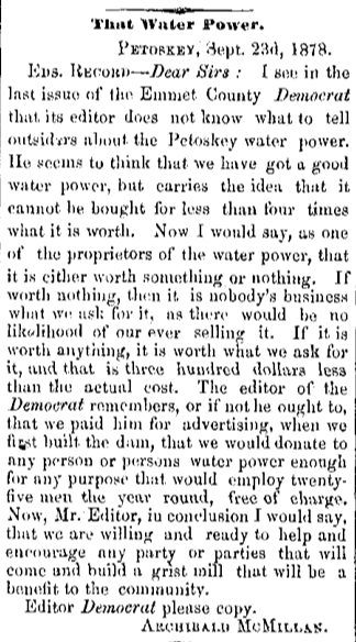
20 September 1878 ~ Emmet County Democrat
|
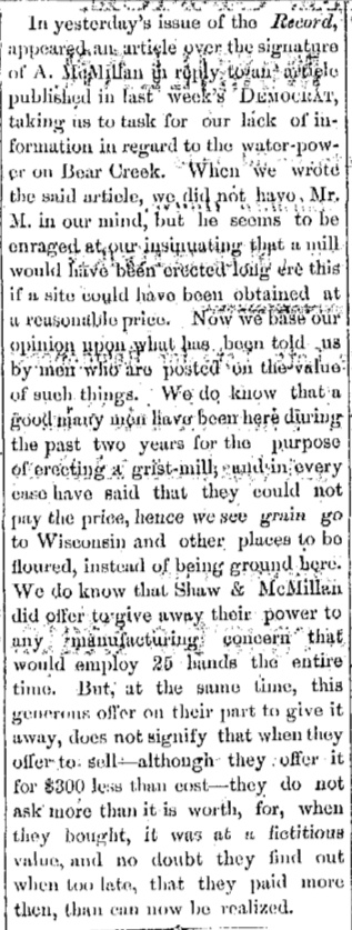
26 September 1878 ~ Petoskey City Record
|
27 September 27 1878 ~ Emmet County Democrat
|
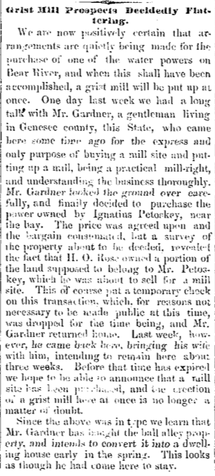
17 October 1878 ~ Petoskey City Record
|
24 October 1878 ~ Petoskey City Record
|
25 October 1878 ~ Emmet County Democrat
|
30 September 1880 ~ Petoskey City Record
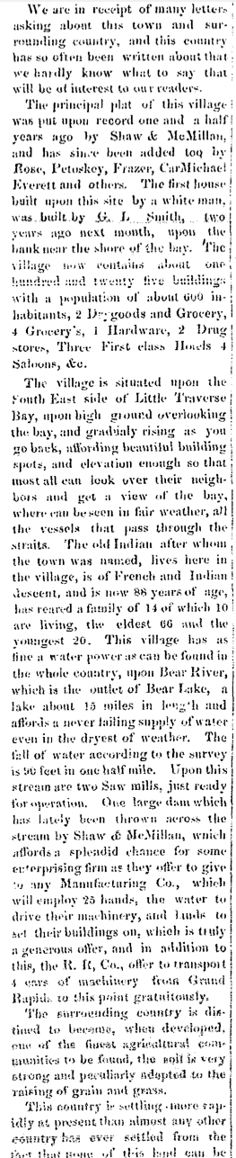
Photo Below: Petoskey's FIRST Factory is shown with lumber, and near the Bear River
with Little Traverse Bay in the background, but no date, or name for the factory was labeled.
with Little Traverse Bay in the background, but no date, or name for the factory was labeled.
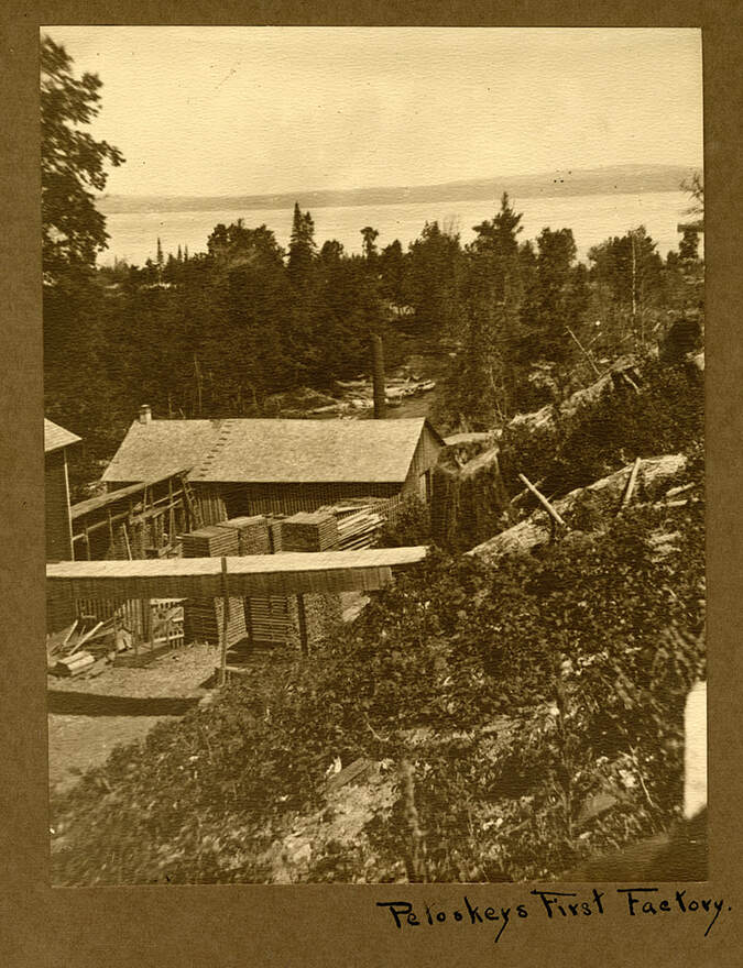
Little Traverse Historical Society Photo Collection (Undated)
* Ken Winters wrote in Historical Glimpses Petoskey on page 52: "In 1866, the family [Hazen Ingalls] again moved, to Bear River, where Mr. Ingalls purchased, reportedly from H.O. Rose, the Bear River water power and sawmill built about 1862 by a nephew of Andrew Porter. Ingalls engaged in farming and later changed the mill to a gristmill." Allan McCune told in the article below that H.O. Rose began buying property on both sides of the Bear River as early as 1862. Rose became very influential in the development of Petoskey with its water related industries.

10 July 1952 ~ Northern Michigan Review
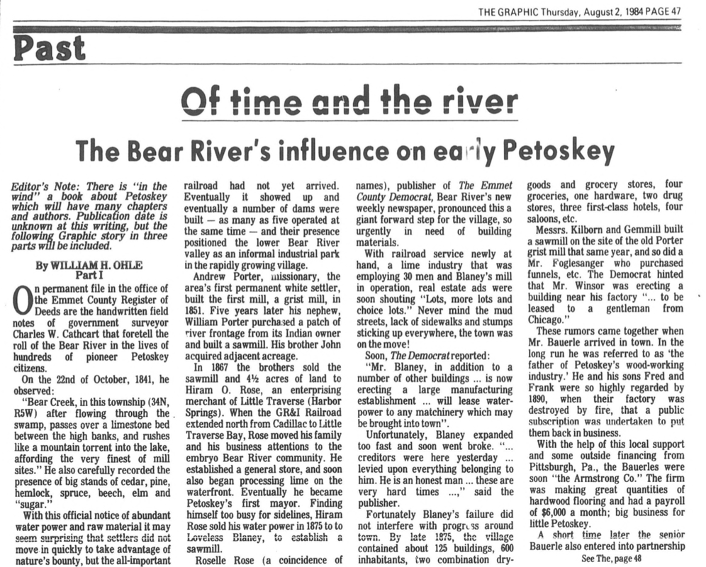
2 August 1984 ~ The Graphic continued article below...
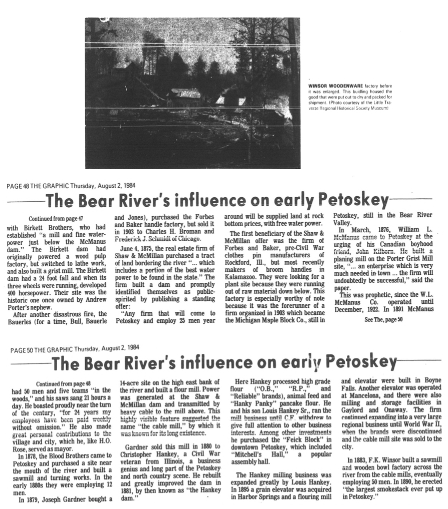
2 August 1984 ~ The Graphic continued article from above...
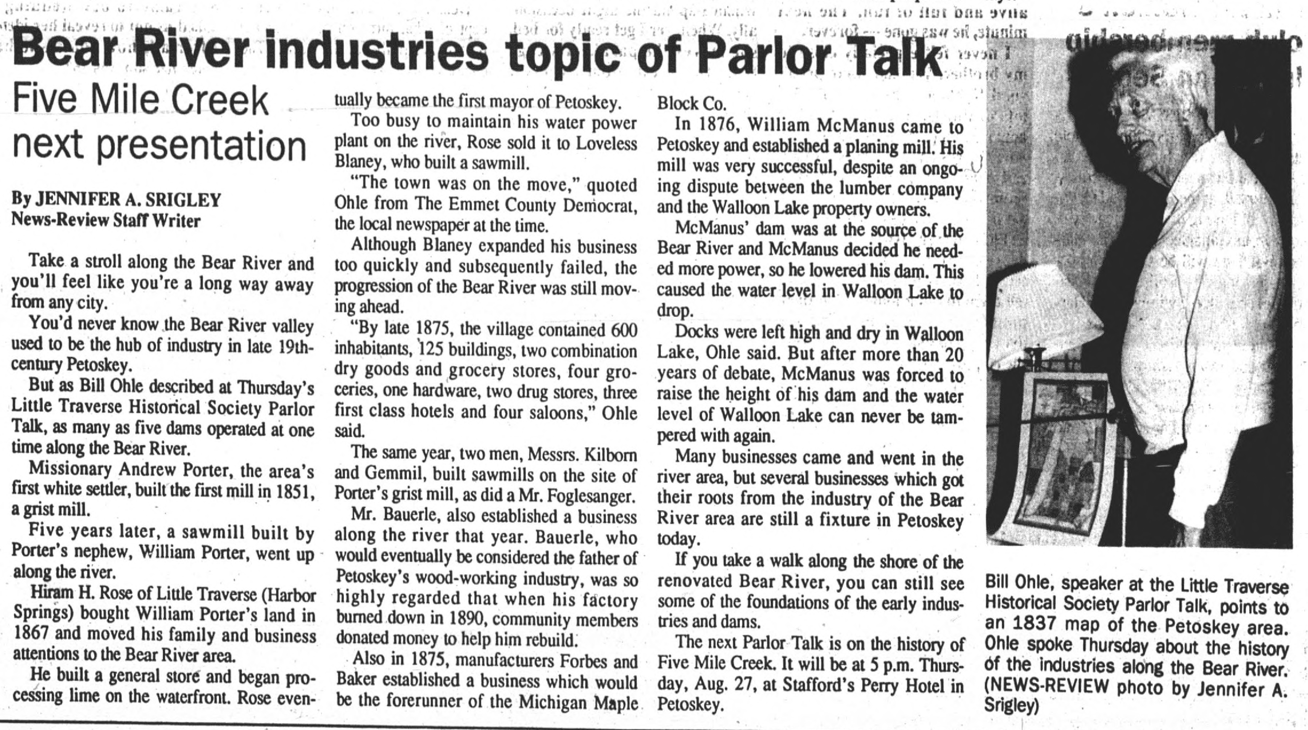
24 August 1992 ~ Petoskey News Review
DAM Map
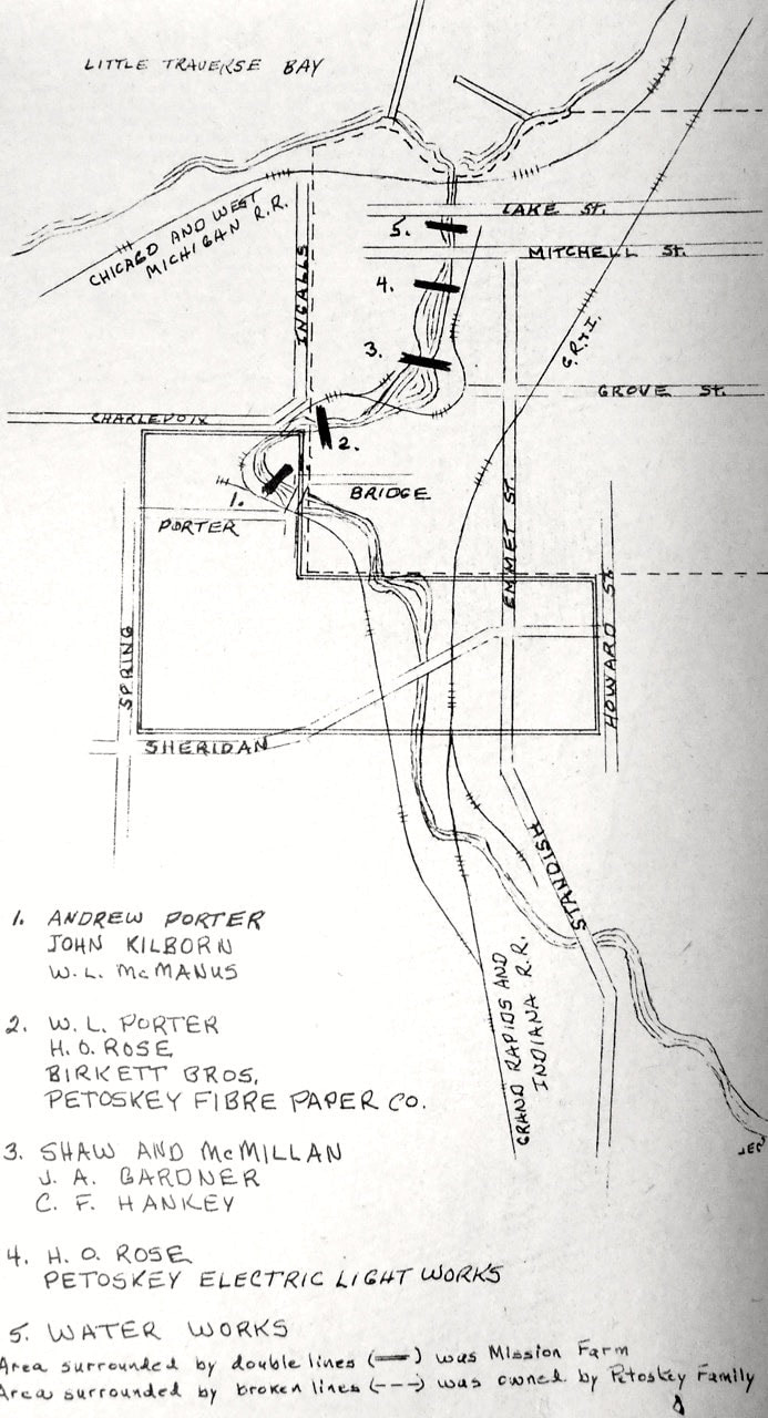
Map Below after 1891 when the mouth outlet to Little Traverse Bay was realigned: Over the years FIVE of the dams that existed on the Bear River are shown in order from the river's upper flow heading north toward the mouth of the river at the bay (with associated early industry owners):
1) McManus Dam (Andrew Porter, John Kilborn, W.L. McManus]
[Goes over Bridge Street into Porter Street and Curtis Avenue]
2) Mitchell Dam (W.L. Porter, H.O. Rose, Birkett Bros., Petoskey Fibre Paper Co., site of Hazen Ingalls mill*)
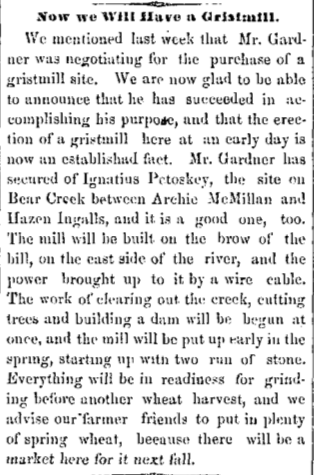
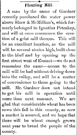
3) Hankey Dam (Shaw and McMillan, J.A. Gardner, C.F. Hankey)
4) Penstock Dam (H.O. Rose, Petoskey Electric Light Works)
[South of the Mitchell Street Bridge]
5) Lake Street Low Head Dam/Weir (Water Works)
[Lake Street ~ Only Petoskey Bear River dam left in 2019}
~~~~~~~~~~~~~~~~~~~~~~~~~~~~~~~~~
6) Rose leased water power to Loveless Blayney, used by the Blood Brothers (Not shown on map, but on the Mouth of the Bear River close to the bay outlet)
1) McManus Dam (Andrew Porter, John Kilborn, W.L. McManus]
[Goes over Bridge Street into Porter Street and Curtis Avenue]
2) Mitchell Dam (W.L. Porter, H.O. Rose, Birkett Bros., Petoskey Fibre Paper Co., site of Hazen Ingalls mill*)
3) Hankey Dam (Shaw and McMillan, J.A. Gardner, C.F. Hankey)
4) Penstock Dam (H.O. Rose, Petoskey Electric Light Works)
[South of the Mitchell Street Bridge]
5) Lake Street Low Head Dam/Weir (Water Works)
[Lake Street ~ Only Petoskey Bear River dam left in 2019}
~~~~~~~~~~~~~~~~~~~~~~~~~~~~~~~~~
6) Rose leased water power to Loveless Blayney, used by the Blood Brothers (Not shown on map, but on the Mouth of the Bear River close to the bay outlet)
24 May 1968 ~ Petoskey News Review
 24 May 1968 ~ Petoskey News Review
As compiled below...
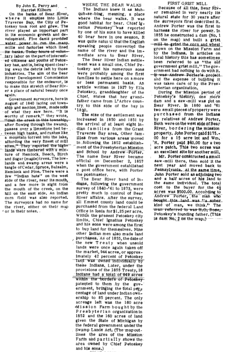
For Michigan Week in 1968, the Little Traverse Regional Historical Society reviewed the Early Days; the 24 May 1968 Petoskey News Review published the map (above) and writings of John E. Perry and Harriet Kilborn, noted Local Historians, concerning the role the Bear River with its "Bridges and Dams" played in Petoskey History.
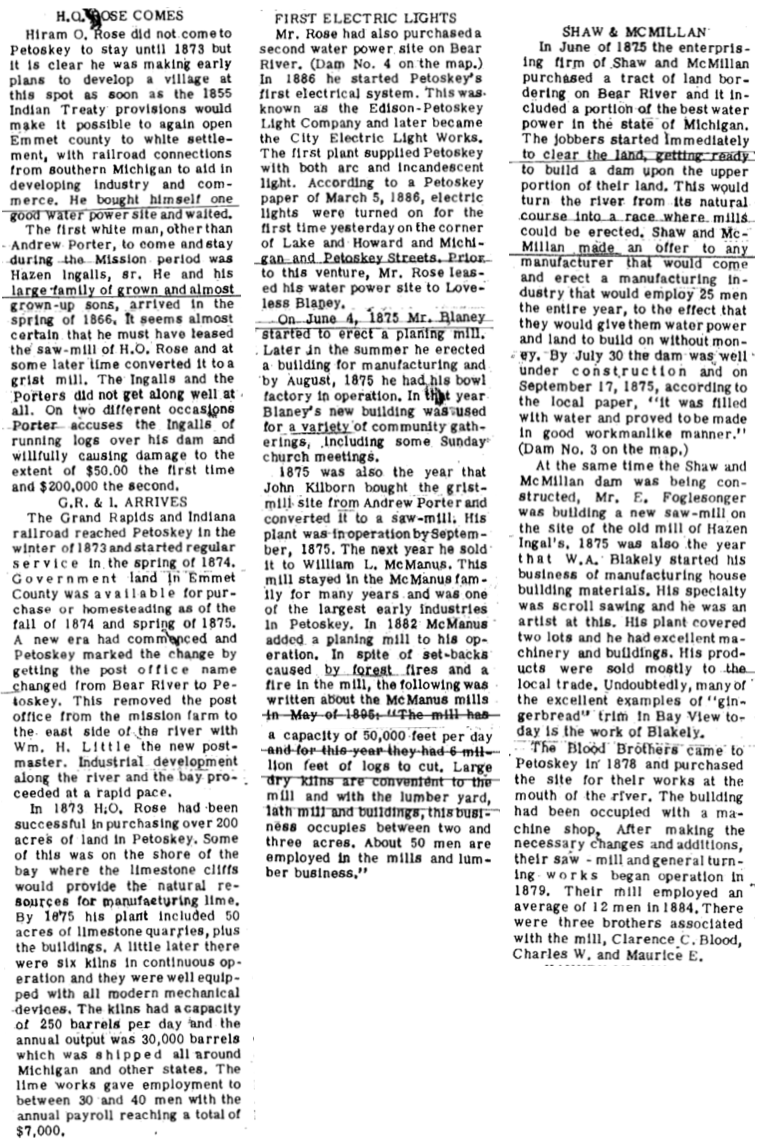
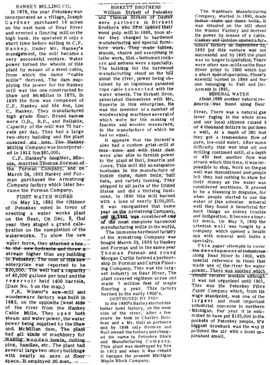
John Perry and Harriet Kilborn's article is compiled on the following three pages... to read the article in proper order, read each full page as presented here, before continuing to the next page.

ONE
TWO
THREE
Early industrialists on the banks of the Bear River...
Photo Below Labeled: "Frank D. Merchant Lumber Mills on the Bear River, south of Sheridan Street"
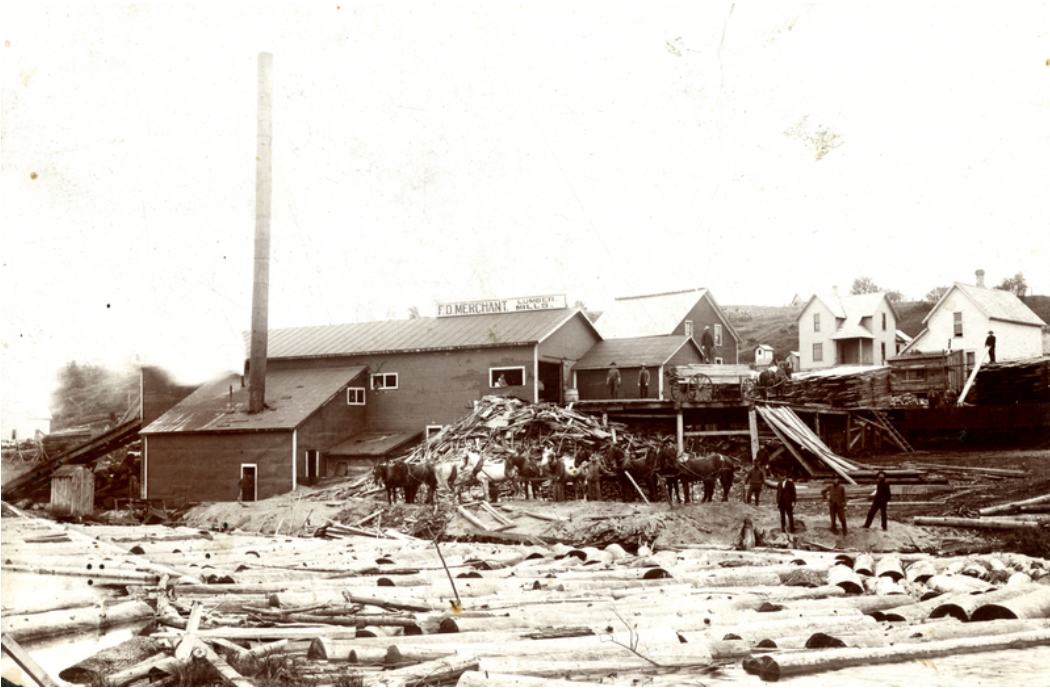
Little Traverse Historical Society Photo Collection (undated)
26 March 1884 ~ The Petoskey Record
|
7 June 1890 ~ The Daily Resorter
|

The Traverse Region ~ 1884 (Page 165)
~ 1901 ~
20 February 1901 ~ The Petoskey Record
~ 1902 ~
Map of Dams and Bridges on the Bear River within the City of Petosky
Map of Dams and Bridges on the Bear River within the City of Petosky
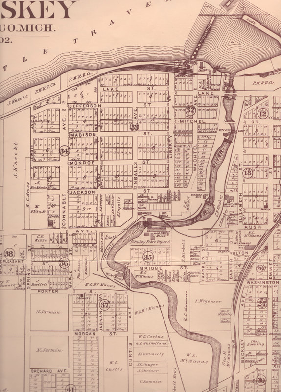
Map is Included in the 1902 Emmet County Plat Book
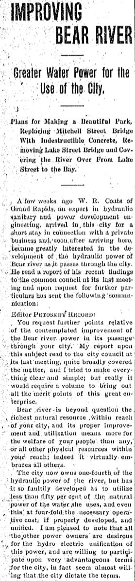
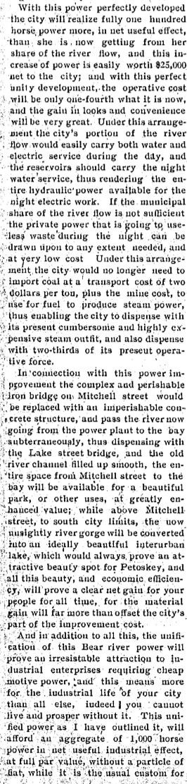
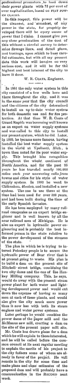
1910 ~ Improving Bear River Power
12 January 1910 ~ The Petoskey Record article continued column at right...
|
12 January 1910 ~ The Petoskey Record article continued column at right...
|
12 January 1910 ~ The Petoskey Record article continued column from left...
|
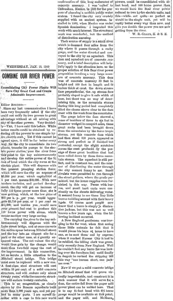
12 January 1910 ~ The Petoskey Record
1910
|
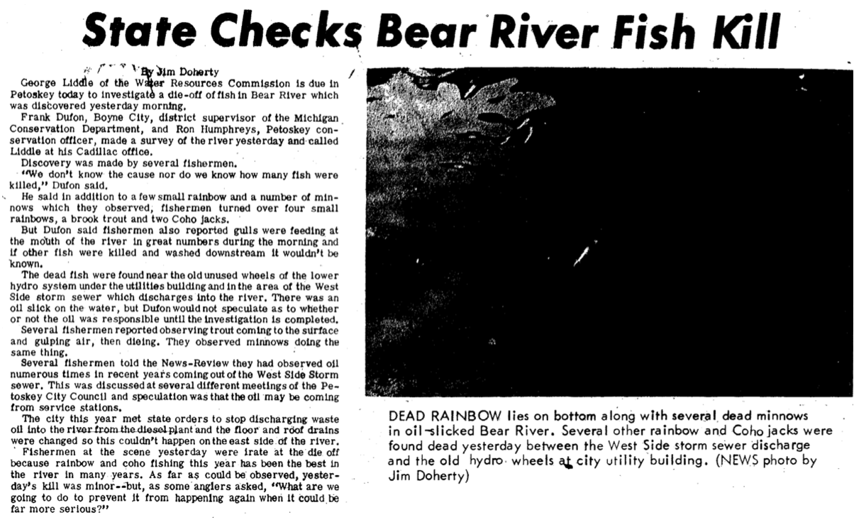
Article Below: Fish Ladder on Bear River
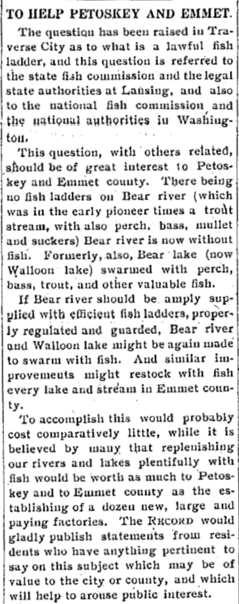
26 January 1910 ~ The Petoskey Record
|
|
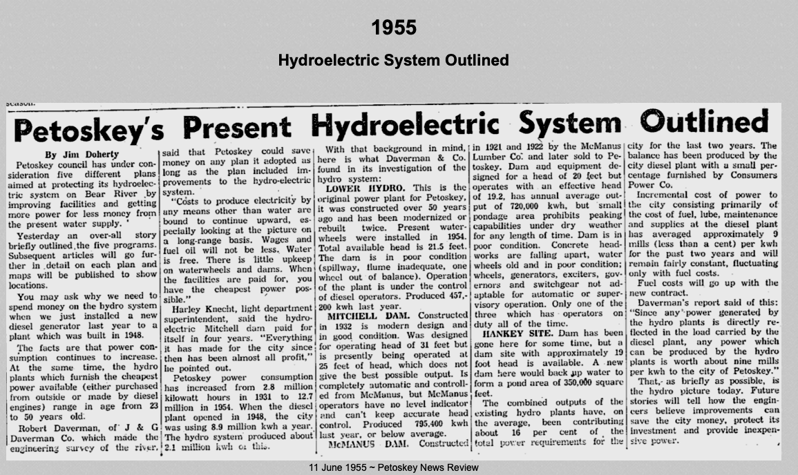
1966
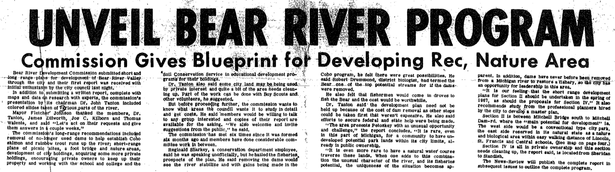
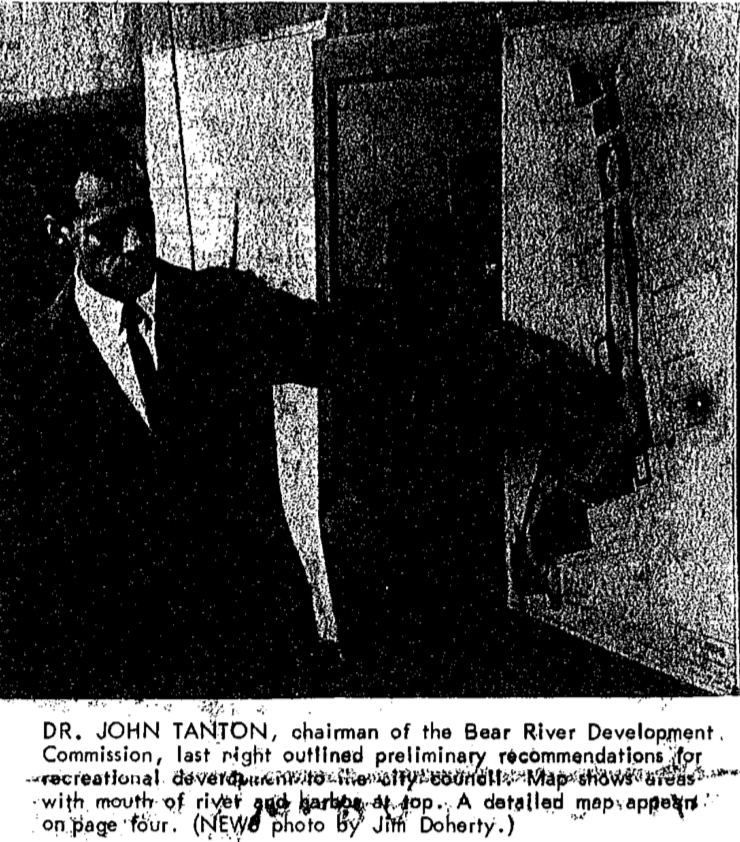
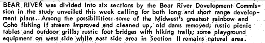
3 November 1966 ~ Petoskey News Review
20 December 1966 ~ Petoskey News Review
20 December 1966 ~ Petoskey News Review
|
20 December 1966 ~ Petoskey News Review
|

Undated newspaper, probably Petoskey News Review
1965 AND 1968
What is the connection with the term Penstock Dam on the above map
AND the word "penstock" in the text under the second photo below?
The definition of "penstock" is:
1. a sluice or floodgate for regulating the flow of a body of water
2. a channel for conveying water to a waterwheel or turbine
(Penstock Dam – Rose/Petoskey Power and Light Dam was removed October 1968)
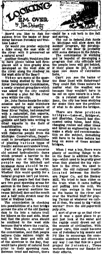
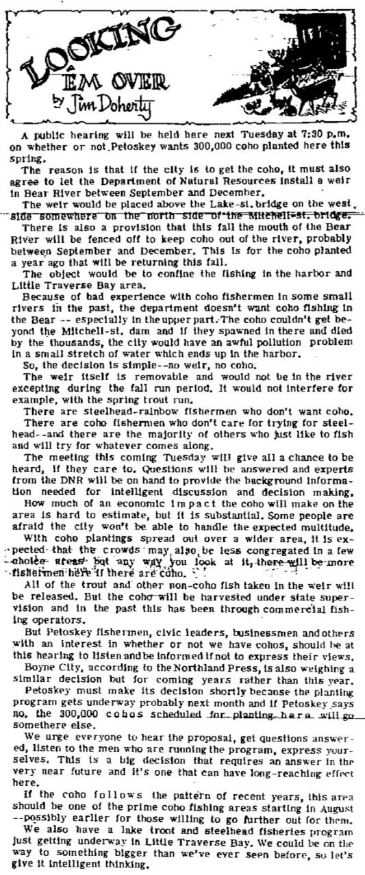
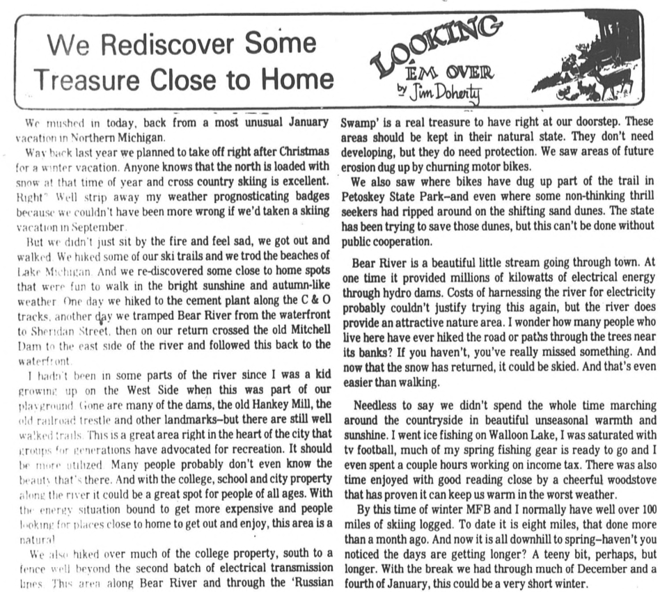
3 November 1966 ~ Petoskey News Review (article written by Jim Doherty)
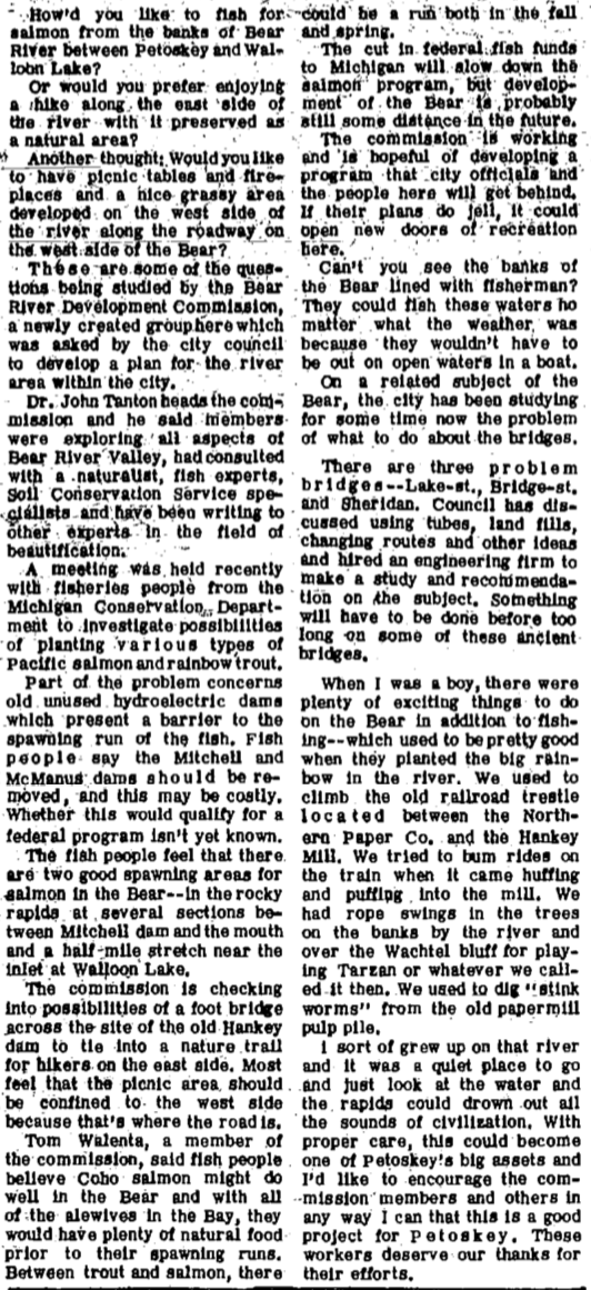
July 1968
Tree on Bear River Over Power Line
Tree on Bear River Over Power Line
Greenwood Photo Archive Collection from Petoskey Newspapers (July 1968)
|
Greenwood Photo Archive Collection from Petoskey Newspapers (July 1968)
|
4 October 1967 ~ Petoskey News Review
23 August 1967 ~ Petoskey News Review

16 November 1967 ~ Petoskey News Review
22 November 1967 ~ Petoskey News Review

8 February 1968 ~ Petoskey News Review
2 March 1970 ~ Petoskey News Review
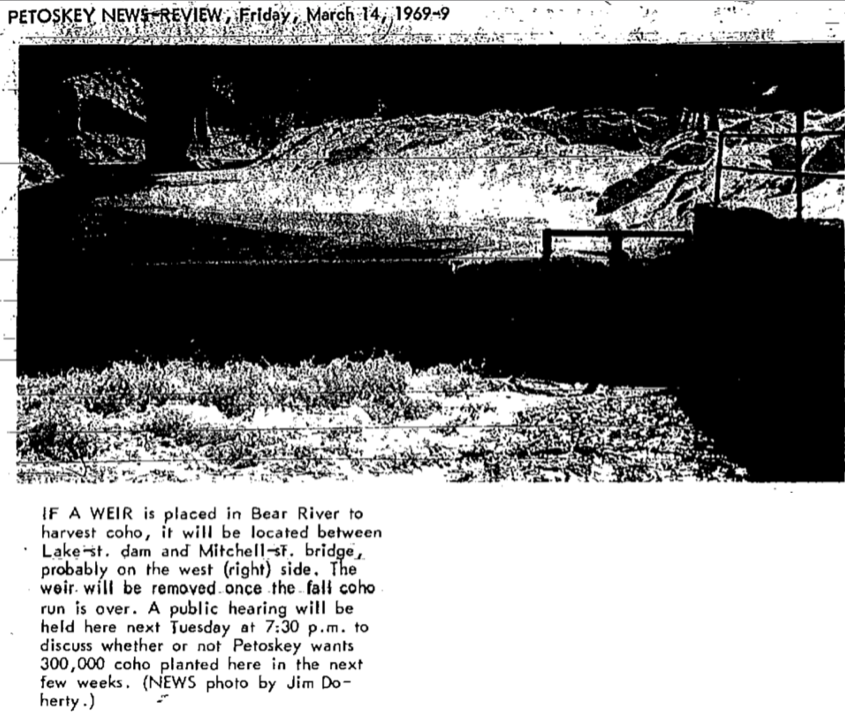
14 March 1969 ~ Petoskey News Review article continued below left column...
14 March 1969 ~ Petoskey News Review article continued right column...
|
14 March 1969 ~ Petoskey News Review article continued from left column...

9 September 1970 ~ Petoskey News Review
|
1976
Bear River winds past the Petoskey Public Schools' stadium, under the Standish Bridge,
past the Michigan Maple Block Company,
then on down through the river valley out to Little Traverse Bay.
Bear River winds past the Petoskey Public Schools' stadium, under the Standish Bridge,
past the Michigan Maple Block Company,
then on down through the river valley out to Little Traverse Bay.
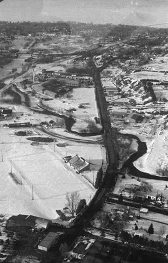
Greenwood Photo Archive Collection from Petoskey newspapers (1976)
8 January 1980 ~ Petoskey New Review
~~~~~~~~~~~~~~~~~~~~~~~~~~~~~~~~~~~~~~~~~~~
13 March 1992 ~ Petoskey News Review article continued below...
13 March 1992 ~ Petoskey News Review article continued from above...
~~~~~~~~~~~~~~~~~~~~~~~~~~~~~~~~~~~~~~~~~~~

13 March 1992 ~ Petoskey News Review article continued below...
13 March 1992 ~ Petoskey News Review article continued from above...
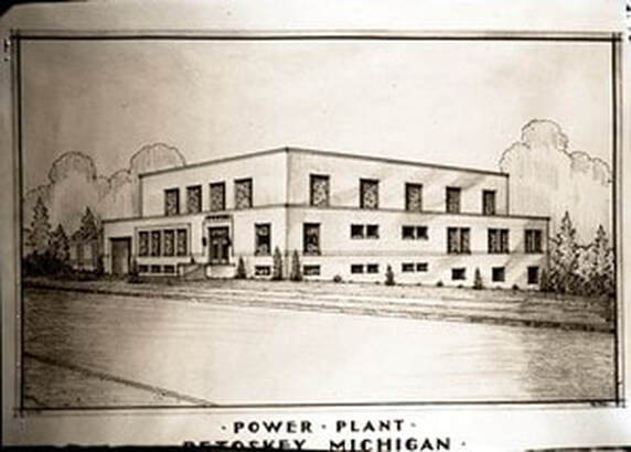
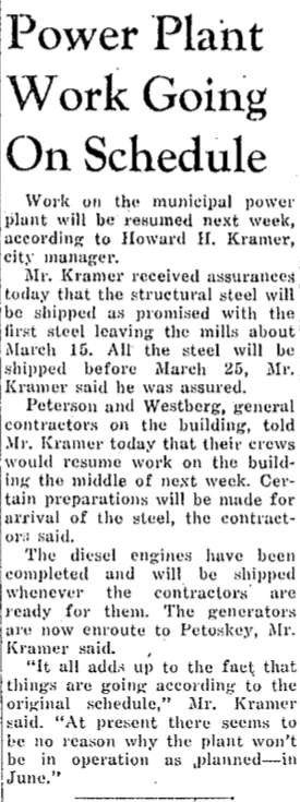
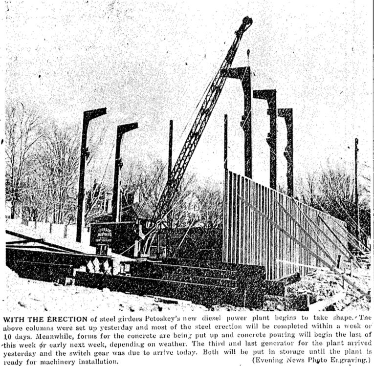
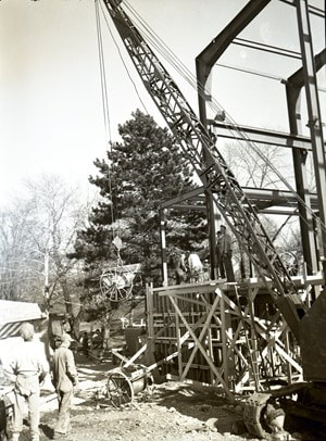
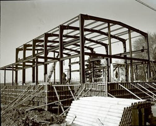
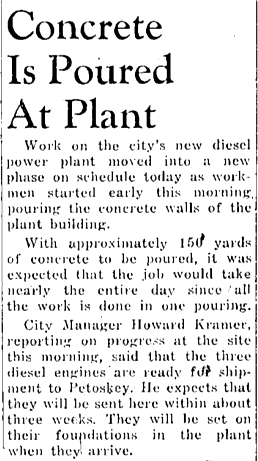
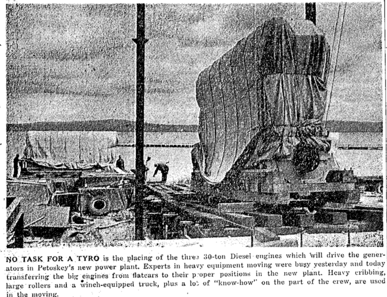
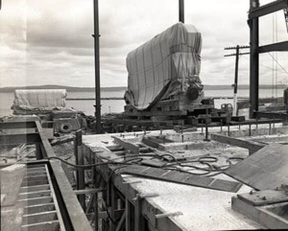
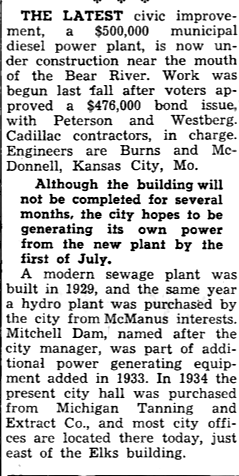
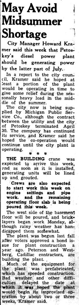
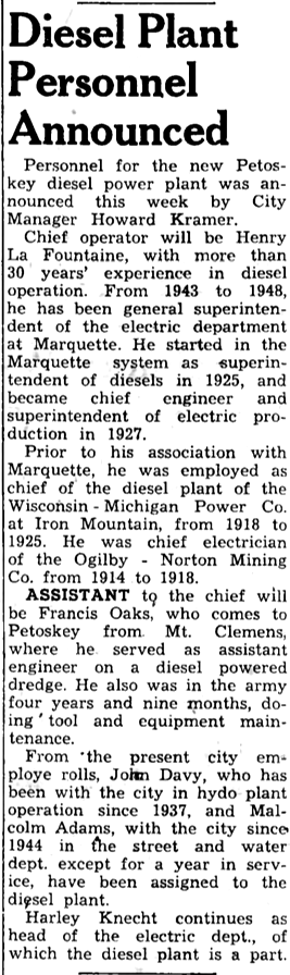
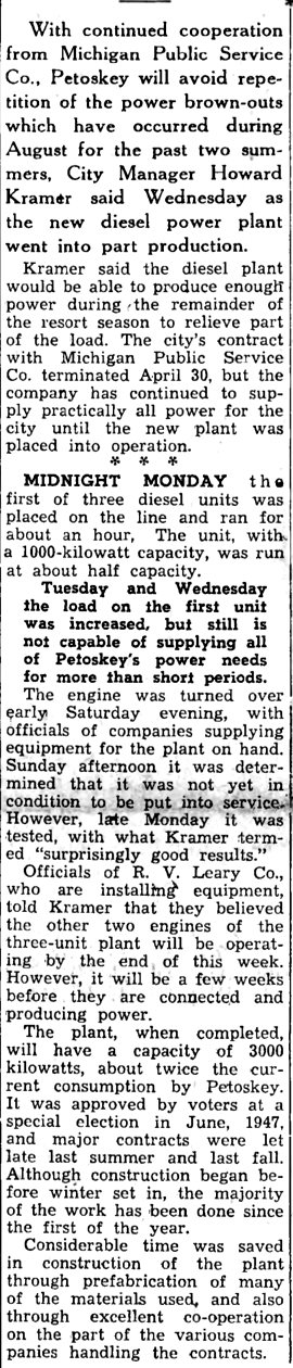
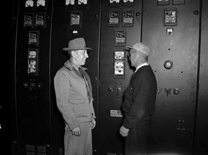
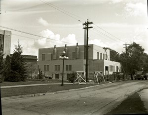
Petoskey Diesel Power Plant
Now in 2019... the Petoskey City Hall
Now in 2019... the Petoskey City Hall
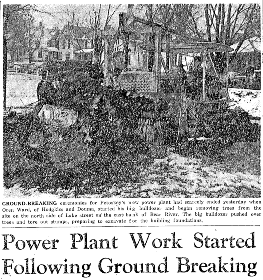
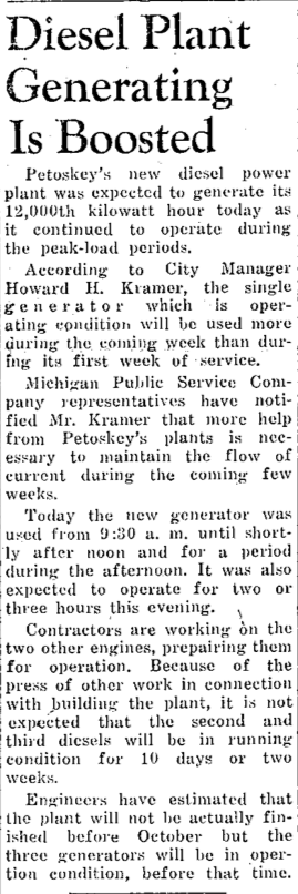
11 November 1947 ~ Petoskey Evening News article continued below...
11 November 1947 ~ Petoskey Evening News article continued from photo clipping above...

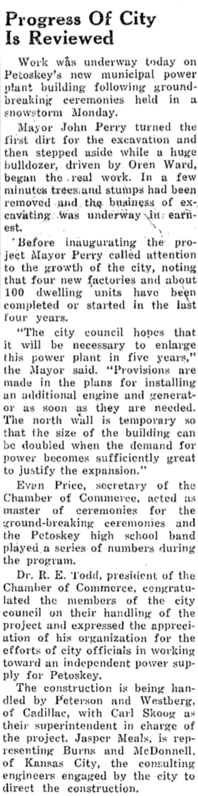
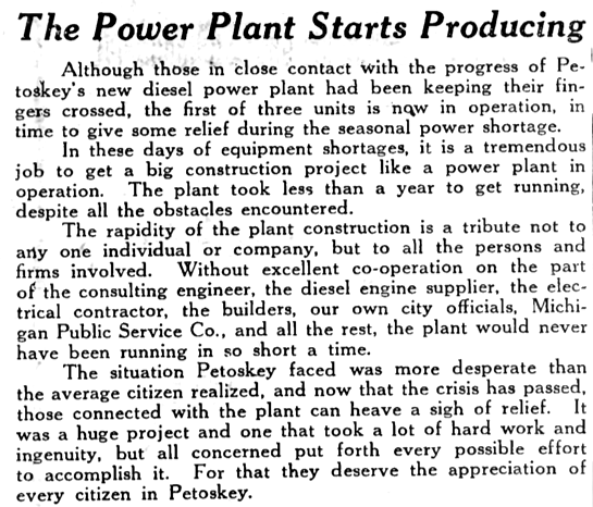
13 November 1947 ~ Northern Michigan Review article continued below left and right...

13 November 1947 ~ Northern Michigan Review article column right...
|
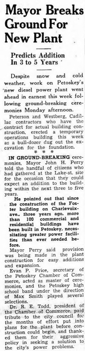
13 November 1947 ~ Northern Michigan Review article continued from left photo/text...
|
Greenwood Photo Arcive Collection from Petoskey Newspapers (Undated)
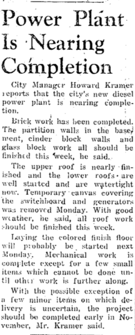
10 March 1948 ~ Petoskey Evening News
|

15 March 1948 ~ Petoskey Evening News
|
31 March 1948 ~ Petoskey Evening News
Greenwood Photo Archive Collection from Petoskey Newspapers (1948)
|
Greenwood Photo Archive Collection from Petoskey Newspapers (1948)
|
30 April 1948 ~ Petoskey Evening News
25 May 1948 ~ Petoskey Evening News
Greenwood Photo Arcive Collection from Petoskey Newspapers (May 1948)
17 June 1948 ~ Emmet County Graphic
|
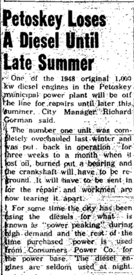
17 June 1948 ~ Northern Michigan Review
|
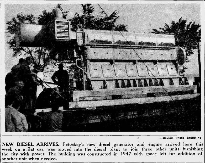
24 June 1948 ~ Northern Michigan Review
|
22 July 1948 ~ Northern Michigan Review
|
5 August 1948 ~ Northern Michigan Review
|

2 August 1948 ~ Petoskey Evening News article continued right column...
|
2 August 1948 ~ Petoskey Evening News article continued from left column...
|
3 August 1948 ~ Petoskey Evening News article continued below...
3 August 1948 ~ Petoskey Evening News article continued from above...
|
4 August 1948 ~ Petoskey Evening News
Greenwood Photo Archive Collection from Petoskey Newspapers (1948)
|
6 August 1948 ~ Petoskey Evening News
|
12 August 1948 ~ Northern Michigan Review
|
6 October 1948 ~ Petoskey Evening News
|

2 November 1948 ~ Petoskey Evening News
|
Greenwood Photo Archive Collection from Petoskey Newspapers (1948)
16 May 1962 ~ Petoskey News Review
|
8 October 1953 ~ Northern Michigan Review
|
1967 Article Below:
Study Already Made on Oil Pollution in Bear River and the Harbor from the City's Diesel Plant
Study Already Made on Oil Pollution in Bear River and the Harbor from the City's Diesel Plant
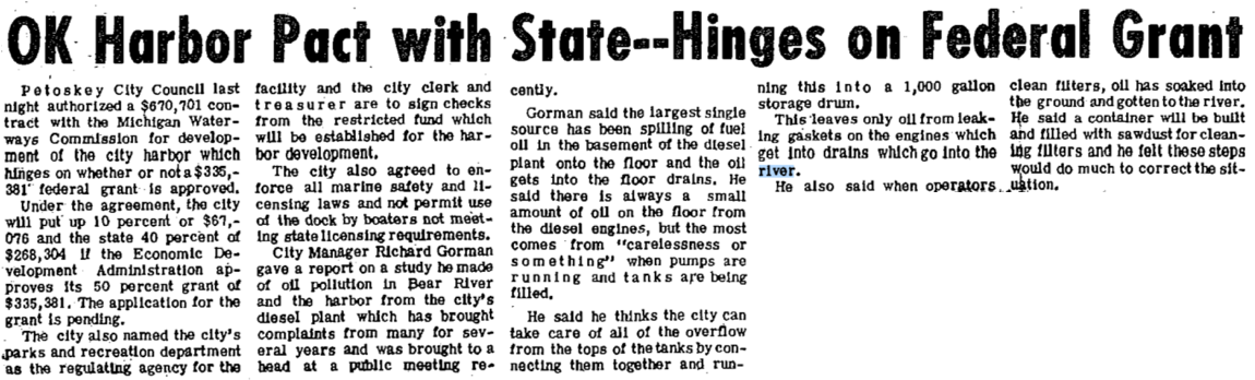
3 October 1967 ` Petoskey News Review
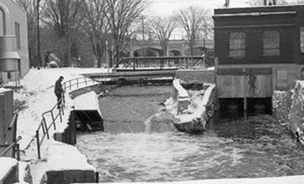
Greenwood Photo Archive Collection from Petoskey newspapers (November 1967)
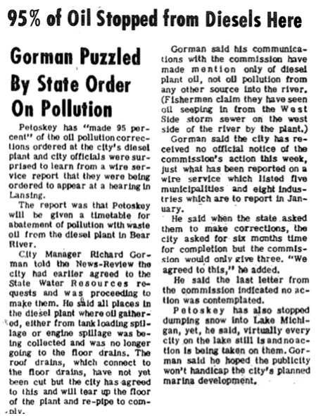
7 December 1967 ~ Petoskey News Review
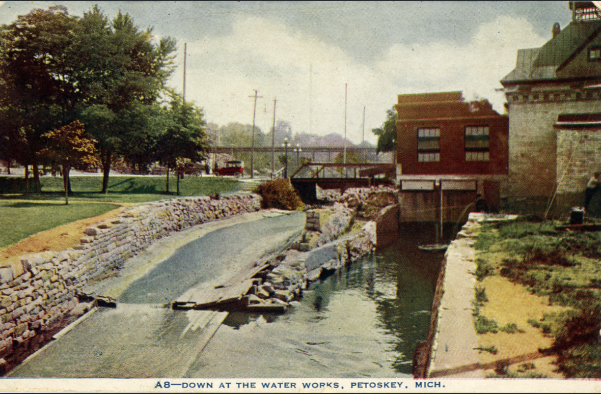
Little Traverse Historical Society Postcard Collection (Undated, but looks very much like the 1967 photo above, except the automobiles look older than 1967)
1968
31 October 1968 ~ Petoskey News Review article continued below...

31 October 1968 ~ Petoskey News Review photo/text accompanied article above...

26 December 1968 ~ Petoskey News Review
2010
Photo/Text Below:
A 75-Foot long pedestrian bridge was set about a block south of the Mitchell Street Bridge.
A 75-Foot long pedestrian bridge was set about a block south of the Mitchell Street Bridge.
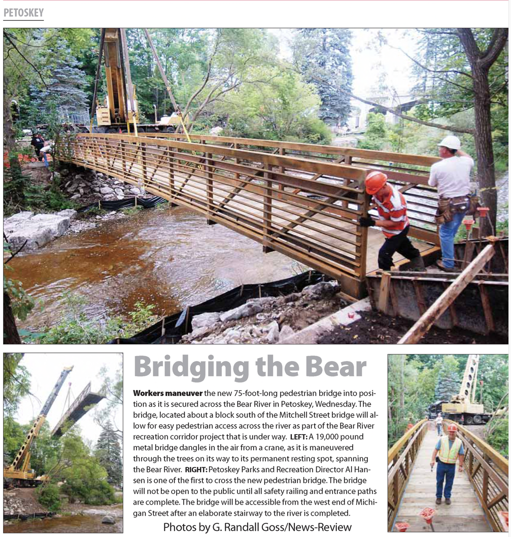
26 August 2010 ~ Petoskey News Review
1950
French Farm Lake's Six Foot Dam in North Emmet County
French Farm Lake's Six Foot Dam in North Emmet County
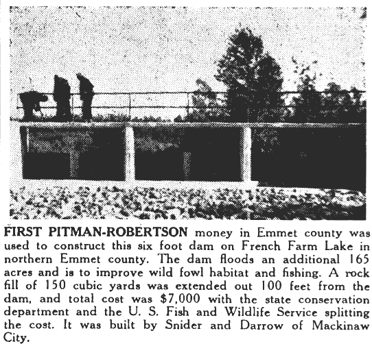
5 January 1950 ~ Northern Michigan Review
