Northern Mich~Mash Preserve
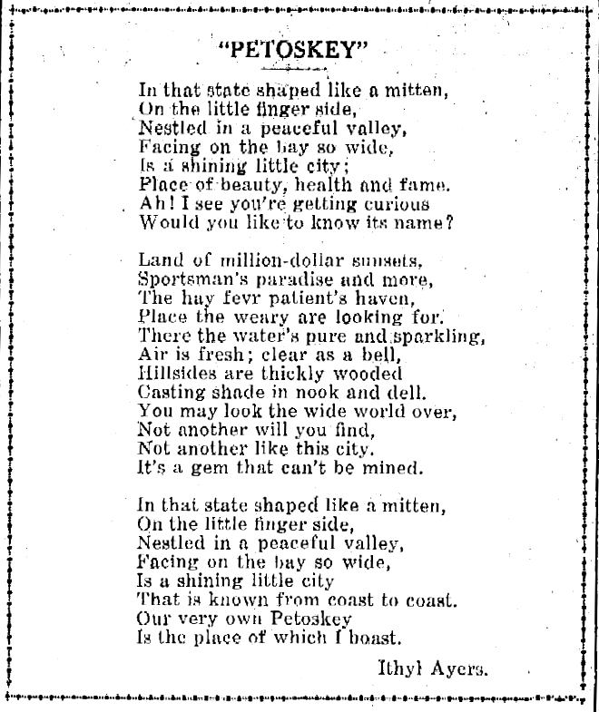
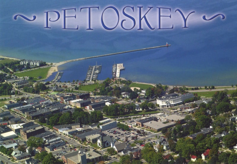
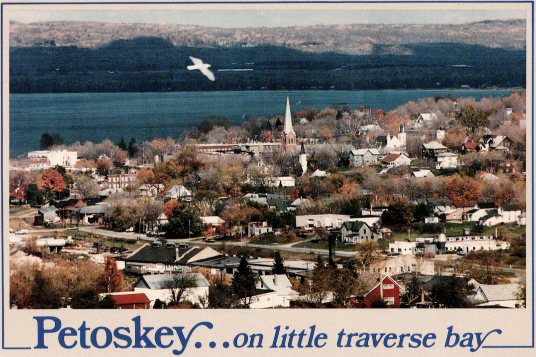
~PETOSKEY~
The design and compilation of the text and photos on this site are copyrighted 2017.
Most posted items will enlarge by "clicking" on them.
"Clicking" on some color highlighted words may access additional information.
Most posted items will enlarge by "clicking" on them.
"Clicking" on some color highlighted words may access additional information.
Please do not copy the photos on this site, many of which have been submitted by private individuals...
just come back and visit the site often to view the photos.
just come back and visit the site often to view the photos.
1897 Bear Creek Township was separated from the City of Petoskey.
2010 Census for Petoskey ~ 5670
2010 Census for Petoskey ~ 5670
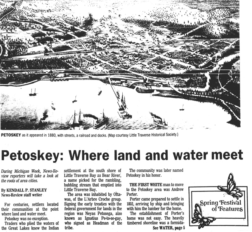
An Indian Mission in 1852
Petoskey and some streets named in 1873 (Click HERE to see information about Petoskey name and street NAMES)
A Backwood Settlement in 1875
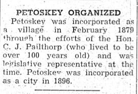
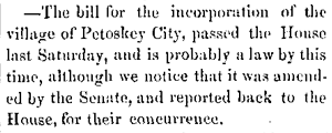
Petoskey organized as a village February 1879.
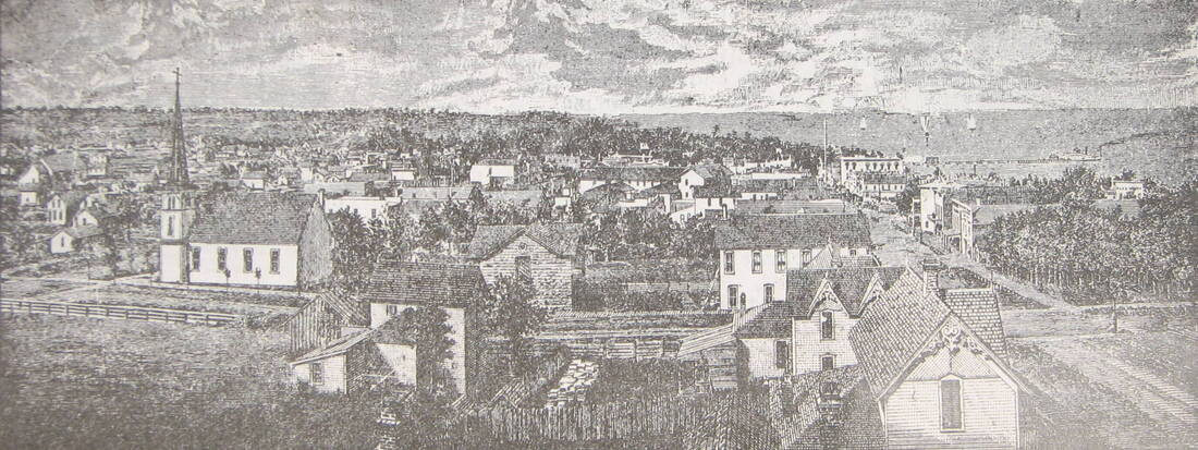
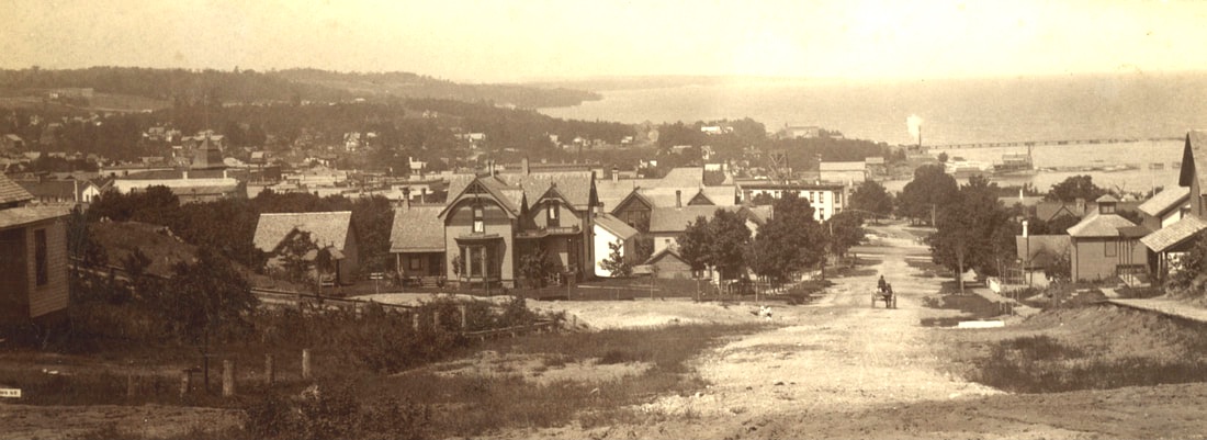
A Busy and Beautiful City in 1895
Petoskey was incorporated as a city in 1896.
Petoskey and some streets named in 1873 (Click HERE to see information about Petoskey name and street NAMES)
A Backwood Settlement in 1875
Petoskey organized as a village February 1879.
A Busy and Beautiful City in 1895
Petoskey was incorporated as a city in 1896.
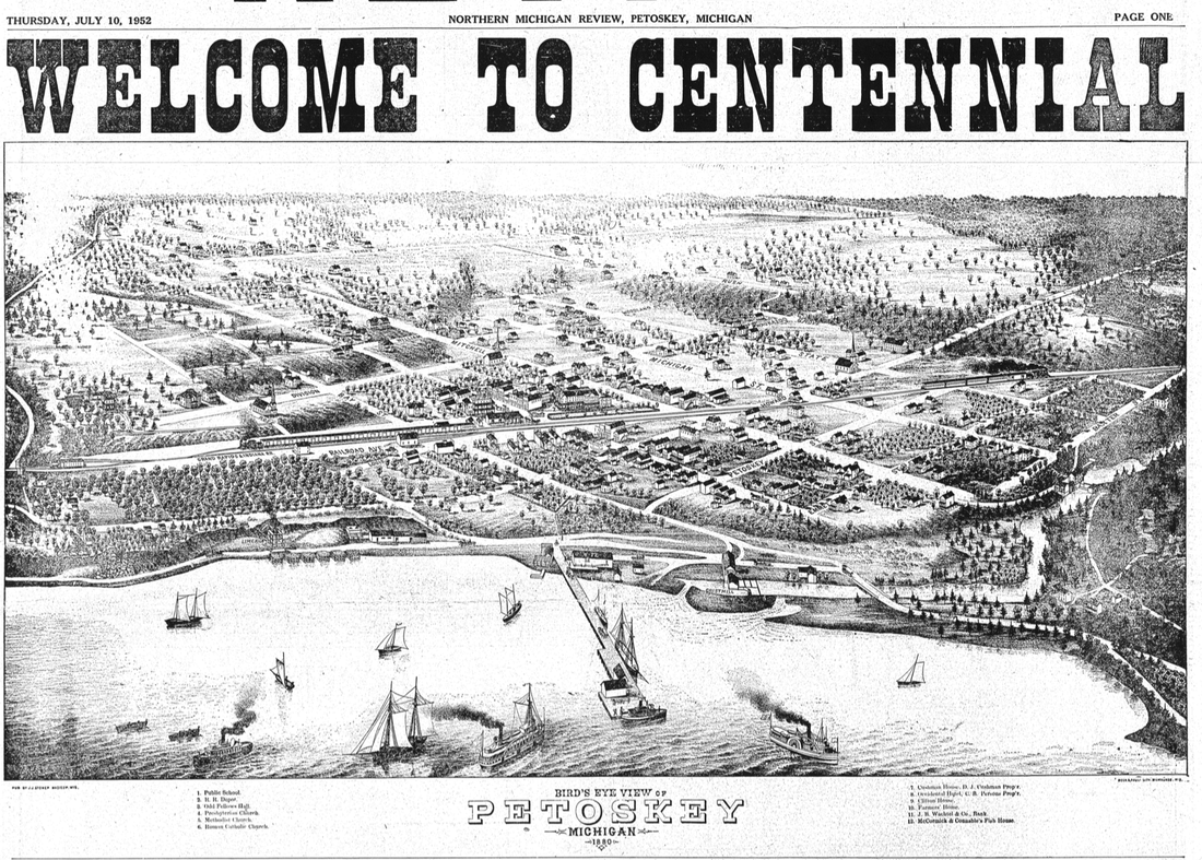
10 July 1952 ~ Northern Michigan Review
Article Below: Discussion of proceeding to incorporating the Village of Petoskey in 1879
6 December 1878 ~ Petoskey City Record
|
19 December 1878 ~ Petoskey City Record
30 January 1879 ~ Petoskey City Record
|
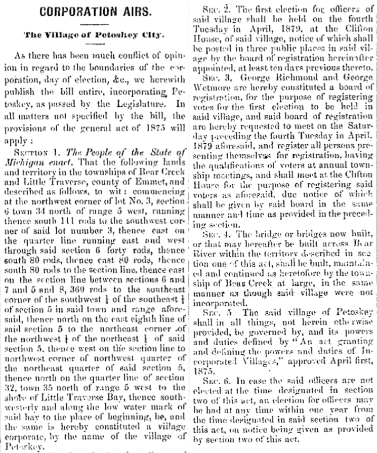
6 March 1879 ~ Petoskey City Record
19 March 1880 ~ Emmet County Democrat
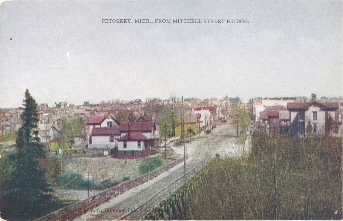
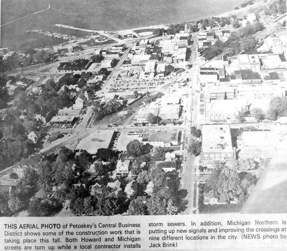
Between both the Header Photo and the Photo Below, most of Petoskey Downtown can be viewed... orient by locating the OLD post office on the corner of Mitchell and Petoskey streets in each photo.
29 October 1936 ~ Posted with permission from Virtual Motor City, Walter P. Reuther Library, Wayne State University
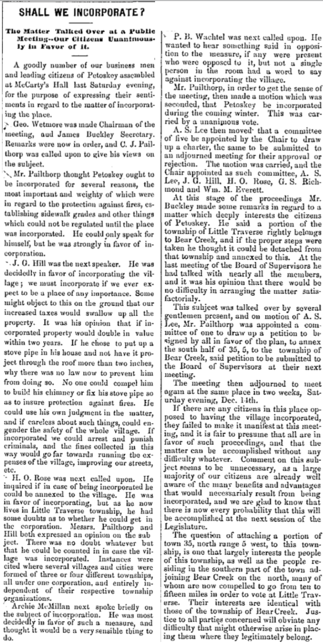
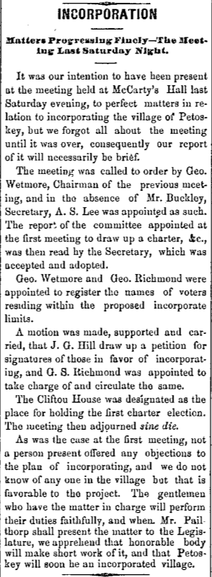
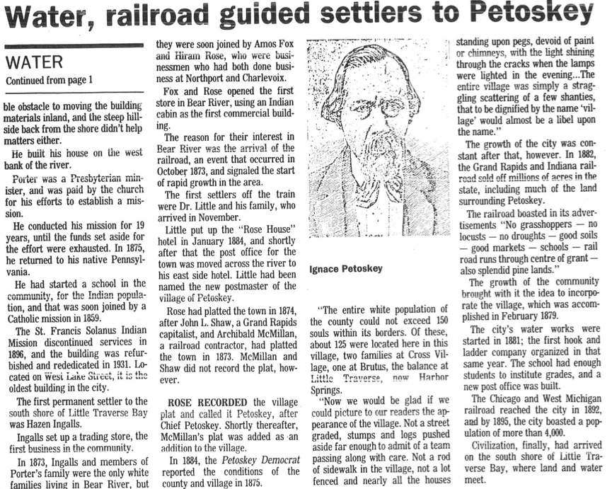
A newspaper reported that "... the most important event held in McCarty's hall (City Park Grill now) occurred Nov. 30, 1878. A public meeting was held for the purpose of taking action in the direction of obtaining a charter for the village. A committee was appointed to draft a map of the territory to be incorporated and take such other steps as necessary.
Hon. C.J. Pailthorp, representative in the legislature from the district, was put in charge, and in February, 1879, he secured the passage of a bill granting the charter to the Village of Petoskey. On 21 February 1879 Petoskey was incorporated as a village. Elections were held and the first village officers were as follows: President, H.O. Rose, trustees, L.C. Watson, A. Bunnell, P.B. Wachtel, C.B. Henika, D.J. Cushman, and last but not least, Alonzo Nash McCarty, the man who owned the hall where the village organization was planned. He served as trustee in 1879, 1880, 1881 and 1885." Access more information about the village presidents of Petoskey by clicking HERE.
Hon. C.J. Pailthorp, representative in the legislature from the district, was put in charge, and in February, 1879, he secured the passage of a bill granting the charter to the Village of Petoskey. On 21 February 1879 Petoskey was incorporated as a village. Elections were held and the first village officers were as follows: President, H.O. Rose, trustees, L.C. Watson, A. Bunnell, P.B. Wachtel, C.B. Henika, D.J. Cushman, and last but not least, Alonzo Nash McCarty, the man who owned the hall where the village organization was planned. He served as trustee in 1879, 1880, 1881 and 1885." Access more information about the village presidents of Petoskey by clicking HERE.
Petoskey was incorporated as the Village of Petoskey on 20 February 1879, with 1,152 inhabitants and became a city in 1895. In the decades following the Civil War, train service extended to Petoskey and hotels were built to serve tourists coming to escape hay fever season, catch Lake Michigan breezes, and explore uncharted northern Michigan.” ~ "11 August 2005, Reflections" supplement to the Petoskey News Review
The 10 July 1952 Petoskey Centennial newspaper reported: "John L. Shaw, the Grand Rapids capitalist and Archibald McMillan, a railroad contractor had platted a town [Petoskey] in '73 but it was not recorded. The original village plat was made by H.O. Rose in 1874 and McMillan's plat was recorded later as an addition. Trains began running regularly late in the spring, and in the early summer Fox & Rose built the first dock."
7 November 1878 ~ Petoskey City Record
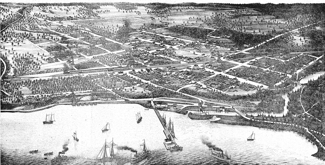
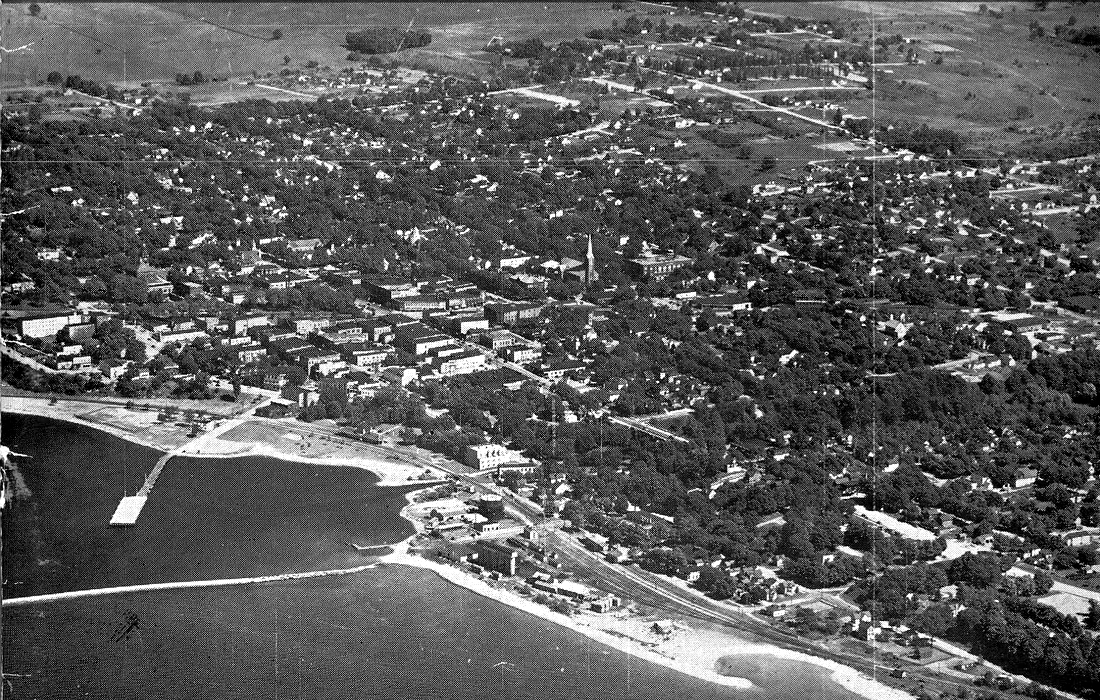
Below: 1880 Map of Petoskey... click to enlarge. Note the Mitchell Street bridge did not yet exist. The settlement existed mostly east of the Bear River. The river outlet at the mouth was in a different location from 2019. Railroad tracks had not yet arrived. Look for other changes.
1 January 1952 ~ Newspaper Supplement
Compare the POST 1963 Sunset Boulevard By-Pass photo below to the 1880 Map of Petoskey Above.
The photo angles are very similar.
The photo angles are very similar.
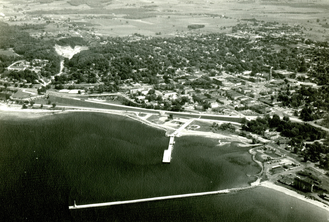
Little Traverse Historical Society Photo Collection (POST 1963 when Sunset Boulevard was constructed)
18 May 1987 ~ Petoskey News Review article continued below...
18 May 1987 ~ Petoskey News Review article continued from above...
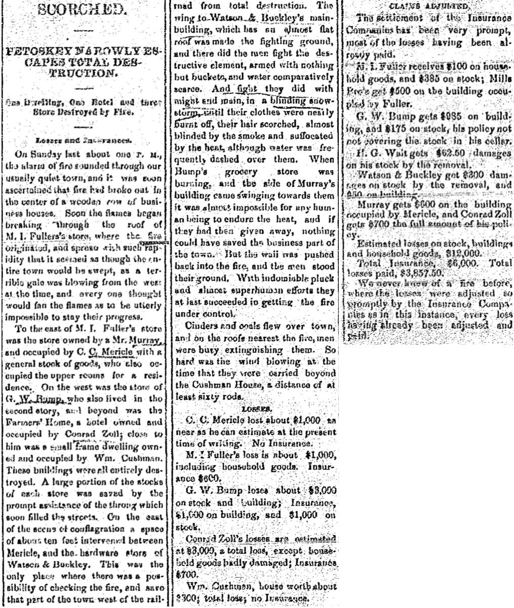
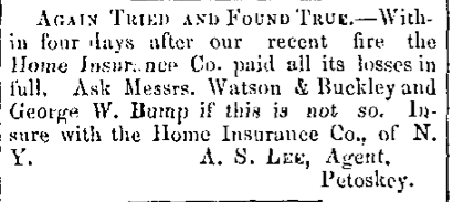
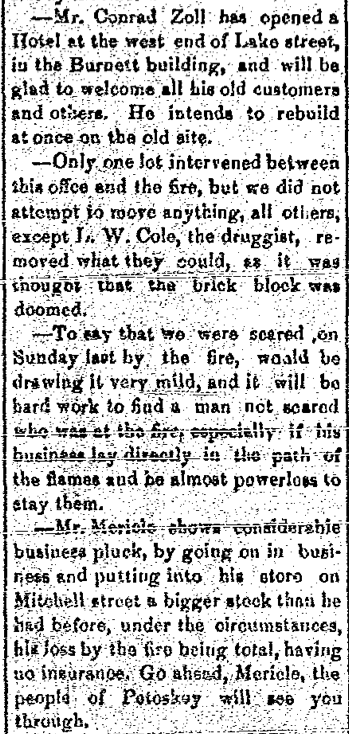
In 1880 when Petoskey was barely getting started as a village, a fire started that almost wiped out most of its business district in a flaming disaster that broke out during a howling blizzard on Sunday, 21 November 1880; even before a village fire department had been organized. The only extra aid was a very heavy snow that kept roofs wet, as sparks and embers snowed down 60 rods away, otherwise citizens with buckets of water were the first line of defense against the raging fire.
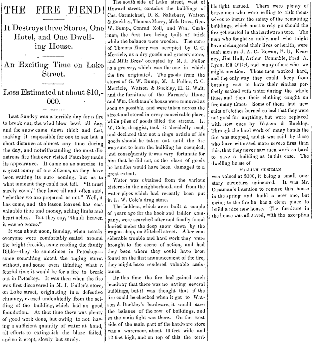
25 November 1880 ~ The Petoskey Record continued on left column below...
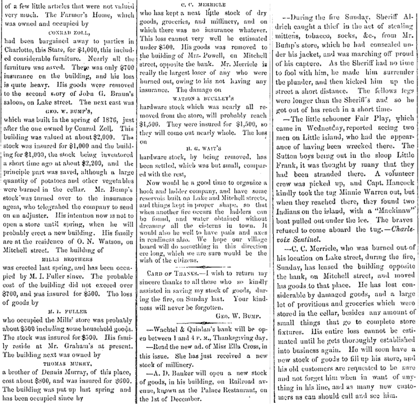
25 November 1880 ~ The Petoskey Record continued from right column above...
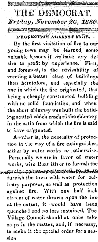
26 November 1880 ~ The County Democrat
9 December 1880 ~ Petoskey City Record
26 November 1880 ~ Emmet County Democrat
|
26 November 1880 ~ Emmet County Democrat
|
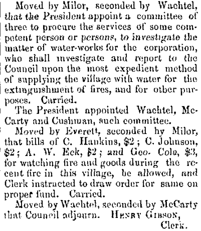
9 December 1880 ~ Petoskey City Record minutes of Petoskey City Council meeting...
|
Photographed from a large photo that hung in the Glen's Supermarket in 2013...

4 April 1882 ~ Emmet County Independent
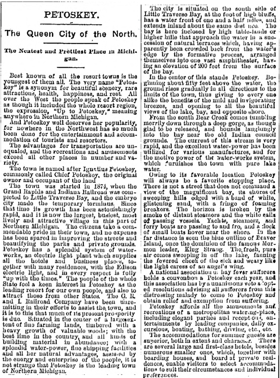
1889 ~ "Petoskey The Queen City of the North"
10 July 1889 ~ The Daily Resorter
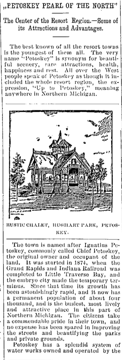
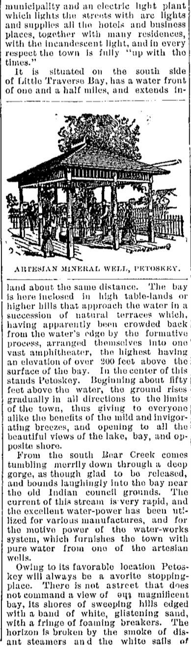
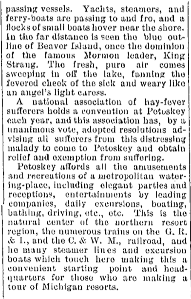
1894 ~ "Petoskey Pearl of the North"
5 September 1894 ~ The Daily Resorter article continued next right column...
|
5 September 1894 ~ The Daily Resorter article continued next right column...
|
5 September 1894 ~ The Daily Resorter article continued from left column...
|
Rustic Chalet in Hughart Park ~ Undated clipping from old personal scrapbook in Michigan Room of Petoskey District Library
1895 ~ Petoskey was Incorporated as a city (Bear River at the time).

14 May 1895 ~ The Independent Democrat
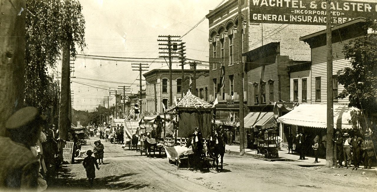
Photo Below: Late 1800s ~ Mitchell Street with festive flags hanging over the street where a sweeper is busy...
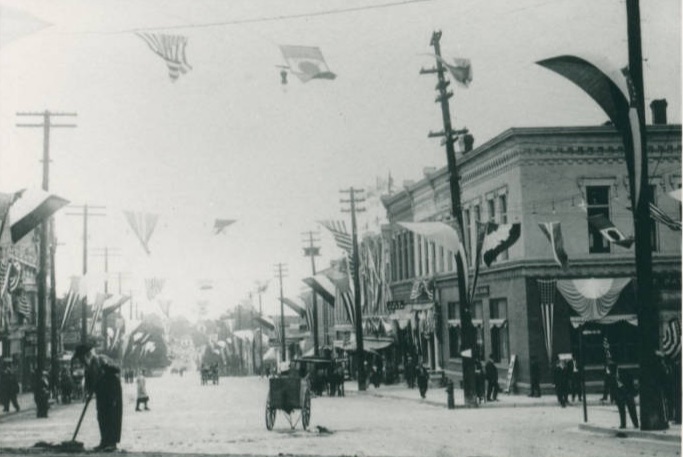
Petoskey District Library with Library of Michigan Digital Repository
1852 ~ Petoskey Centennial ~ 1952
The fact of 1952 being the Centennial Year was based on the June 1, 1852 "landing" of Andrew Porter
to establish the Presbyterian Mission and School for the Indians of the settlement here.
The fact of 1952 being the Centennial Year was based on the June 1, 1852 "landing" of Andrew Porter
to establish the Presbyterian Mission and School for the Indians of the settlement here.
10 July 1952 ~ Petoskey Evening News
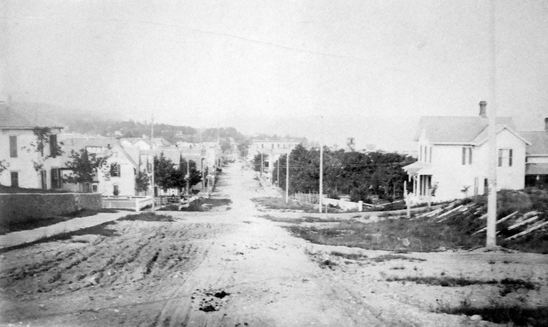
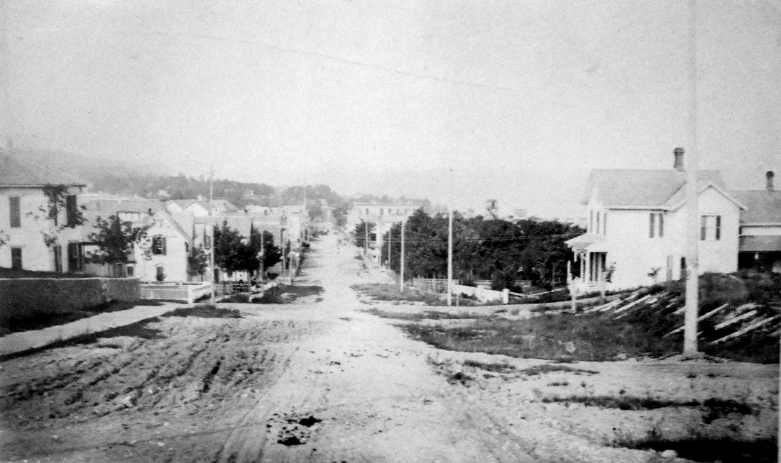
1875 ~ Petoskey
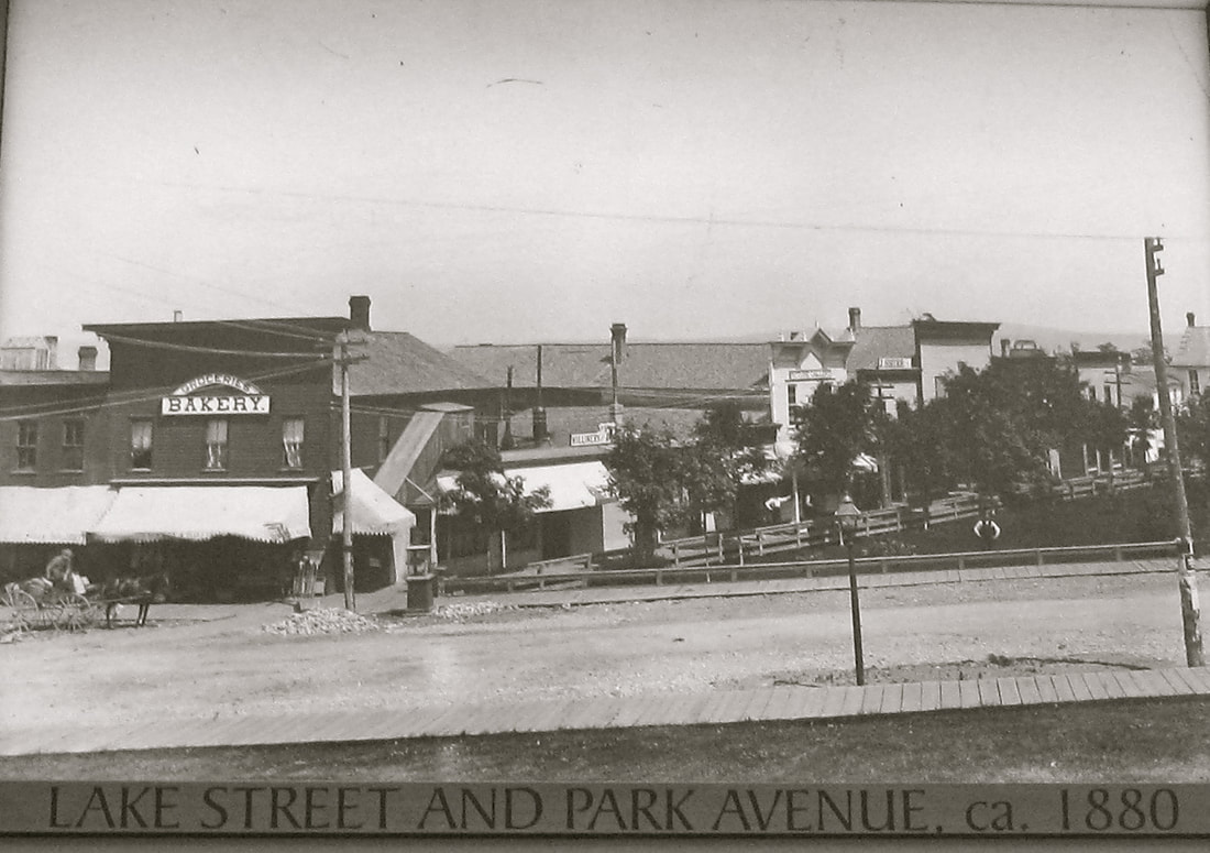
Looking West on Lake Street

10 July 1952 ~ Petoskey's Centennial Paper
Photo Below: Labled as "Petoskey 1877-78" is the same photo as noted above with the date of 1875...
AND the same photo was also in the album and labeled in 1875... close enough?
AND the same photo was also in the album and labeled in 1875... close enough?

Allan McCune a successful Petoskey businessman and local historian donated several of his albums to Petoskey's Little Traverse Historical Museum
Photo Below: Petoskey from Lake and Williams streets in 1878
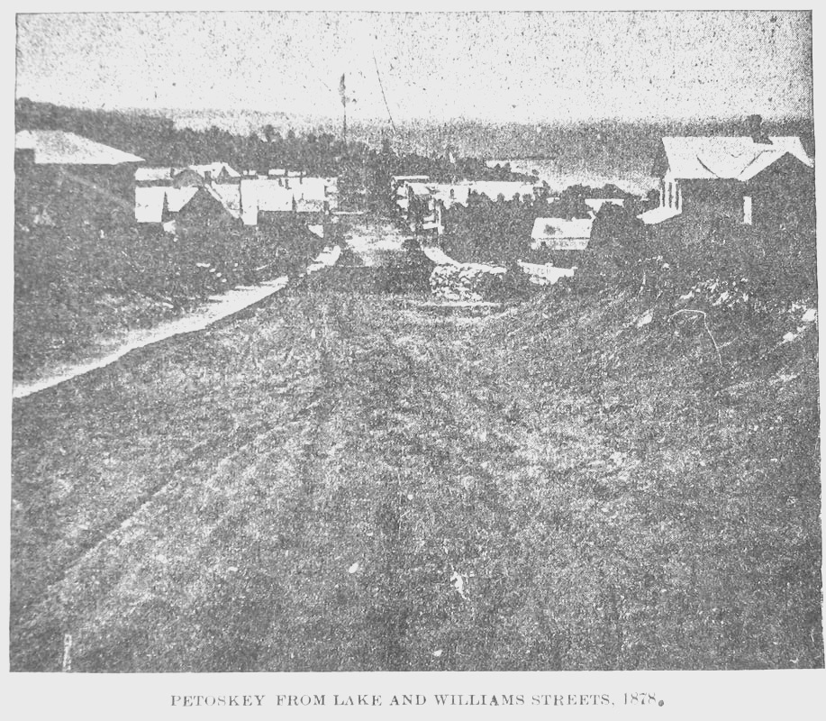
Greenwood Photo Archive Collection from Petoskey newspapers (1878)
Drawing Below: Petoskey in 1878
Greenwood Photo Archive Collection from Petoskey newspapers (1878)
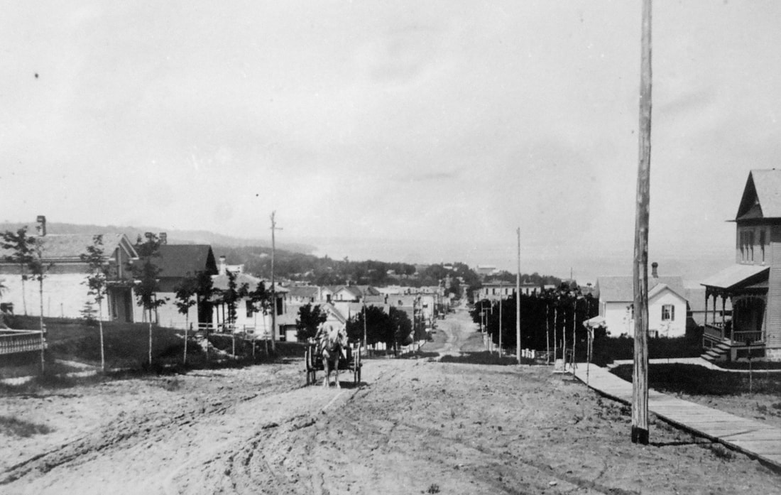
Photo Below: Looking west on Lake Street in 1890
Little Traverse Historical Society Photo Collection (1890)
Photo Below: Looking west on Lake Street (Undated)
Little Traverse Historical Society Photo Collection
Photos Above and Below...
same angle/view, but the buildings closest to Park Avenue have been rebuilt in brick,
probably following a fire of the wood structures
same angle/view, but the buildings closest to Park Avenue have been rebuilt in brick,
probably following a fire of the wood structures
Little Traverse Historical Society Postcard Collection
Photo Below: Looking west on Lake Street... Behind the wooden fence on the far right is the corner of Lake and Division where the Emmet County building is located in 2019. The site of the Occidental Hotel on the right is where the Emmet County Sheriff's office and jail are located in 2019.
Allan McCune a successful Petoskey businessman and local historian donated several of his albums to Petoskey's Little Traverse Historical Museum. One of his albums included this photo of Petoskey, looking down Lake Street in 1900.
1884 ~ Petoskey

14 May 1895 ~ The Independent Democrat
1894 ~ Petoskey
14 May 1895 ~ The Independent Democrat
|
14 May 1895 ~ The Independent Democrat
|
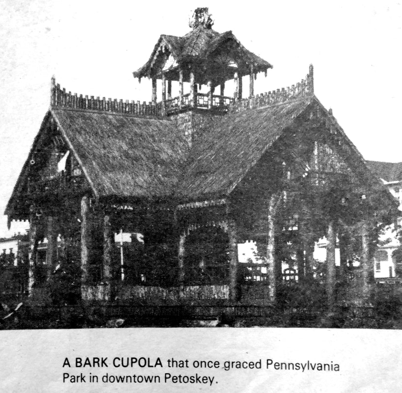
Photo Below: The cupola on the Cushman Hotel on Pennsylvania Park was visible in a different 1895 photo,
so this photo is obviously after 1895.
The roadway is unpaved Bay Street in Petoskey, Michigan, looking west.
so this photo is obviously after 1895.
The roadway is unpaved Bay Street in Petoskey, Michigan, looking west.
Little Traverse Historical Society Photo Collection (Undated)
To access a "Souvenir of Petoskey and Bay View in 1895" click HERE.
~ Booklet was Created by J.C. Van Ness ~
~ Booklet was Created by J.C. Van Ness ~
1900 ~ Petoskey
Looking Down Lake Street
Looking Down Lake Street
Allan McCune a successful Petoskey businessman and local historian donated several of his albums to Petoskey's Little Traverse Historical Museum. One of his albums included this photo of Petoskey, looking down Lake Street in 1900.
Allan McCune a successful Petoskey businessman and local historian donated several of his albums to Petoskey's Little Traverse Historical Museum. One of his albums included this photo of Petoskey, looking down Lake Street in 1900.
1901 ~ Petoskey
Looking Up Lake Street AND the Waterfront
Looking Up Lake Street AND the Waterfront
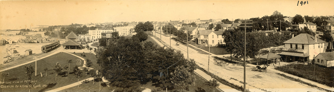
Greenwood Photo Archive Collection from Petoskey Newspaper (1901)
1910 ~ Petoskey
Looking Down Lake Street
Looking Down Lake Street
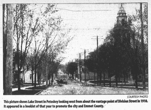
20 September 2000 ~ Petoskey News Review
Greenwood Archive of Postcard Collection (Undated)
26 December 1900 ~ The Petoskey Record
This poster below shows photos of Downtown Petoskey as it looks today
and as it morphs on the right into Petoskey in Days Gone By... 1904
Preserving Petoskey's Past.
and as it morphs on the right into Petoskey in Days Gone By... 1904
Preserving Petoskey's Past.
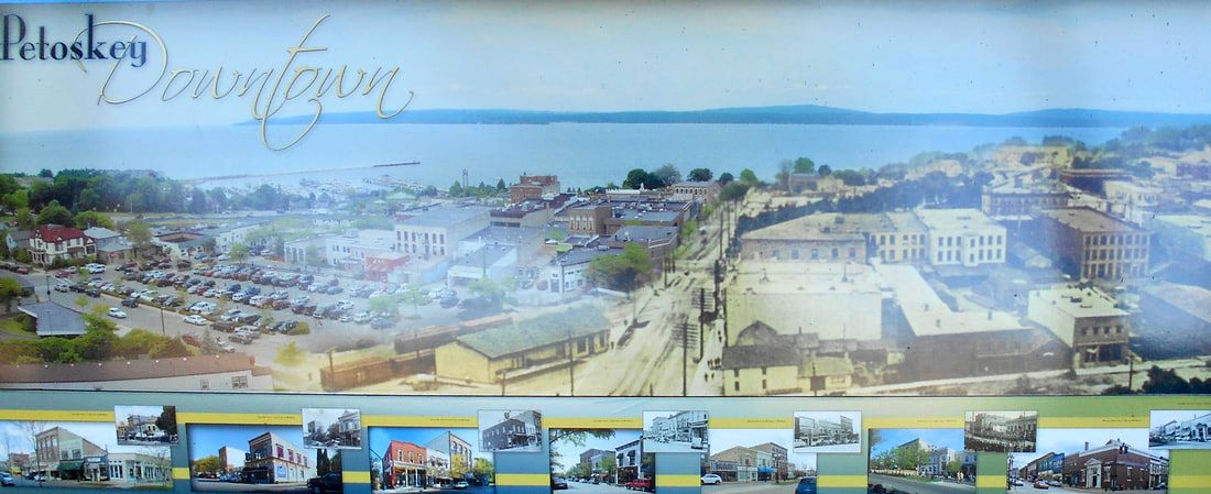
23 September 2019 ~ Little Traverse Historical Museum Poster
1904 Photo Below: Looking north on Howard Street from the Catholic Church...
(with Michigan Street running east and west)
This photo below was used as the right hand side of the Petoskey Downtown poster above...
(with Michigan Street running east and west)
This photo below was used as the right hand side of the Petoskey Downtown poster above...

Little Traverse Historical Society Photo Collection ~ 1904 photographed by Charles J. Ditto
Map Below:1904 City of Petoskey's Four Wards
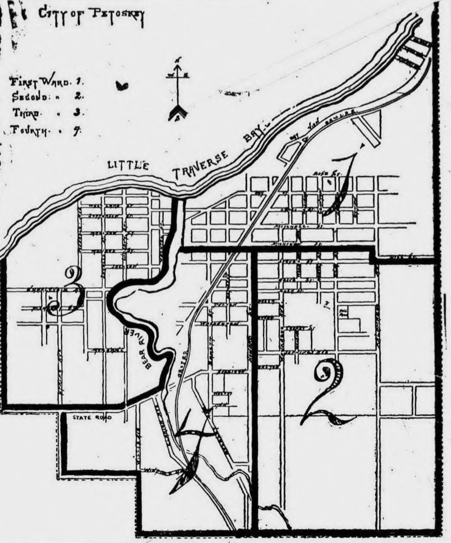
22 March 1904 ~ Petoskey Evening News (Same map also posted in the 30 March 1906 Petoskey Evening News)
8 February 1921 ~ Petoskey Evening News
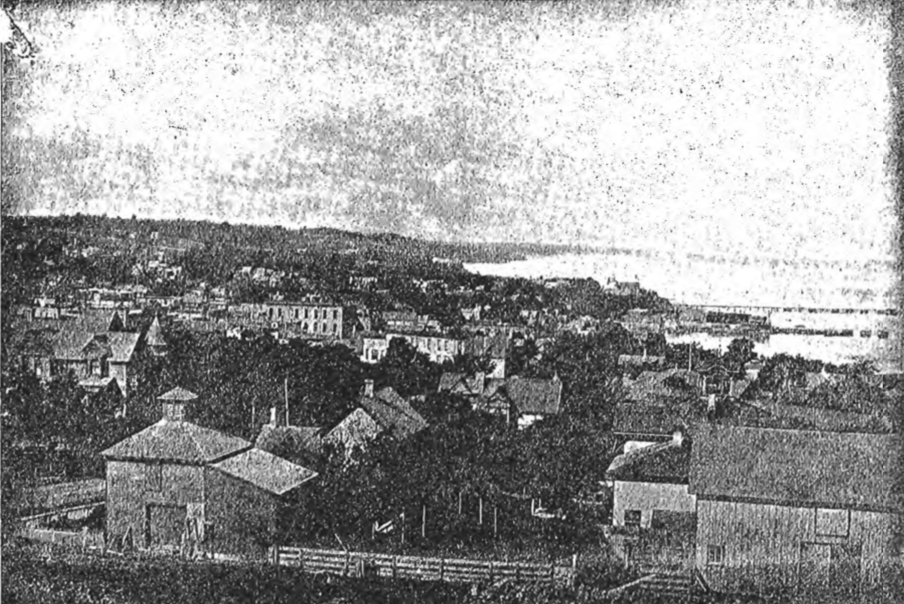
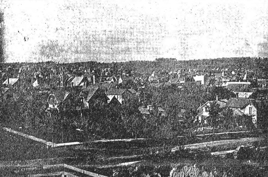
Photo Below: Petoskey Aerial View in 1920s
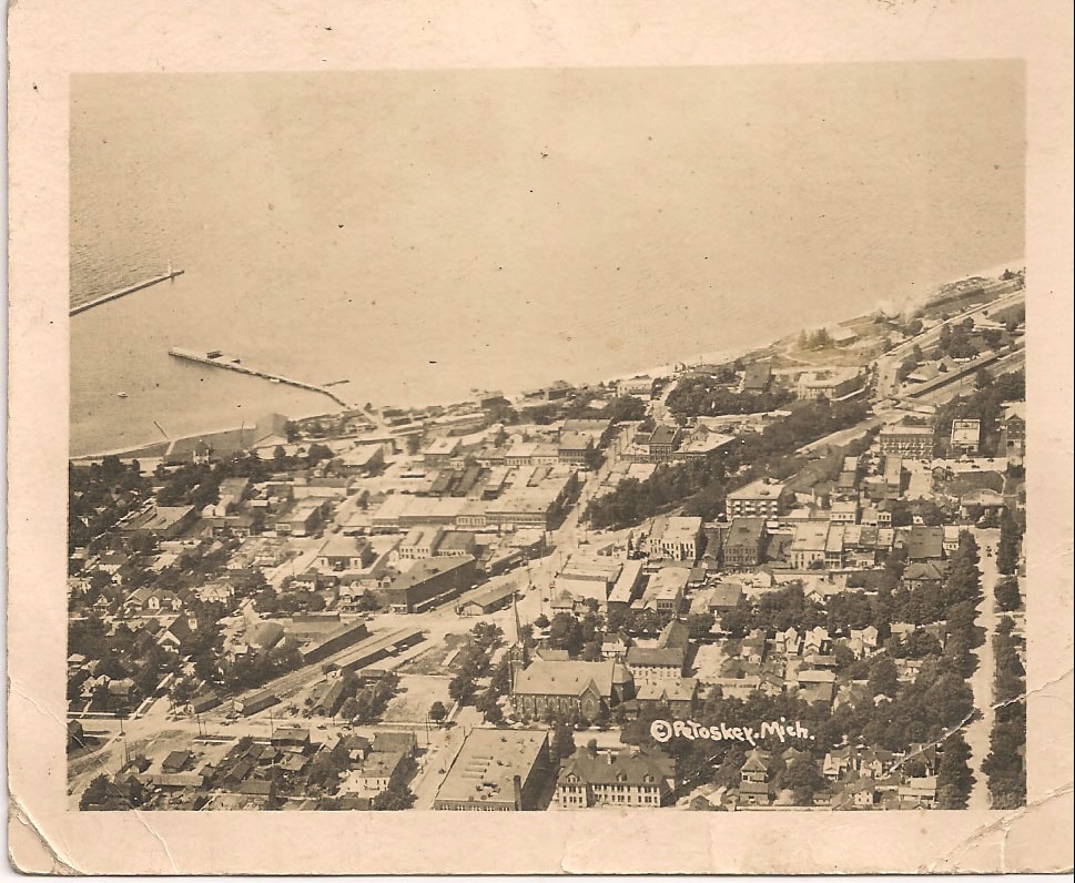
Greenwood Photo Archive Collection from Petoskey Newspaper (1920s)

Greenwood Photo Archive Collection from Petoskey Newspapers (1 November 1927 ~ Petoskey Evening News)
The same photo above was on the front page of the 14 May 1895 The Independent Democrat.
It was labeled: "Petoskey from Lake and Williams Streets, 1878."
It was labeled: "Petoskey from Lake and Williams Streets, 1878."
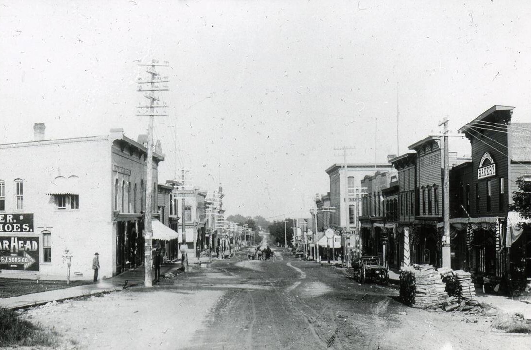
Looking west on Mitchell Street with Fochtman's Food Market at the left in the photo/postcard
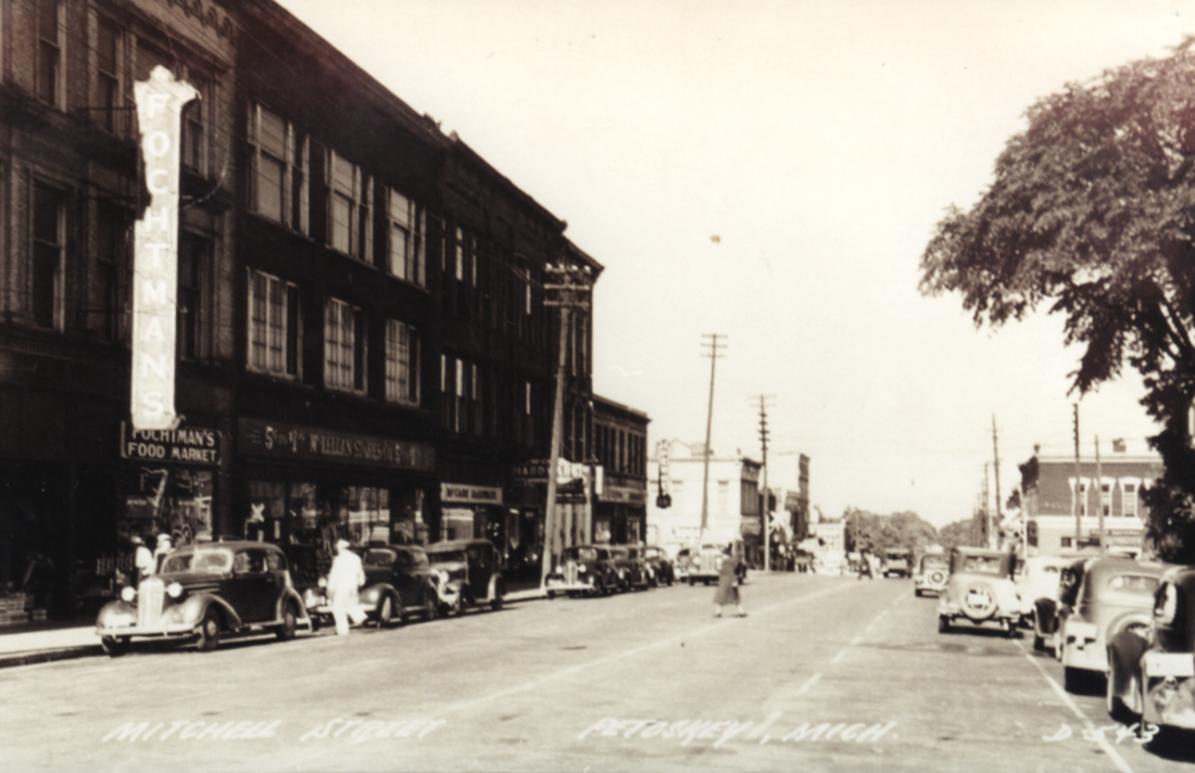
Photo/Postcard Above: Dean (a grandson to Lucy Bacon Wheaton) and Marna Wheaton who have given me permission to post the photos only on this Northern Mich ~ Mash Preserve web site ~ Karla Howard Buckmaster
TOP
~ Petoskey's STATE STONE ~
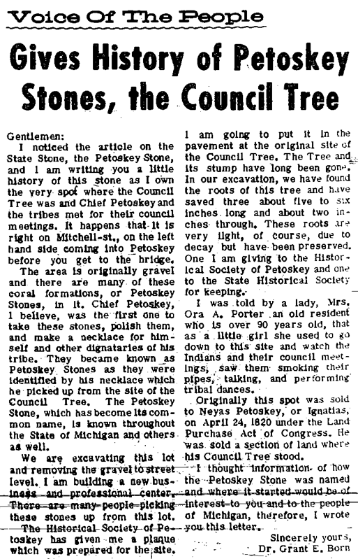
The Petoskey Stone was not the state's stone until the law became effective on
31 March 1966 with Act 89 of 1965.
The Petoskey Stone was not the state's stone until the law became effective on
31 March 1966 with Act 89 of 1965.
~ Petoskey and the Petoskey Stones in 1887 ~

13 September 1916 ~ Petoskey Evening News
~ Petoskey Stones on Petoskey Street in 1949 ~

25 June 1949 ~ Petoskey Evening News
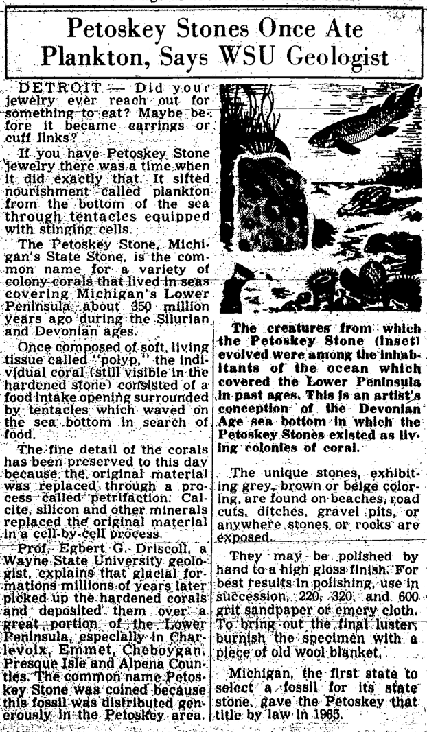
Michigan, the first state to select a fossil for its state stone, gave the Petoskey that title by law in 1965.
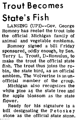
The trout is the official state fish.
The robin is the official state bird.
The white pine is the state tree.
The apple blossom is the state flower.
The wolverine was an unofficial member of the group.
The trout is the official state fish.
The robin is the official state bird.
The white pine is the state tree.
The apple blossom is the state flower.
The wolverine was an unofficial member of the group.
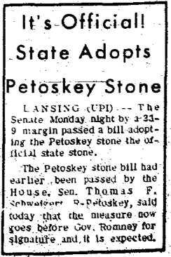
15 June 1965 ~ Petoskey News Review
|
19 June 1965 ~ Petoskey News Review
|
24 June 1965 ~ Petoskey News Review
|
30 June 1965 ~ Petoskey News Review
|
20 March 1968 ~ Petoskey News Review
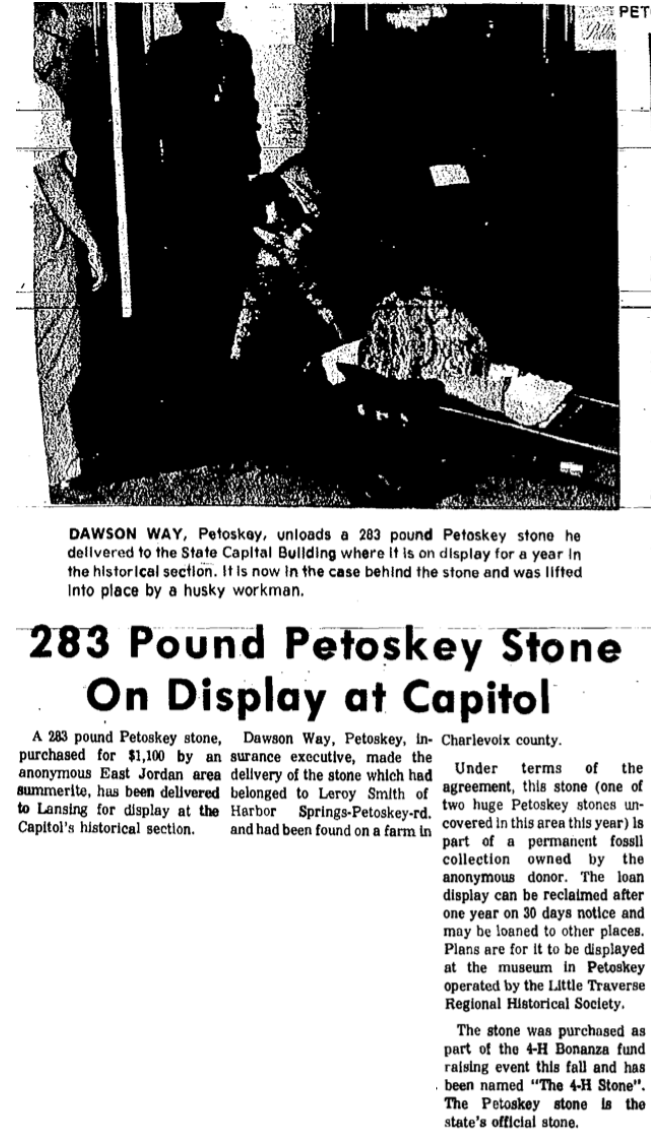
28 November 1972 ~ Petoskey News Review
~ Petoskey Stone ~
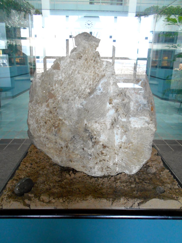
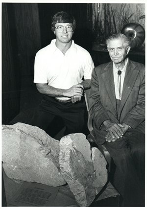
29 November 2017 ~ Petoskey Stone in the Glass Case Displayed in the Center of the Petoskey City Hall
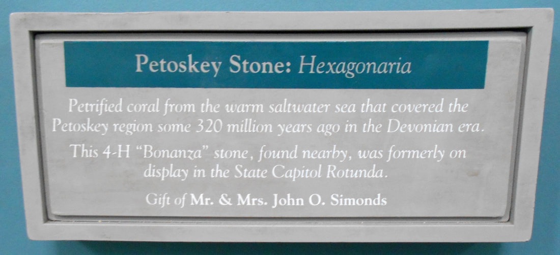
29 November 2017 ~ Label for the Above Petoskey Stone in the Glass Case
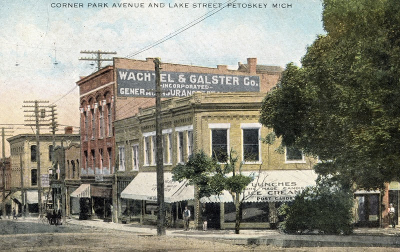
Northgoods in downtown Petoskey advertises the State Stone... the city's Petoskey Stone!
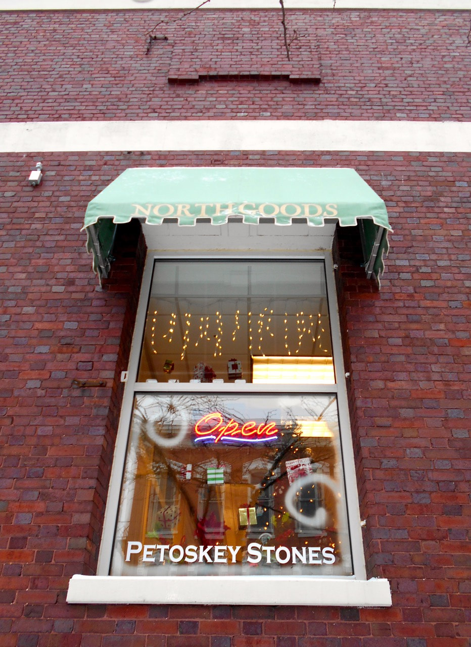
22 December 2017 ~ Northgoods in downtown Petoskey advertises the State Stone... the city's Petoskey Stone!
State Stone ~ Petoskey Stone Tower ~ 8 1/2 Feet Tall
(Located at the Harsha House which was built in 1891, Museum in Charlevoix, Michigan)
(Located at the Harsha House which was built in 1891, Museum in Charlevoix, Michigan)
|
Charlevoix's Harsha House Museum displays a Bicentennial Petoskey Stone Tower that is "8 1/2 feet tall, made of polished Petoskey stones in the form of a 200 story skyscraper, each story of which represents one year in the history of the United States. Conceived as a personal observance of the Bicentennial in the early seventies, it was completed in late 1975. The base of the tower represents the long period before the Declaration of Independence. The outer square represents the country before the coming of the white men. The inner square, in 13 sections, represents the original Colonies. The letters in stone W.S.P.A. stand for the four freedoms: Worship, Speech, Press, and Assembly. The first floor of the tower represents the year 1776 when our Independence was Declared, and each floor thereafter represents one year in our history. Since George Washington tried to point the way for the young nation, a miniature Washington Monument stands atop the lower, pointing again to the future. In the sweep of time it is only natural for us to think of history horizontally. Events recede into the distance of our consciousness. By using the vertical concept it is possible to visualize history as a growing structure, something with form and body. This I have tried to do. Bob Miles" 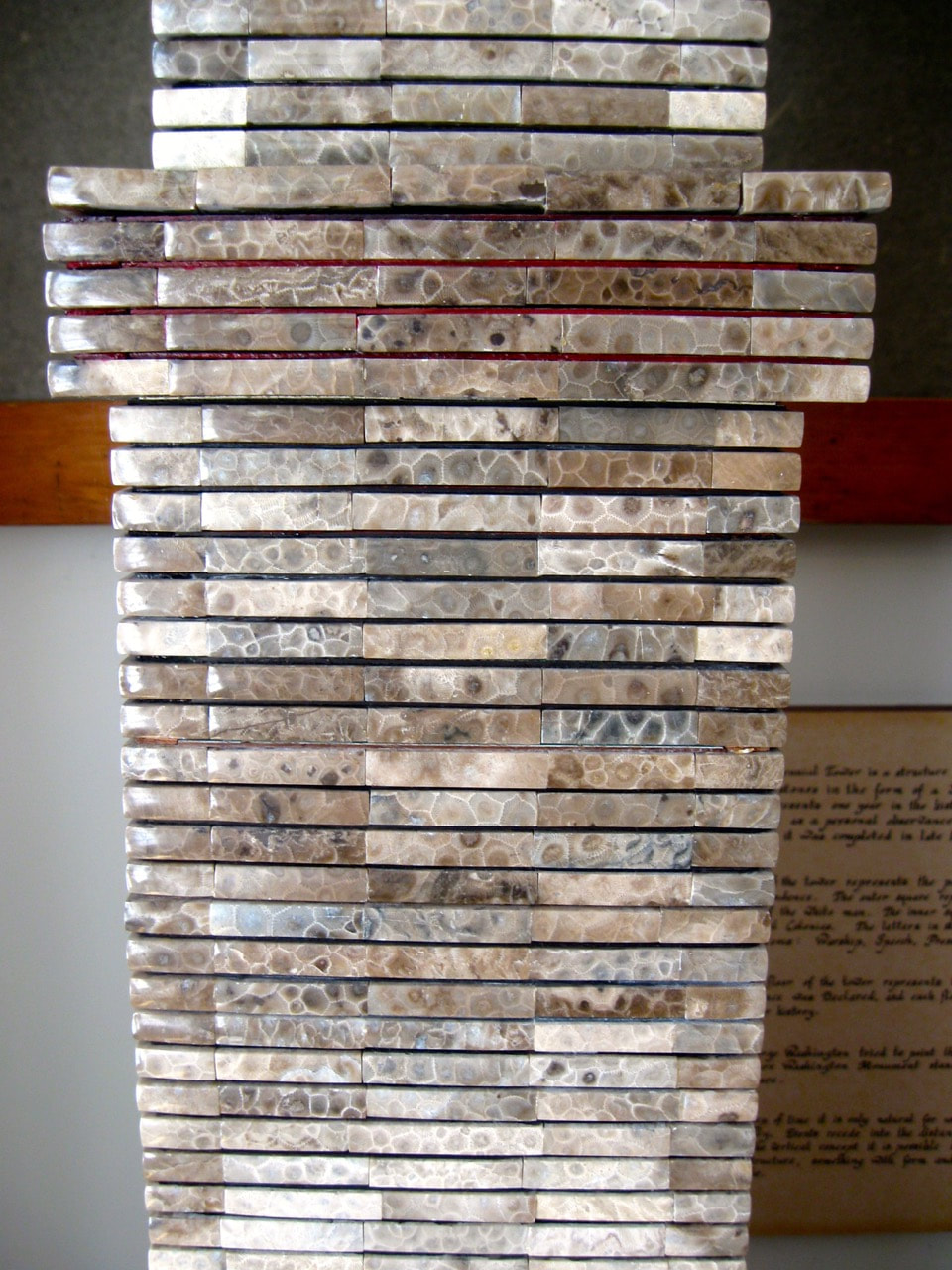
23 September 2014 ~ Harsha House Museum
|
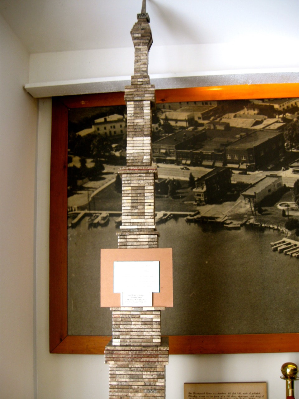

23 September 2014 ~ Harsha House Museum
|
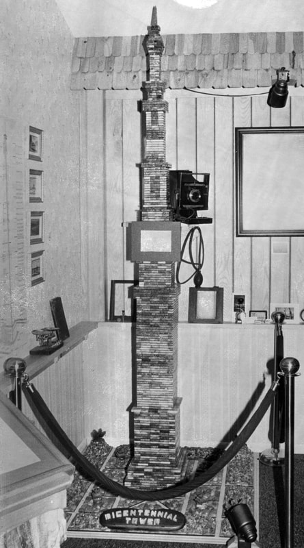
Greenwood Photo Archive Collection from Petoskey newspapers (Undated, but for 1975 Centennial)
|
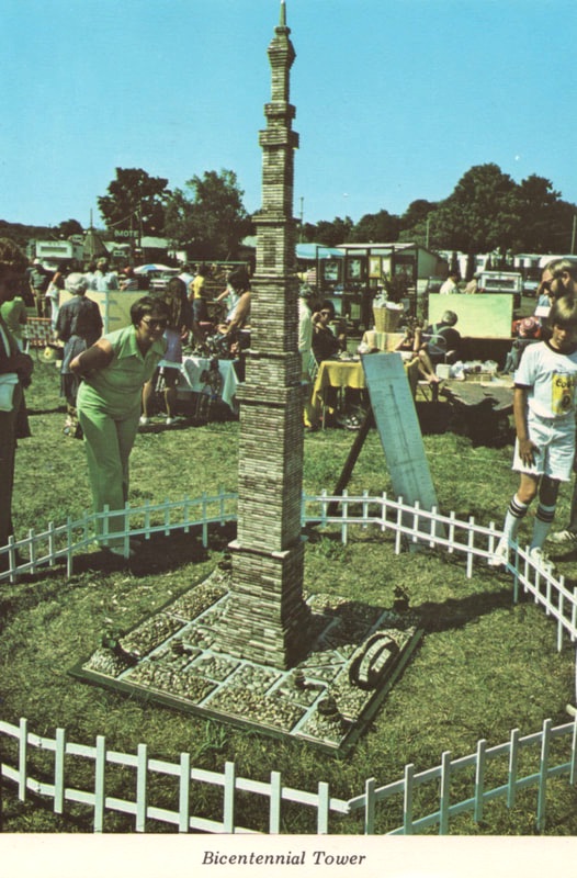
Old Postcard of the Petoskey Stone Tower on Display
|
Photo Below: The interesting Petoskey Stone shaped like the state of Michigan found in the Greenwood Photo Archive Collection from Petoskey Newspapers has no additional information. IF anyone knows anything about this photo, the people, or the Petoskey stone, please contact the webmaster.
Greenwood Photo archive Collection from Petoskey Newspapers (Undated)
Click HERE to access 26 September 2017 Up North Live news article:
"Two years later, where is the 92-pound Petoskey Stone?"
"Two years later, where is the 92-pound Petoskey Stone?"
1893 ~ FIRST Permanent Sidewalk Laid in Petoskey
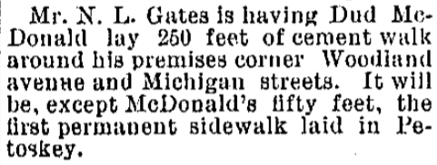
14 June 1893 ~ The Petoskey Record

11 July 1959 ~ Petoskey News Review
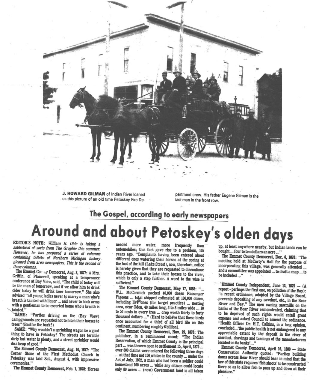
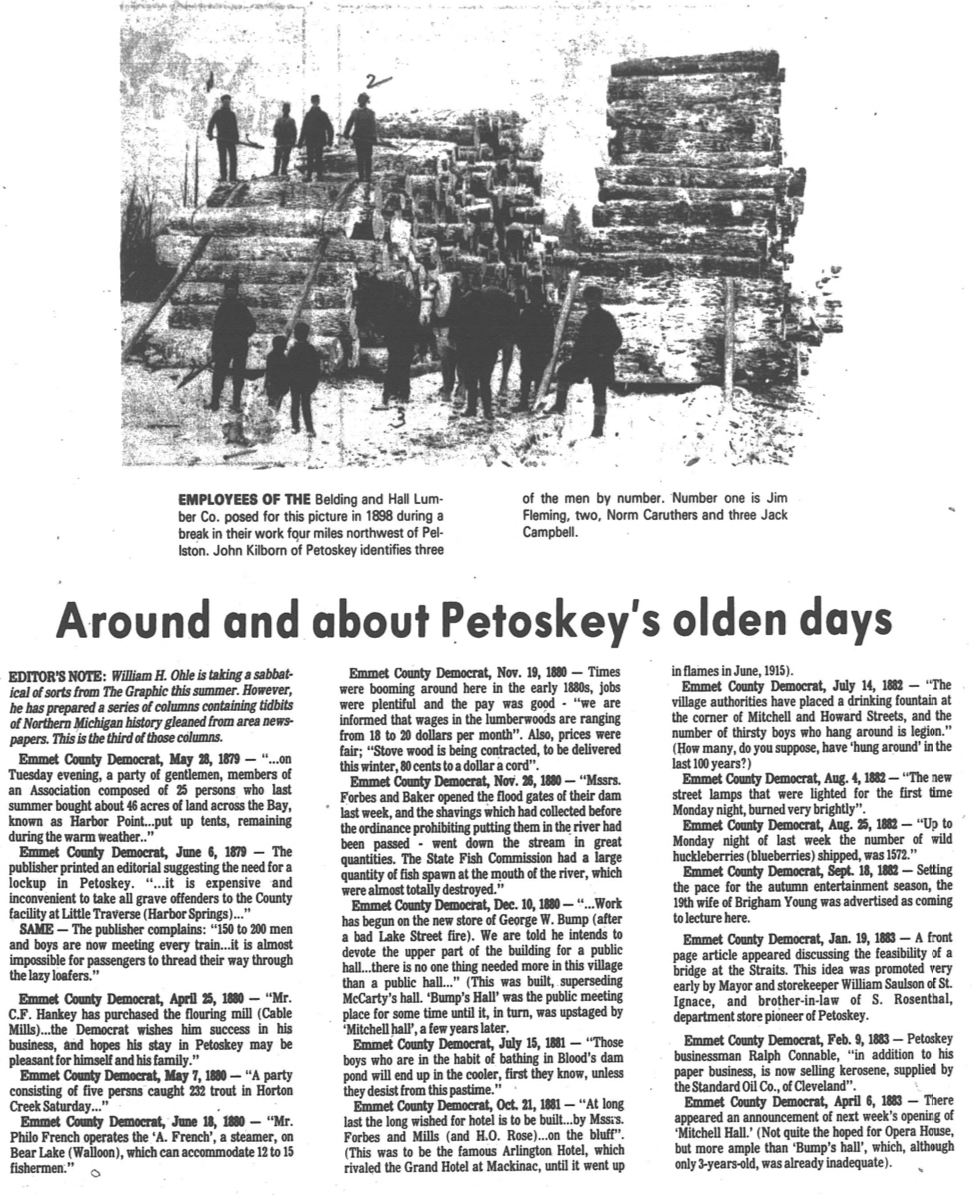
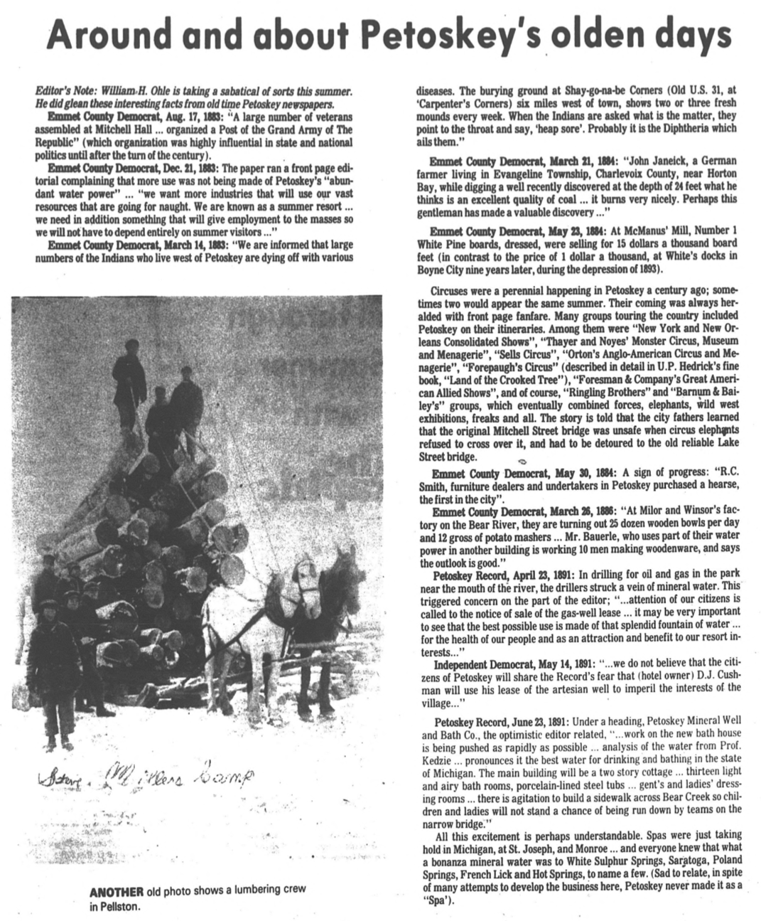
1800s ~ Petoskey's Olden Days
22 July 1982 ~ The Graphic
Photo Below: The FIRST train came into Petoskey in 1874 so this photo is later than that. All of these tracks are going right through Petoskey's downtown park area... at one time "Railroad Park," "Cushman Park," and now "Pennsylvania Park." The hotel in the far distance on the left is The New Arlington, with the Perry Hotel closer in front, but still on the left. The hotel at the right with the cupola is the Cushman. Click HERE to access additional information on this same web site about the area Railroads.
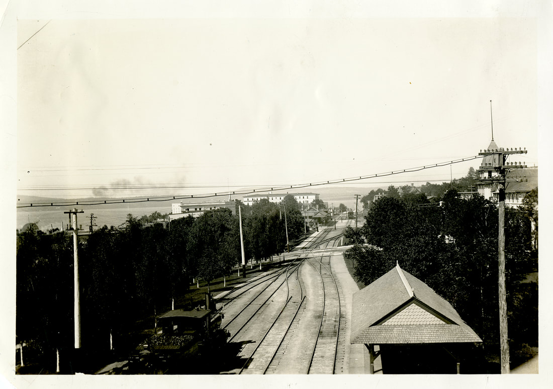
Little Traverse Historical Museum Photo Archive
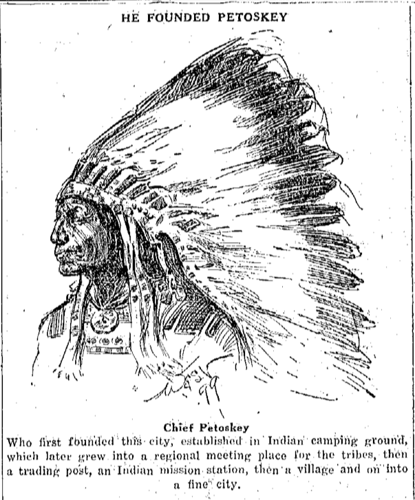
The City of Petoskey was named after Chief Petoskey (different spelling of his original name). The picture below, a drawing, was found on the 24 February 1930 Petoskey Evening News. A full-page article was featured, written by R. H. Little (brother to Dr. Little) one of Petoskey's earliest pioneers, remembering back, and telling about the "many interesting happenings in Petoskey in the years of 1873 and 1874." Other sources tell that the first train came into Petoskey in 1874.
24 February 1930 ~ Petoskey Evening News
~ Petoskey A Promising Place ~
1901
1901

15 February 1901 ~ The Independent Democrat... continued next column
|
15 February 1901 ~ The Independent Democrat... continued next column
|
15 February 1901 ~ The Independent Democrat... continued from previous column
|
TOP
~ Petoskey Lady Has Vision of Future Glory of City Beautiful ~
1909
1909

20 December 1909 ~ Petoskey Evening News
|
20 December 1909 ~ Petoskey Evening News
|
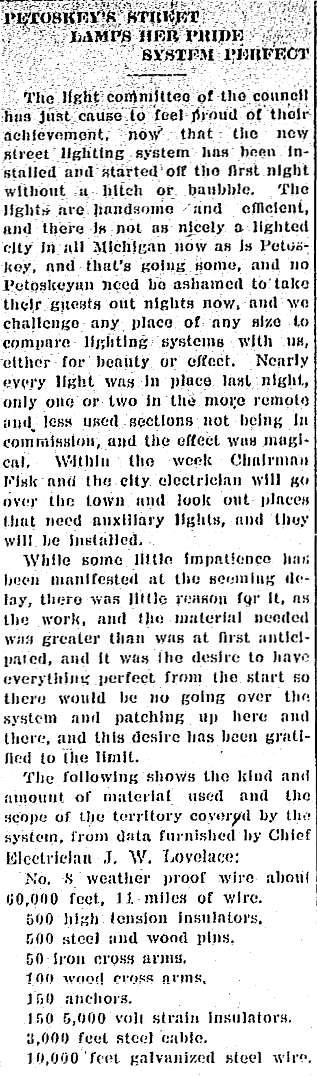
~ Glimpse of Petoskey's Past ~
1910
1910
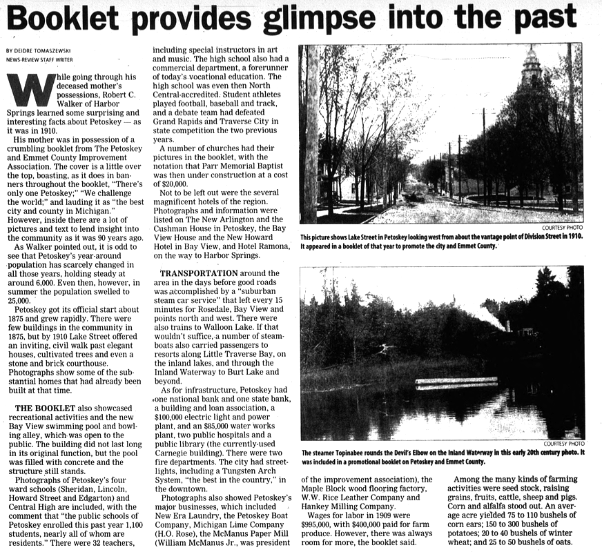
20 September 2000 ~ Petoskey News Review
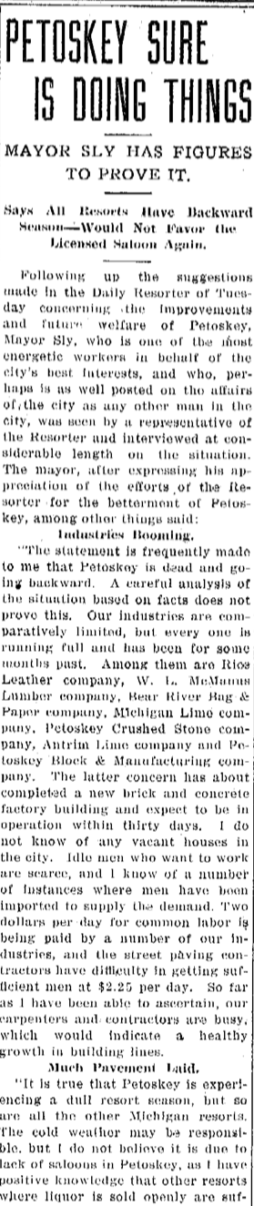
~ Petoskey Street Lights ~
1910
10 June 1910 ~ Petoskey Evening News
~ Petoskey Sure Is Doing Things ~
1912
1912
25 July 1912 ~ Petoskey Evening News article continued right column...
|
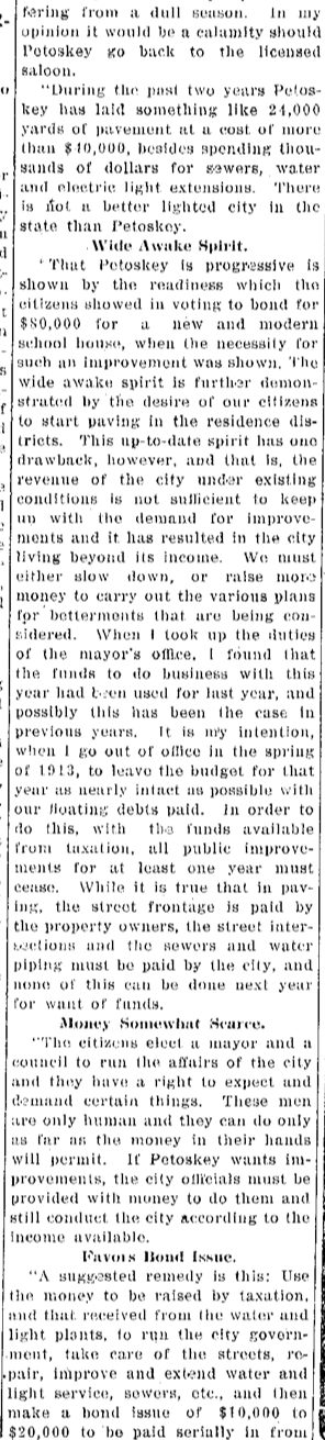
25 July 1912 ~ Petoskey Evening News article continued right column...
|
25 July 1912 ~ Petoskey Evening News article continued from left column...
|
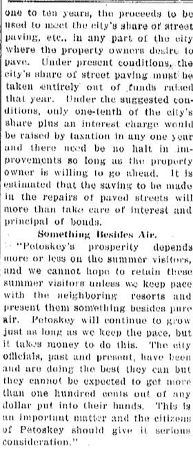
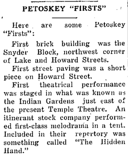
~ Find Fine Old Time Sidewalks ~
1916
1916
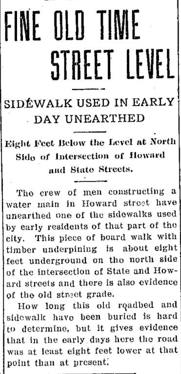
11 July 1916 ~ Petoskey Evening News
1938
|
1938
28 June 1938 ~ Petoskey Evening News
18 June 1938 ~ Petoskey Evening News
|
~ Petoskey Building ~
1938 
18 May 1938 ~ Petoskey Evening News
|
~ New Gas Ready for Petoskey ~
1938 
24 May 1938 ~ Petoskey Evening News
|
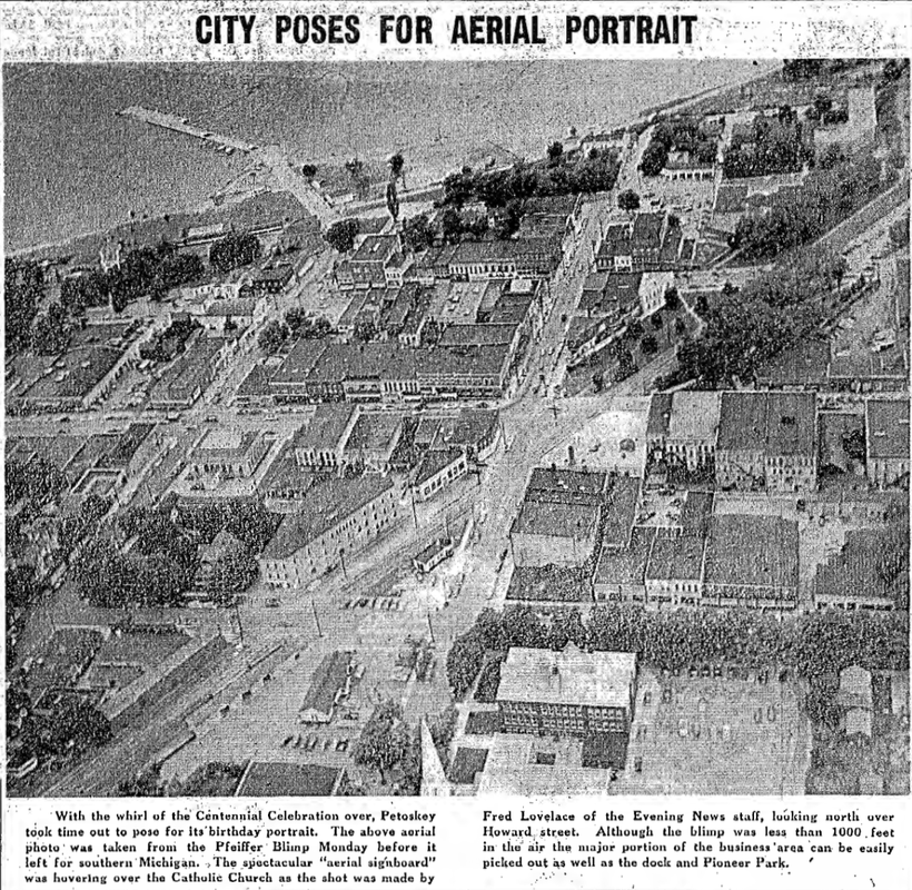
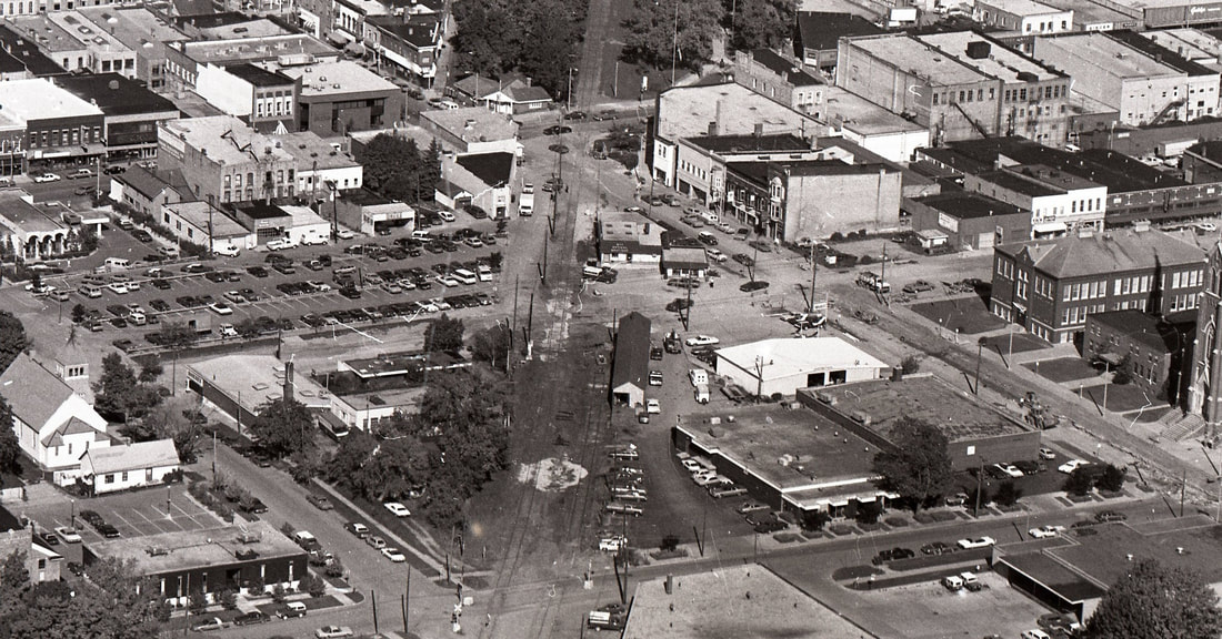
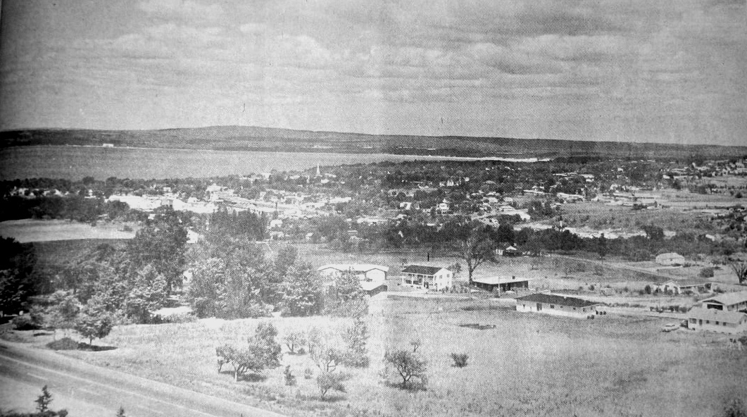
~ Aerial Portraits of Petoskey ~
Corner of Howard and Michigan Streets taken from top of Catholic Church
1904
1904
Little Traverse Historical Society Photo Collection
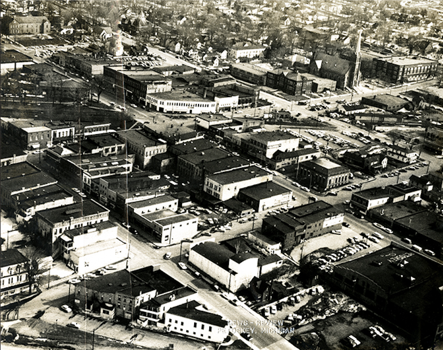
From Petoskey High School Yearbook
1941

1941 Petoskey High School Yearbook (LATER: Found that this aerial photo was taken in 1938)
1 August 1946 ~ Petoskey News Review
Greenwood Photo Archive Collection from Petoskey newspaper (1947)
From Pfeiffer Blimp
1952 Centennial Year
1952 Centennial Year
17 July 1952 ~ Petoskey Evening News
Photo Below: Same photo as in above 1952 news clipping/text
Little Traverse Historical Society Photo Collection ~ (Undated)
Greenwood Photo Archive Postcard Collection
Little Traverse Historical Museum Photo Archive ~ Labeled 1 September 1961 "Your Daily Picture" Petoskey, Michigan
1962
28 April 1962 ~ Petoskey News Review
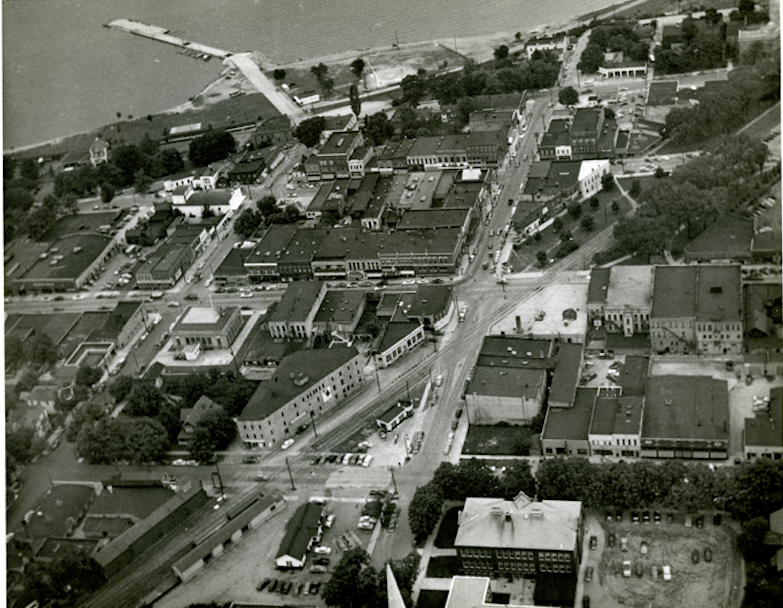
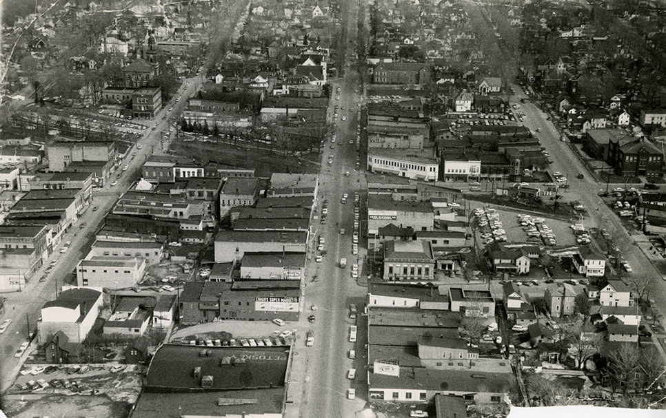
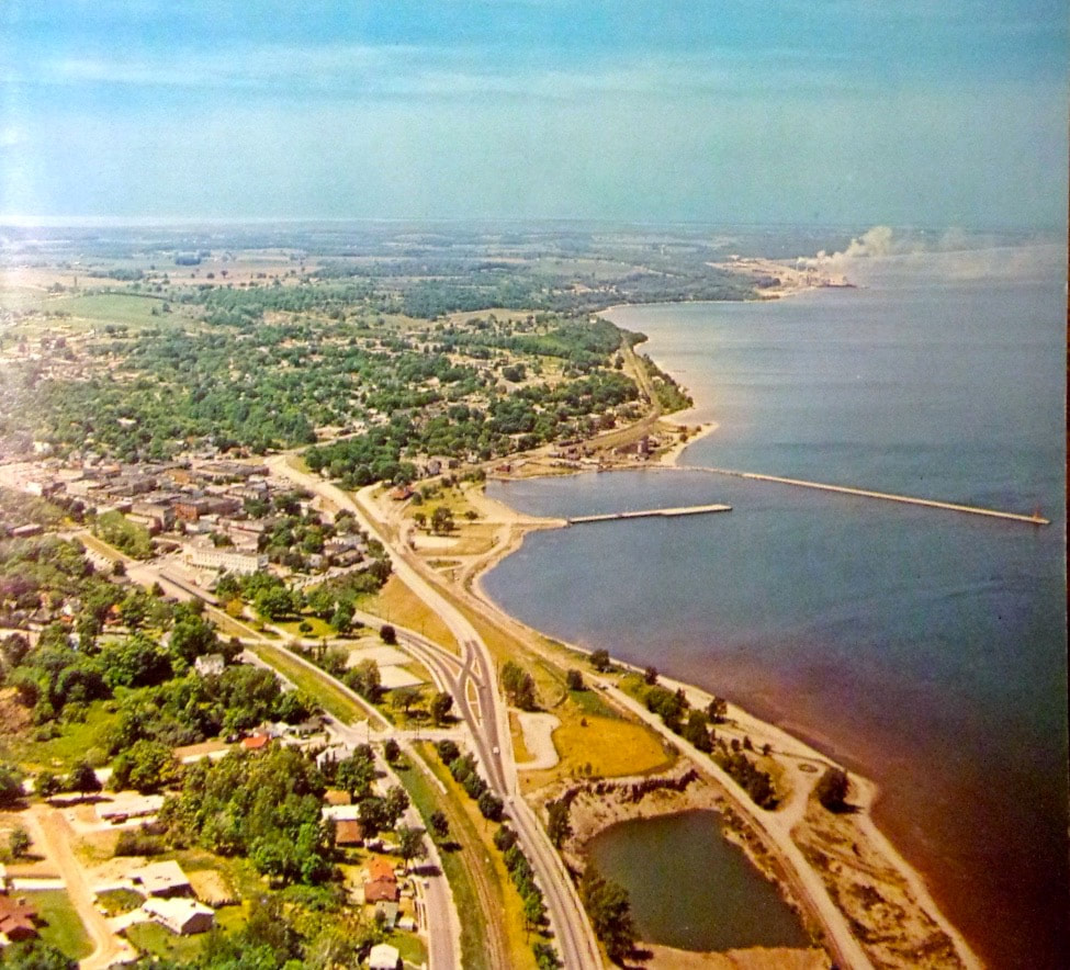
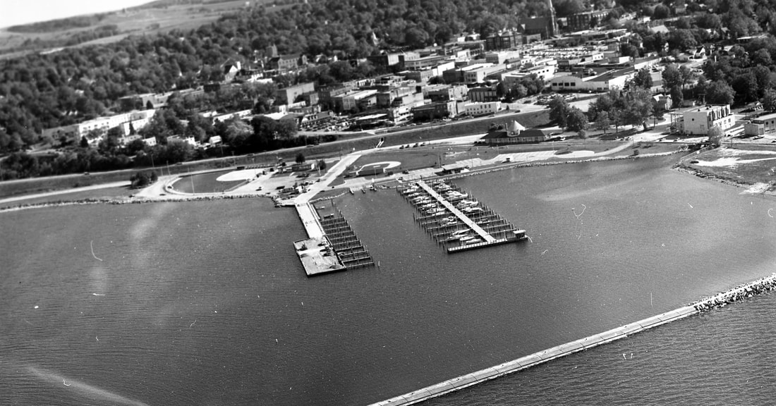
Photo Below: Sunset Boulevard By-Pass was newly opened...
Greenwood Photo Archive Collection from PEtoskey newspapers (1962)
Little Traverse Historical Society Photo Collection ~ Undated but, still before the old post office on the corner of Mitchell and Petoskey streets was torn down...
Published in a Michigan History Magazine (Undated)
POST Bypass
PRE-The Hole...
PRE-The Hole...
Personal Postcard POST-1963, but undated ~ Photo by Penrod
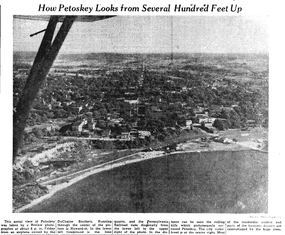
1966
2 November 1966 ~ Petoskey News Review
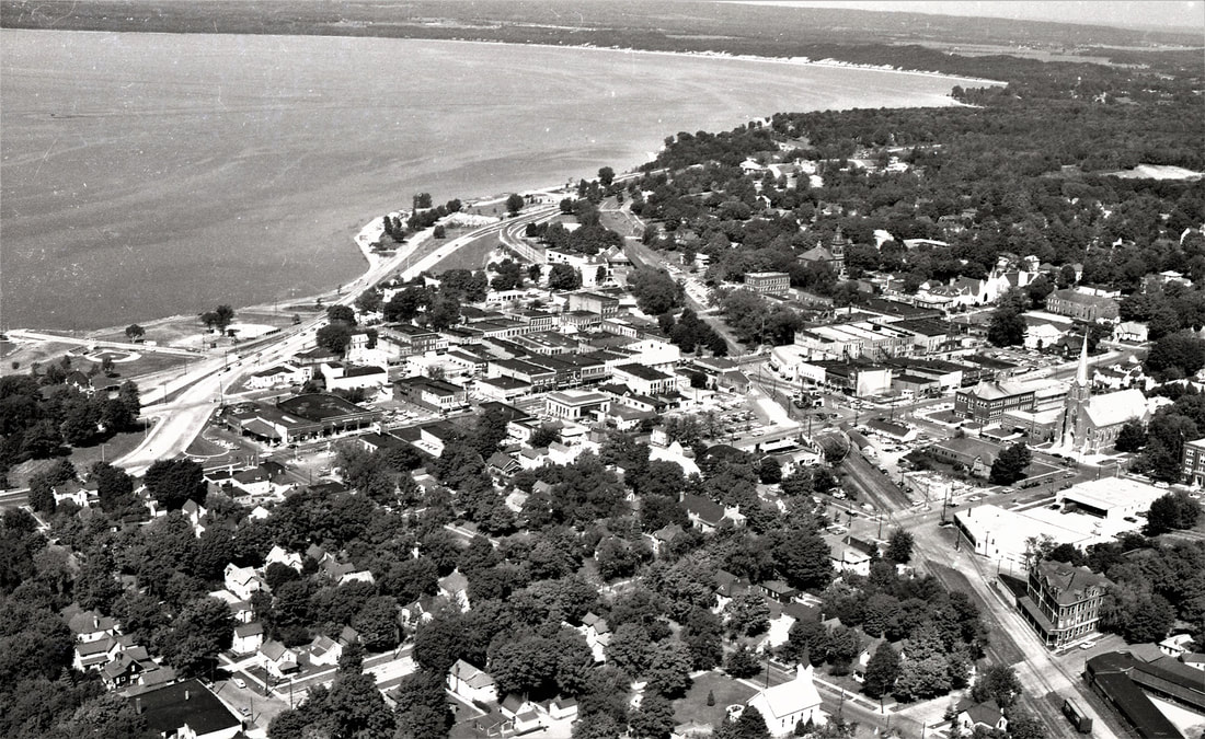
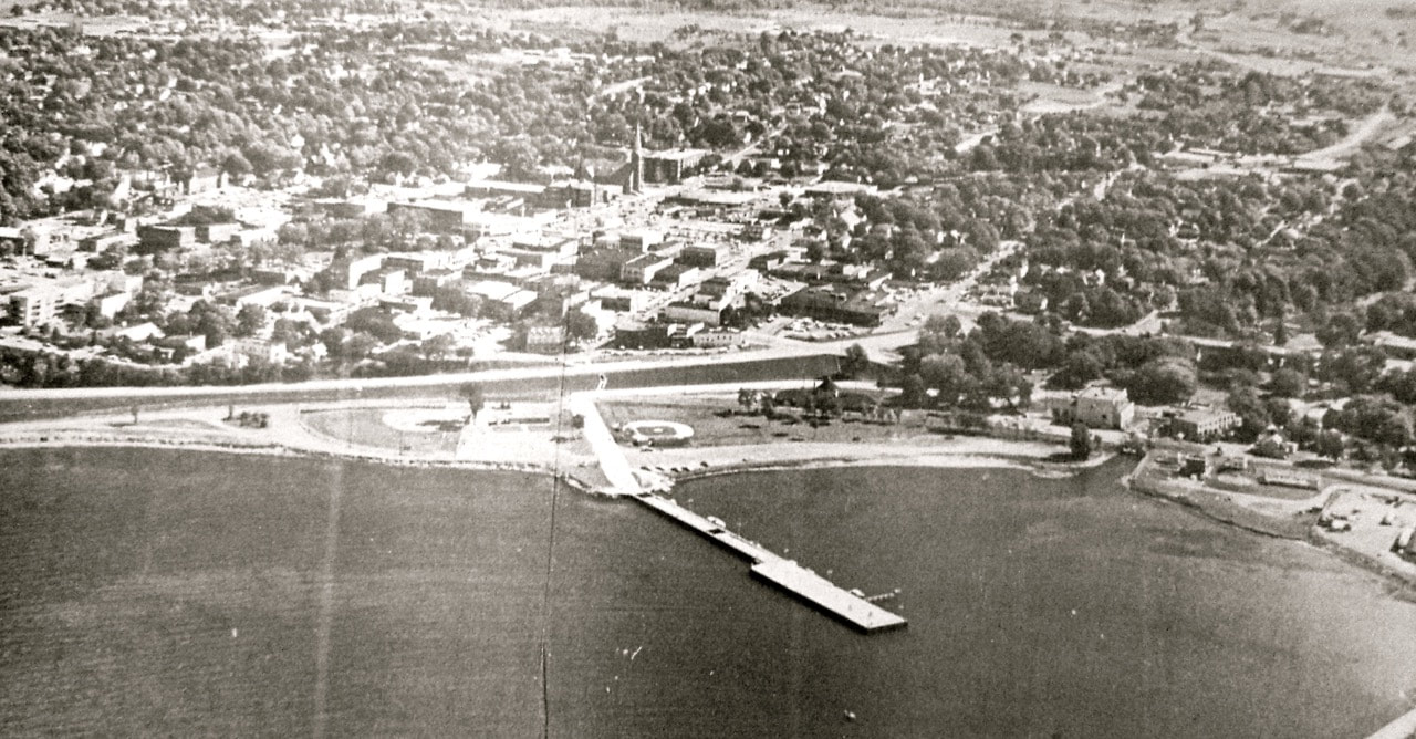
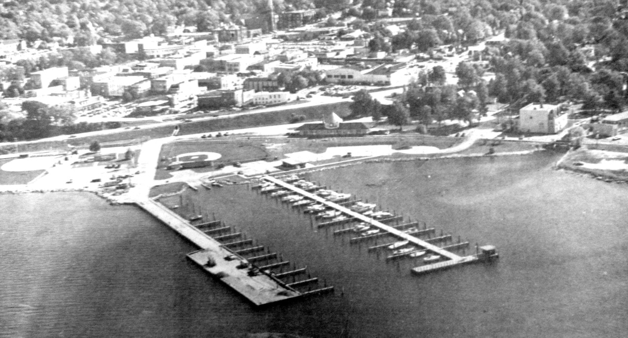
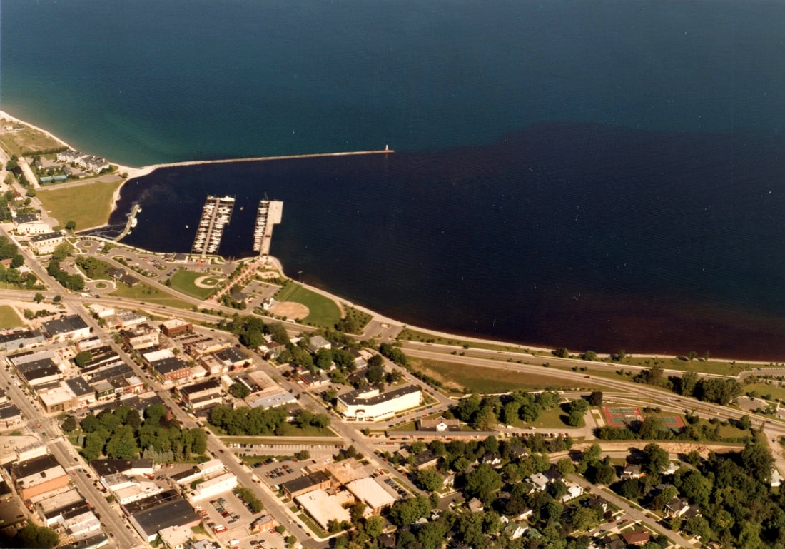
Text for Photo Above: "Petoskey from the air appears to be a business district surrounded by forest and lakes, but there are homes down among the trees. The waterfront area with the softball diamond, Bates Field, dock, river, diesel plant, utility building and breakwater show up well. This view shows part of the East Side of Petoskey, an earlier photo showed the West Side. Can you find your house? (NEWS aerial photo by Fred Lovelace via Phillips Flying Service.)"
1967
Front Page of 1967 Petoskey Jaycees Present "Little Traverse Bay Historical Review"
(Cement Plant Smoke in Background)
Front Page of 1967 Petoskey Jaycees Present "Little Traverse Bay Historical Review"
(Cement Plant Smoke in Background)
Front Page of 1967 Petoskey Jaycees Present "Little Traverse Bay Historical Review"
1968
1 May 1968 ~ Petosksey News Review
1980
10 October 1980 ~ Petoskey News Review

10 October 1980 ~ Petoskey News Review
Greenwood Photo Archive Collection from Petoskey newspapers (October 1980)
Photo Below: Possibly about 1980 like the photo above because of the similar TWO docks in the bay...
Undated clipping from OLD personal scrapbook in Michigan Room of Petoskey District Library
Greenwood Photo Archive Collection from Petoskey newspapers (October 1980)
Greenwood Photo Archive Collection from Petoskey newspapers (1994)
Greenwood Photo Archive Postcard Collection (Undated
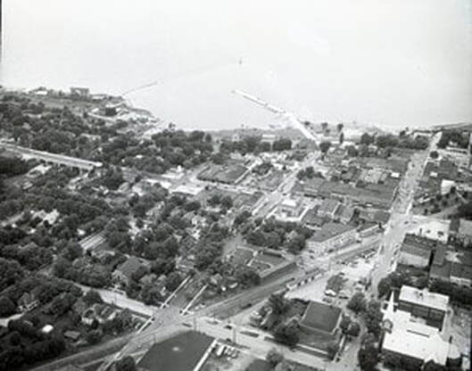
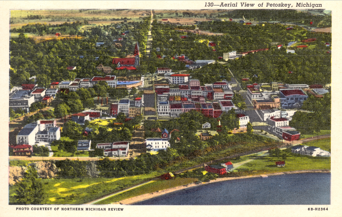
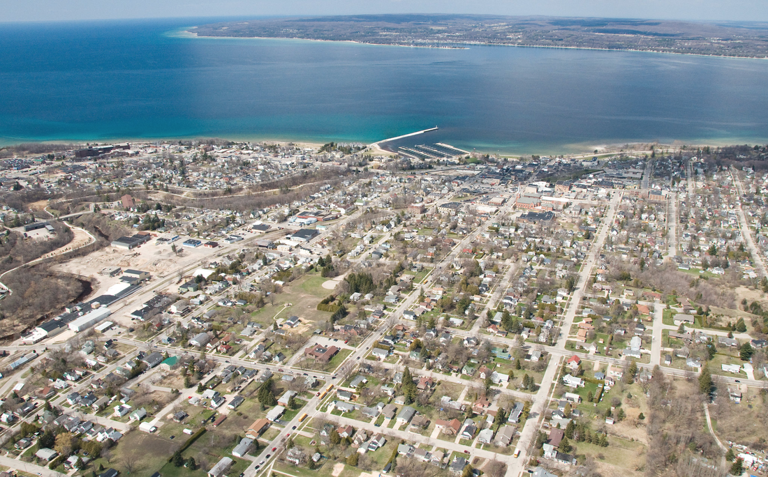
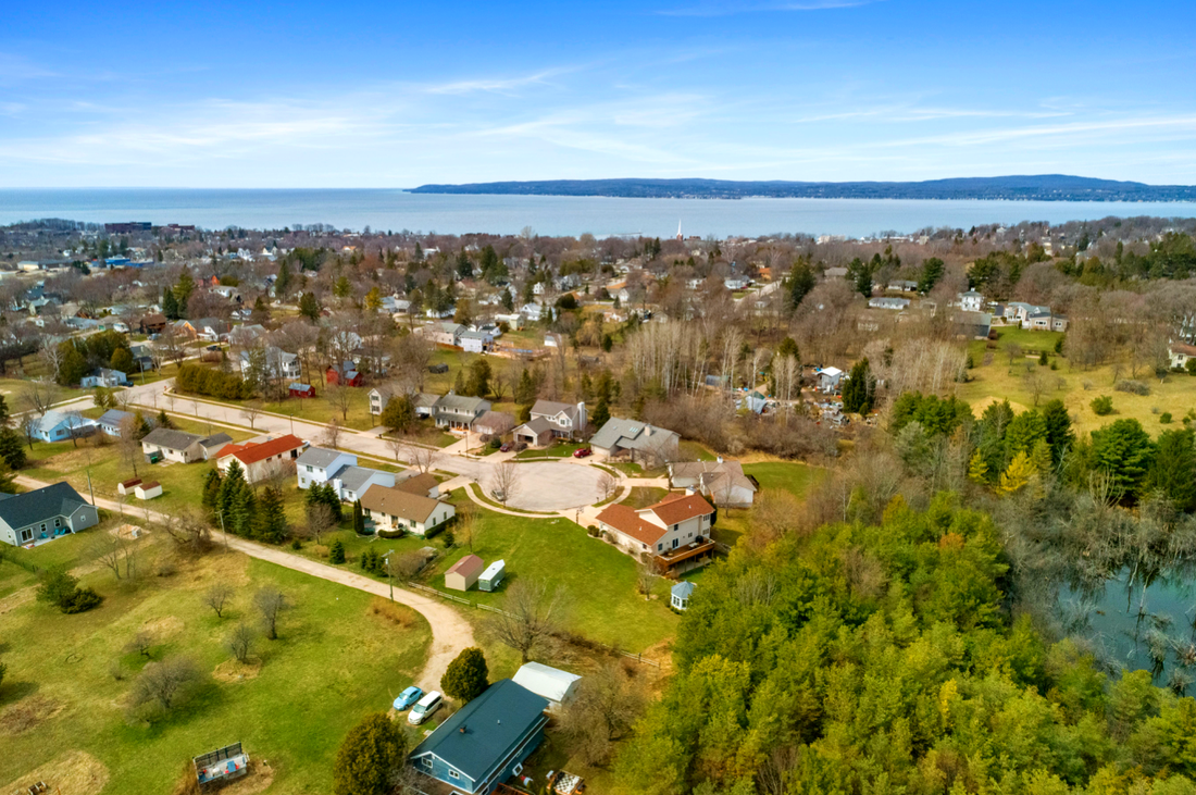
~ Most of City of Petoskey ~
(Click on Photo to Enlarge)
Posted Below only by Permission from Drone Photographer Charles Dawley, Up North Imaging
Drone Photography from Charles Dawley "Up North Imaging"
(Click on Photo to Enlarge)
Posted Below only by Permission from Drone Photographer Charles Dawley, Up North Imaging
Drone Photography from Charles Dawley "Up North Imaging"
25 April 2011 ~ Posted only by Permission from Drone Photographer Charles Dawley, Up North Imaging
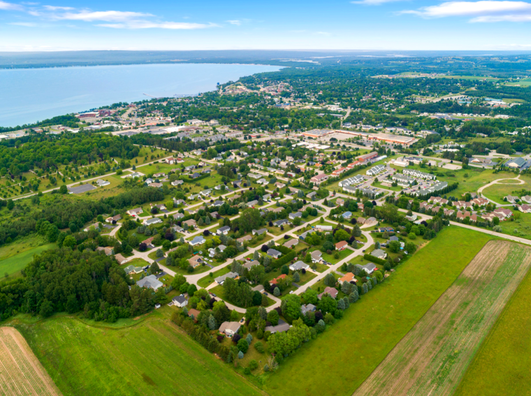
~ The West Side of Petoskey ~
PRE-KMart Plaza (Built in 1976)
1966 Photos Below: Taken from the water tower area...
Greenwood Photo Archive Collection from Petoskey newspapers (1966)
Greenwood Photo Archive Collection from Petoksey newpapers Taken in 1966 (Before construction of K-Mart in 1976)
Greenwood Photo Archive Collection from Petoksey newpapers Taken in 1966 (Before construction of K-Mart in 1976)
1997
Taken from area of original Holiday Inn Hotel
Taken from area of original Holiday Inn Hotel
Greenwood Photo Archive Collection from Petoskey newspapers (11 September 1997)
2008
(Looking East from the Hospital)
(Looking East from the Hospital)
27 November 2008
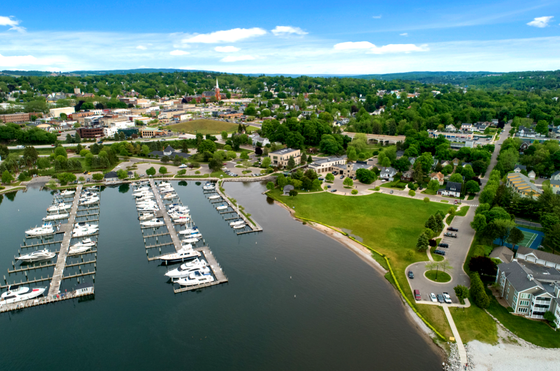
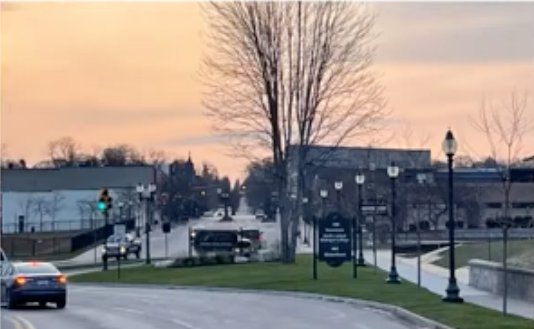
~ Petoskey from North Central Michigan College Area ~
27 April 2020
27 April 2020
27 April 2020 ~ Posted only by Permission from Drone Photographer Charles Dawley, Up North Imaging
11 June 2020 ~ Posted only by Permission from Drone Photographer Charles Dawley, Up North Imaging
Two 2020 Photos Above and one 2021 Photo Below of Vantage View:
More of Charles Dawley's remarkable videos and photography can be viewed on
Drone Photography from Charles Dawley "Up North Imaging".
Posted only by Permission from Drone Photographer Charles Dawley, Up North Imaging
More of Charles Dawley's remarkable videos and photography can be viewed on
Drone Photography from Charles Dawley "Up North Imaging".
Posted only by Permission from Drone Photographer Charles Dawley, Up North Imaging
29 June 2021 ~ Posted only by Permission from Drone Photographer Charles Dawley, Up North Imaging
~ Fire Hall on the Water Front ~
2012
2012
5 March 2012 ~ Petoskey Fire Hall
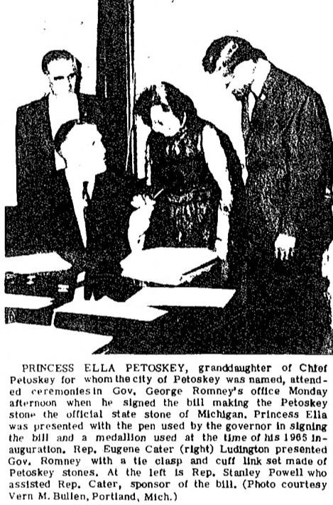
~ Ella Petoskey, Granddaughter of Chief Petoskey ~
1952
1952
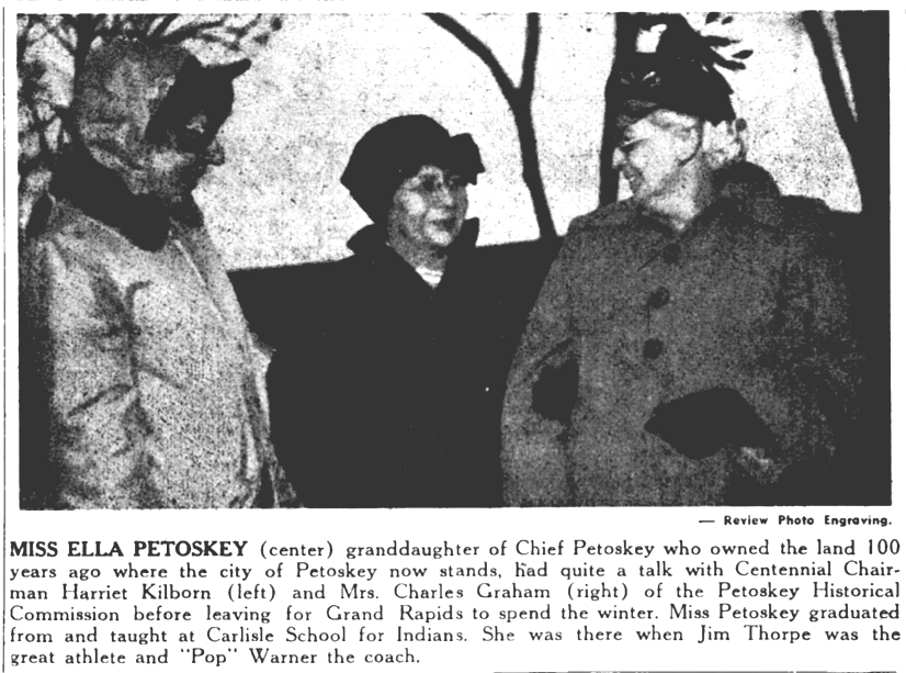
31 January 1952 ~ Northern Michigan Review
~ Plat of Priebe Acres Added to Petoskey ~
1952
1952
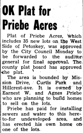
22 May 1952 ~ Northern Michigan Review
TOP
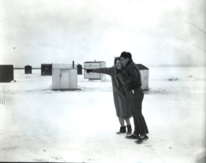
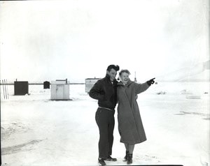
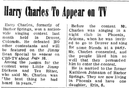
~ A Musical Record Set in Petoskey ~
("Petoskey Town" Sung by Harry Charles)
1960
("Petoskey Town" Sung by Harry Charles)
1960
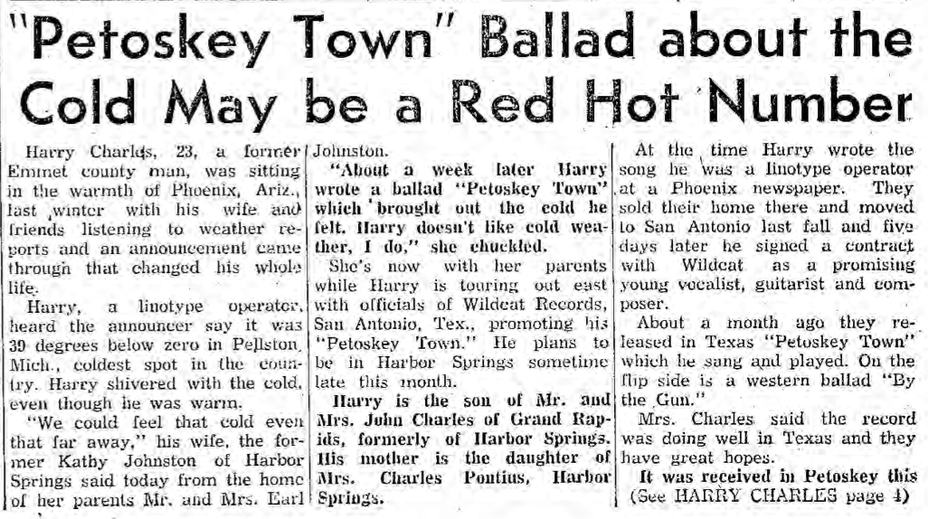
2 February 1960 ~ Petoskey News Review article continues below left...
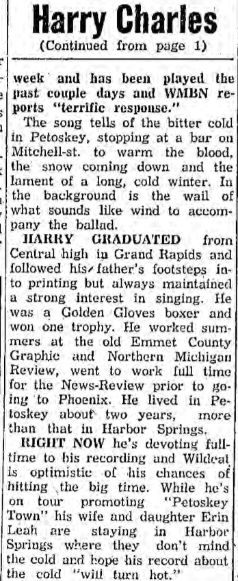
2 February 1960 ~ Petoskey News Review article continued from above right...
|
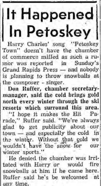
9 February 1960 ~ Petoskey News Review
|
21 March 1960 ~ Petoskey News Review
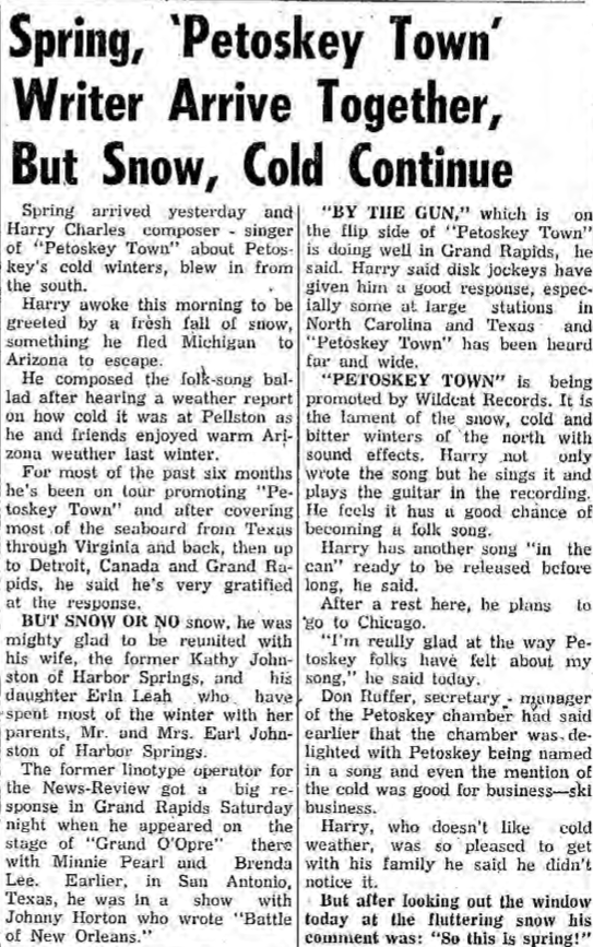
~ "That's Petoskey Town" ~
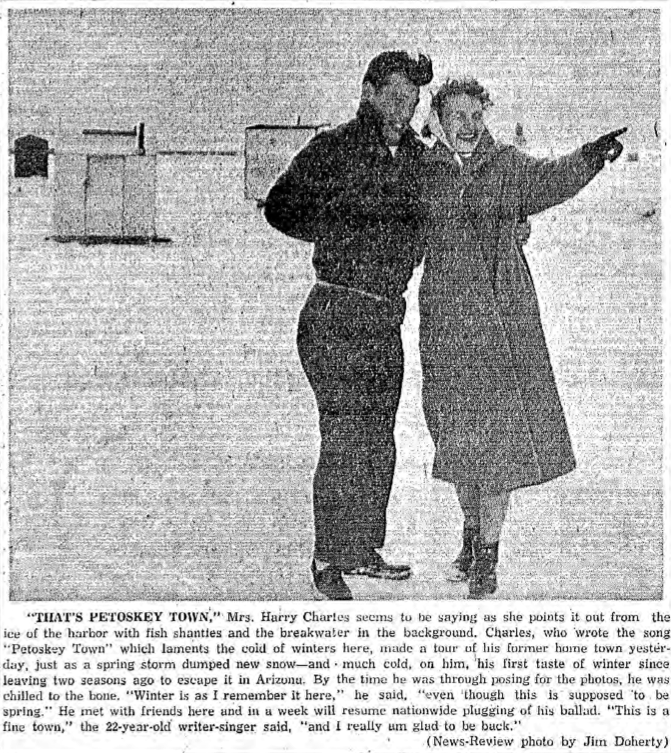
22 March 1960 ~ Petoskey News Review
|
Greenwood Photo Archive Collection from Petoskey newspapers (22 March 1960)
Greenwood Photo Archive Collection from Petoskey newspapers (22 March 1960)
Greenwood Photo Archive Collection from Petoskey newspapers (22 March 1960)
|
15–21 June 1966 ~ The Harbor Lite
Wondering who is to maintain the road improvements within the city?
Petoskey City Council minutes for 17 September 2012:
"Mayor Fraser asked for public comments and Carla [sic Karla] Buckmaster, Bear Creek Township, reported that
she wrote MDOT asking who would maintain the US-31 corridor improvements and MDOT responded,
the City would maintain most of the vegetation and MDOT would maintain the islands along the corridor."
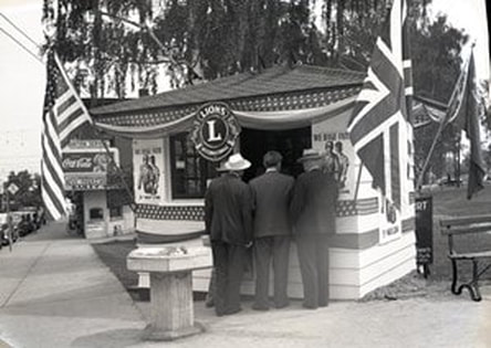
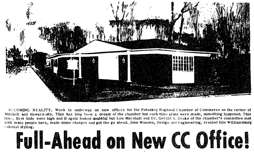
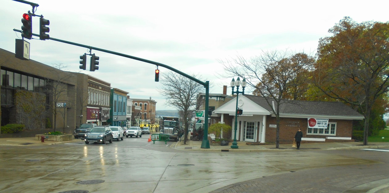
~ Chamber of Commerce ~
Undated Photo Below: Chamber of Commerce on the corner of Howard and Mitchell streets
with a cutter and horse, and also a dog team nearby.
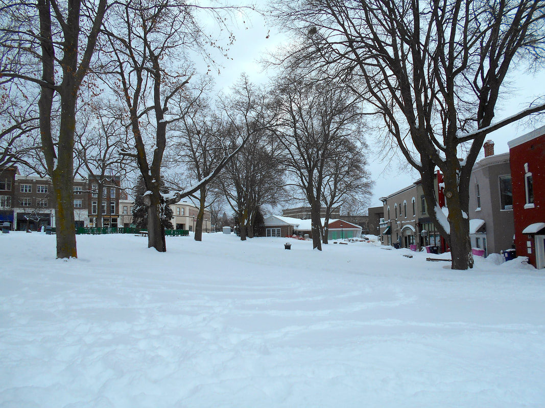
The trees in Pennsylvania Park were white birch trees at that time.
with a cutter and horse, and also a dog team nearby.
The trees in Pennsylvania Park were white birch trees at that time.

Submitted by Linda (Lewis) Lark for viewing only on this Northern Mich~Mash Preserve web site...
1944
Greenwood Photo Archive Collection from Petoskey newspapers (27 September 1943)
15 June 1944 ~ Northern Michigan Review
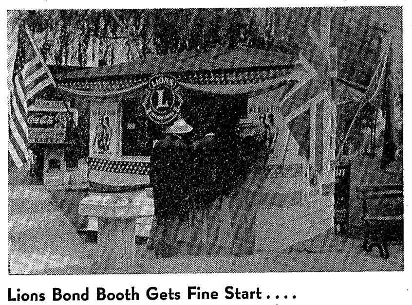
~ PRE-Petoskey Chamber of Commerce Corner in Front of the Fountain, was used to sell war Bonds ~
1945
14 June 1945 ~ Northern Michigan Review
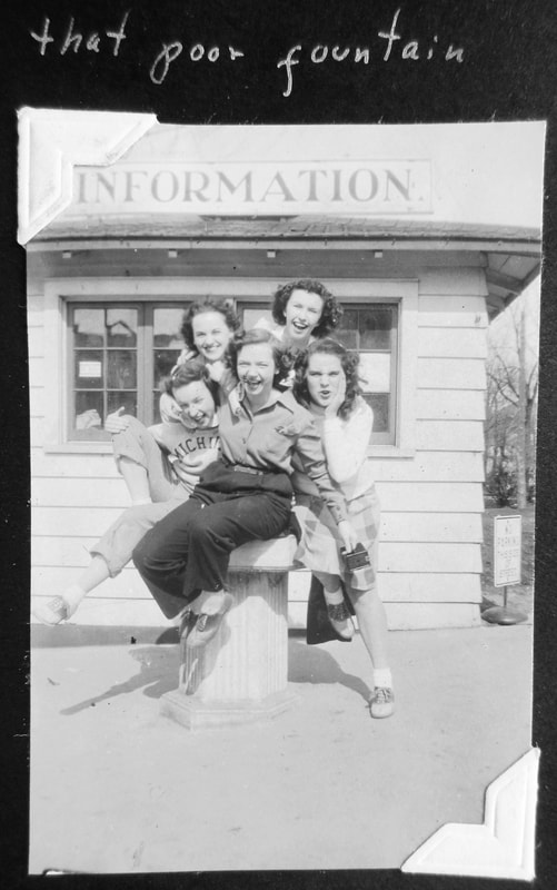
From the personal album of Joan Rose with other photos mostly from about 1946-47. The girls were not identified.
~ Information Booth on C of C Location ~
Corner of Howard and East Mitchell streets, Petoskey, Michigan
1955
Corner of Howard and East Mitchell streets, Petoskey, Michigan
1955
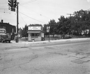
Greenwood Photo Archive Collection from Petoskey newspaper (July 1955)
11 September 1958 ~ Petoskey News Review
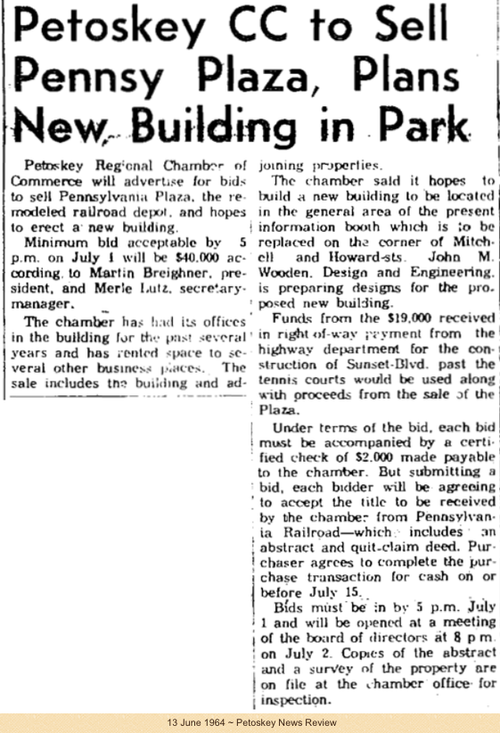
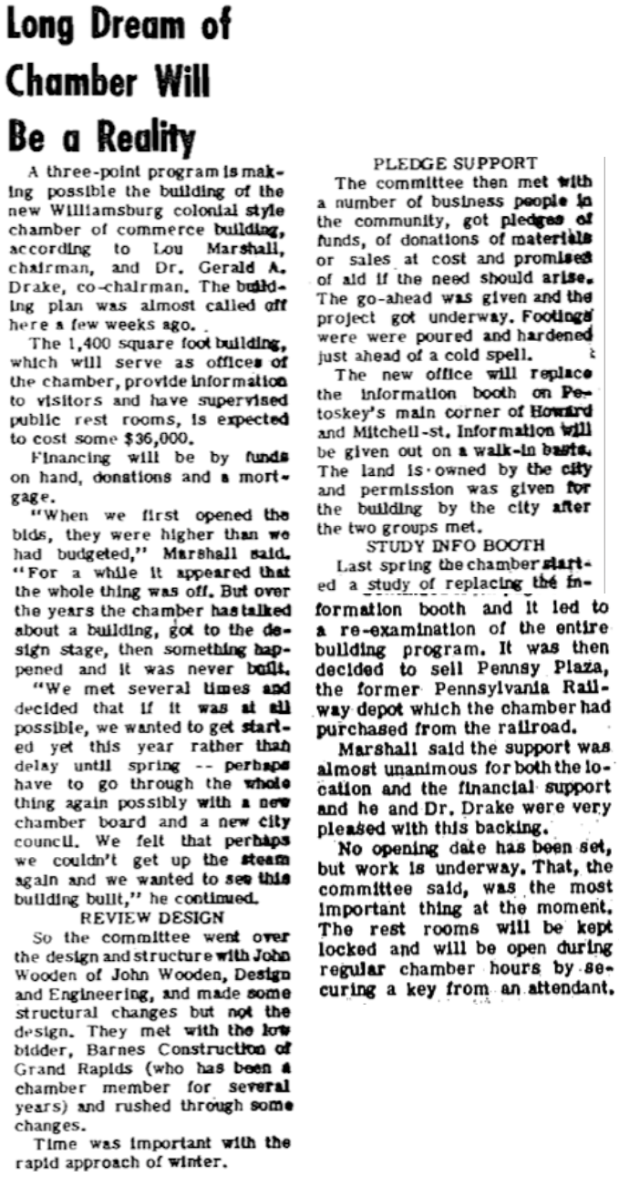
~ Petoskey CC to Sell Pennsy Plaza, Plans New Building in Park ~
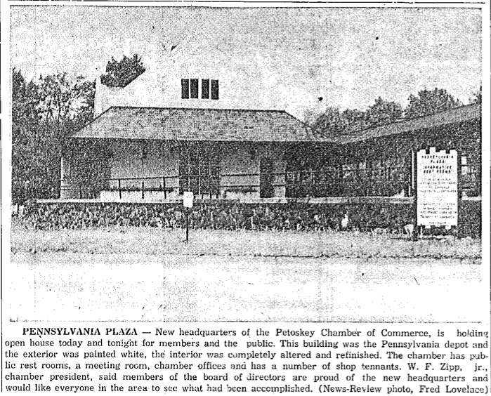
2 December 1964 ~ Petoskey News Review photo/text accompanied article below...
2 December 1964 ~ Petoskey News Review article accompanied photo/text above...
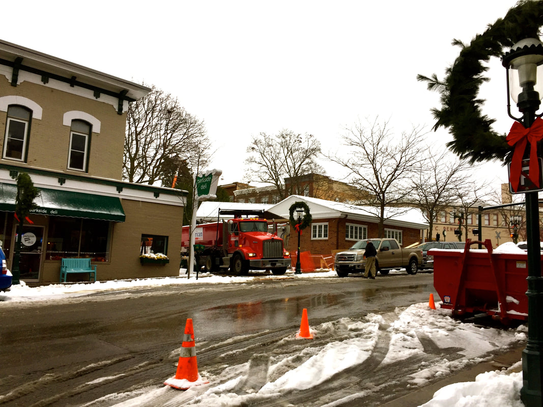
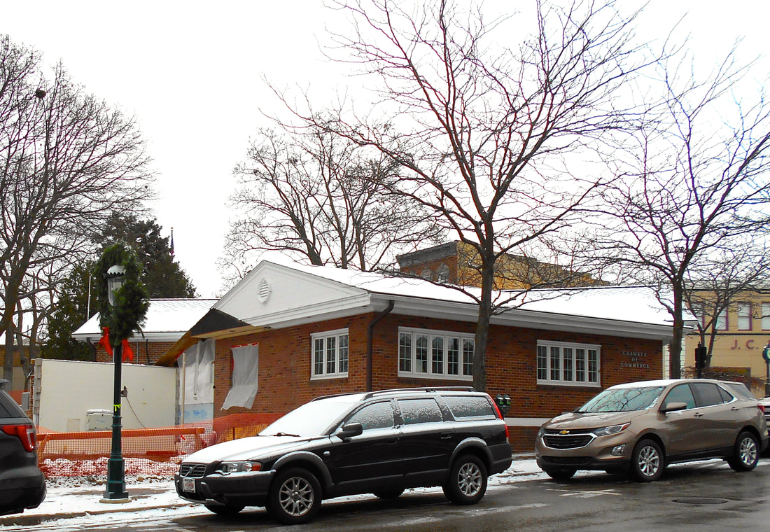
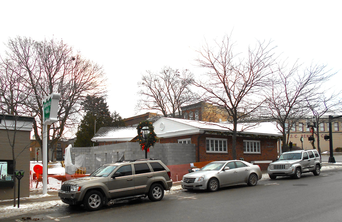
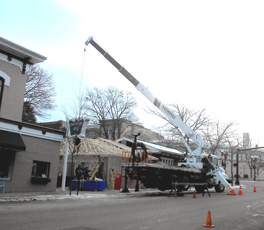
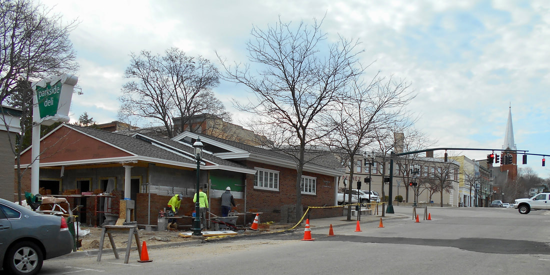
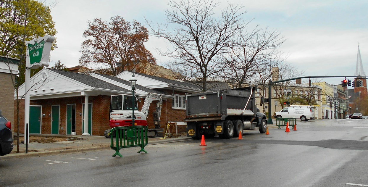
~ WELCOMING New Restrooms at the Chamber of Commerce ~
2018
2018
The Restroom project cost a total of $371,000, with $150,000 coming from a National Parks Service Land and Water Conservation Grant. The remaining $221,000 is being split between the Downtown Management Board and city funds as reported in the 30 April 2019 Petoskey News Review.
12 November 2018
|
19 November 2018
|
10 December 2018
|
14 December 2018
|
17 February 2019
19 April 2019
|
22 April 2019
|
Two Photos Below: With Memorial Day weekend arriving in two days, the public bathrooms by the Chamber of Commerce need to be finished. A problem arose when the cement contractors poured the cement with the lay angled in the wrong direction, making water flow into the building rather than away from the building. Consequently, 22 May 2019, the cement contractors were busy removing the huge chunks of new concrete, to be replaced... hopefully, in time for the holiday weekend, but that seems impossible???
22 May 2019
22 May 2019
Click below to access: PETOSKEY TOPICS OF INTEREST...
(on this same web site)
(on this same web site)
Businesses
"The Hole" PDP (Petoskey DISappointe Pit)
"The Hole" ~ Second Coming?
Hotels
Mayors (& Presidents) of Petoskey
Mitchell Street Was A Dead End
Parking
Parks & Recreation
Veterans Memorials (On the Charlevoix Emmet History Web Site)
Waterfront & Steamer Ships
Winter Sports Parks
~ Petoskey in Ye Olden Days ~
1 July 1982 ~ The Graphic
8 July 1982 ~ The Graphic
22 July 1982 ~ The Graphic
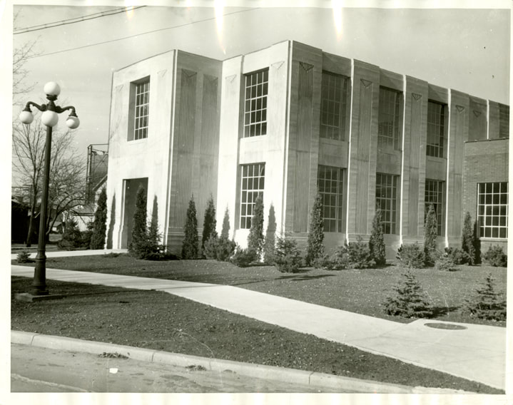
Petoskey City Hall
1902
New Petoskey City Hall
New Petoskey City Hall
2 May 1902 ~ Thie Independent Democrat
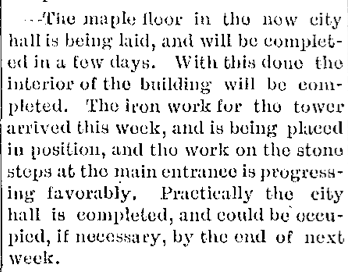
Photo Below: City Building Construction
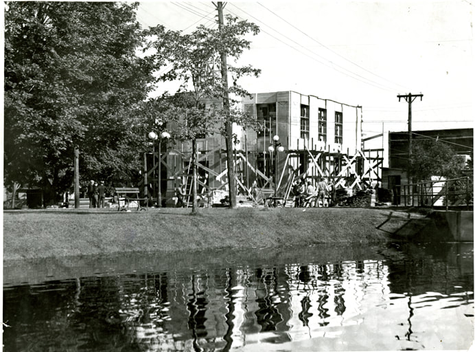
Little Traverse Historical Society Photo Collection
Little Traverse Historical Society Photo Collection
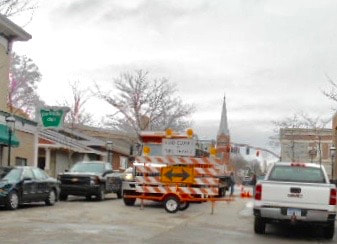
Two Photo Below: The Petoskey City manager reported the before and after views of downtown's entry point,
after removing trees that had blocked the view of Mitchell Street when approaching.
after removing trees that had blocked the view of Mitchell Street when approaching.
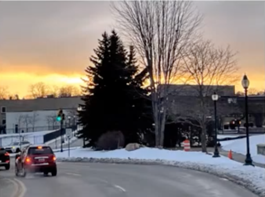
1 May 2023 ~ Petoskey City Council meeting city manager's report...
|
1 May 2023 ~ Petoskey City Council meeting city manager's report...
|
Access a "Petoskey Walking Tour" Petoskey Area Visitor's Bureau pamphlet by clicking HERE.
